Tag: hike haida gwaii

  • Exploring Damaxyaa Conservancy – Louise Dover Trail

    Exploring Damaxyaa Conservancy – Louise Dover Trail

    • Louise Dover Trail
    • Louise Dover Trail

    LOUISE DOVER TRAIL FEATURES:
    Old Growth forest
    Culturally Modified Trees
    Dover Falls


    ABOUT

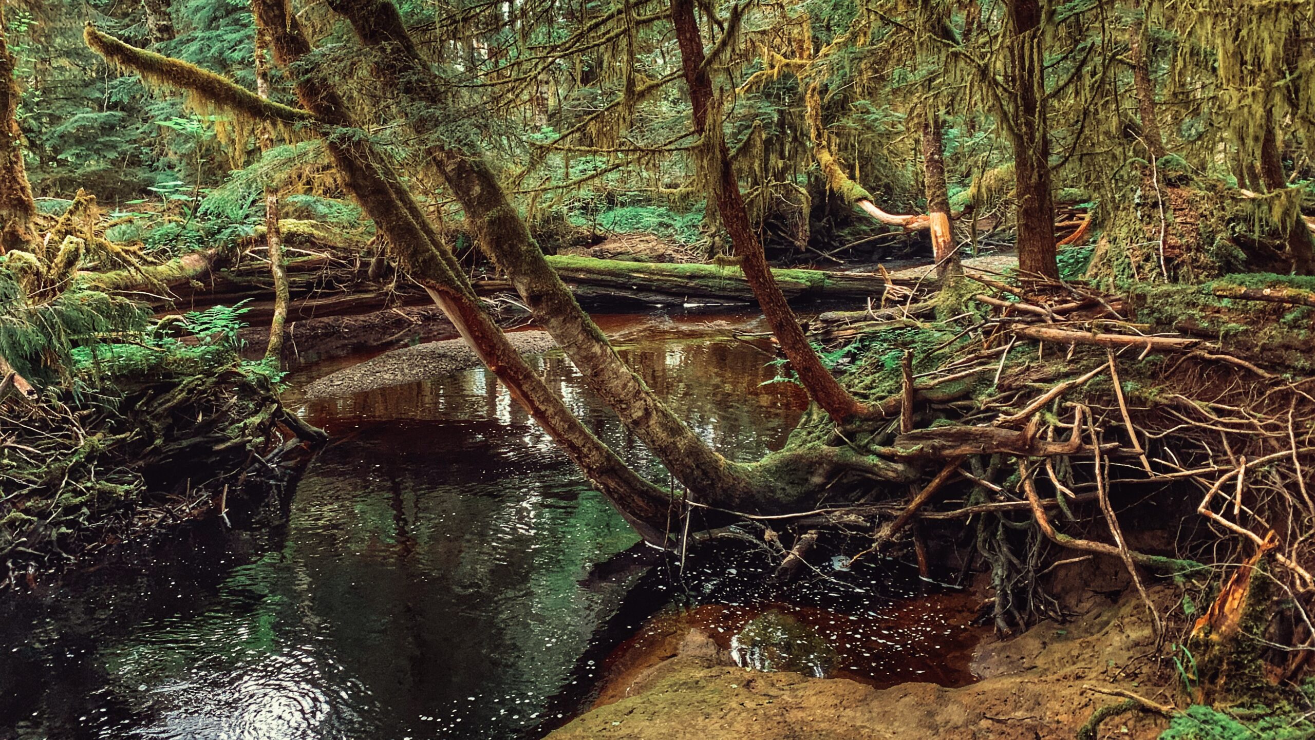
    The Louise Dover Trail is located adjacent to the Haans Creek bridge, just before entering Sandspit. Initially conceived in the mid-1990s, the trail is named after Louise Dover, an influential woman of Haida ancestry who lived in the community of Sandspit. In many respects, the trail is an apt memorial and tribute because it introduces hikers to key elements of Haida Gwaii: Important fish streams; unique flora and fauna; ancient Haida culture; rare geology and fossils; and, a larger appreciation for how everything depends upon everything else.

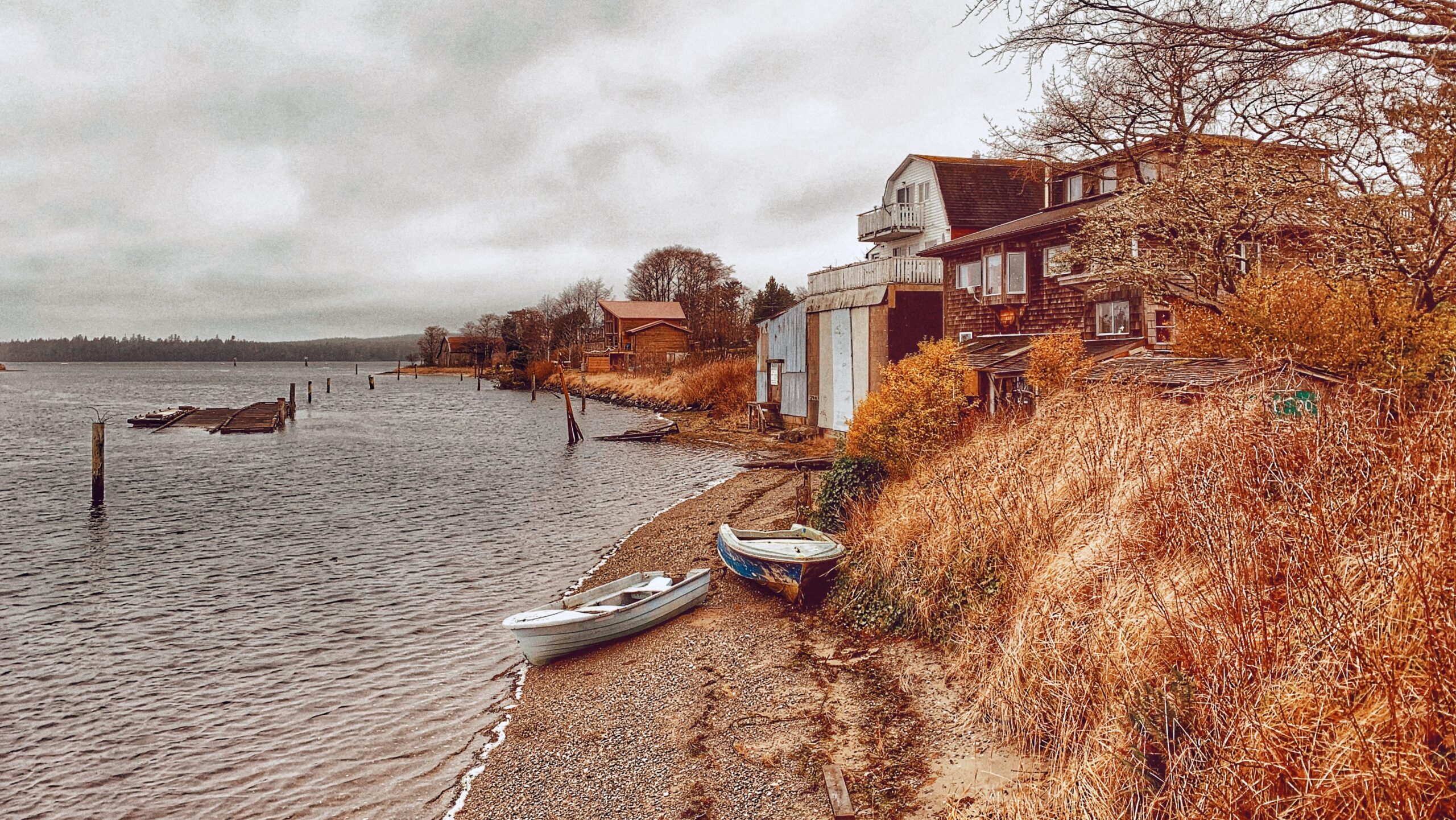
    In 2008, the Dover Trail became part of the larger Damaxyaa Heritage Site and Conservancy. Encompassing some 829 hectares, the conservancy plays host to important fish-bearing streams โ€“ one of which is Haans Creek โ€“ and contains a high density of recorded culturally modified trees (CMTs), a few of which can be spied along the Dover Trail. Both in pre-history and the current day, Damaxyaa is an important place for the Haida in terms of food gathering, medicine and culture. A seasonal Haida camp known as Kil was originally located at the mouth of Haans Creek, but no evidence of this remains today.

    Most official documentation on the Dover Trail clocks it in at 3.5km in length, but 4km is much more accurate. The first 200 meters are dubbed universal access, and bring you to a handsome viewing gazebo, thanks to significant upgrades completed in the autumn of 2020. After this, the trail becomes narrow and rough for most of the loop.

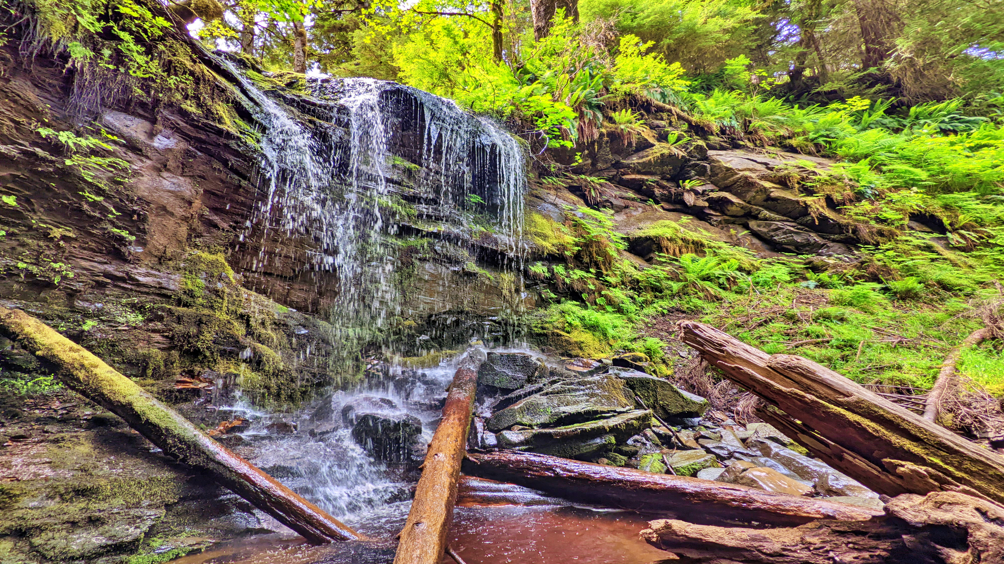
    Expect a lot of โ€œup, down, up downโ€ for much of your hike. Once you hit the mid-way point of the Dover loop, youโ€™ll see a marked side trail. This leads you to a lava bed and fossils โ€“ one of the trailโ€™s key highlights. If you ignore this trail, though, and continue along the main Dover loop, the route climbs quite steeply away from Haans Creek. Near the end of your climb, a small stake in the ground indicates 400 meters of โ€œhardโ€ trail leads to a waterfall.

    If youโ€™re feeling ambitious, itโ€™s certainly worth the effort; however, be advised that much of this side trail is steep and muddy with a couple of rope sections. Early in, you also have to get creative in getting over a fallen monumental cedar tree.

    The final section of the Dover Trail loops back towards the road and trailhead, connecting with the trail you started near the natural log bridge at Haans Creek. Much of this trail is muddy, but home to many old-growth Sitka Spruce and Cedar trees. As you hike back towards the trailhead and Haans Creek, youโ€™ll spy at least one CMT with a large โ€œtest holeโ€ in it. Youโ€™ll also come across the โ€œSkyline Trail,โ€ which remains closed for whatever reason as of this writing.

    Many who visit Haida Gwaii declare the Dover Trail to be their favourite overall hike. The terrain is varied; there are a number of side trails to visit and explore; it offers a glimpse into the old-growth forest and Haida culture; and, it represents a great way to reconnect with nature. Think of it as forest therapy.


    DIFFICULTY: Moderate
    TOTAL DISTANCE: 4km (longer if exploring side trails)
    TIME: 3 hours
    TYPE: Loop
    ELEVATION GAIN: 106 meters
  • Smugglers Cove: A Delightful Beach

    Smugglers Cove: A Delightful Beach

    • Smugglers Cove
    • Smugglers Cove
    • Smugglers Cove
    • Smugglers Cove cabin

    SMUGGLERS COVE FEATURES:
    Picnic spot
    Swimming


    ABOUT

    We came upon Smugglers Cove quite by accident. We were en route to the Kwuna Point Trail when we spied this lovely little cove just 250 meters up Kwuna Point Road in Sandspit. Youโ€™ll see a small pullout suitable for one vehicle when you reach it. With its serene and peaceful setting, it called to us; thus, after hiking Kwuna Point, we decided to enjoy a few moments of zen at Smugglers Cove.

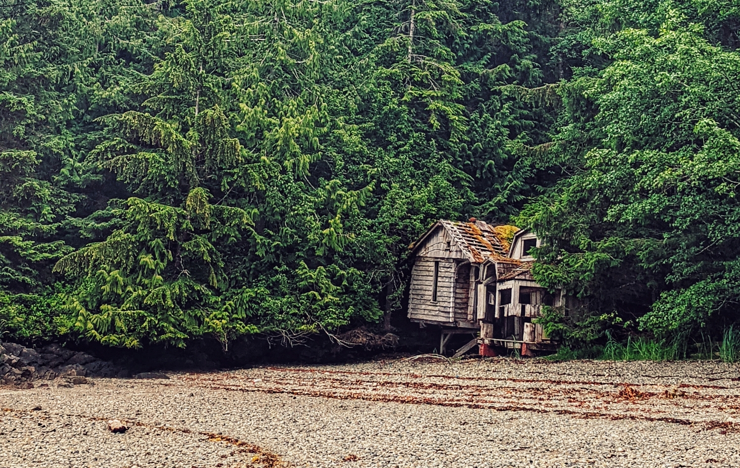
    As noted, Smugglers Cove is tiny but its ease of access makes it far more attractive, in our view than the more popular Secret Cove. Smugglers Cove is literally right off the road whereas, with Secret Cove, you have to drive nearly an hour on rough logging roads and then hike a short trail. Its physical geography is also similar to that of Secret Cove: The beach is primarily made up of small stones while each side of the cove features a rocky shoreline replete with a variety of stunning sea life. Keep an eye peeled for small beach crabs! Smugglers Cove is also home to some old cabin remnants, which makes for a unique photo opportunity!

    While it is possible to take a dip in the ocean, we think Smugglers Cove is far more suitable for a picnic or relaxation on the pebbly beach. The cold water from the open ocean can be challenging if you do not have a wetsuit even on a hot summer day. It is also recommended you have a pair of strong sandals when dipping in the water as the sharp little rocks can be hard to navigate. As you sit here and marvel at Haida Gwaiiโ€™s natural beauty, you just might spy โ€œRemiโ€™s Cabinโ€ in the distance!


    DIFFICULTY: Easy
    TOTAL DISTANCE: N/A
    TIME: N/A
    TYPE: Beach walk
    ELEVATION GAIN: None

     
  • Roughing It Out at Three Mile Creek Trail

    Roughing It Out at Three Mile Creek Trail

    THREE MILE CREEK TRAIL FEATURES:
    Salmon spawning creek
    Cascade
    Tlall Conservancy


    ABOUT

    The Three Mile Creek Trail is found deep within the Tlall Conservancy. Accessing it in the current day requires a bit of effort because the original point of entry โ€“ Survey Forest Service Road โ€“ was formally decommissioned in 2016 after years of disuse.

    Now, if you wish to visit this trail, youโ€™ll have to drive nearly 1.5 hours along the Daajing Giids backroads: First, drive approximately 20 minutes along the QC Mainline (passing the decommissioned Survey Forest Service Road) until you come upon the un-signed junction for Lakes Main Road to your RIGHT.

    Take this turn and follow Lakes Main for nearly an hour โ€“ you will eventually connect to whatโ€™s left of the Survey Forest Service Road. Once here, youโ€™ll spy a bridge that crosses Three Mile Creek.

    If youโ€™ve come all this way to hike the trail, do NOT cross the bridge because the unsigned trailhead for Three Mile Creek Trail is just before the bridge on your RIGHT.

    Lack of maintenance for nearly two decades has made the route difficult to see but the faint outline of a trail is there. Descend the minor slope and begin your trek!

    In the late 1990s and early 2000s, Three Mile Creek Trail โ€“ along with the nearby Monique Creek Trail โ€“ was promoted in an interpretive booklet by the Tlell Watershed Society. Evidence of their โ€œwilderness interpretive routeโ€ narrative can still be found near the start of the trail. Look up at an alder tree near the Three Mile Creek bridge โ€“ youโ€™ll spy signage explaining the creekโ€™s role as an important area for spawning coho and steelhead salmon. I suspect there were more signs like this along the trail, but we didnโ€™t see any on our hike. Time and the elements have likely eliminated them.

    While the trail is only 1 kilometre in length, expect to take at least an hour to complete the full route. Three Mile Creek hasnโ€™t seen any maintenance for nearly 2 decades โ€“ well before the decommissioning of Survey Forest Road โ€“ and it shows. Almost right out of the gate, the trail is difficult to find and follow.

    The path is mostly overgrown and significant deadfall litters the trail. The odd trail marker can still be found, and they help somewhat, but we still lost the trail for brief moments. I guess the best thing to keep in mind is that the route basically follows Three Mile Creek for its duration.

    As we hiked along the creek, we admired the old-growth Sitka Spruce and Red Cedar. We did not encounter any wildlife; however, we did spy on elk tracks and bear dung along the way.

    Why might someone wish to come into the backcountry and hike this trail? I can posit a couple of reasons: 1) To explore an important tributary to the Tlell River Watershed; and, 2) To probe deeper into the Tlall Conservancy beyond whatโ€™s available near the community of Tlell. Either way, getting here and hiking the trail are certainly adventures in their own right!


    DIFFICULTY: Moderate
    TOTAL DISTANCE: 2km (return)
    TIME: Approximately 2 hours, depending on skill level
    TYPE: Out-and-Back
    ELEVATION GAIN: None

  • Ocean Views on the Government Docks

    Ocean Views on the Government Docks

    GOVERNMENT DOCKS FEATURES:
    Family-friendly
    Views of Masset & Skidegate Inlets
    Urban hike


    ABOUT

    It might seem silly to write about the three Haida Gwaii Government Docks as trails โ€“ and believe me, I do feel kind of silly โ€“ but they are identified as โ€œtrailsโ€ in the Haida Gwaii Trails Strategy document (2011). I suspect this was probably done for funding purposes and to inflate the number of trails on the archipelago, though Iโ€™m not sure why one would need to do that. Even if we went for a very loose definition of what constitutes a โ€œtrail,โ€ I somehow doubt these would make the cut; after all, they are, as their name explicitly states, docks.

    But letโ€™s ignore that for a moment. Letโ€™s presuppose that these three docks donโ€™t just serve a specific function (as a place for boats to moor). Instead, letโ€™s treat them as trails โ€“ a marked or established path to be followed.

    Masset Government Dock

    Located at the end of Collison Avenue, just off Delkatla Street, the Masset Government Dock is the shortest of the three, at least as far as the โ€œmain fingerโ€ goes, clocking in at approximately 100 meters long. From here, you can get nice views of both Delkatla and Massett Inlets; watch the busy harbour activity below; and, if youโ€™re lucky, spy a few ducks swimming along the harbour docks.

    The main Government Dock is wheelchair accessible; however, I would suggest that the boat moorage areas are not quite as friendly. Of note, this dock does feature a lovely โ€œLittle Library.โ€ Interestingly, just down the road from the Masset Government Dock is the Village of Masset Wharf.

    Located at the end of Main Street, this wharf is just under 200 meters in length and provides nice views of Massett Inlet. In addition, there is a small path at the head of the wharf which provides beach access. Be warned that the wharf is very slippery in some sections.


    Port Clements Government Dock

    Located along Bayview Drive, the Port Clements Government Dock is approximately 200 meters in length; provides nice views of Massett Inlet; is wheelchair accessible; and, features a couple of benches at its end. One thing I liked about this dock is the creative birdhouse tree located just off to its right.

    The views you can get from this dock on a clear day are nice, but the endless activity of our feathered friends in the birdhouse tree can keep one occupied for a long time! Also, this dock is nicely lit up with Christmas lights during the holiday season!


    Queen Charlotte Government Dock

    This โ€œtrailโ€ technically begins at the Queen Charlotte Visitors Centre, takes you through Spirit Square, and then along Wharf Street onto the dock, which affords you nice views of the adjacent harbour and inlet. As the Port Clements dock it is approximately 200 meters in length. Part of this โ€œtrailโ€ may be a bit confusing because the Queen Charlotte Seawalk also starts at the Visitor Centre; however, the Seawalk moves in the opposite direction of the Government Dock.

    All in all, the three Government Docks provide for a fairly uniform, if not unremarkable, experience. Despite being categorized as trails you will not find any trailhead markers indicating as such, which hardly surprising given their function and purpose. Still, if youโ€™re looking for a quick and easy walk-in Queen Charlotte, Port Clements, or Masset, these docks may suffice. What they may lack in excitement, they kind of makeup for with the scenery surrounding them.

    Of course, if you want actual trails Haida Gwaii has plenty of those, too!


    DIFFICULTY: Easy
    LENGTH: Each approximately 200 meters or less
    TRAIL TYPE: Out and Back