Go Hike
-
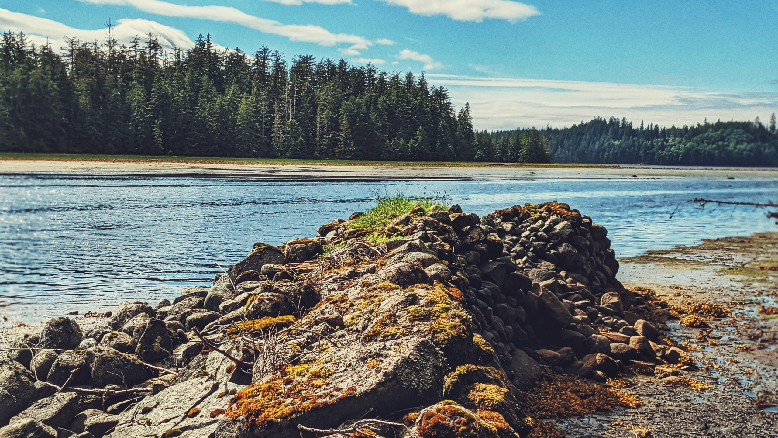
Charlie Hartie Trail Hike
Charlie Hartie Trail, named after a nearby creek which itself was named after early residents of what was then Queen Charlotte City, located at the top of 6TH street, just off 1ST Avenue (turn right).
-
Spirit Lake Connector/K’yuu Aanagung – A Relaxing Hiking Network
The Spirit Lake Connector /K’yuu Aanagungis a user-maintained point-to-point trail in Skidegate. The route is relatively short, clocking in at just over 2 kilometres one-way. Depending upon one’s fitness level, and how long you spend at each of the lookout points, the entire trail can be completed in about 2 hours.
-
Old Growth Alley: The “Forgotten” Trail
For those wishing to access the lower Tlell River and experience the old growth “alley” in a more expedient way and manner, then the northern entrance is the most convenient. To access this trailhead, turn up the short dirt road indicated by Tlell “Farmers Market” signage and then park your vehicle at the nearby soccer…
-

A Local Favourite – Miller Beach
Located approximately 5 minutes north of Skidegate by car, you’ll find Chinukundl Creek, more popularly known as Miller Creek. Just up from the bridge, you’ll also spy Chinukundl Road. Turning up the road will take you into the informal community known as Miller Creek.
-
Rose Spit – First People at the Edge of the World
Located on the northeastern tip of Graham Island, and wholly within Naikoon Provincial Park, Rose Spit is perhaps best described as a long beach walk rather than a trail hike. To begin your North Beach trek towards “the Spit,” walk down the dirt road from the Hiellen Cabins and onto the beach: You are now at…
-
A Serene Walk: Pure Lake Trail
To access Pure Lake Trail, you must hike a short trail of approximately 329 meters (one-way). It only takes about 3 minutes to reach the lake, but please note that sections of this trail can and do get quite muddy – especially after some rainfall. Once you reach the terminus point of the trail, you’ll…
-
Windy Bay Sitka Spruce Trail
In order to get to Hlk’yah GawGa, you’ll have to book a tour through one of Haida Gwaii’s local touring operators or, if you’ve got the endurance and seafaring knowledge, a multi-day kayak adventure.
-
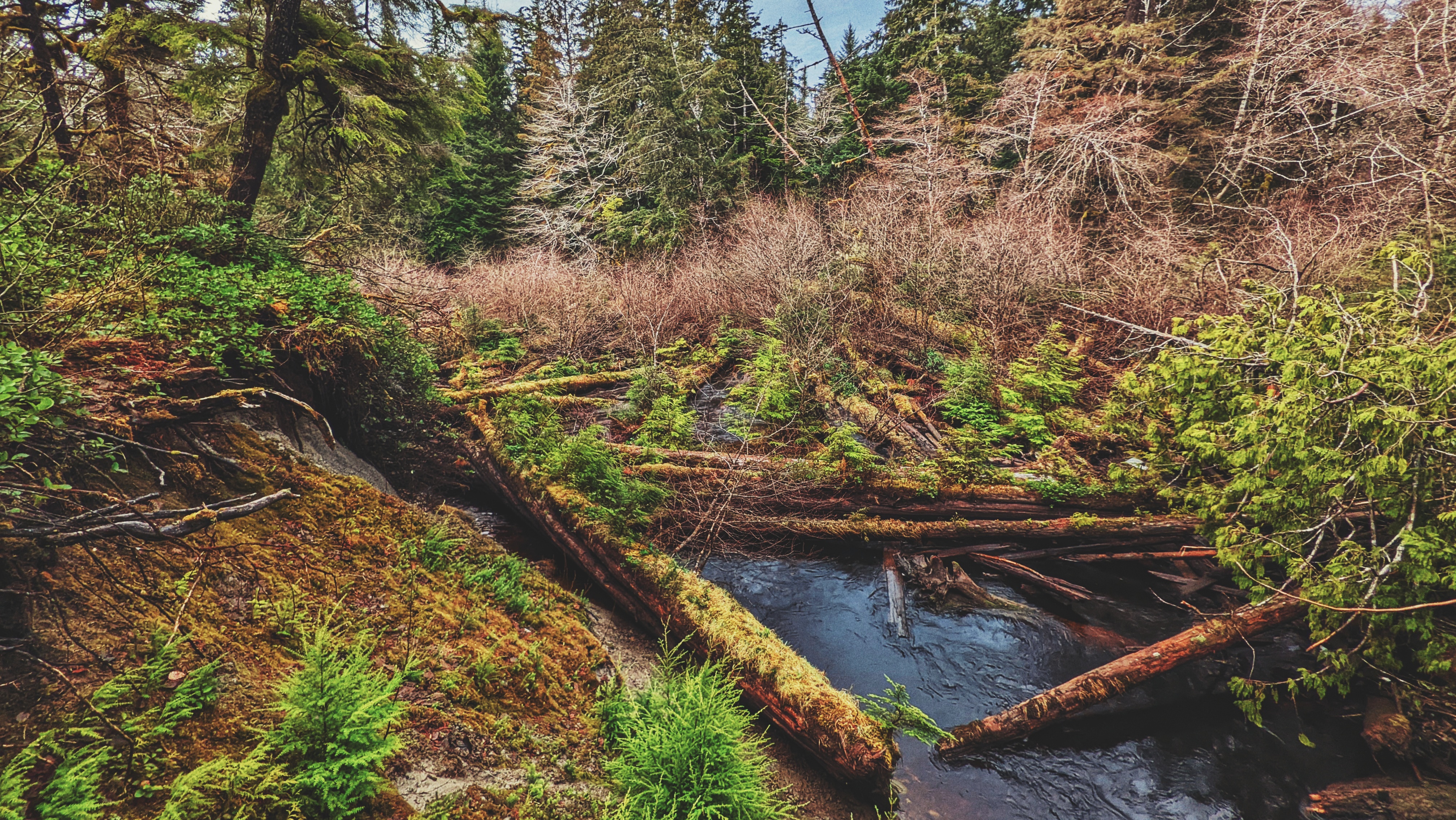
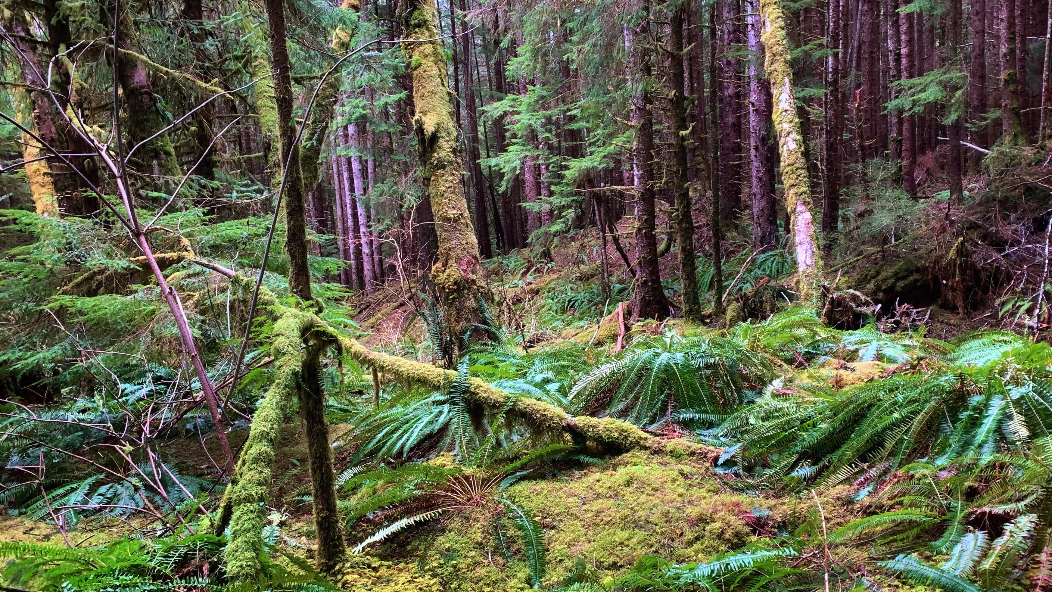
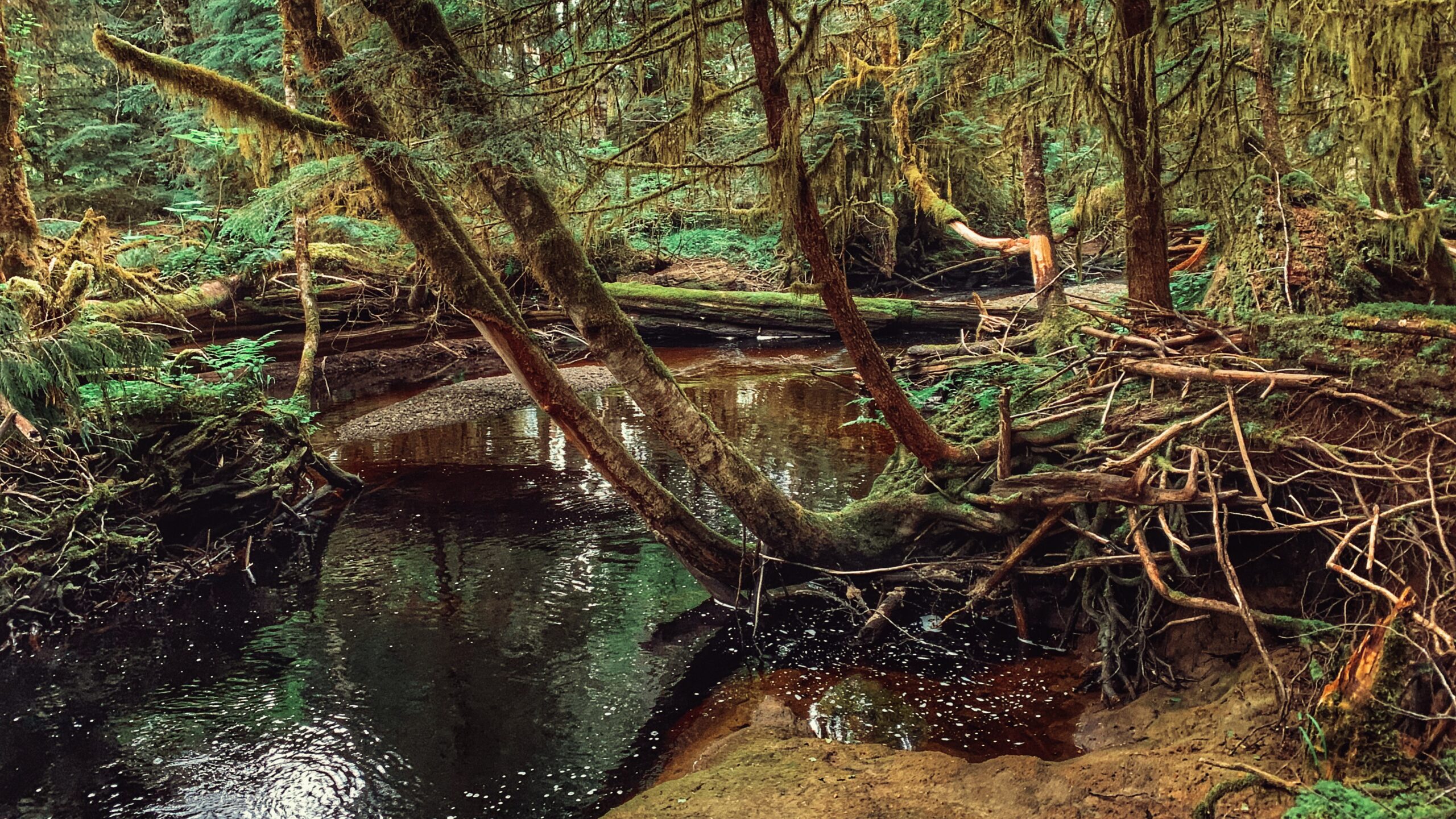
Anvil Trail – Find Log Jams and Old Growth Forest
The Anvil Trail, which is located in the Tlall Conservancy, is one of the more popular trails on Haida Gwaii and is the only maintained route originally developed by the Tlell Watershed Society (TWS). It follows a 5-kilometre interpretive route and takes you through second-growth forests, old-growth, riparian floodplains, and even some minor boggy sections.
-
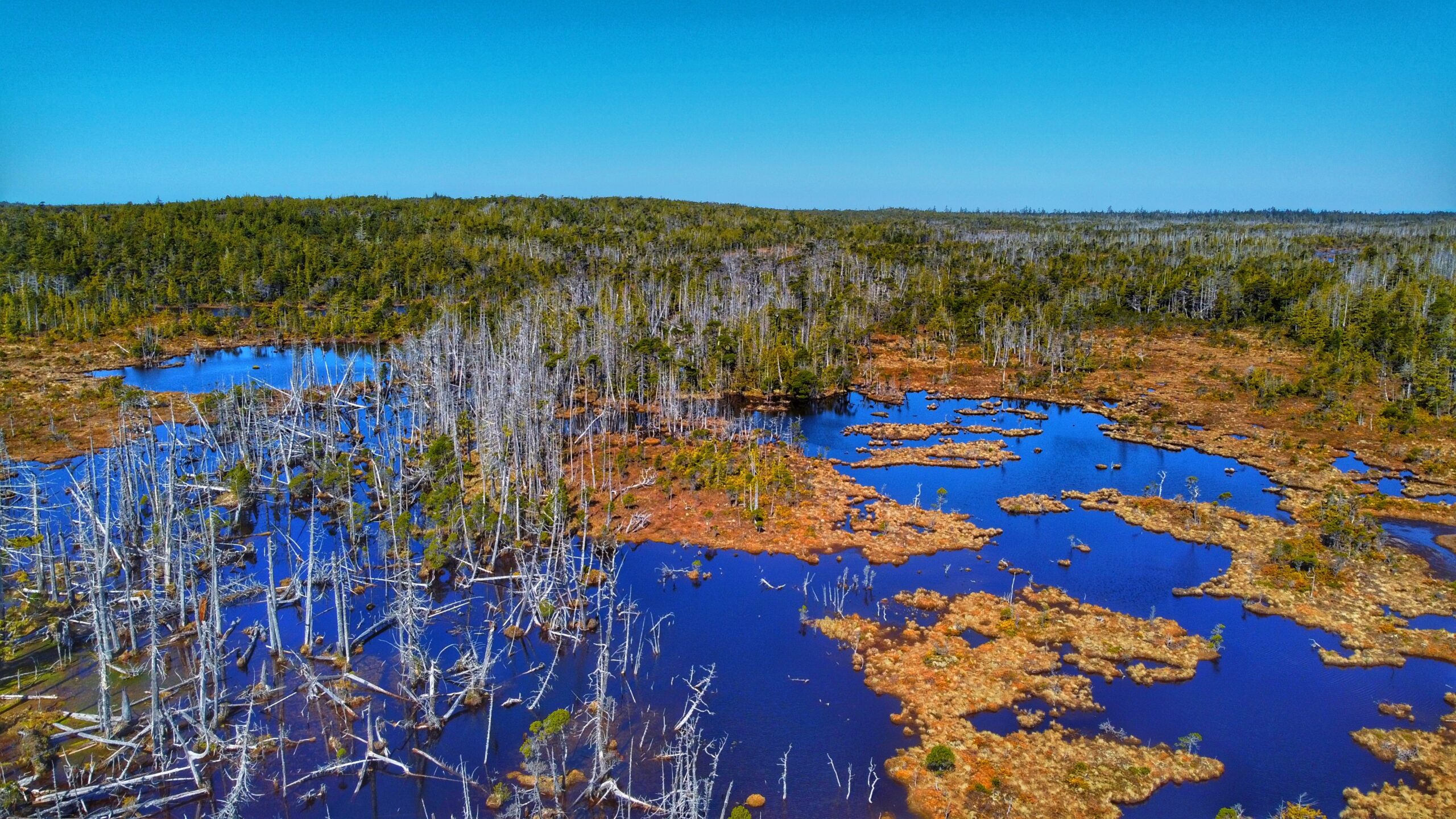
Serengeti of Haida Gwaii – White Creek Trail
Situated within Naikoon Provincial Park, White Creek Trail is a relatively flat 3.5-kilometre out-and-back trail. The trail, which is an early 20th-century settler wagon road, begins on the west side of White Creek, near the bridge. You’ll see a small sign – the trailhead marker – indicating that the route is not maintained. Despite this,…
-
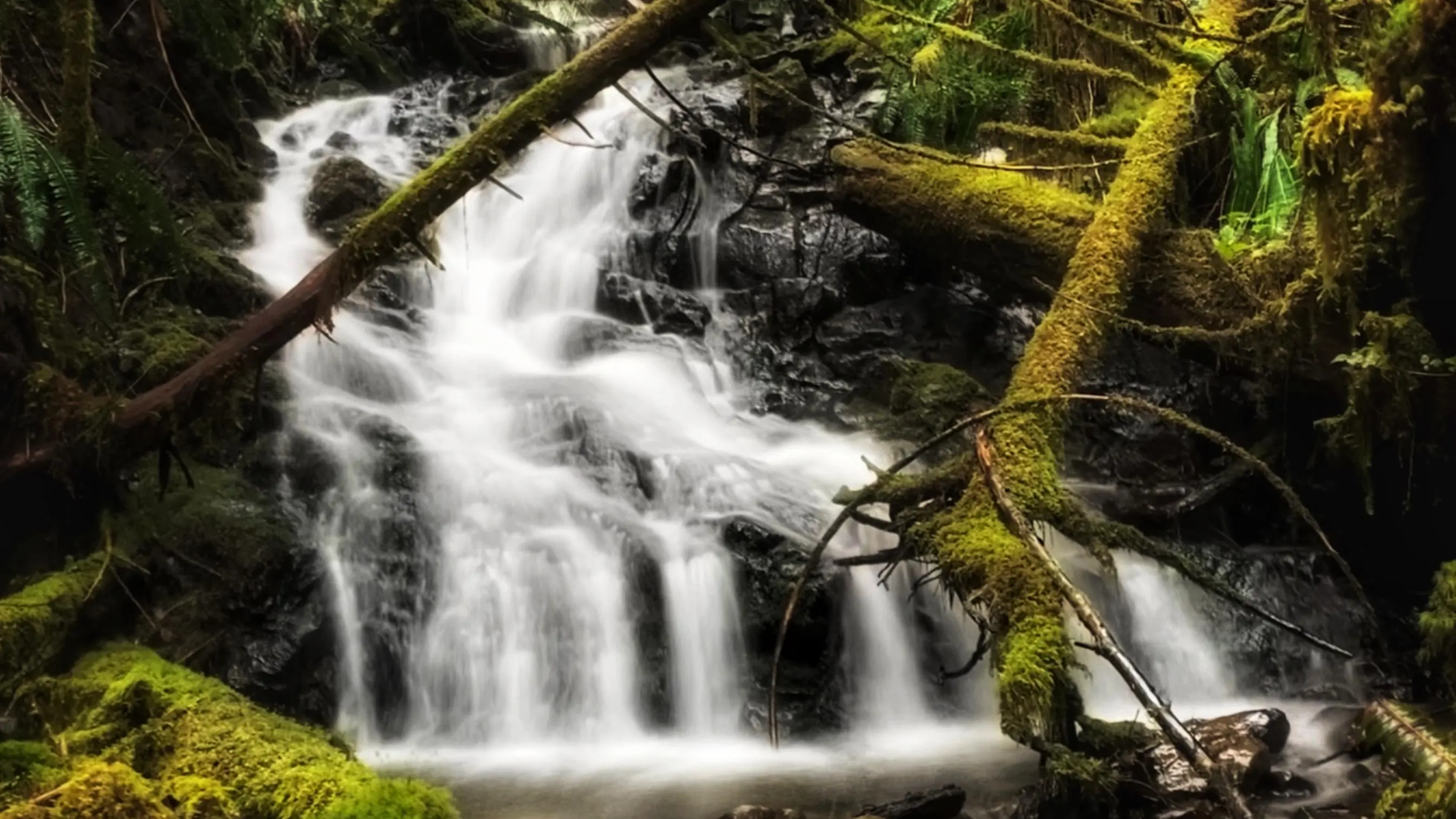
Impressive 5-Mile Marker Waterfall Trail
5-Mile Marker Waterfalls TrailQuick & easy to accessRelaxing spot ABOUT While there are a number of nice waterfalls on Haida Gwaii, most are either extremely remote and/or require a bit of effort to get to – some are some exceptions like the 5-Mile Marker Waterfall Trail. Then there are a select few that are relatively…
-
Survey the Evans Homestead Trail
Located within the 2,722-hectare Kamdis Heritage Site/Conservancy, the “Evans Homestead” Trail was first brought to our attention via a series of old photos taken in 1957 by Terry Annis, and posted by Go Haida Gwaii. The ruins of the homestead, and the promise of massive rhododendrons, were most enticing. Unfortunately, directions towards this unmarked and…
-
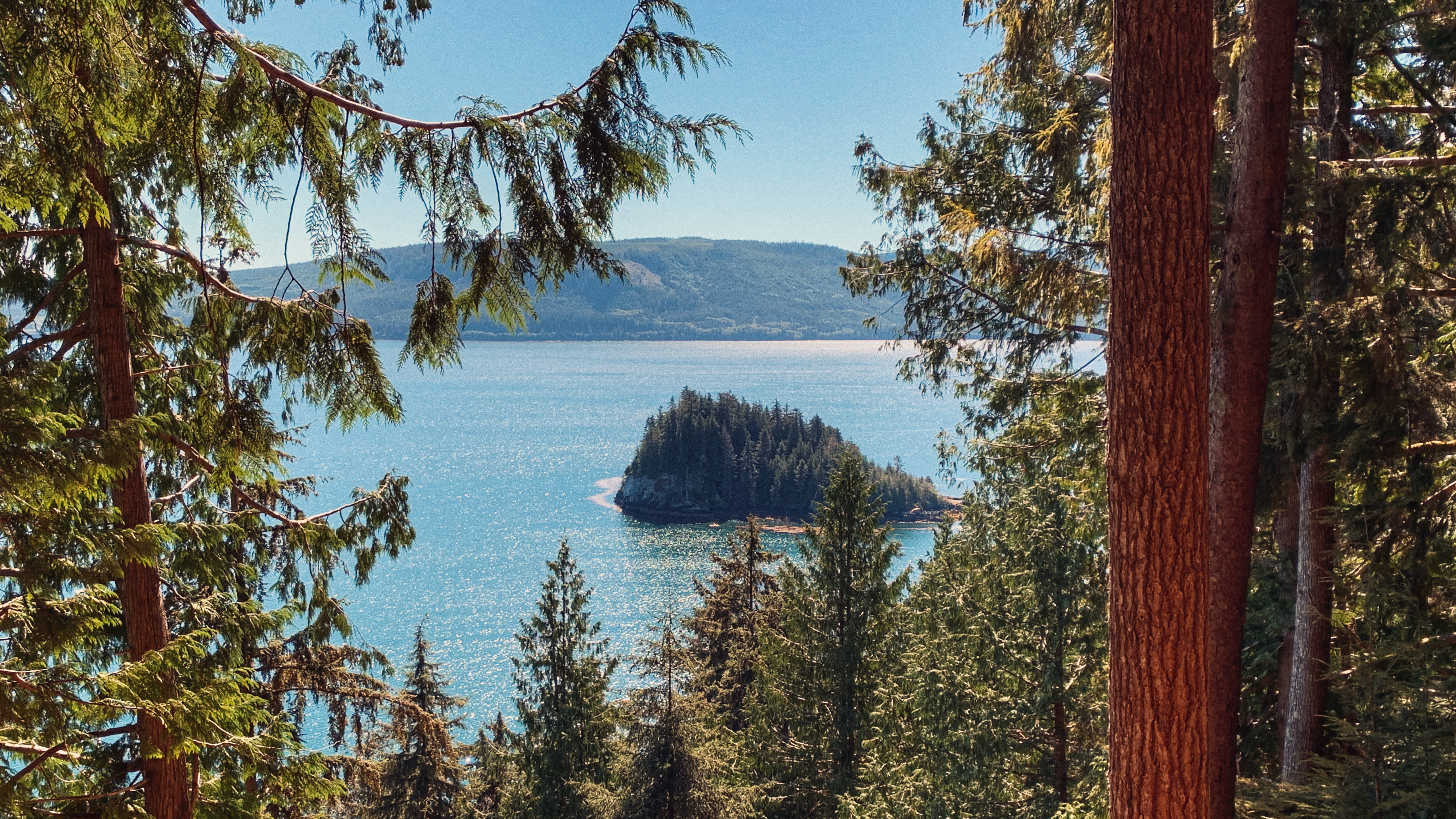
Vintage Point Gazebo – Onward Point Trail
Onward Point Trail – While at the gazebo – gaze out towards Skidegate Inlet … you may even spy a grey whale or an orca in springtime.
-
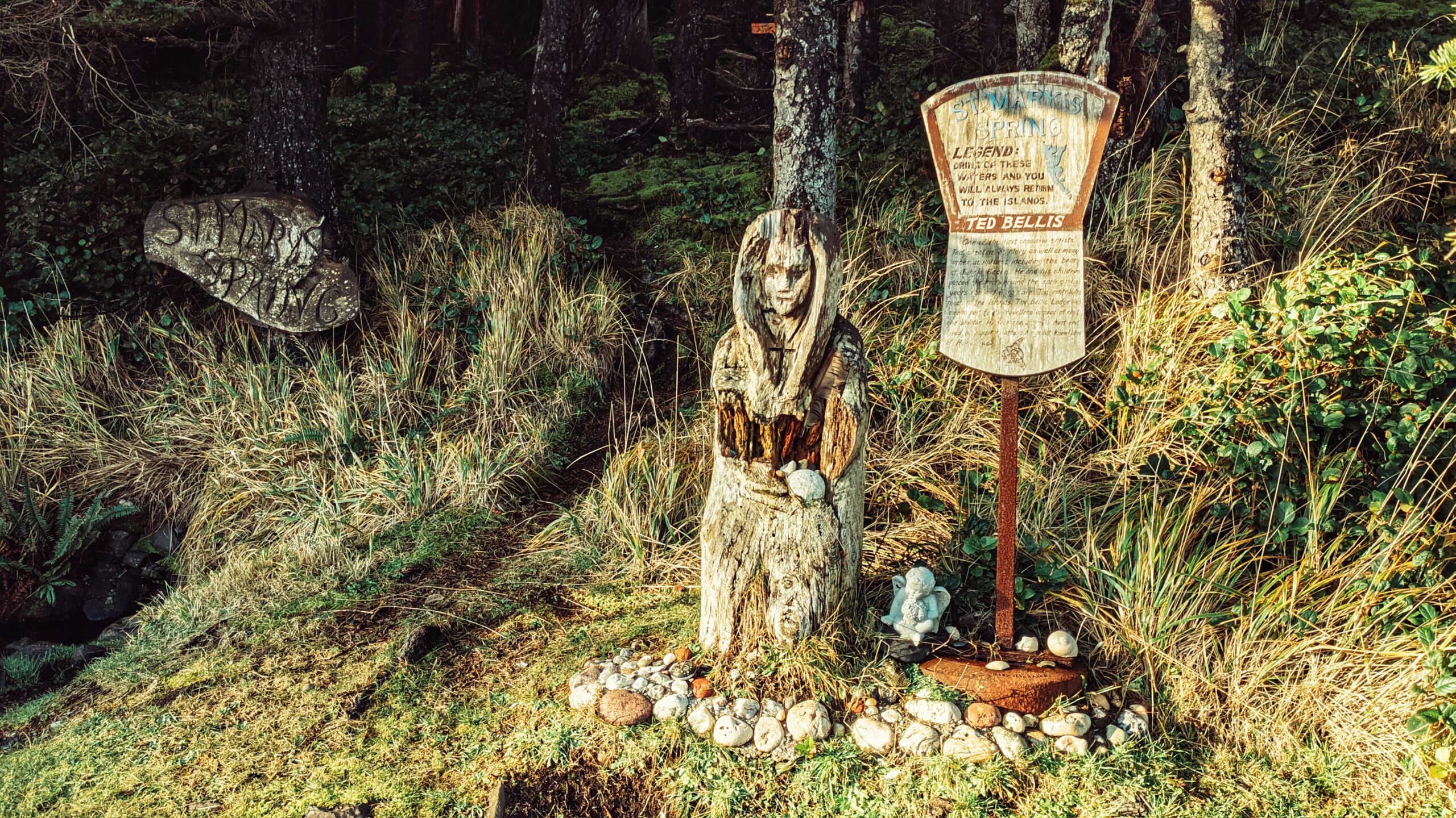
Haida Gwaii’s Wooden Madonna – St. Mary’s Spring Trail
Unlike most places on Haida Gwaii, St. Mary’s Spring Trail is quite young in terms of its history. At the beginning of the 20th century, this area was known as “Duncan’s Well,” named after an early homesteader. It is said that travellers used to stop and re-hydrate their horses at the small well. Beginning in the…
-
Naikoon Canoe Trail Along Tow Hill Road
The “Naikoon Canoe Trail” is very short at just 140 meters one-way. It is also unmarked, but well worth the effort to find. Having seen and witnessed many blank or old Haida Canoes over the last few years, we were both keen and curious to locate this one after having seen it in some tourist…
-
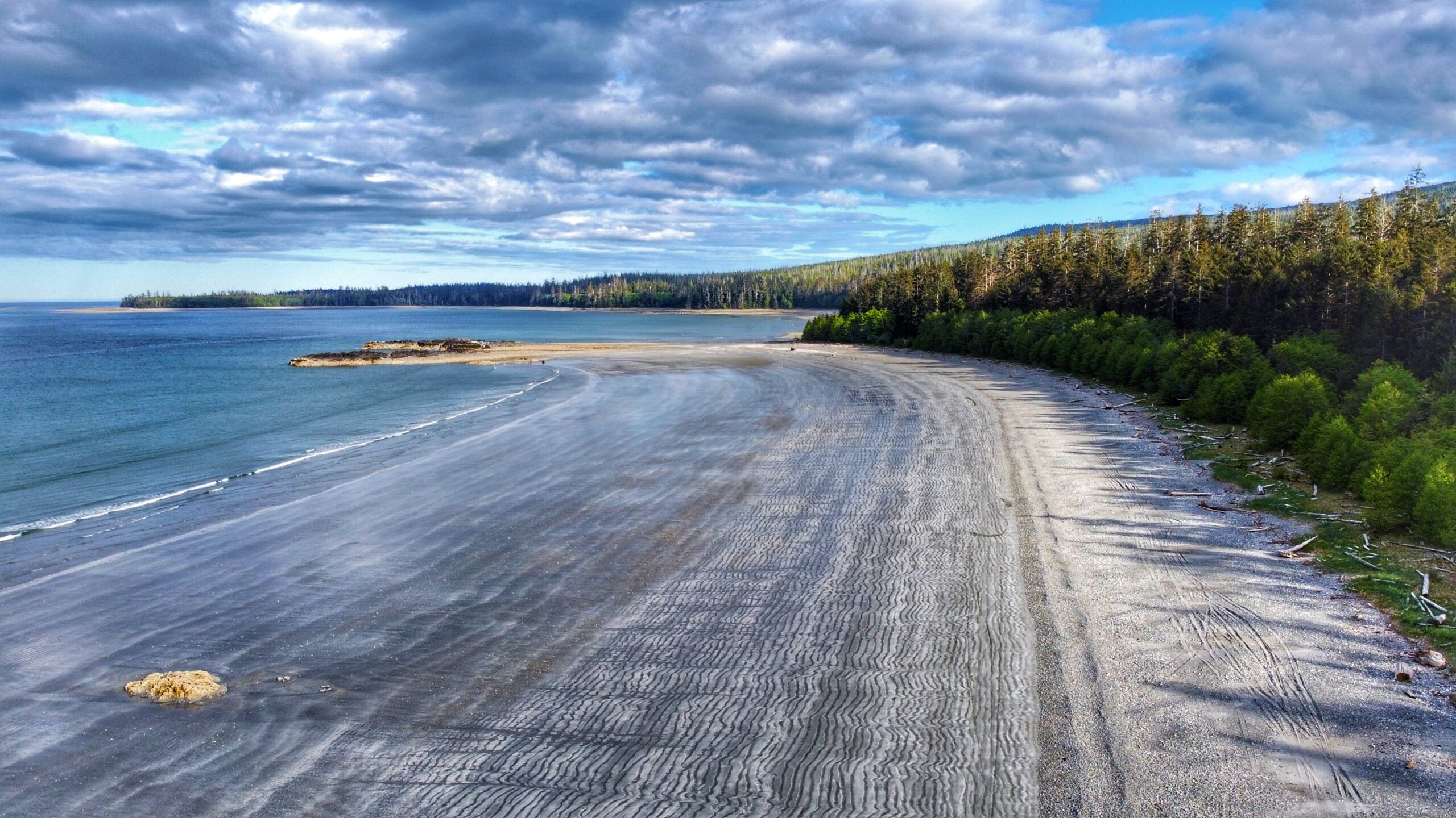
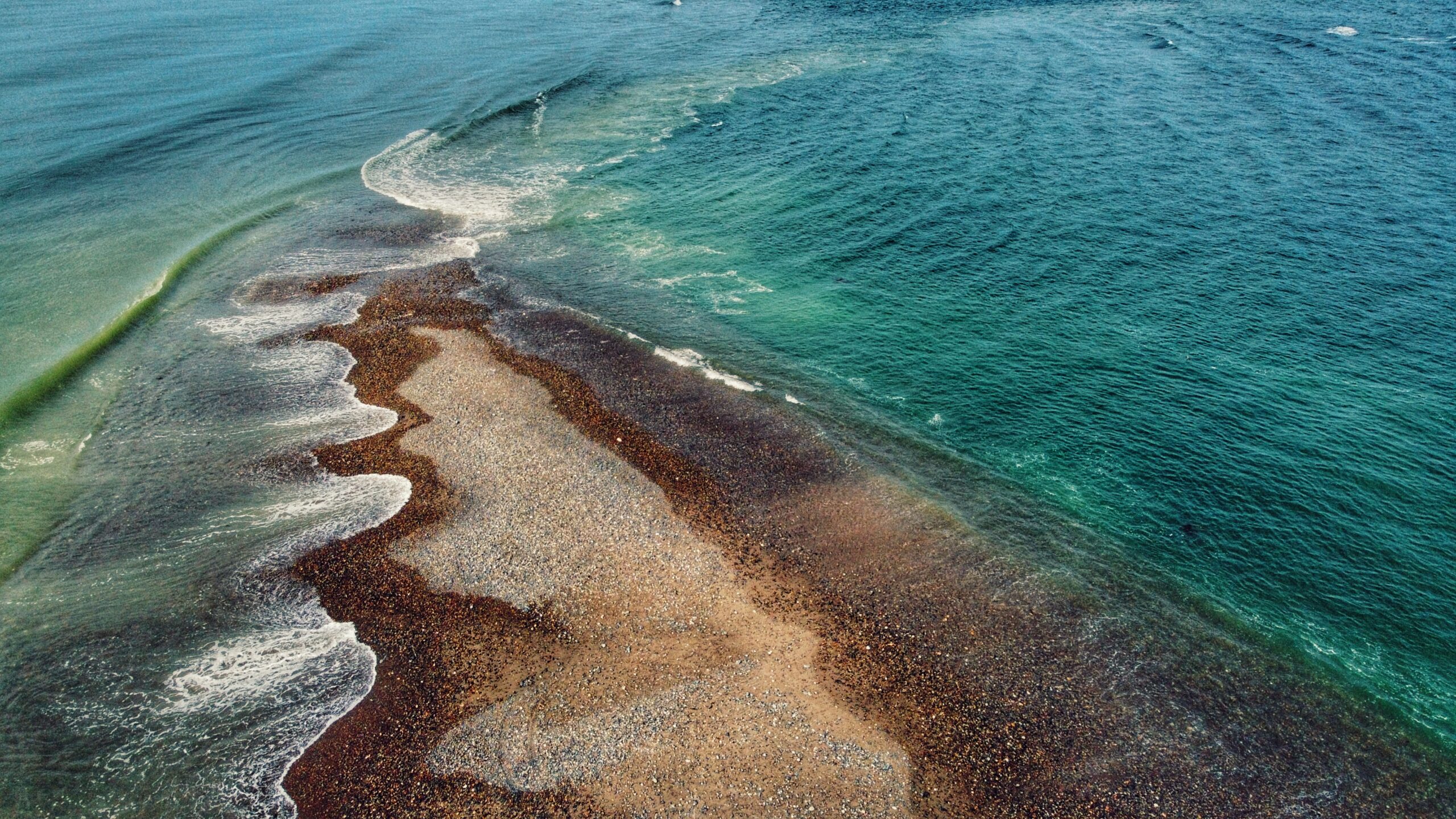
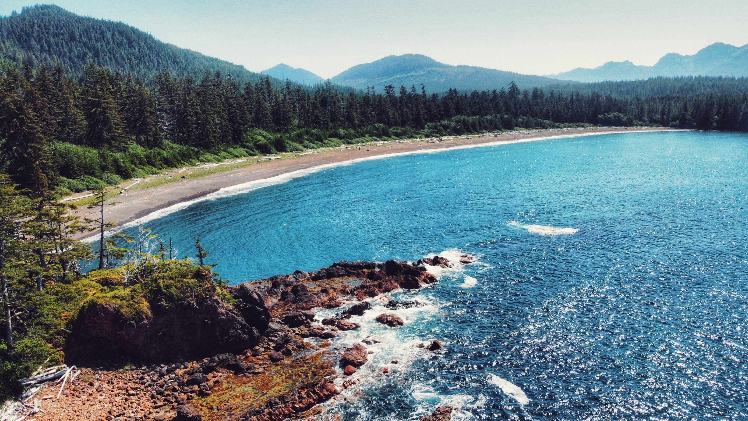
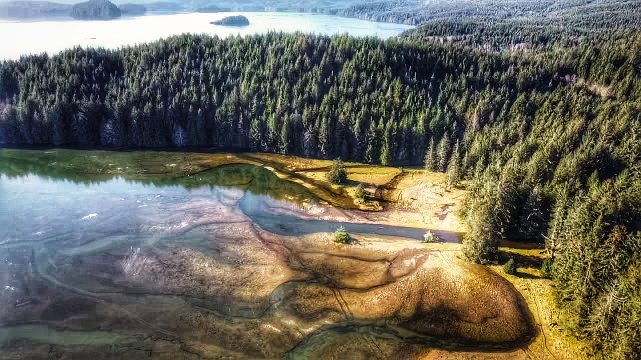
Gray Bay: A True Wilderness Beach
At low tide, one could seemingly walk for miles along the unique “wavy” gray sand, admire the delicate sea life in nearby tidal pools, beach comb, ride an ATV, kayak or enjoy a nice dip in the ocean. If hiking is more your thing, the 12km (one-way) Cumshewa Head Trail can be found at the…
-
A Rich Beach – Kagan Bay Beach Trail
Located west of Daajing Giids, and approximately 3 kilometres along the Honna Forest Service road, is the Kagan Bay Beach Trail. The Kagan Bay Beach recreational site offers six user-maintained campsites, all of which face the beach.
-
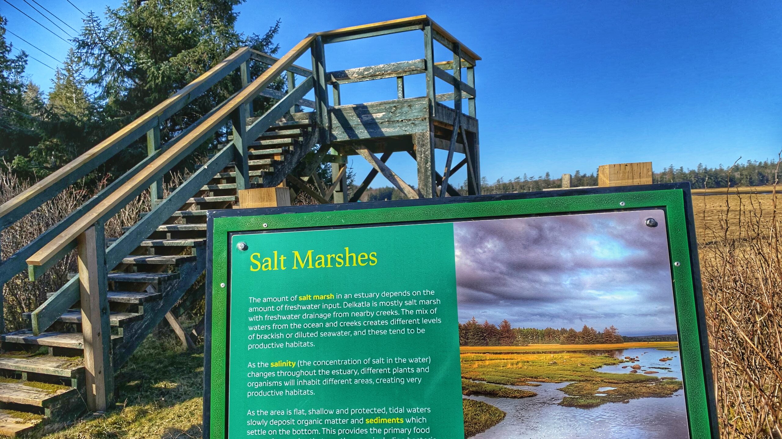
A Birdwatcher’s Delight – Stroll the Delkatla Nature Sanctuary Trail
Described by the Village of Masset as “one of [its] main attractions,” the Delkatla Nature Sanctuary Trail was established in 1969 and is a 290-hectare intertidal wetland area that serves as a “critical migratory stopover for birds during spring and fall migration, an important wintering waterfowl area and home to many summer nesting species.” Since…
-
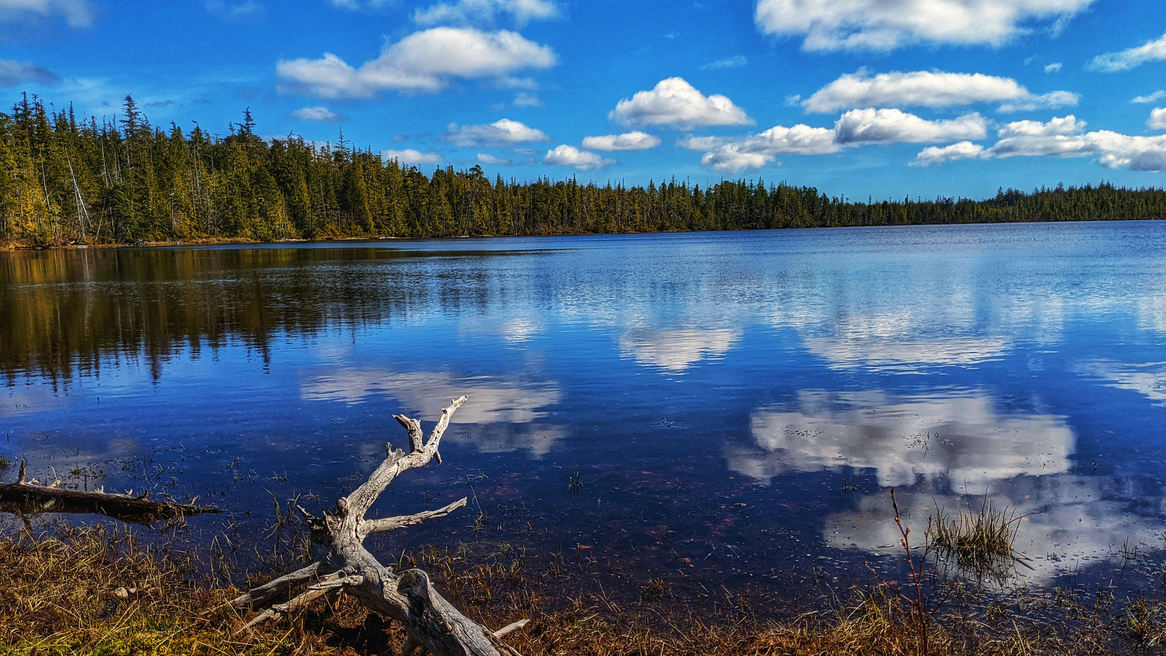
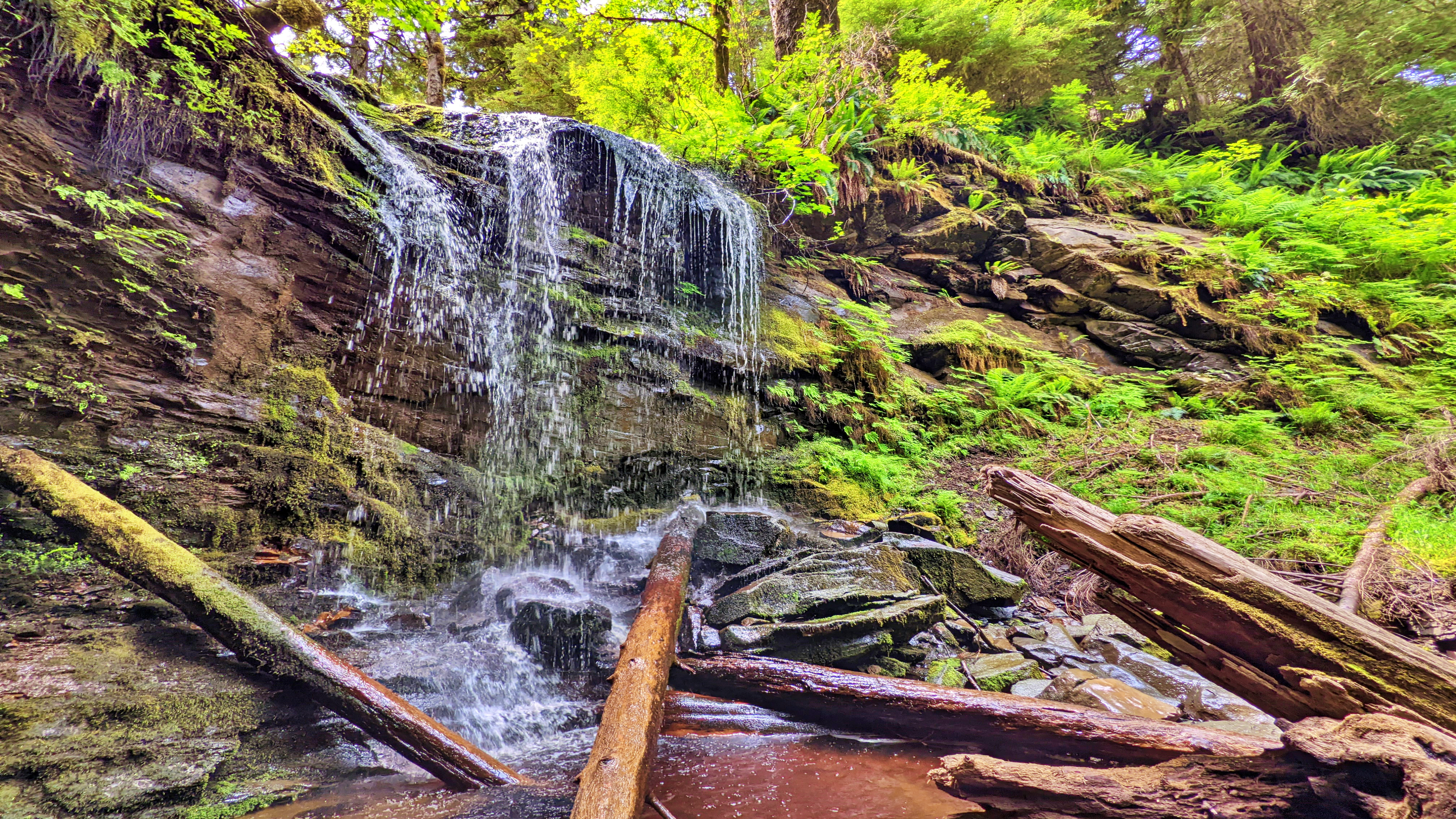
Challenge the Slopes to Scout Lake Trail
Locating the Scout Lake Trailhead marker is an adventure in itself. To find this trail, you first have to hike the full Charlie Hartie Trail, which clocks in at approximately 800 meters one way and has an elevation gain of 160 meters. After about an hour of hiking, you’ll come upon the official terminus point…
-
Andrews Place Road Trail: Easy Access to Naikoon Provincial Park
The Andrews Place Road Trail is a short out-and-back route located at the end of, well, Andrews Place Road in Tlell. The trailhead is not formally marked; however, it can be seen adjacent to a hydro pole at the end of the cul-de-sac, next to Sandy House. At just 250 meters in length, it only…
-
Exploring Damaxyaa Conservancy – Louise Dover Trail
The Louise Dover Trail is located adjacent to the Haans Creek bridge, just before entering Sandspit. Initially conceived in the mid-1990s, the trail is named after Louise Dover, an influential woman of Haida ancestry who lived in the community of Sandspit. In many respects, the trail is an apt memorial and tribute because it introduces…
-
Roughing It Out at Three Mile Creek Trail
The Three Mile Creek Trail is found deep within the Tlall Conservancy. Accessing it in the current day requires a bit of effort because the original point of entry – Survey Forest Service Road – was formally decommissioned in 2016 after years of disuse.
-
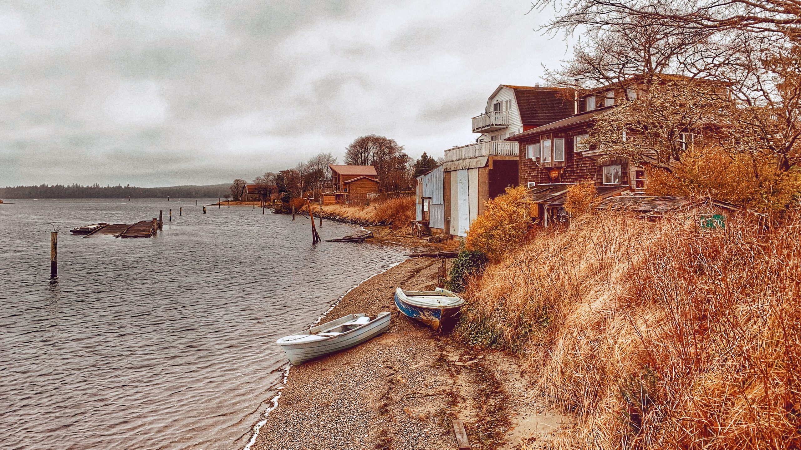
Ocean Views on the Government Docks
It might seem silly to write about the three Haida Gwaii Government Docks as trails – and believe me, I do feel kind of silly – but they are identified as “trails” in the Haida Gwaii Trails Strategy document (2011). I suspect this was probably done for funding purposes and to inflate the number of…
-
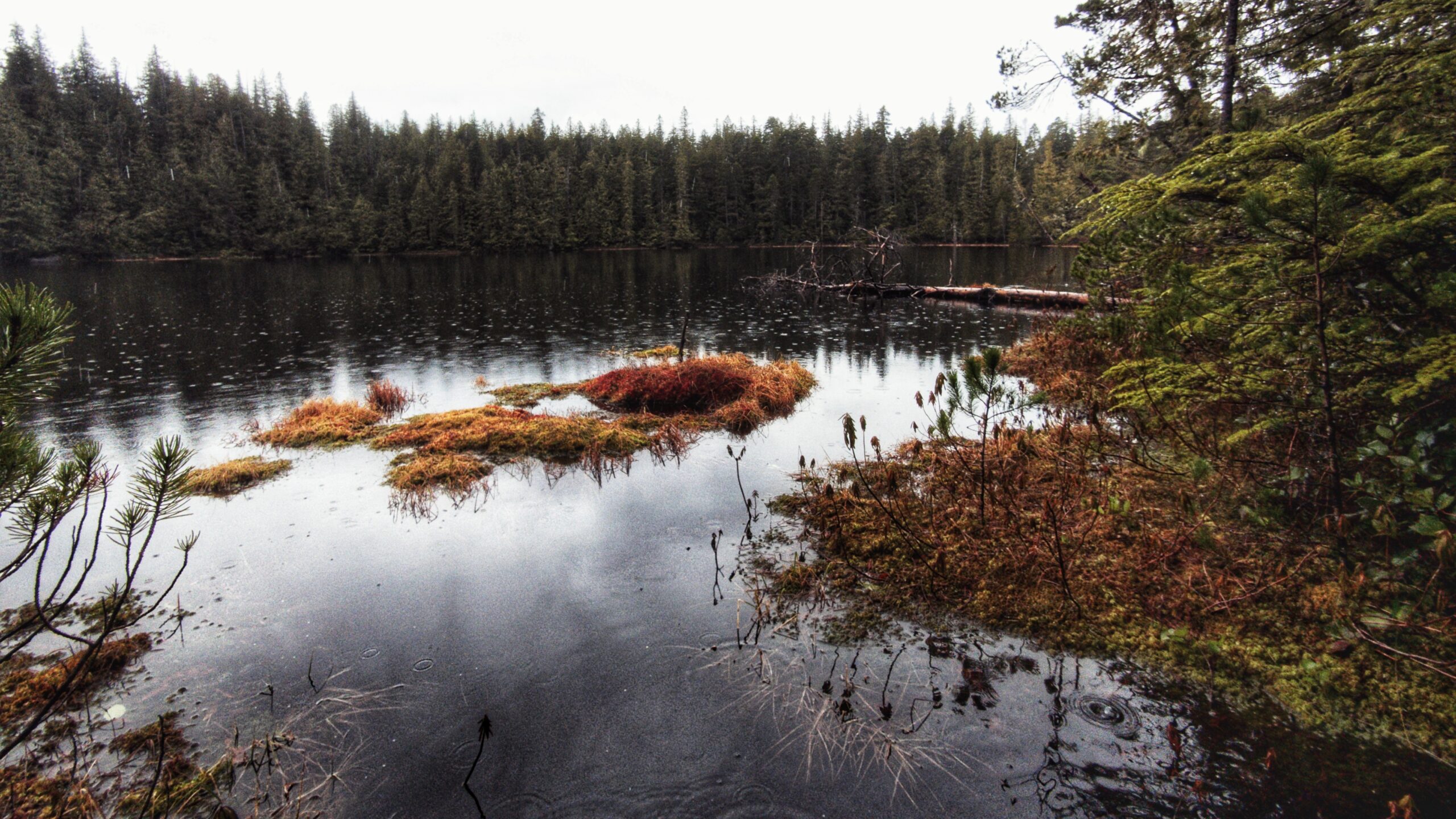
Canoe or Rat Lake Trail- Ancient Haida Canoes and CMTs
The Canoe Lake Trail, also lovingly called “Rat Lake,” is a rough route just outside the southern boundary of the Yaaguun Gandlaay Conservancy. The lake itself is small and characteristic of other bog lakes on Haida Gwaii; however, what makes this trail worth the trek and effort is what can be found around its general…
-
Sleeping Beauty Trail – Hiking Kuu Jad TlldaGaaw K’yuu
There’s no actual “Sleeping Beauty” trail on Haida Gwaii — the name refers to Mount Slatechuck and Mount Raymond, whose silhouette resembles a resting woman when viewed from Daajing Giids, leading hikers to mistakenly use it as a trail name.
-
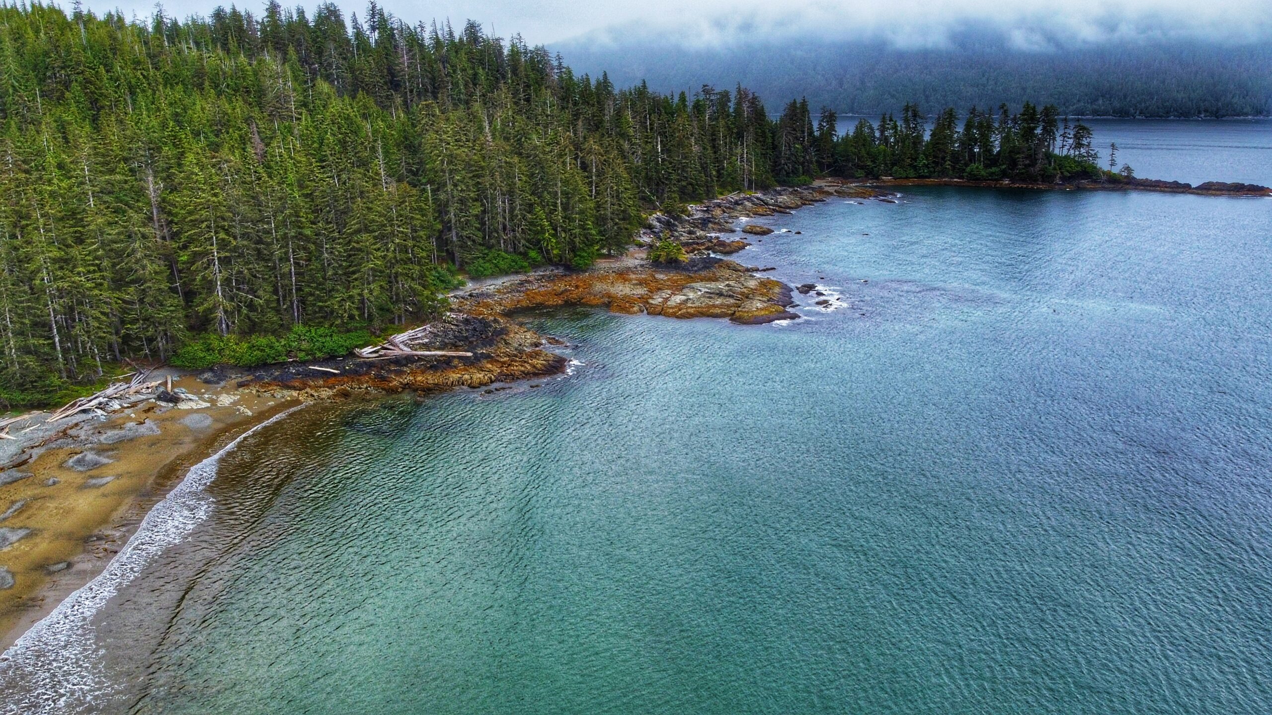
Gregory Beach – A Beachcomber’s Delight
Located within the Duu Guusd Conservancy, Gregory Beach offers a lovely sand and pebble beach for those wishing to relax and experience the dynamic environment that is Haida Gwaii’s rugged west coast. At the beach’s north end you will find Gregory Creek, which is home to spawning salmon in August and September. The small Gregory…
-
Riley Creek Trail – A Hike Through Old Growth Forest on the West Coast of Haida Gwaii
The Riley Creek Trail is the only substantive hiking trail within Rennell Sound where the trail itself functions as the attraction (with the other three, the trails are secondary to the beaches). While not formally maintained, the path is obvious and generally well-marked. When we hiked the route, there were only a couple of spots…
-
Five Mile Beach Trail – Short Hike to a Rocky Beach
The Five Mile Beach Trail is short and straightforward. Clocking in at just 180 meters, it should take no more than a few minutes to reach the rocky beach. The trail, while not formally maintained, is clear. Step with caution as you near the beach, however, because there are some minor tree roots to watch…
-
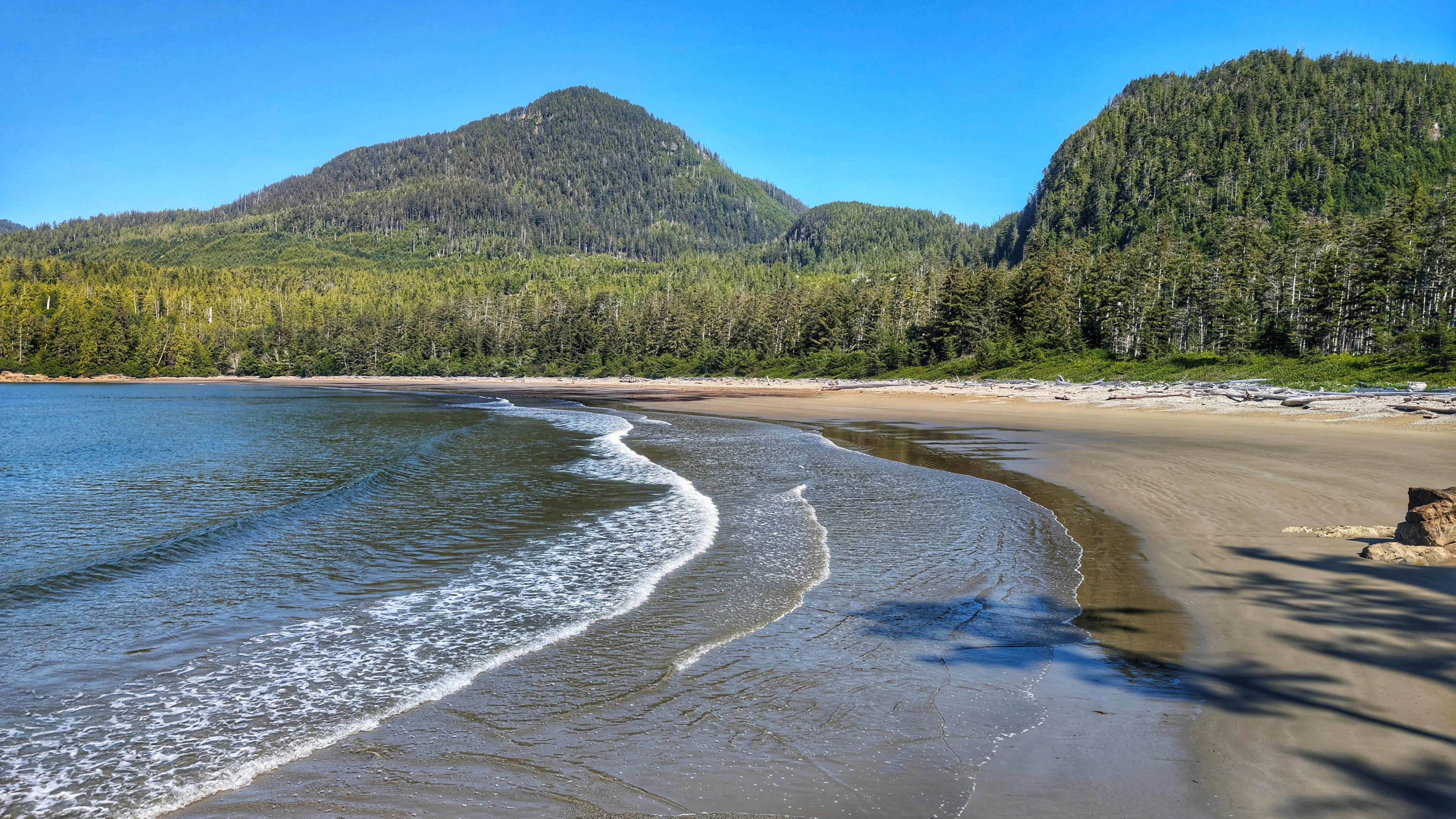
Bonanza Beach – Arguably The Most Beautiful Beach on Haida Gwaii
The trail to Bonanza Beach is brief @ only 400 meters one-way. As you hike towards the beach, you will be treated to second-growth forest, giant spruce burls, dense salal, and some beautiful old growth cedars as you approach the beach. It should take less than ten minutes for one to reach one of Haida…
-
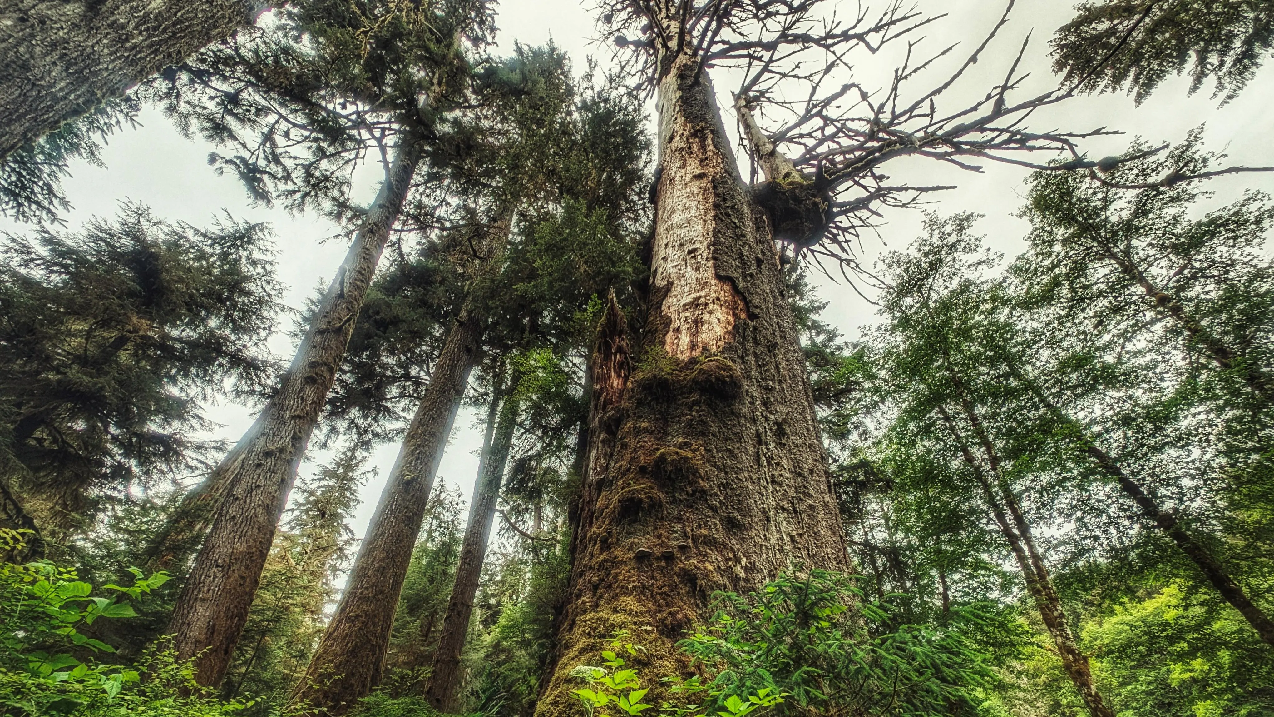
Yakoun Old Growth Sitka Spruce Grove
As noted, this is not a formal trail of the Yakoun Old Growth Sitka Spruce Grove; however, you should see a vague path once you cross the river. It will lead you to an old de-activated road. The grove of old growth Spruce is facing the river. Take your time and explore these monumental trees.…
-
Tarundl Lookout Trail – Epic Views of the Tarundl Flats
Be prepared for six rope sections. Most of these are short, and designed to help you over minor obstacles, but the final two – just before you reach the zenith – are essential in helping you reach the viewpoint safely. Once at the top, follow the narrow trail to a couple of viewpoints of the…
-
Hiking the High Road – Hatchery Loop Trail
The trail takes hikers along the “high road,” an old deactivated logging road, and gives the adventure-minded many options for completing the route: You can treat it as a large loop and come back hugging the highway; or, you can use the Hatchery Trail as a “connector” and branch out to other routes, including the…
-
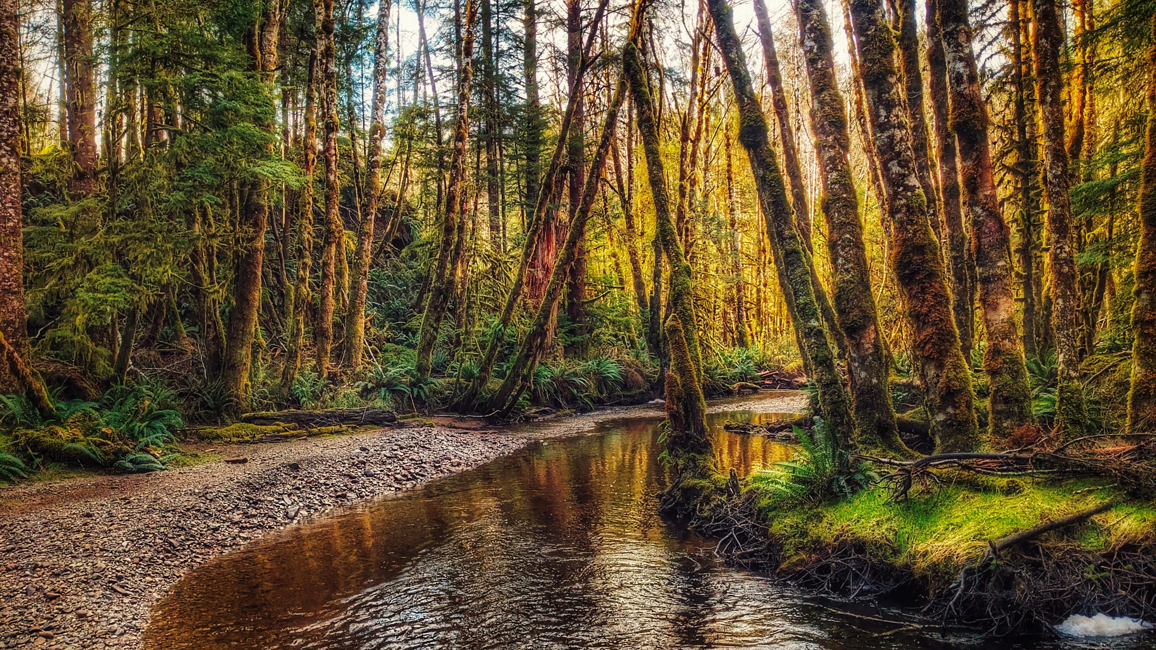
Sachs Creek Trail: A Lovely Wilderness Hike
Located roughly 1.6 kilometers east of the Moresby ferry waiting area, and just off Highway 16, you will find the informal Sachs Creek Trail. The trail is unmarked and isn’t primarily used as a recreational hiking route; the creek has been used with some regularity by university students in environmental studies programs. Today Sachs Creek…