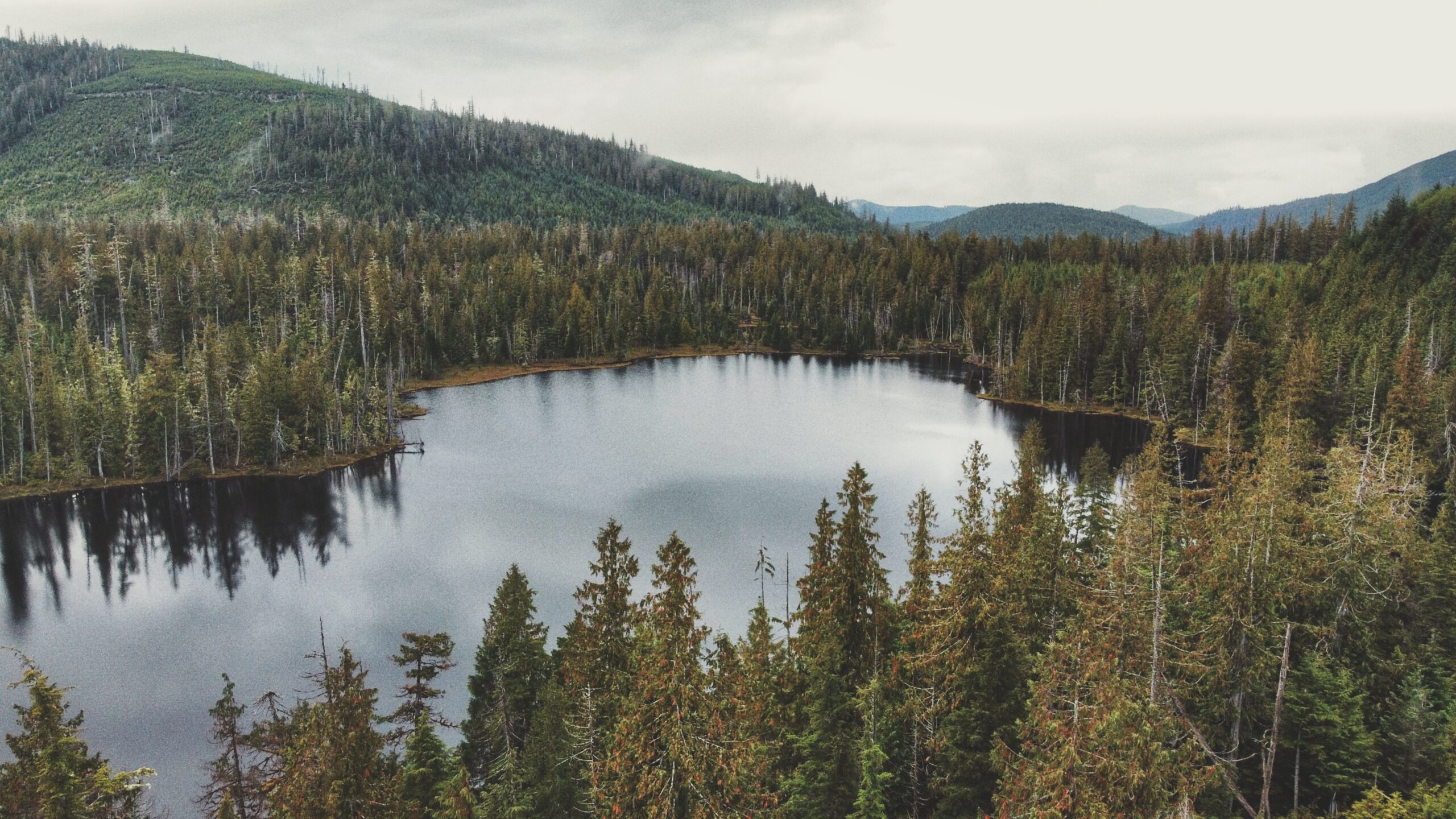
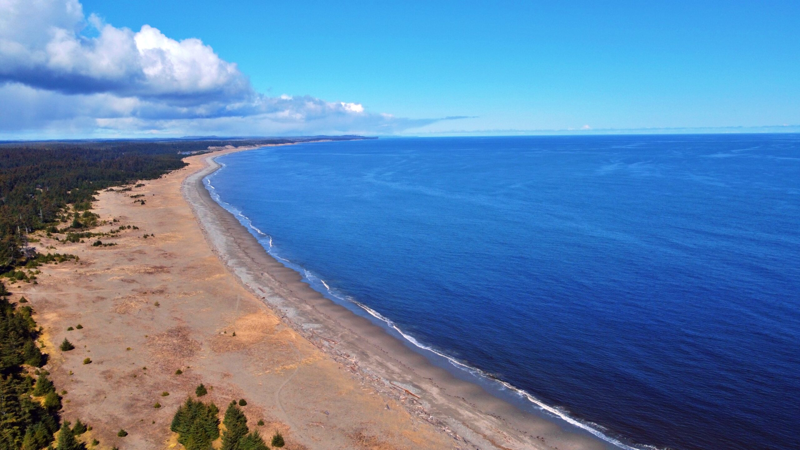
Aerial view facing towards Bear Skin Bay on the horizon
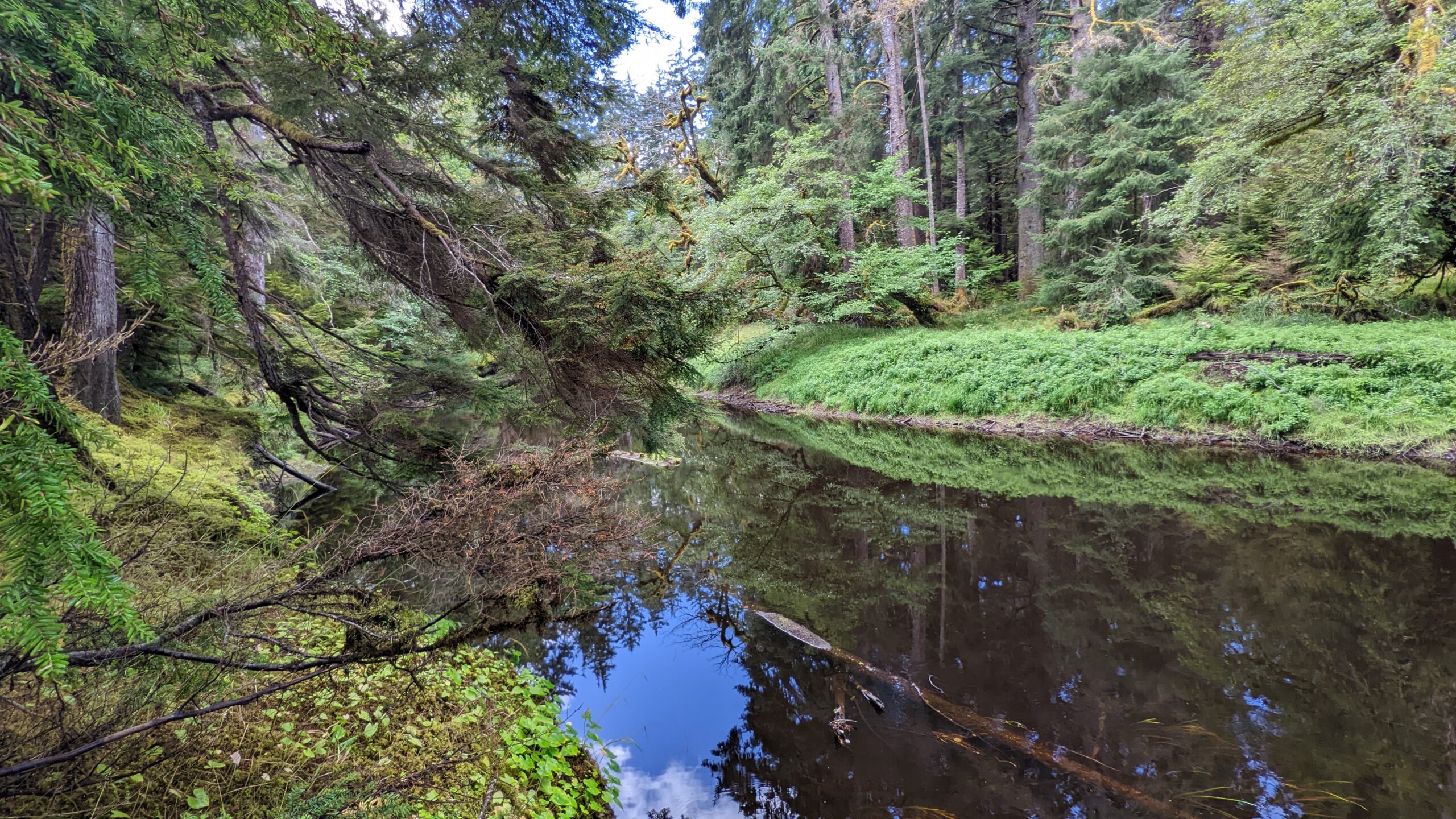
Small Lake in eye level
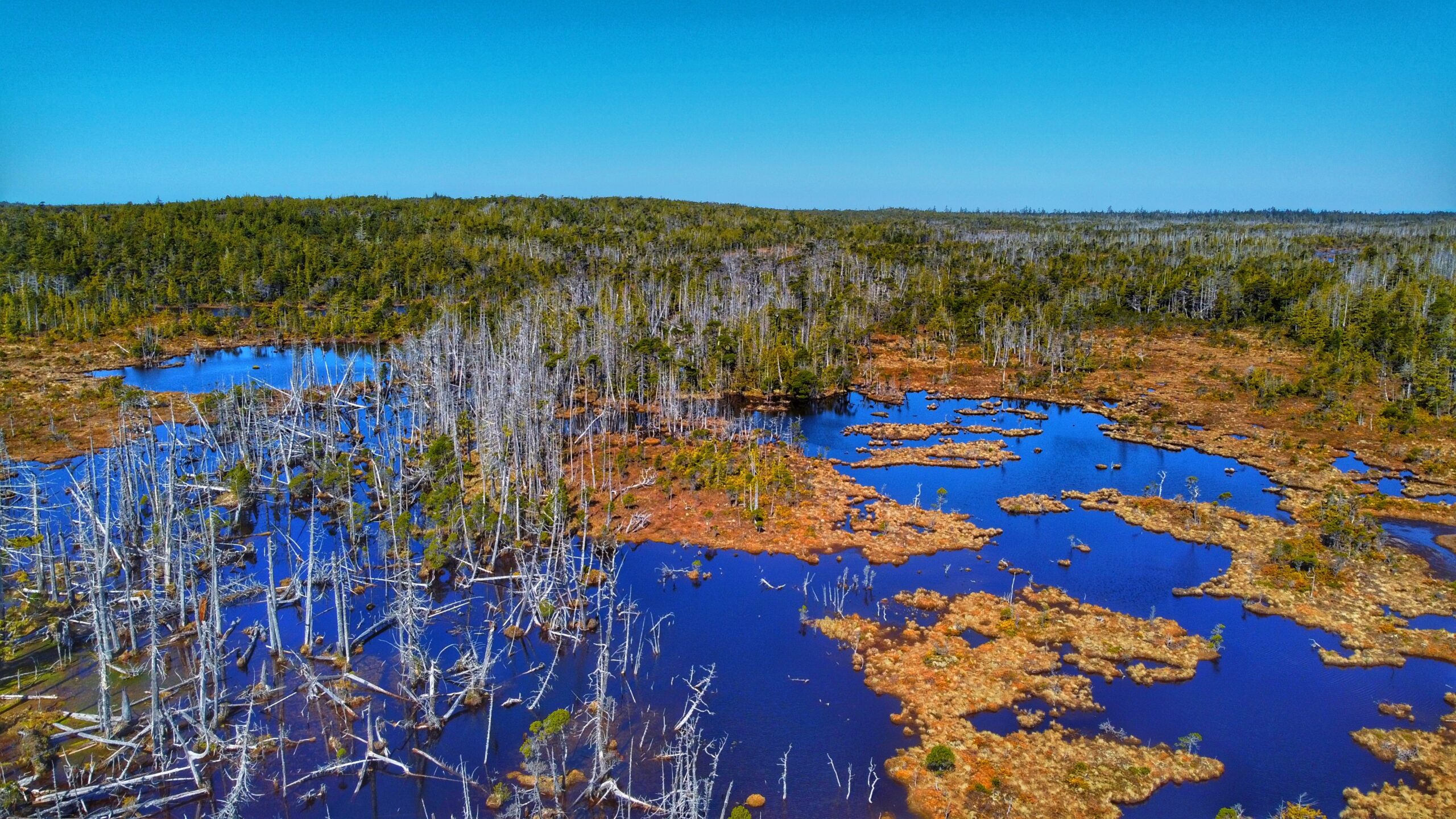
Some evidence of a past forest fire?
Boggy environment for exploration around the lake
Small Lake Features: Boggy explorations Old Forest Fire Remnants A most likely Elks’ destination
ABOUT
Small Lake came to our attention after perusing an early edition of Fern Henderson’s Trail Hikes and Beach Walks. We got curious about this trail because it is not mentioned in the Haida Gwaii Trails Strategy (2011), nor is it mentioned in the last edition of Fern Henderson’s text (2005). Thus, we made it a point to explore this hike and see if the trail still existed since – we presumed – it probably was not being maintained.
LOCATING THE TRAILHEAD
Getting to Small Lake can be a little tricky: Drive west of Daajing Giids along the Honna Forest Service Road. Follow the Honna FSR north, past the Sleeping Beauty trail signage. The road gets fairly steep, so make sure you are driving a truck or capable SUV. A small car will not be able to complete the drive.
After driving for approximately 9.23 kilometres, or 20 minutes, you should notice a fairly obvious pullout to your RIGHT. We came upon this quite by chance. As we were driving up the narrow road, we spied what looked like an old spur road and assumed that’s where we’d have to walk to find Small Lake. We drove a few feet further and saw the pullout – that’s when we saw the unmarked trailhead! Talk about a stroke of luck!
HIKING THE TRAIL
The trail to Small Lake is unmarked, but obvious, and takes about 10 minutes to complete. It is single- track and muddy, so one should use caution. The environment is one of young Sitka Spruce, some moss, huckleberry bushes, and other flora typical of a bog environment. Once you arrive at Small Lake, the grounds are soggy (bog), but dense with Labrador Tea and sundews. In early editions of Trail Hikes and Beach Walks, Fern Henderson notes that Small Lake is “an interpretive circle walk [. . .] through virgin forest.” The brochure she mentions is long gone, but it is still possible to walk a circle around the lake.
The trail around Small Lake has been completely overgrown, but it is possible to identify the odd white trail marker on dead cedars that are still standing. At the time we did our hike, we only walked about halfway around the lake before turning around due to torrential rains. Given the size of Small Lake, we would anticipate it would take no more than 35-40 minutes to complete the circle.
At the time Fern Henderson wrote her text (1978), she noted the lake was a popular place for swimming, fishing, berry-picking and picnicking. While one can certainly still do those things, it’s probably not a beehive of activity these days; however, it is obvious that somebody still uses Small Lake as a recreational site. When we visited, there was clear evidence of a recent campfire and a small boat nearby.
Of note: Elk appear to frequent the area. As we ambled about the lake, we spied numerous elk droppings along the boggy ground.
OLD GROWTH ALLEY FEATURES: • Riparian forest • Old Growth trees • Remote wilderness hike
ABOUT
The Old Growth Alley Trail is a complex beast. It is both a contradiction and a stinging example of what happens with haphazard, piecemeal funding.
When the trail was first developed by the Tlell Watershed Society (TWS) in 2004, they said it was “bound to be a new favourite trail for visitors and residents” of Haida Gwaii. Offering a unique window into the riparian forest of the lower Tlell River, the route had much to teach those willing to hike this challenging 9.5km point-to-point trail. Unfortunately, a lack of maintenance led to the trail’s quick decline. Now, in 2022, if you ask locals about the “Old Growth Alley Trail in Tlell,” almost all will shoot you a quizzical look and ask, “Where’s that?”
The question is fair because, although formal trailhead signage was erected in 2004, these have all been removed; thus, the trail lies hidden in plain sight. Because it is a point-to-point trail, it has two separate entrances, which are approximately 3 kilometres apart. The southern entrance is located along Highway 16, near hydro pole 805. If beginning your hike here, park your vehicle at a small grassy pullout on the “ocean side” of the highway and then walk across the road and northward for a few feet. You’ll eventually spy a small white sign to your left: “DANGER! Do Not Hike During HIGH WINDS.” This sign represents the Old Growth Alley southern trailhead. From here, it is a 3km walk to the Tlell River. The route is very overgrown and takes you through a bog environment. There’s also clear evidence of the Great Fire of the 1840s, but not much else of note.
For those wishing to access the lower Tlell River and experience the old growth “alley” in a more expedient way and manner, then the northern entrance is the most convenient. To access this trailhead, turn up the short dirt road indicated by Tlell “Farmers Market” signage and then park your vehicle at the nearby soccer fields, just behind the Tlell Fire Hall. From this point, walk along the far northwest corner of the soccer field until you come upon a dense stand of young spruce trees. If you look closely you’ll spy a weathered, old piece of flagging tape. This represents the northern trailhead of Old Growth Alley.
From here, push your way through dense salal bushes and walk through second-growth forest for about 20 minutes before coming upon the Tlell River and the start of the old growth “alley.” It is here where the magic and importance of this trail really shines through.
Once you reach the river, the trail follows the main stem of the lower Tlell for about 6km before exiting at one of the two trailheads. Thankfully, a fair number of the blue arrow markers remain intact and guide you along the route. While this portion of the hike is mostly flat, be prepared for some minor hill climbs, significant blowdown, a couple of stream crossings and potentially slippery logs. As you meander along the tranquil, dark waters of the Tlell, be sure to admire the many “old growth” trees that hug the river bank. Large cedar and sitka spruce dominate this area. These trees, alone, highlight the importance of this route, but the old growth alley is about so much more.
Think about it. You’re walking the rough trail along the Tlell River. Beautiful old growth trees of Sitka and Cedar surround you, but what else do we see? The effects and importance of riparian wilderness areas in regulating water in the watershed; the importance of large woody debris; unique habitat for a variety of wildlife species; and, of course, the important role we all play in this. These are deeper observations, but they come readily when exploring such an isolated and relatively untouched area.
We said, above, that Old Growth Alley was a contradiction. It’s a contradiction because it was supposed to be a major trail popular for those seeking a day in the wilderness; however, it just sort of withered away. We also said this trail is a classic example of what happens with piecemeal funding: When it was developed nearly 20 years ago, it was likely still a challenging trail but definitely a lot easier to navigate.
Now, though, significant overgrowth and lack of maintenance has all but hidden the route – and this is unfortunate exactly because Old Growth Alley offers so much to those of us who hike it.
DIFFICULTY: Hard TOTAL DISTANCE: 9.5km TIME: 8 hours TYPE: Point-to-point ELEVATION GAIN: None
The endless beach at the Misty Meadows Beach Loop trail
The “main” camping grounds structures
The accessibility friendly section towards the beach
Aerial view of the sand dunes on the shorted beach loop trail
The Tlell River vista point where you can see the Pesuta Ship Wreck trail on the right, the Misty Meadow Beach Loop trail on the left
The trail lets you spy the Pesuta Ship wreck at a distance
Sand dunes on the trail
View of the trail from the Haida House side of Tlell River
Misty Meadows Beach Loop Trail Features
Sand dunes Beach access Proximity to campground
ABOUT
Primarily thought of as a campground, Misty Meadows offers a whopping 30 sites for campers. Potable water, picnic tables and pit toilets are also available on-site. From a recreational perspective, Misty Meadows Beach Loop Trail serves as a nice introduction to the wonders of Naikoon Provincial Park. It offers beach access and some nice hiking. From the main campsite, the beach is literally a 3-minute walk; however, we’d argue the beach is only particularly noteworthy during a very low tide. At other times, the beach in this area is rock and pebbles. For those wishing to hike, Misty Meadows Beach Loop Trail offers two options: 1) A short beach loop, which clocks in at about 1km round-trip; and, 2) A much longer beach loop, which comes in at around 10.5km round-trip.
The shorter loop is well marked – just follow the posted signage. It should take about 20 minutes to complete and goes through the forest, sand dunes and beach. Note: There are a couple of side trails at the dunes – one of which takes you to the park boundary and beyond; however, please note that once you hit the boundary (denoted with a small sign), you will be skirting along private property. The dunes in this part of Naikoon are nice, but there are much larger ones further north along the Pesuta and East Beach trails.
If you’re feeling energetic, though, the longer loop may be for you. Basically, start at the same point as the shorter loop. Once you begin walking north along the beach, DO NOT turn in toward the Misty Meadows campsite; instead, just keep walking north for a good 5 kilometres or so. You will eventually come upon the mouth of the Tlell River and, assuming its low tide, you can actually get fairly close to the Pesuta Shipwreck, which sits on the opposite side of the river. From here, and for another 5 kilometres, the “loop” basically follows the Tlell River inland. Walking this route, you will come across impressive sand dunes and spy remnants of previous settlements. During Spring and early Summer, the dunes are full of wild strawberries while the sandy riverbank is rife with delectable sea asparagus.
Once you reach the Haida House, you can continue walking along the Tlell via the riverbank or Beitush Road. It is not uncommon to see locals fishing for steelhead, coho and trout along this stretch of the river. The “trail” will eventually have you cross Beitush Road and walk a short way up the dirt road towards Tlell cemetery. A few meters in, you will see the trail, denoted by a pink flagging tape, resume to your right. This single-file, well-maintained stretch runs for about 500 meters and brings you out by one of Misty Meadows’ more notable attractions, lovingly referred to as “the big tree.” From here, simply walk along the paved road back to the Misty Meadows campground.
One can go closer to the creek side with no problem
In the summer, the Piper Creek is more calmer
Some foraging delights in Piper Creek Trail
PIPER CREEK TRAIL FEATURES: Monumental trees Foraging
ABOUT
The Piper Creek Trail is located approximately 3 kilometres west of Sandspit, adjacent to the “Piper Creek” bridge, heading towards the Kwuna ferry line-up. There is no formal parking; however, there is enough space on the shoulder of Piper Creek Bridge for two small cars. The trailhead is indicated by a small white marker a few feet from the bridge.
While there is minor elevation gain, we would classify Piper Creek Trail as easy. The route is mostly flat and well-marked for its duration. The trail, which winds through a mix of alder, spruce and cedar, basically follows Piper Creek upstream for about a kilometre before terminating at a small ravine adjacent to the creek. The dense forest part of the trail heading to the creek access is a relaxing experience and it is encouraged to take the time to savour forest walking.
Indeed, the trail is short, but it also connects to other routes like Around the Pond and Onward Point, making for a more robust hike. The connecting trail towards Onward Point, notably, takes you through a stand of monumental cedar trees sure to delight the tree-lover in all of us.
Along with being a relatively popular hiking trail, Piper Creek is also used for local foraging. The outstanding Raincoast Breads, for example, will come here and forage, Woodruff, Oyster mushrooms and even “aromatic” stones. We’ve also witnessed some large “Chicken of the Woods” growing near the entrance of this route.
Note: There is also a short trail directly across Highway 16, opposite the Piper Creek trailhead. Just look out for blue flagging tape. This brief route, which clocks in at about 250 meters one-way, takes you to the mouth of Piper Creek, through the trees and down to the beach.
The mossy forest and trees makes it a relaxing hike in White Creek Trail
Bog parts of the White Creek Trail
Harelda Lakes after the White Creek Trail
Bogs in bird’s eye view
WHITE CREEK TRAIL FEATURES Bog environment Settler remnants
ABOUT
Situated within Naikoon Provincial Park, White Creek Trail is a relatively flat 3.5-kilometre out-and-back trail. The trail, which is an early 20th-century settler wagon road, begins on the west side of White Creek, near the bridge. You’ll see a small sign – the trailhead marker – indicating that the route is not maintained.
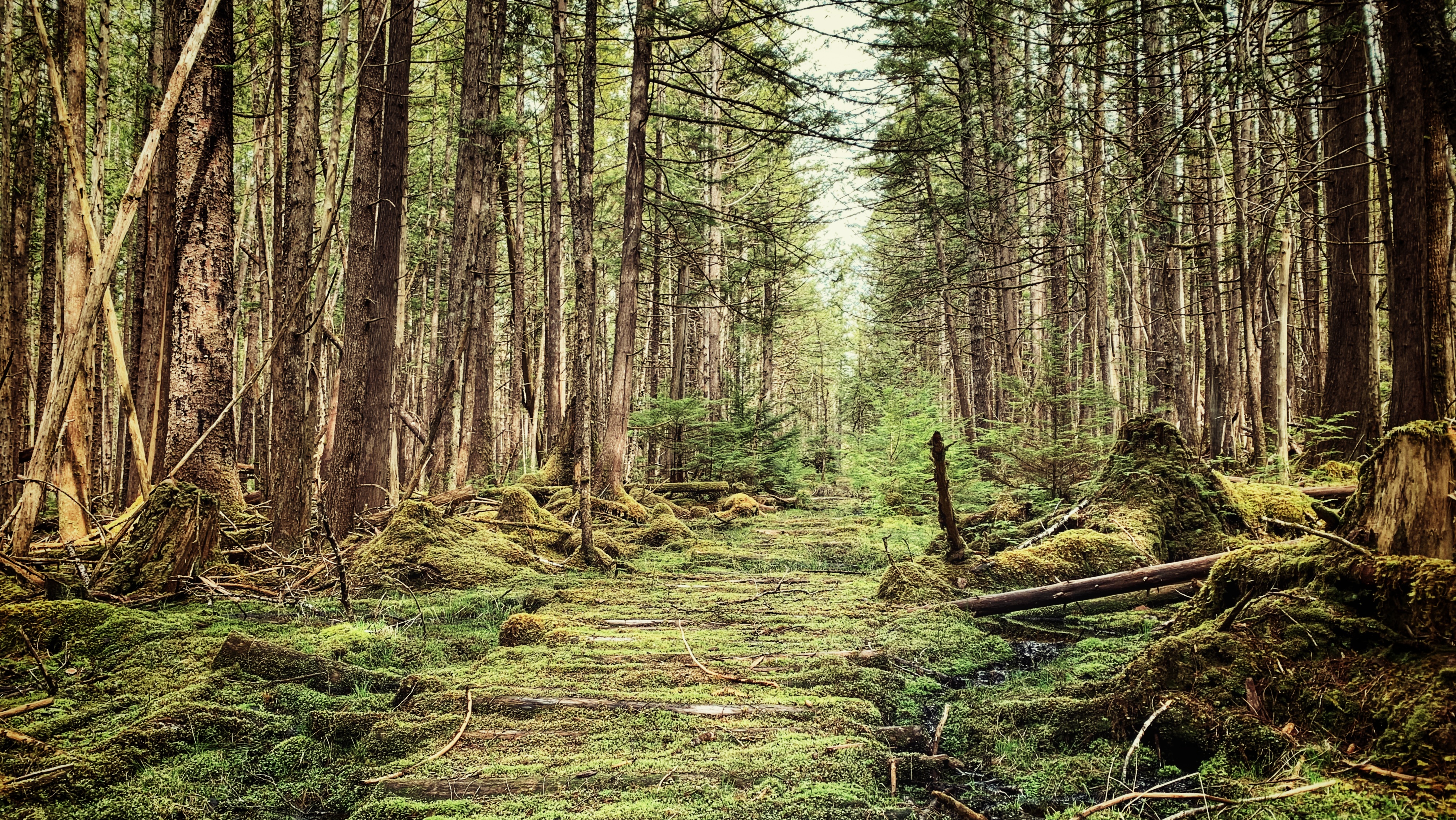
Despite this, it’s clear the trail is “user maintained” because it was clear and easy to navigate for the duration of our hike. The first kilometre of the hike takes you through a beautiful second-growth forest, carpeted with thick green moss, along an unmistakable wagon road.
As you walk this section it’s not difficult to imagine the old settlers, in their horse and buggy, trudging along to their homesteads. In the current day, besides the obvious road, the hand-dug ditches and corduroy bridges are all that remain of this pioneering era along White Creek.
After about 30 minutes or so, you’ll emerge from the brush into what Go Haida Gwaii has described as “Haida Gwaii’s Serengeti.” The unique bog ecosystem – with its small ponds, grassland, and twisted and stunted pines – is certainly reminiscent of the African Savannah! As you hike this section of the White Creek Trail, you’ll notice several small side trails, all of which provide access to the bog.
We’d recommend taking your time here to explore but do tread gently. Depending on the time of year you visit, it’s possible to observe Shooting Stars, Labrador Tea, Sundews, and a host of other plants endemic to this environment. Who knows, you might even hear the frat boy-like calls of male grouse in the distance!
The bog section of White Creek Trail runs for about 2.5 kilometres before you come upon the “trail ends” signage. If you’re wearing good boots, it is possible to cross Kliki Damen Creek and continue some 19 kilometres, past the Harelda Lakes, all the way to East Beach along what eventually becomes the Carr-Whittle Trail. If you do this, though, please note that the route is not marked or maintained.
While there are other trails on Haida Gwaii offering access to bog environments (Nadu Homestead and Regier Lake, for example), White Creek is the most popular and, we’d suggest, photogenic.
If you visit, take your time here. The mystical and magical effect of forest and bog still occupies and entices the mind!
The corduroy walkways are still visible in most parts of the trail
The Fall walk in the North Road launches a strew of generous patches of mushrooms (Oct 2022)
The wagon road that leads to the Inside Road, Pretty John’s, and Pontoons Meadow trails
Afternoon hikes also is welcome on a dry day to see the logs walkway
This mighty tree deafall points one to the Poontons Meadow Trail
POONTOONS TRAIL FEATURES Early settler history Pontoons Meadow Foraging and hunting
ABOUT
Unlike most trails on Haida Gwaii, the Pontoons Trail actually has a signed trailhead marker. Unfortunately, the trail can still be a little tricky to find, if only because there isn’t much-published information available.
If you pick up the Backroad Mapbook at the Daajing Giids Visitor Centre or download the app, you should have an idea of where the trailhead is. Nevertheless, we’ll endeavour to make finding this unique and epic hike a little easier to find:
Assuming you’re coming from Skidegate, drive roughly 17 kilometres along Highway 16 until you come upon the intersection of Lawn Hill Road. Turn left onto Lawn Hill Road.
Drive down Lawn Hill Road until you cross Lawn Creek Bridge. From here, and directly ahead, you’ll see a joke sign: “Violators will be prostituted.” This rather humorous sign indicates a private property; however, to your LEFT you will see a small yellow sign posted on an alder tree: “OLD WAGON ROAD.” This sign essentially signifies the start of your hiking adventure, but it is not the trailhead.
If you have a truck, it is possible to drive approximately 1 kilometre up this old road but, if you don’t, then we strongly recommend hiking it. There is some minor incline and fairly deep potholes along the way.
After you’ve walked or driven the 1 kilometre, you will see some blue and pink flagging tape to your RIGHT and a small footbridge. Cross this bridge onto a wide, but not the too obvious path. You should see the trailhead marker for the “Pontoons Wilderness and Historic Interpretive Route” straight ahead (and the trailhead marker for the Prettyjohn’s Trail route to your left).
From the trailhead sign, continue walking north. You are now en route to the Pontoons! It’s little wonder most people have difficulty finding this route or are completely ignorant as to its existence. In the current day, the trailhead isn’t exactly easy to find unless you already know where it is.
Difficulty in locating the trail aside, what makes this route a “must do” when visiting Haida Gwaii? In brief, you’ll want to hike this wild and remote route because it’s an immersive experience.
The full Pontoons trail is approximately 9 kilometres one way. Along the route, you get to experience settler and natural history; Haida culture; envelop yourself in outstanding examples of old-growth Sitka Spruce, Western Hemlock, Red Cedar, and Riparian forest; and, of course, explore the unique fen and marsh complex that makes up the Pontoons.
Because the Pontoons hike is so rich, we will divide it into three manageable “chunks.” Two of the three “chunks” can be completed individually, as separate hikes in their own right: 1) The North Road; 2) Durant Homestead; and, 3) The Pontoons Meadow.
The North Road Trail
Walking the North Road Trail on foggy days makes it a magical and must-repeat experience (Oct 2022)
Once you reach the Pontoons trailhead marker noted above, you’ll officially be on the North Road which, as the name suggests, basically runs north for about 4 kilometers before turning west (or LEFT, if you prefer that term) towards the Pontoons Meadow.
This section of the hike is an old wagon road developed in 1910 as part of a government strategy to encourage settlement in the area. The land was sold for cheap, but living here wasn’t easy.
Much of the designated farming land was originally muskeg and therefore incredibly low in nutrients. A lot of hard work went into making the land arable; however, because of the challenges faced, most settlers were gone by the early 1930s.
In the early 1900s, this route had a lot of small homestead cabins dotting the road, but most of these were abandoned by the end of the First World War. Unfortunately, not many remains of ye olde pioneering spirit today.
There is, of course, the old wagon road itself and, as you hike, you will see and cross some corduroy bridge structures. Besides that, the only other notable evidence of past settlement along this section of the Pontoons trail is the hand-dug drainage ditches, which run along large segments of the North Road.
While the North Road is pleasant to hike at any time of the year, we’ve found it to be especially magical during autumn. As you walk the moss-covered road, its surface comes to life with all sorts of unique fungi, including chanterelles and honeys. It’s a proverbial mushroom picker’s delight.
And the old road, with its towering trees and dense fog, creates an almost magical, otherworldly environment. Indeed, for us, this segment of the Pontoons is the very definition of forest therapy.
After hiking approximately 3 kilometres, you will come upon an active logging road. It is called “Lawn Hill Road North” and is fairly recent, only having been built in the last 15 years. Prior to its construction, the North Road travelled uninterrupted for just over 4 kilometres. This “break” in the trail represents the second “chunk” of the route: The Durant Homestead.
The Durant Homestead
The rhododendrons in Durant Homestead framed one of the well-built cabins
After crossing the logging road, continue north for approximately 1.5 kilometres towards – you guessed it – the Durant Homestead. While part of the North Road, the Village of Daajing Giids has this segment of the old wagon road listed as a separate trail on its Visitor Centre website. Indeed, while we find this kind of odd, it is nevertheless possible to access the “Durant Homestead Trail” by itself.
Unfortunately, the Visitor Centre is wonderfully vague in this regard: “Access old corduroy road [. . .] from 6.5 k on Lawn Hill Road North.” If driving from Skidegate, drive north for approximately 22 kilometres until you see the crudely written “LAWN NORTH MAIN” sign to your left.
When you turn onto this dirt road, be aware that you’re driving on an active logging road, so take the necessary precautions. The road is in decent enough shape that an SUV could probably drive it, but you might “bottom out” on the steep incline near the beginning of the road.
After the initial hill, though, the road remains relatively flat. Drive along Lawn North for 10 minutes, or approximately 5.3 kilometres (the Village of Daajing Giids says 6.5 kilometres, but this is wrong). At this point, you should see the fancy trailhead marker for the Durant Homestead Trail: A stump with some rocks piled on top of it!
From here, the Durant Homestead is approximately 40 minutes, or 1.5 kilometres, down the North Road. While the first part of this trail is quite miry, the rest of it remains in relatively good shape.
There are some muddy sections; parts of the corduroy road are slippery and loose; and, there is some deadfall requiring you to get down on your knees but, for the most part, the trail is easy to navigate and follow.
As you amble about this route, it’s not difficult to transport oneself to an earlier time, circa 1910, when homesteaders were trying to cultivate and develop this land.
About mid-way through your hike, you’ll come upon a sign: “The Great Fire of the 1840s.” Without a bit of context, this might seem rather queer. 20 years ago, the Tlell Watershed Society (TWS) undertook a project of developing/maintain a number of trails in the Tlell Watershed area.
The purpose was essentially twofold: 1) Create awareness of, and protect and conserve the watershed; and, 2) Provide an opportunity for people to experience this unique wilderness through interpretive hiking trails. Signage like “The Great Fire” was posted at strategic points along TWS trails and was originally meant to be accompanied by a short booklet.
Unfortunately, a lack of funds resulted in nearly zero formal upkeep and a good number of these trails – especially Three Mile Creek, Monique Creek and Old Growth Alley – fell into rapid disuse. While some interpretive signage has survived, most have fallen to the elements.
If you’ve kept a keen eye throughout your hike, chances are you will have noticed a number of burnt trees – these are all a result of the “Great Fire of the 1840s.” The cause of the fire remains unknown, but it burned a massive amount of forest from the upper Tlell all the way to Masset.
You will also see evidence of this fire on other trails in the Tlell area: Prettyjohn’s, Old Growth Alley and the Anvil Trail. After walking about 40 minutes from the Durant trailhead, you’ll come upon a large fallen Sitka spruce tree. If you look beyond it, you’ll see signage for the Pontoons – this represents the third “chunk” of our hike. But more on that in a moment.
If you intend to visit the Durant Homestead, look to the immediate left of the fallen tree. You’ll spy a small wooden bridge – follow it a few minutes to the homestead.
As you can see, these structures are modern and still occasionally used by hunters today. Besides the well-constructed cabin, you’ll also see an old outhouse, garden, sauna, and what appears to be a chicken coup on site.
During spring and early summer, the rhododendron bushes are in bloom and make for an impressive site. Before you leave, be sure to sign the guestbook in the cabin!
The Pontoons Meadow
The crude wooden sign points you to the right direction of the Pontoons Trail
The Pontoons are approximately 3 kilometres, or 1.5 hours, beyond the Durant Homestead. From this point, the old wagon road becomes less evident, but still easy to follow thanks to flagging tape.
After navigating some wet/boggy areas, you will finally reach the Tlell River and Pontoons at the 8.8-kilometre mark. Welcome to the Pontoons Meadow!
The Pontoons, often referred to as the “Heart of the Tlell,” make up the majority of the Tlall Heritage Site/Conservancy. Because it is Haida Gwaii’s only interior wetland ecosystem, numerous moves have been made to protect it, including a failed attempt in the 1980s. In 1996, Survey Creek (a tributary of the Tlell River) and the Pontoons were identified by the Province as “Goal 2 Study Areas” under the Protected Areas Strategy due to their “unique” characteristics.
In 2008, the area was formally protected with the signing of the Haida Gwaii Strategic Land Use Agreement, which stated that protected areas – like the Pontoons – are to be set aside for cultural, spiritual, ecological and recreational purposes. They are also to be maintained for the education and enjoyment of future generations.
After such a lengthy and, at times, challenging hike, the views presented by the Pontoons are a breath of fresh air. Mostly flat and relatively shallow, the Pontoons Meadow is home to a unique wetland environment on Haida Gwaii: Bogs, Fens and Marshes all call this 690-hectare space home. Viewed from above, you can observe all tributaries of the Tlell – less Geikie Creek – converging at the Pontoons.
As a result, the ground is rich in nutrients, contributing to the diverse flora of the area. It is also what attracts the island’s local elk population, introduced in 1929, to the area.
Besides the beautiful natural environment, there’s also a bit of history – or folklore – attached to the Pontoons. Allegedly there was once a & quote “floating barn” on the Pontoons, built for storing hay.
As the story goes, farmers producing cattle allowed their herd to enjoy the grounds in summer; however, because the Pontoons often flood during the winter months, a “floating barn” was created so that, when the Tlell floods its banks, the barn and its cargo of precious hay would simply float up with the swelling river.
The existence of this barn hasn’t been verified, but a structure – possibly the fabled barn – can be found at about the 9.1-kilometre mark.
All in all, the Pontoons Trail is an epic hike on a number of fronts. If you’re feeling ambitious, you can choose to tackle it in one 18-kilometre round-trip swoop, or just walk segments of the route (North Road and Durant).
No matter what you decide, you’ll enjoy old growth and second growth forest; settler history in the form of the wagon road and its associated structures; gain an appreciation of Haida cultural values; and, of course, totally immerse yourself in the beating heart of the Tlell River.
Pretty John’s Trail boast of pristine forest parts
The “Old Wagon Road” trail head
One of the many cordoroy bridges in the muddy parts of the trail
The Great Fire of the 1840s
Some parts have endless moss covering the both sides of the path
The Pretty John’s Meadow which is pointed as the main camping ground by hidden signage
Near the beginnings of Tlell River that leads to the Tlell Falls
PRETTY JOHN’S TRAIL FEATURES Early Settler history The Great Fire of 1940s Tlell Falls
ABOUT
Like many trails on Haida Gwaii, it can be challenging to locate Prettyjohn’s trailhead thanks to the nebulous and sparse literature out there. We shall endeavour to make finding this special trail a little easier:
If travelling north from Skidegate, drive roughly 17 kilometres along Highway 16 until you come upon the intersection to Lawn Hill Road. Turn LEFT onto Lawn Hill Road. Drive down Lawn Hill Road until you cross Lawn Creek Bridge. From here, and directly ahead, you’ll see a rather humorous sign: “Violators will be prostituted.”
This sign indicates private property; however, to your LEFT you’ll see a small yellow signposted to an alder tree: “OLD WAGON ROAD.” This sign signifies the start of your hiking adventure, but it is not the trailhead. Park your vehicle on the side of the road and prepare for your hike!
Begin hiking up this road. At about the 1-kilometre mark, you should see some pink and blue flagging tape to your RIGHT and a small footbridge. This is the start of the North Road and “Pontoons Wilderness Historic Interpretive Route.” If you cross the bridge and walk a few meters, you should also see a trailhead marker for Prettyjohn’s interpretive route to your LEFT.
While this side road is technically the start of the Prettyjohn’s hike, it has fallen into disuse over the last 20 years. Now, the standard practice is to IGNORE the aforementioned pink and blue flagging tape and CONTINUE walking west an additional 500 meters past some dilapidated Vehicles.
After hiking 1.5 kilometres, you will come upon another small footbridge. Cross the bridge and walk up a small hill. You will come upon an intersection in the settler wagon road. While it may be tempting to go left, you’ll actually want to go RIGHT (note the well-worn ATV tracks).
You are now on the Inside Road and on your way to Prettyjohn’s Meadow and the Tlell Falls! Follow the blue arrows for approximately 7.4 kilometres to reach the historic meadow.
“But,” you may be wondering, “why Prettyjohn’s?” Indeed, the name is kind of baffling, but the route is named after William Prettyjohn, one of the first British settlers to build in the area circa 1910.
According to the Tlell Watershed Society (TWS), he was a short, bowlegged man who wore thick glasses. Nevertheless, he exemplified the optimism of early pioneers, working his land on the banks of the upper Tlell River and producing many crops of delicious fresh fruits and vegetables.
He is purported to have walked the 12 miles from his homestead to Skidegate and Daajing Giids to sell his wares and then walk all the way back home almost daily. He was one of the last pioneers to depart the area, leaving in the early 1930s.
Today, the only evidence remaining of Prettyjohn’s homestead is the meadow, which is now promoted as an ideal remote camping spot – a special place to spend the night!
We should note, as an important aside, that there’s some debate about the name “Prettyjohn.” Some, like the Over the Hill Hikers Group and locals in Tlell, have suggested “Prettyjohn” is a misspelling of “Pettyjohn.”
We wouldn’t be surprised if this were the case – it’s happened before with the Pesuta Shipwreck trail. Regardless, it would appear “Prettyjohn” is the name that’s won out since it is recorded as such by the Tlell Watershed Society and Haida Nation. What do you think? 😉
As you hike the old settler road, you will come across signage like “The Inside Road,” “The Great Fire of the 1840s” and “Settlers in the Lawn Hill Area,” amongst a few others. These signs are remnants of the Tlell Watershed Society’s interpretive trails project of the early 2000s.
Back then, the TWS sought to maintain or develop important routes within the Tlell watershed and bring awareness to this rich and diverse ecosystem. One way to do that, they thought, was through wilderness interpretive hikes, of which Prettyjohn’s is one.
Signage was placed at strategic points along the trail and was to be accompanied by short booklets – which were available at Visitor Centres across the Island – to provide an explanation. Unfortunately, a lack of funding prevented regular upkeep and most of the trails fell into disuse.
The first part of this wilderness hike takes you along the Inside Road. This old road was constructed at the beginning of the 20th century by settlers hoping to develop farmland for crops away from the coast.
In order to make access to inland portions of the Tlell easier, they created this loop road: One end begins at Lawn Hill and the other near Miller Creek. The full Inside Road is approximately 15 kilometres in length, but the Prettyjohn’s route only takes you through the first 5 kilometres or so near Lawn Hill.
Today, when you hike the Inside Road/Prettyjohn’s route, not much of the pioneering history remains other than the wagon road, some ditching, corduroy bridges and a few fence posts. Still, the road remains in relatively good shape because it is still used by the hiking community and hunters (with the latter’s ATV tracks being very evident). It’s not difficult to imagine William Prettyjohn walking these roads to sell his fruits and vegetables.
As you make your way ever closer to Prettyjohn’s Meadow, you’ll likely notice many burned and charred trees along the way. These are the result of the “Great Fire” of the 1840s, which burned most of the upper Tlell all the way to Masset.
The cause of this fire is still hotly debated, but its effects can still be seen today, some 180 years after the fact. Indeed, the fire helps explain why the trees in this area of the Tlell are all roughly the same size – they started growing at the same time!
Approximately 30 minutes out from the Meadow, the settler wagon road splits. Pay close attention to where you’re going and be sure to follow the blue arrows! You’ll want to turn WEST to continue along Prettyjohn’s route. If you continued going SOUTH, you’d eventually make your way to Drain Lake and Miller Creek. Indeed, following the marked route on these wilderness routes is essential.
A hiker and his dog did get lost on this very trail in 2018. The ending was a happy one, but he had to spend the night in the bush!
Once you reach the meadow, take a lunch break and enjoy the quiet serenity! If you’ve still got enough energy to visit the majestic Tlell Falls, you must hike approximately 800 meters upstream from the meadow. If water levels are low enough, just follow the Tlell River and you’ll eventually come upon the Falls.
If necessary, you can also get to the Falls by hiking along some steep side hill that someone has flagged with tape. Be advised that this portion of the hike requires waterproof footwear and steady feet.
The Tlell Falls is a sight to see but, if we’re being honest, there are much nicer waterfalls on Haida Gwaii that aren’t quite as work-intensive: The Dover Falls and Blackwater Creek Falls, for example.
Overall, the Prettyjohn’s and Tlell Falls Historic Interpretive Route is a beautiful day hike. You get to observe pioneering history, second & old growth forest, and the idyllic Falls. Who knows, if you’re lucky, you might also encounter some of Haida Gwaii’s resident elk since they do like to visit this part of the Tlell.
Note: We would only recommend doing this hike during the summer months. From late September through late May, heavy rains could make some parts of this trail difficult, if not impossible to pass!
We’re speaking from personal experience here: We hiked the route once in late September – the start of the rainy season – and the trail was muddy and slippery most of the way. Once we arrived at the Meadow, it was so flooded it made any attempt at getting towards the Tlell Falls next impossible.
MONIQUE CREEK TRAIL FEATURES Magical Sitka Spruce Forage destination during Fall Season Fishing spots along creek
ABOUT
The Monique Creek Trail, like the Three Mile Creek Trail, is found deep within the Tlall Conservancy. Accessing it in the current day requires a bit of effort because the original point of entry – Survey Forest Service Road – was formally decommissioned in 2016 after years of disuse.
Now, if you wish to visit this trail, you’ll have to drive nearly 1.5 hours along the Daajing Giids backroads: First, drive approximately 20 minutes along the QC Mainline (passing the decommissioned Survey Forest Service Road) until you come upon the un-signed junction for Lakes Main Road, near the Mile 17 marker, to your RIGHT. Take this turn and follow Lakes Main for nearly an hour – you will eventually connect to what’s left of the Survey Forest Service Road. Once here, turn to your RIGHT and park your vehicle. You will see the decommissioned section of the Survey Forest Road. For all intents and purposes, this is where your hike begins.
You must hike along the Survey Forest Road for approximately 3.5 kilometers before hitting the “official” Monique Creek Trailhead. This portion of the hike is relatively straightforward and easy; however, the numerous trenches dug as part of the decommissioning process – there are more than 10 of them – can be a bit of a challenge. Long grass has grown over the rocks, making footing a little uncertain.
The official Monique Creek Trail begins at an overgrown spur road and will be to your LEFT. An orange arrow – one of the few still left after 20+ years – and an extremely faded trailhead sign indicate the start of the route. The official trail follows the spur road for a few hundred meters before turning off into the dense bush. Because most of the trail markers have gone, it’s very easy to miss the turnoff point, which is exactly what we did. We continued hiking along the increasingly overgrown road for a good 5 minutes before realizing we were off the trail.
Because the turnoff point is extremely dense, how do you know where to depart the old road? The best answer we can give is, as you’re hiking the overgrown road, keep your eyes peeled for a lone orange trail marker pointing BACK towards the Monique Creek Trailhead. From the marker, turn LEFT into the dense bush. This is where the route gets fun because the trail is almost non-existent at this point. There is the odd marker, but they’re far and few between. We spent 30 minutes in here, trying to find our way.
Once you emerge from the dense bush, you’re rewarded with the lovely confluence of Survey and Monique Creeks. You’ll spy a trail marker on the opposite side of Survey Creek. Cross here. There apparently used to be a natural log bridge, but it’s not there anymore. Be prepared to get your feet wet unless you’re wearing boots! After you cross, walk upstream along Monique Creek.
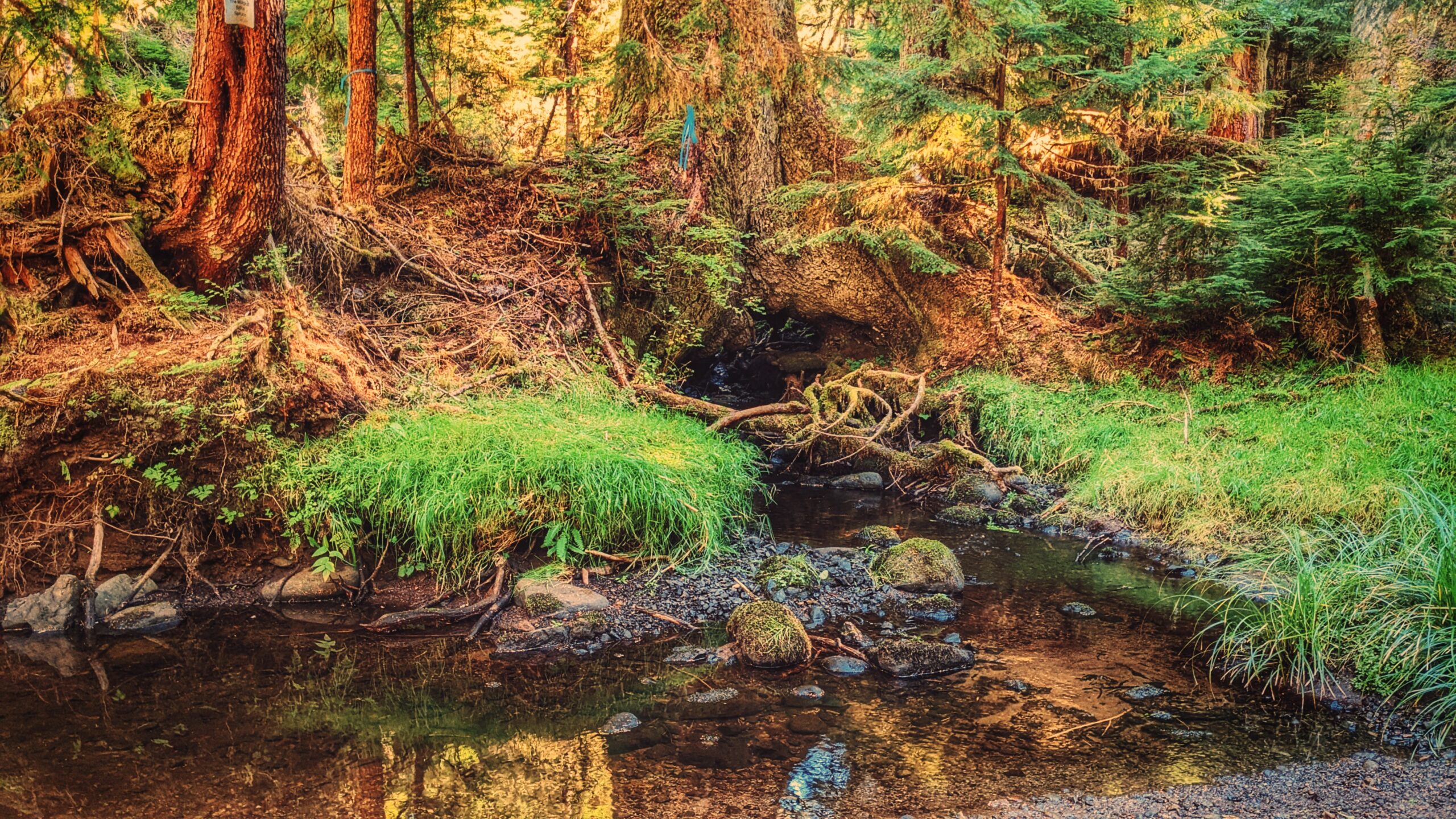
The Monique Creek is a nice example of a coho spawning stream flowing through old-growth forests. Unaffected by development, it’s an ideal place to study the unique habitat features for spawning coho. As we hiked along the creek, we found many frogs, some elk tracks, and salmon Fry in the creek!
By the route’s end – just minutes after a log jam – you’ll come upon the trail’s star attraction: A large Sitka Spruce that has a creek running through its roots! The tree is a special sight and well worth the hike.
Unfortunately, trails like Monique Creek have fallen into severe disuse due largely to the difficulty associated with getting to them. Once upon a time, you could probably do this hike in a couple of hours; however, because you now have to drive nearly 1.5hrs + hike 3.5km before getting to the trailhead, it is best to give yourself a full day to enjoy the serenity of nature.
DIFFICULTY: Moderate TOTAL DISTANCE: 3km (return, official trail); 10km (return, from Survey Forest Rd) TIME: 6 hours TYPE: Out-and-Back ELEVATION GAIN: 40 meters
BLACKWATER CREEK WATERFALL TRAILS FEATURES: · Relatively easy access to waterfalls · Challenging rope sections
ABOUT
The Blackwater Creek Waterfall Trails are a couple of hidden gems on Haida Gwaii. The two trails are short – clocking in at about 200 and 400 meters respectfully – and very remote; however, if one enjoys chasing waterfalls, these two routes are definitely worth the effort. As these trails are not well known, they do not appear in any of the literature available on Haida Gwaii. Here’s how you get to them:
1) Starting in Port Clements, drive south along Bayview Drive towards the Golden Spruce Trail.
2) Keep driving. Bayview Drive eventually turns into the Port Man Forest Service Road – an active logging road. At about the 11km mark from Port Clements, you’ll come upon signage for the “HAIDA CANOE” Trail. Then, 150 meters from this point you’ll spot a “Y” or split in the road. Turn RIGHT onto the New Mainline Road. You will then cross a bridge over the Mamin River before coming to another “Y.”
Keep left on the New Mainline Road for approximately 500 meters. You will then see a minor logging road to your LEFT. Turn here and drive for nearly 5 kilometres. Note that, from this point on, the road is narrow (single track) and does have a few low-hanging alder trees you’ll have to clear.
3) After driving along the road for nearly 5 kilometres, you’ll cross a small bridge over Blackwater Creek. Barely 100 meters past this bridge, you’ll come upon another “Y.” Turn RIGHT. Drive approximately 2 kilometres along this narrow road. If you’ve made it this far, you’ll spy the trailhead marker for the first waterfall. It is signified by pink and orange flagging tape hanging from young spruce trees.
The trail is short – approximately 200 meters one-way – but it is more reminiscent of a stroll through the bush than an actual trail. Expect to walk through dense forest, a lot of deadfalls and a few muddy sections. The good news, though, is the route is extremely well-marked: There is bright flagging tape every few feet, so it’s virtually impossible to get lost.
At the end of your hike, you’ll come upon a moderately steep section, which you must carefully descend in order to view the waterfall. The waterfall itself is quite nice; however, it is difficult to photograph on account of being obstructed by large logs. After enjoying the cascading falls and the sounds of nature, return the way you came.
4) To view the second waterfall, continue driving approximately 1.2 kilometres up the same narrow road. You will eventually see the trailhead markers – signified by candy cane patterned flagging tape – to your LEFT. A pullout, large enough for 2 vehicles, is just a few feet up the road. Unlike the first waterfall, the route to this second waterfall resembles a more traditional trail (albeit a little rough).
It, too, is extremely well marked with flagging tape. The total length of this trail is approximately 400 meters (one way), but that’s because, at the mid-point, it splits. If you go to the RIGHT, you’ll come upon the “top” of the falls, which is picturesque in its own right and features an attractive “kiddie pool” more than suitable for a swim.
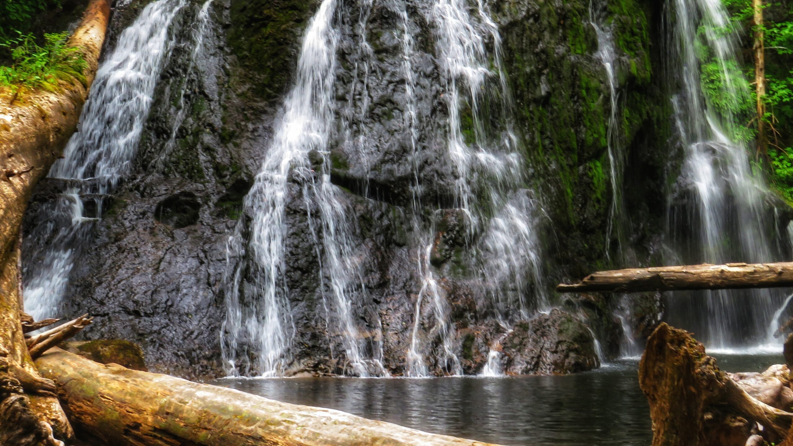
If you go to the LEFT at the trail split, you’ll eventually make your way to a fairly large waterfall, cascading down a rounded rock face. Use caution, though: To get to these falls, you must descend an extremely steep area that, in one area, is almost completely vertical. There are several sturdy ropes to assist you here. Once you make it down, however, it is only a short walk to the impressive falls.
It is not uncommon for people to linger here for many a moment and cool off under the cascading water. Once you’re finished admiring the serene beauty laid out before you, simply head back the way you came.
Getting to these waterfalls may be tricky (both in navigating the narrow logging roads and hiking), but it is well worth the effort. In both instances, the waterfalls are a mere 10 to 15 minutes off the road. In our view, the second waterfall, in particular, is the major highlight because of its size and relative ease of access; in fact, we’d even suggest it rivals the Dover Falls in Sandspit!
Again, though, keep in mind that you will be driving on active logging roads; thus, proper caution should be exercised. In addition, while a truck is not necessary to reach these sites, a standard vehicle is not ideal for these roads.
DIFFICULTY: Easy to Moderate TOTAL DISTANCE: 400 and 800 meters (return) TIME: 50 minutes (for both trails, out and back) TYPE: Out-and-Back ELEVATION GAIN: Minimal
Cookie Consent
We use cookies to improve your experience on our site. By using our site, you consent to cookies.
Contains information related to marketing campaigns of the user. These are shared with Google AdWords / Google Ads when the Google Ads and Google Analytics accounts are linked together.
90 days
__utma
ID used to identify users and sessions
2 years after last activity
__utmt
Used to monitor number of Google Analytics server requests
10 minutes
__utmb
Used to distinguish new sessions and visits. This cookie is set when the GA.js javascript library is loaded and there is no existing __utmb cookie. The cookie is updated every time data is sent to the Google Analytics server.
30 minutes after last activity
__utmc
Used only with old Urchin versions of Google Analytics and not with GA.js. Was used to distinguish between new sessions and visits at the end of a session.
End of session (browser)
__utmz
Contains information about the traffic source or campaign that directed user to the website. The cookie is set when the GA.js javascript is loaded and updated when data is sent to the Google Anaytics server
6 months after last activity
__utmv
Contains custom information set by the web developer via the _setCustomVar method in Google Analytics. This cookie is updated every time new data is sent to the Google Analytics server.
2 years after last activity
__utmx
Used to determine whether a user is included in an A / B or Multivariate test.
18 months
_ga
ID used to identify users
2 years
_gali
Used by Google Analytics to determine which links on a page are being clicked
30 seconds
_ga_
ID used to identify users
2 years
_gid
ID used to identify users for 24 hours after last activity
24 hours
_gat
Used to monitor number of Google Analytics server requests when using Google Tag Manager