


MONIQUE CREEK TRAIL FEATURES
Magical Sitka Spruce
Forage destination during Fall Season
Fishing spots along creek
ABOUT
The Monique Creek Trail, like the Three Mile Creek Trail, is found deep within the Tlall Conservancy. Accessing it in the current day requires a bit of effort because the original point of entry – Survey Forest Service Road – was formally decommissioned in 2016 after years of disuse.
Now, if you wish to visit this trail, you’ll have to drive nearly 1.5 hours along the Daajing Giids backroads: First, drive approximately 20 minutes along the QC Mainline (passing the decommissioned Survey Forest Service Road) until you come upon the un-signed junction for Lakes Main Road, near the Mile 17 marker, to your RIGHT. Take this turn and follow Lakes Main for nearly an hour – you will eventually connect to what’s left of the Survey Forest Service Road. Once here, turn to your RIGHT and park your vehicle. You will see the decommissioned section of the Survey Forest Road. For all intents and purposes, this is where your hike begins.
You must hike along the Survey Forest Road for approximately 3.5 kilometers before hitting the “official” Monique Creek Trailhead. This portion of the hike is relatively straightforward and easy; however, the numerous trenches dug as part of the decommissioning process – there are more than 10 of them – can be a bit of a challenge. Long grass has grown over the rocks, making footing a little uncertain.
The official Monique Creek Trail begins at an overgrown spur road and will be to your LEFT. An orange arrow – one of the few still left after 20+ years – and an extremely faded trailhead sign indicate the start of the route. The official trail follows the spur road for a few hundred meters before turning off into the dense bush. Because most of the trail markers have gone, it’s very easy to miss the turnoff point, which is exactly what we did. We continued hiking along the increasingly overgrown road for a good 5 minutes before realizing we were off the trail.
Because the turnoff point is extremely dense, how do you know where to depart the old road? The best answer we can give is, as you’re hiking the overgrown road, keep your eyes peeled for a lone orange trail marker pointing BACK towards the Monique Creek Trailhead. From the marker, turn LEFT into the dense bush. This is where the route gets fun because the trail is almost non-existent at this point. There is the odd marker, but they’re far and few between. We spent 30 minutes in here, trying to find our way.
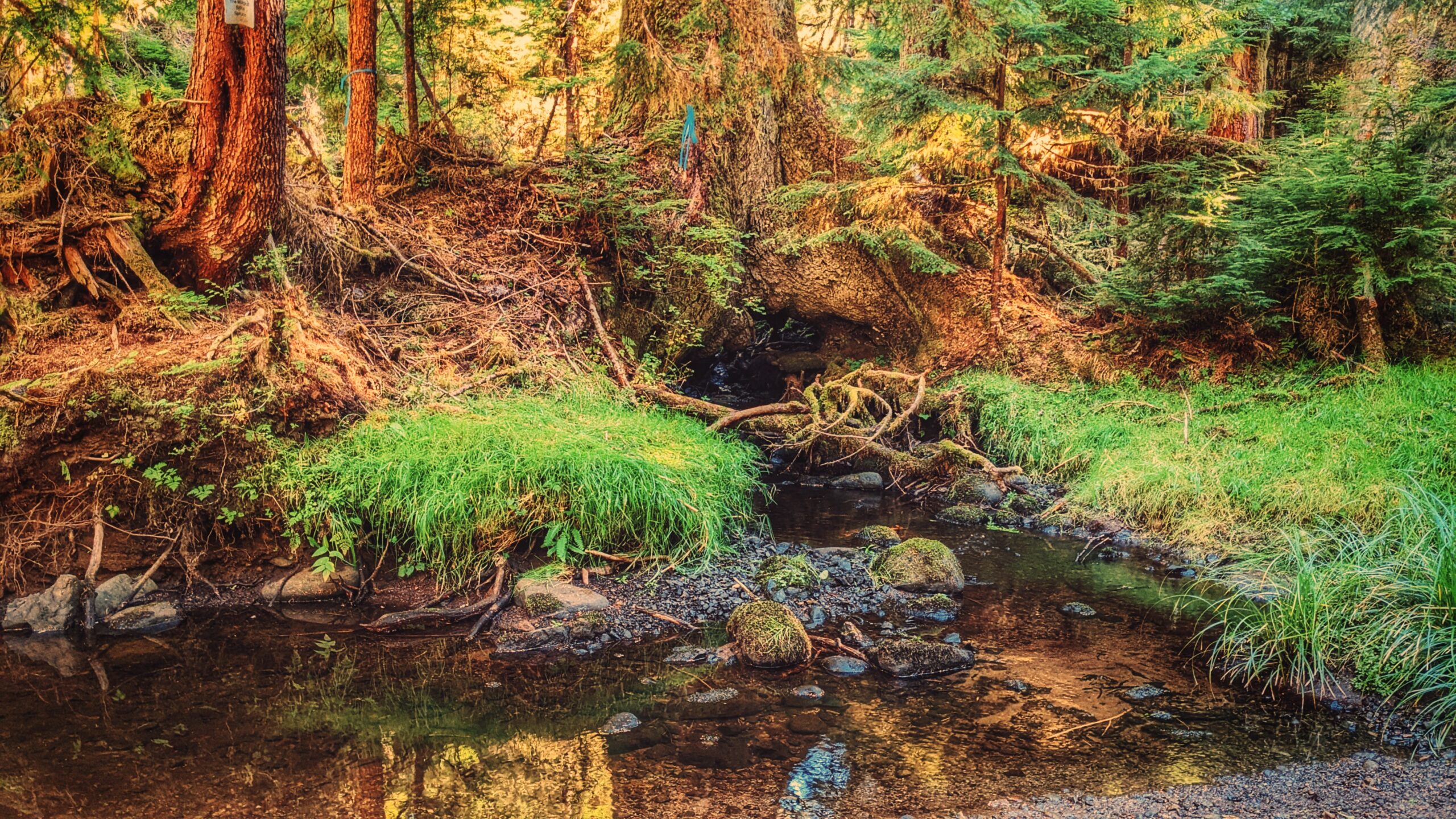
Once you emerge from the dense bush, you’re rewarded with the lovely confluence of Survey and Monique Creeks. You’ll spy a trail marker on the opposite side of Survey Creek. Cross here. There apparently used to be a natural log bridge, but it’s not there anymore. Be prepared to get your feet wet unless you’re wearing boots! After you cross, walk upstream along Monique Creek.
The Monique Creek is a nice example of a coho spawning stream flowing through old-growth forests. Unaffected by development, it’s an ideal place to study the unique habitat features for spawning coho. As we hiked along the creek, we found many frogs, some elk tracks, and salmon Fry in the creek!
By the route’s end – just minutes after a log jam – you’ll come upon the trail’s star attraction: A large Sitka Spruce that has a creek running through its roots! The tree is a special sight and well worth the hike.
Unfortunately, trails like Monique Creek have fallen into severe disuse due largely to the difficulty associated with getting to them. Once upon a time, you could probably do this hike in a couple of hours; however, because you now have to drive nearly 1.5hrs + hike 3.5km before getting to the trailhead, it is best to give yourself a full day to enjoy the serenity of nature.
DIFFICULTY: Moderate
TOTAL DISTANCE: 3km (return, official trail); 10km (return, from Survey Forest Rd)
TIME: 6 hours
TYPE: Out-and-Back
ELEVATION GAIN: 40 meters