Every spring, millions of shorebirds leave their winter homes and fly north to nesting grounds in the Arctic region. A key migration route lies along the western edge of North America – the Pacific Flyway.
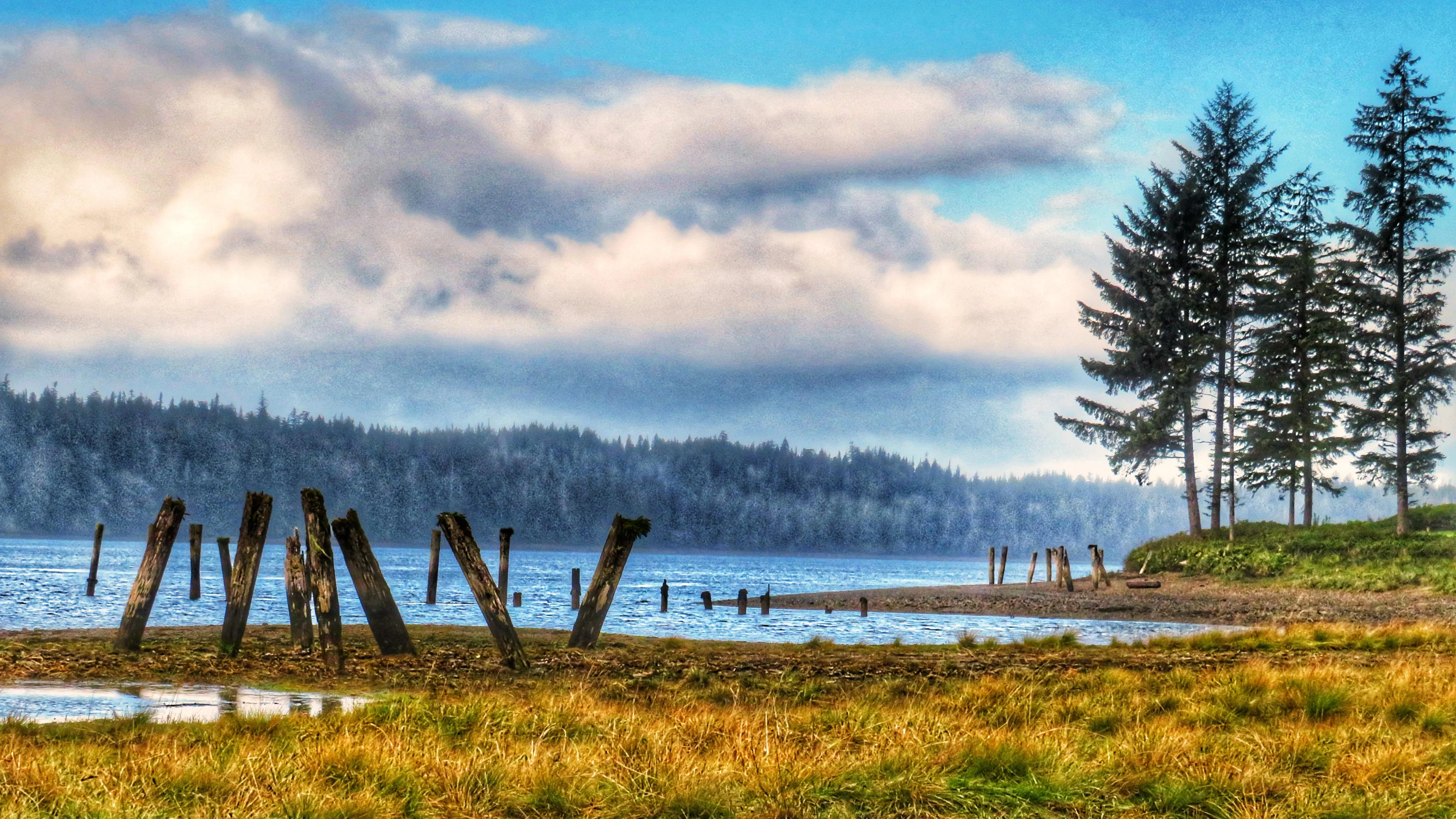
Birds making the long journey will typically stop for a brief sojourn on Haida Gwaii at the Delkatla Sanctuary. Here, the sanctuary’s marsh, ponds, and dense conifers provide an excellent place to rest and gather nourishment for the long journey onward. For us, it also makes for some excellent birding as well.
One important trail – as part of Delkatla – is the Simpson Tower Trail. The layout of this 1.7-kilometer (one way) the route is kind of interesting. Once you turn onto Cemetery Road, you will see the trailhead about a hundred or so meters in on your left, as signified by a marker.
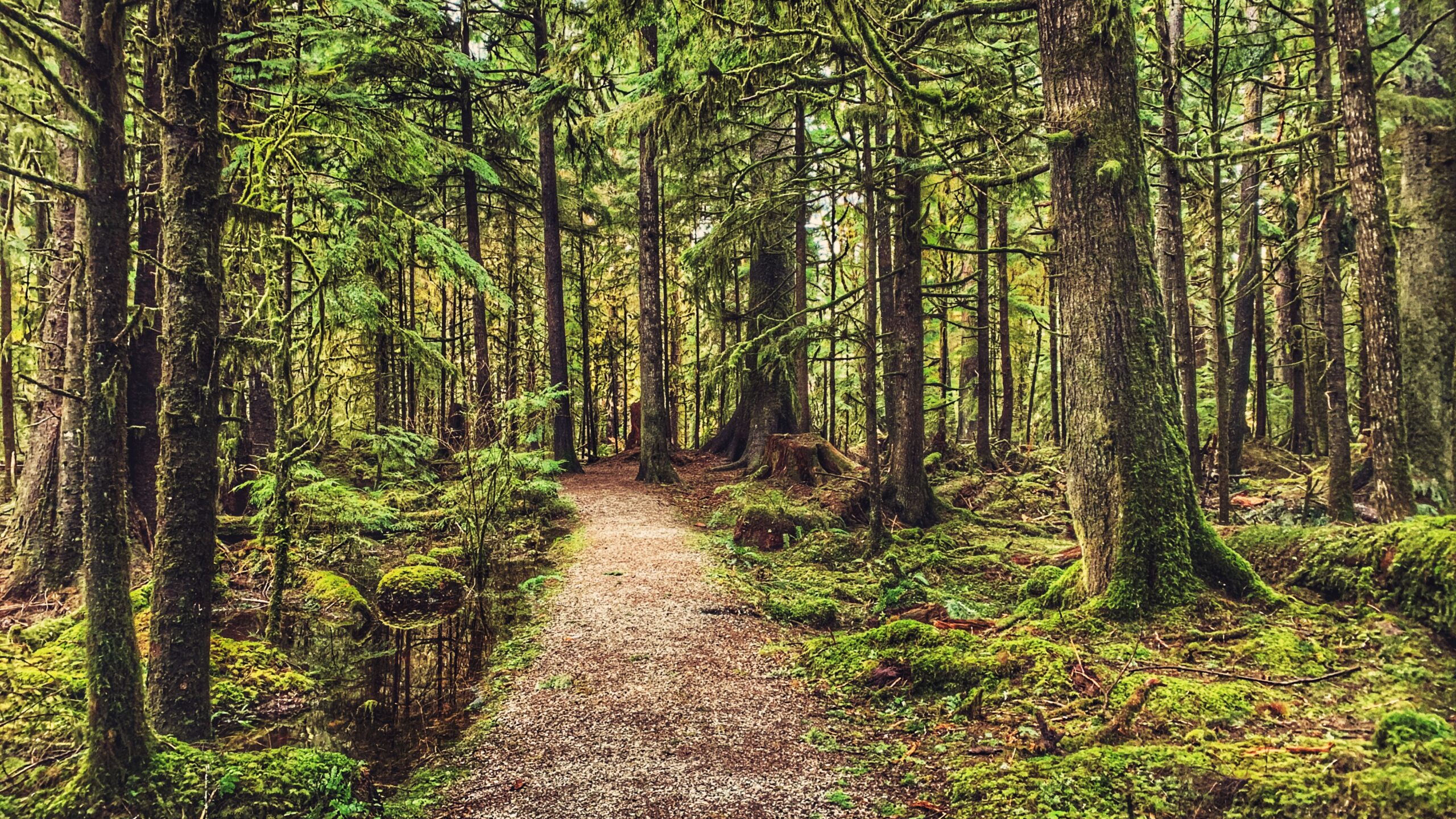
The parking lot, however, is found at the trail’s northern terminus point, nearly 2 kilometers away. Nevertheless, the route is a pleasant and easy stroll since it basically runs parallel to the road. As you walk through the treed side of the sanctuary, take the time to listen for beautiful birdsong and appreciate some of the quirky artwork/signage along the way. As you hike, you may even catch a glimpse of the chatty Steller’s Jay or Hairy Woodpecker, both of which are endemic to Haida Gwaii.
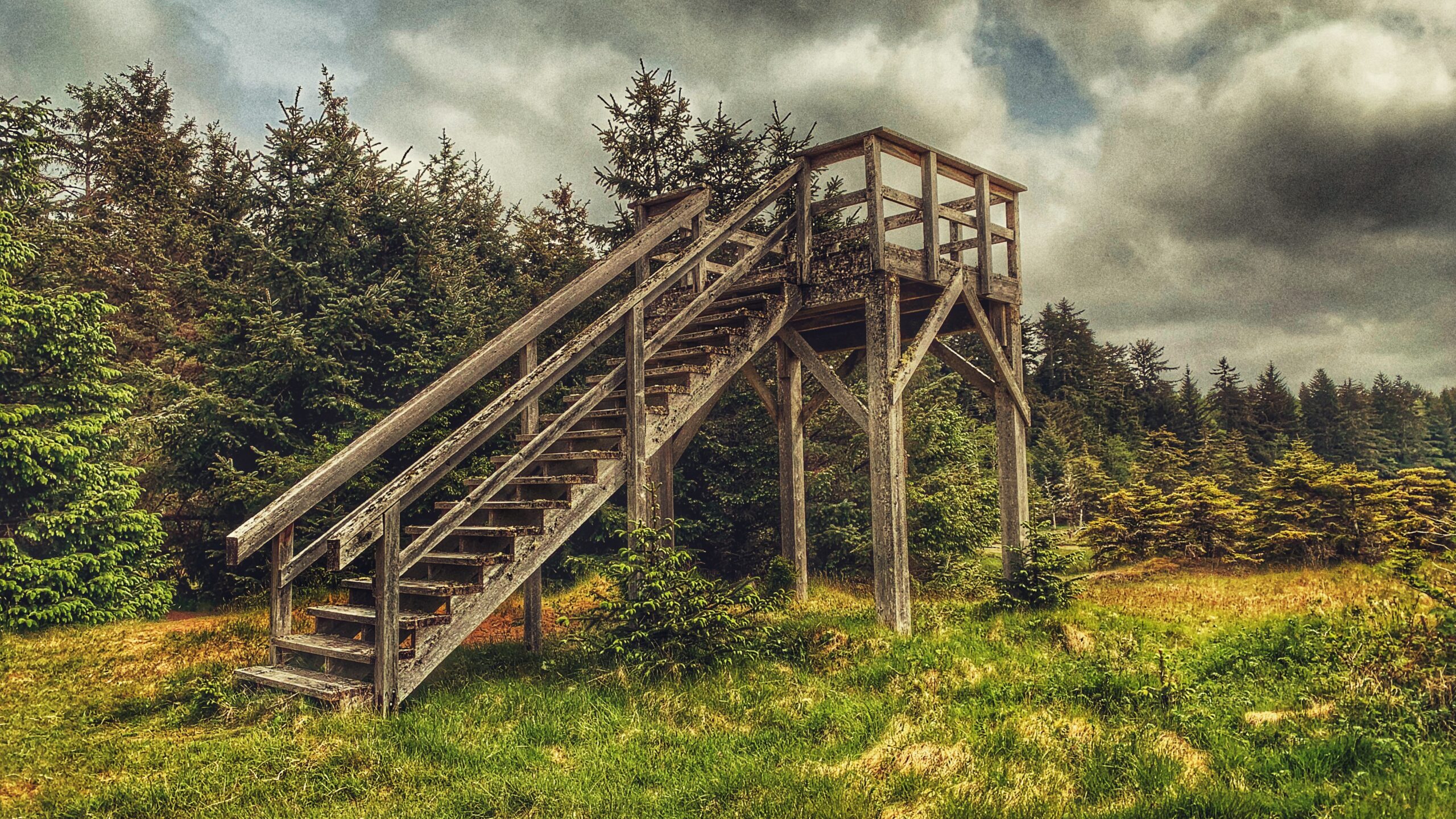
At several spots along this route, the trail dips into the various meadows and ponds of Delkatla, giving birders easy access to parts of the sanctuary. If you began your hike at the trail’s northern terminus (parking lot), a short route there leads you to the Simpson viewing tower which, you guessed it, is where this trail gets its name.
Please note that while the trail is classified as “easy,” lack of maintenance has made parts of the trail kind of rough. You will encounter some deadfall along the route, but nothing major.
DIFFICULTY: Easy TOTAL DISTANCE: 3.4km (return) TIME: Approximately 1 hour TYPE: Out-and-Back ELEVATION GAIN: None
This is one of the key featured tree on the trail – showing a nursing log sustaining new growth
The trail is well-maintained
GOLDEN SPRUCE TRAIL FEATURES: Haida legend Old growth trees Access to Yaaguun Gandlaay Conservancy
ABOUT
The Golden Spruce Trail is located approximately 10 minutes (3.5 km) outside the community of Port Clements and represents a brisk 20-minute roundtrip walk. Up until January 1997, the end of this short well-manicured trail led to a viewpoint whereby you could see and admire Kiidk’yaas, the Golden Spruce.
An old photo of the Golden Spruce.
Credit: Marla Abbott
The ancient tree, estimated to be about 300 years old, was a massive Sitka spruce known for its rare golden needles. It figured prominently in Haida stories. Unfortunately, in mid-January 1997, the tree was chopped down by the deranged “protester,” Grant Hadwin. His actions sparked international outrage; the tale is powerfully told in John Vaillant’s The Golden Spruce (2005), a must-read and primer for anyone wanting to walk this short trail. Context is essential to understanding and appreciating this sacred place.
I had the privilege of seeing the actual Golden Spruce in June of 1996, a mere 7 months before it was felled. The trail was a bit narrower back then, but still easy to navigate. Seeing and being surrounded by the massive old-growth forest was a fantastic experience, but nothing could compare to seeing Kiidk’yaas in person. Its golden foliage radiated in contrast to its greener relatives and the almost black Yakoun River at its base.
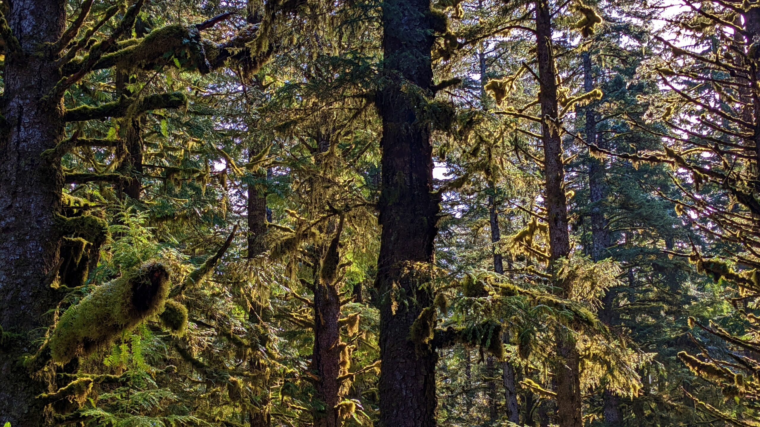
Currently, the Golden Spruce Trail has been widened and is accessible to those with mobility issues. The old-growth forest; the soft and lush moss; monumental trees and decaying nurse logs still maintain and hold their power over those who hike the trail. It is a very serene experience; one heightened even further by the plaques, designed by the late Ben Davidson, placed throughout highlighting the Haida’s spiritual, emotional, and practical attachment to the land.
Once you reach the end of the official trail, you come upon a viewpoint that, up until about 3 years ago, allowed you to view the skeleton of the Golden Spruce. Now, all that remains is a stump, which is difficult to see and identify. In a very real sense, the walk is both beautiful and tragic at the same time.
In death, however, we often find life. After the Golden Spruce fell in 1997, a number of cuttings were taken from the tree in hopes of planting “golden” offspring. One such cutting has indeed survived and is viewable in Port Clements’ Millennium Park. The golden needles shine bright and radiant.
While the official Golden Spruce Trail is only 400 meters one-way, it is possible to walk nearly an additional 2 kilometres along the “unmaintained” portion of the trail (indicated by signage at the end of the “official” route). In our view, the reason you may wish to hike this route is for the golden opportunity it presents to explore more of the Yaaguun Gandlaay Conservancy. The Conservancy has been used by the Haida for at least 10,000 years and is rife with historic, cultural, social, and spiritual meaning – something very evident along this trail.
Lasting structures – remnants of the old docks at the end of the Watun River Road
Watun River spilling over to the Masset Inlet
Top view of the remaining dock structures
Near the entrance of the road
Watun Road Features Historic remnants of a cannery Docks remains Fishing spots
ABOUT
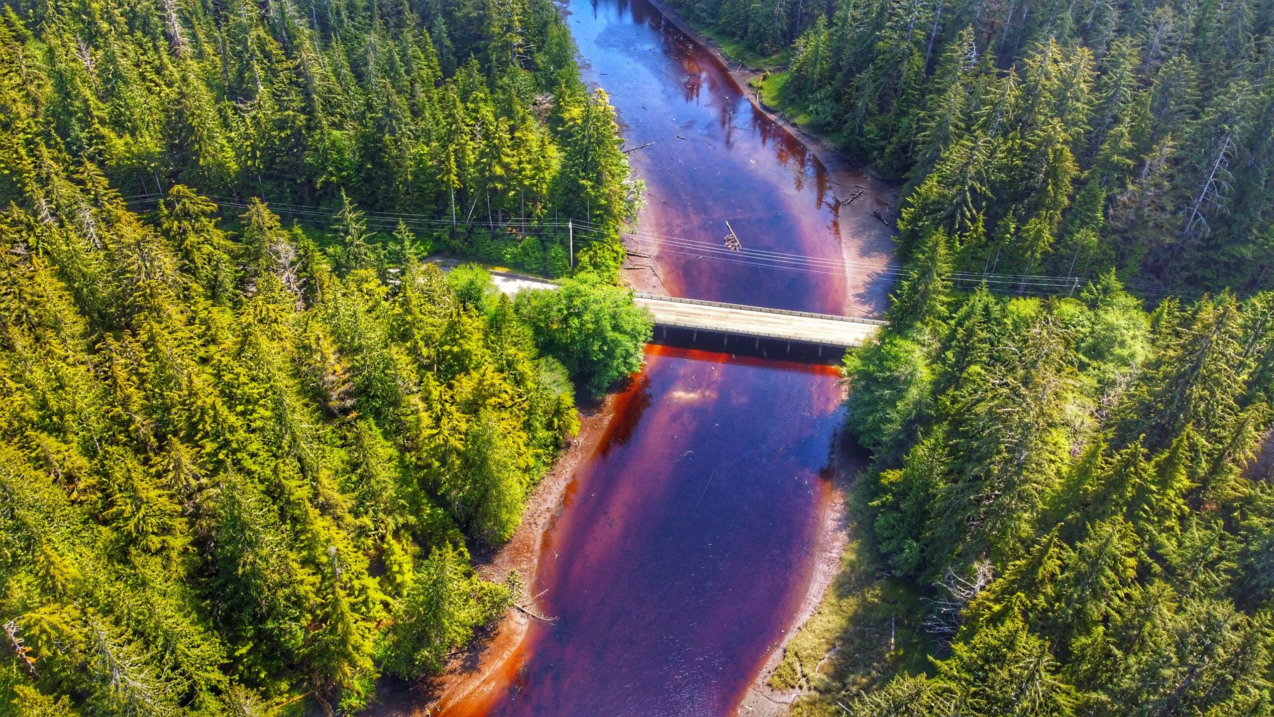
The Watun River Road, which has also been identified as a trail elsewhere, is accessible just off the Watun River Bridge, approximately 20 minutes south of Masset. The road is roughly 400 meters in length but is often muddy.
We would not recommend driving the length of the road unless you have a 4-wheel capable truck. If driving a standard vehicle, a safe alternative would be to pull off to the side of the bridge – where there’s ample parking for at least 3 mid-size vehicles – and walk the length of the road. It’s a brief and easy trek, taking only about 6 minutes to reach the mouth of Watun River and Masset Sound. As you walk this route, you can enjoy the scenic beauty that surrounds you. Western hemlock, ferns, and grasses dominate the trail landscape and are often blanketed by lush mosses.
Once you reach the terminus point of the trail/road, you’re treated to the unique wetlands protected by the Kamdis Conservancy. These intertidal shallows are rich in vegetation and sea life: sedges, grasses, and rushes abound thanks to the rich waterways and soils. If walking here at low tide, use caution as the area can be a bit slippery.
Beyond the wetland expanse, you’ll undoubtedly notice old wooden pillars off in the distance. These are all that remain of a primitive dock system that used to be in the area. Decaying and returning to nature, these columns have their own charm about them now. These old pillars might also be part of the Watun River Cannery that existed in the area from 1919- 1930.
As part of the Kamdis Conservancy site, the Watun River road/trail access is important for ecological and cultural purposes. Here you can get a glimpse of early settler development while also seeing but a small part of why Kamdis is a significant intertidal estuarine wetland complex. It’s a short hike (or an even shorter drive), but the rewards are many!
DIFFICULTY: Easy LENGTH: Approximately 400 meters TRAIL TYPE: Out and Back
SCOUT LAKE TRAIL FEATURES Sloped trails Lake on top Boggy environment
Note that in some literature Scout Lake is also referred to as “Charlie Hardie South Lake Trail.”
ABOUT
Locating the Scout Lake Trailhead marker is an adventure in itself. To find this trail, you first have to hike the full Charlie Hartie Trail, which clocks in at approximately 800 meters one way and has an elevation gain of 160 meters. After about an hour of hiking, you’ll come upon the official terminus point of the Charlie Hartie Trail, as indicated by a fork and some signage. One arrow points left towards “Charlie Hardie,” but blowdown and lack of maintenance have made this route towards the creek virtually unnavigable. The right-pointing arrow, on the other hand, indicates the route to Scout Lake and, in effect, represents the trailhead. From this point onwards, it’s an uphill climb – of just over 1 kilometer in the distance – towards the small lake. Blue tape indicates your path.
The Scout Lake Trail, much like the Charlie Hartie that precedes it, is rough, narrow, miry, and quite steep in some places. For much of the climb, you’ll be making your way through dense forest, but there are a few monumental cedars along the way. Seeing these giants up close really helps to put things into perspective and highlights, only too clearly, why protecting our forests is important.
Just before reaching the zenith of your climb, you will have to descend into a small ravine and cross Templeton Creek before climbing again and finally reaching the flat bog lands. This part of the trek is fairly straightforward in summer, but if you hike the route during winter be prepared to deal with plenty of packed snow and ice.
Once you reach the bog, the ground is mostly flat and it’s an easy hike to Scout Lake from here. Just make sure you’re wearing good waterproof gear and be cautious of the numerous small pools dotting the landscape. DO NOT step in these. They may look shallow but they’re deceptively deep!
As you close in on Scout Lake, you’ll come across one of this hike’s more interesting features – a sign that looks like it came right out of a Dr. Seuss book! It points every which way and nowhere in particular. The wooden sign gives general distances to Scout Lake, Regier Lake, Chinukundl Creek, and Queen Charlotte. We’ve wondered if it’s possible to hike towards Regier Lake from here.
Once you reach the Dr. Seuss sign, Scout Lake will be to your left (or west) – a little over 5 minutes away. Just follow the pink tape on what looks like a deer trail and you’ll eventually reach your destination. When we saw Scout Lake, it was still partially frozen, which added to its charm.
All in all, Scout Lake is a good, albeit challenging, hike. It is more scenic than the Charlie Hartie, though we say that only because Scout Lake actually leads somewhere rather than ending at a random point (as the existing “Charlie” does). Hiking to Scout Lake, you encounter beautiful green mosses; monumental cedars; and a unique bog environment, featuring salal, Labrador Tea, and a host of other flora. In brief, it’s a challenging but rewarding hiking adventure!
DIFFICULTY: Hard TOTAL DISTANCE: 3.5 kilometers return (including Charlie Hartie Trail) TIME: 2 hours one-way TYPE: Out-and-Back ELEVATION GAIN: 395 meters
MONIQUE CREEK TRAIL FEATURES Magical Sitka Spruce Forage destination during Fall Season Fishing spots along creek
ABOUT
The Monique Creek Trail, like the Three Mile Creek Trail, is found deep within the Tlall Conservancy. Accessing it in the current day requires a bit of effort because the original point of entry – Survey Forest Service Road – was formally decommissioned in 2016 after years of disuse.
Now, if you wish to visit this trail, you’ll have to drive nearly 1.5 hours along the Daajing Giids backroads: First, drive approximately 20 minutes along the QC Mainline (passing the decommissioned Survey Forest Service Road) until you come upon the un-signed junction for Lakes Main Road, near the Mile 17 marker, to your RIGHT. Take this turn and follow Lakes Main for nearly an hour – you will eventually connect to what’s left of the Survey Forest Service Road. Once here, turn to your RIGHT and park your vehicle. You will see the decommissioned section of the Survey Forest Road. For all intents and purposes, this is where your hike begins.
You must hike along the Survey Forest Road for approximately 3.5 kilometers before hitting the “official” Monique Creek Trailhead. This portion of the hike is relatively straightforward and easy; however, the numerous trenches dug as part of the decommissioning process – there are more than 10 of them – can be a bit of a challenge. Long grass has grown over the rocks, making footing a little uncertain.
The official Monique Creek Trail begins at an overgrown spur road and will be to your LEFT. An orange arrow – one of the few still left after 20+ years – and an extremely faded trailhead sign indicate the start of the route. The official trail follows the spur road for a few hundred meters before turning off into the dense bush. Because most of the trail markers have gone, it’s very easy to miss the turnoff point, which is exactly what we did. We continued hiking along the increasingly overgrown road for a good 5 minutes before realizing we were off the trail.
Because the turnoff point is extremely dense, how do you know where to depart the old road? The best answer we can give is, as you’re hiking the overgrown road, keep your eyes peeled for a lone orange trail marker pointing BACK towards the Monique Creek Trailhead. From the marker, turn LEFT into the dense bush. This is where the route gets fun because the trail is almost non-existent at this point. There is the odd marker, but they’re far and few between. We spent 30 minutes in here, trying to find our way.
Once you emerge from the dense bush, you’re rewarded with the lovely confluence of Survey and Monique Creeks. You’ll spy a trail marker on the opposite side of Survey Creek. Cross here. There apparently used to be a natural log bridge, but it’s not there anymore. Be prepared to get your feet wet unless you’re wearing boots! After you cross, walk upstream along Monique Creek.
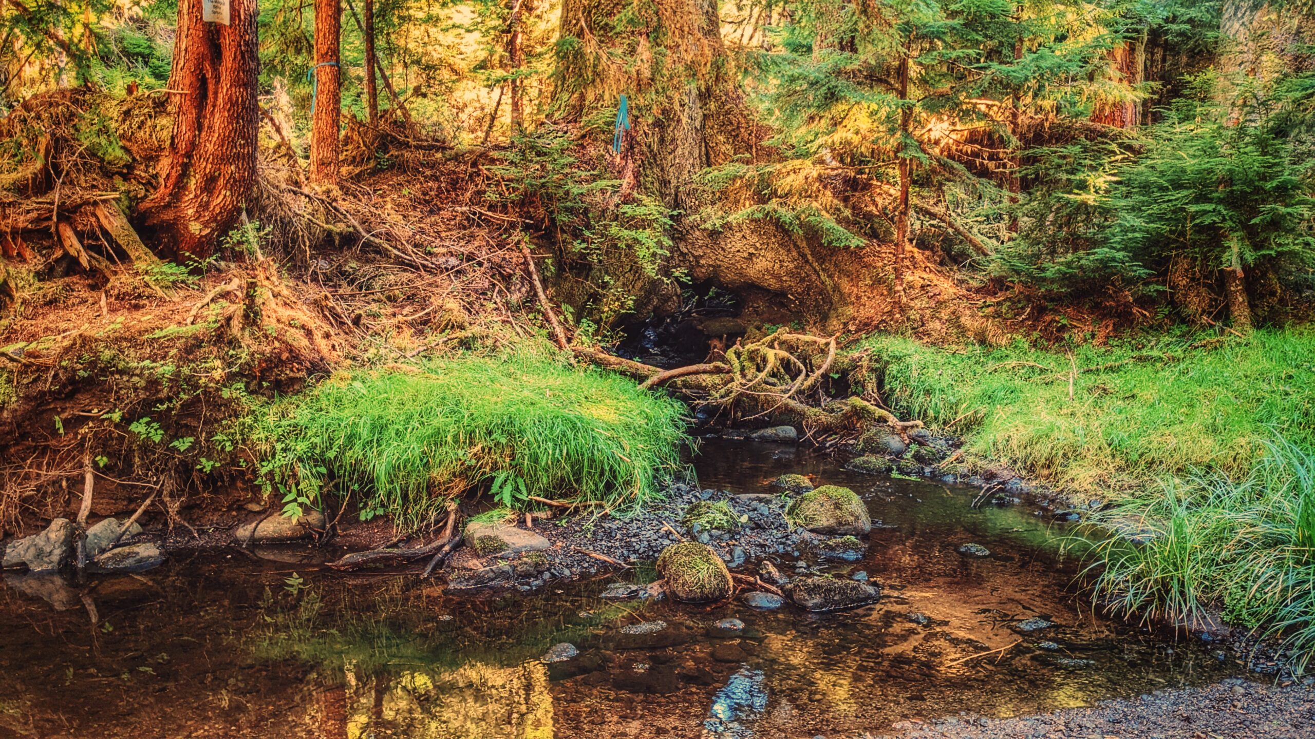
The Monique Creek is a nice example of a coho spawning stream flowing through old-growth forests. Unaffected by development, it’s an ideal place to study the unique habitat features for spawning coho. As we hiked along the creek, we found many frogs, some elk tracks, and salmon Fry in the creek!
By the route’s end – just minutes after a log jam – you’ll come upon the trail’s star attraction: A large Sitka Spruce that has a creek running through its roots! The tree is a special sight and well worth the hike.
Unfortunately, trails like Monique Creek have fallen into severe disuse due largely to the difficulty associated with getting to them. Once upon a time, you could probably do this hike in a couple of hours; however, because you now have to drive nearly 1.5hrs + hike 3.5km before getting to the trailhead, it is best to give yourself a full day to enjoy the serenity of nature.
DIFFICULTY: Moderate TOTAL DISTANCE: 3km (return, official trail); 10km (return, from Survey Forest Rd) TIME: 6 hours TYPE: Out-and-Back ELEVATION GAIN: 40 meters
The logging barge and the river flow spilling into Masset inlet
The logging barge up close
KUMDIS RIVER TRAIL FEATURES: Environmental research Barge remnants Duck hunting grounds
ABOUT
The Kumdis River Trail is a short out-and-back route located approximately 2 kilometers outside the village of Port Clements. Like most trails on Haida Gwaii, the Kumdis River Trail lacks a formal trailhead; however, it is easy enough to find. As you drive along Yellowhead 16 towards Masset, you’ll come upon a small pullout to the immediate left of the Kumdis River Bridge. This short dirt road essentially represents the trailhead.
At the very beginning of the hike, you’re treated to lovely views of the Kumdis River and promised a flat trail to complete. The Kumdis River often acts like a mirror on a clear and calm day. The trees on the opposite side of the riverbank flawlessly reflect on the water. The end result is almost dream-like – quiet reflections hinting at what’s to come.
Walking the rest of this short trail is fairly uneventful and straightforward. For the first few minutes, you walk through a nice pocket of old growth filled with towering red cedar and thick Sitka spruce. You then pass through a grassy clearing before re-entering the forest. Finally, just before entering the grasslands and sedge at Kumdis Bay, you come upon what, in our view, is a highlight of this trail: Stunted and twisted trees covered in long, wispy old man’s beard lichen. It’s quite a sight and unlike most anything, you’ll see on Graham Island.
Once you enter the grassy lowlands of Kumdis Bay, you can take a few moments to explore and appreciate this unique environment. Part of the Kumdis River conservation area, it’s not uncommon to see the Council of the Haida Nation, in partnership with NCC, conducting necessary fieldwork. As an estuary, this area is home to a plethora of fish, invertebrates, and waterfowl, giving Kumdis high ecological importance.
It’s most curious (and even a little ironic), then, when you spot an old barge once used to transport logs resting on the river. It has been here so long – close to 100 years – that it’s now become part of the landscape. Moss, shrubs, and trees now dominate the structure. Nature is taking over!
Slightly elevated part of the trail with helpful cut logs to help you up
Part of the beach you see at end of trail
The open horizon leading up o the beach
ANDREWS PLACE ROAD TRAIL FEATURES: Beach Access Access to Naikoon Provincial Park
ABOUT
The Andrews Place Road Trail is a short out-and-back route located at the end of, well, Andrews Place Road in Tlell. The trailhead is not formally marked; however, it can be seen adjacent to a hydro pole at the end of the cul-de-sac, next to Sandy House. At just 250 meters in length, it only takes 5 minutes to complete this trail and emerge, first, onto the flat sand dunes and then the pebbly beach below.
Because of its short length, I suspect this trail was created more for functional reasons – beach access – than recreational hiking. As such, proper hiking gear is not required. The path is user-maintained and the terrain is mostly flat; however, there are some roots to watch out for as well as some potentially slippery steps to climb en route to the beach.
For the first three minutes of the hike, you walk through fairly dense salal bushes and young Sitka Spruce. Beautiful green moss carpets areas of the forest floor. Just before reaching a set of stairs, you’ll spy a heavily worn and faded sign pointing “to the beach.” After climbing the stairs, you’ll come upon a beautiful memorial bench that sits at the junction of forest and sand dunes. From here, it’s a short two- minute walk towards the beach.
In late Spring and early Summer, the sand dunes in this area – and throughout Naikoon Provincial Park are rife with life. As you walk, be sure to keep an eye out for delicious wild strawberries! At times, the sweet aroma is enough to envelop the mind!
At high tide the beach in this area is pebbly and rough; however, low tide exposes the smooth, packed sand. Most who visit this area either do so for a refreshing dip in the Pacific Ocean or to walk along the shoreline – technically part of the larger Misty Meadows Loop Trail – toward the mouth of the Tlell River. On a clear day, the expanse of beach and sand dunes can, and do, appear most welcoming.
BLACKWATER CREEK WATERFALL TRAILS FEATURES: · Relatively easy access to waterfalls · Challenging rope sections
ABOUT
The Blackwater Creek Waterfall Trails are a couple of hidden gems on Haida Gwaii. The two trails are short – clocking in at about 200 and 400 meters respectfully – and very remote; however, if one enjoys chasing waterfalls, these two routes are definitely worth the effort. As these trails are not well known, they do not appear in any of the literature available on Haida Gwaii. Here’s how you get to them:
1) Starting in Port Clements, drive south along Bayview Drive towards the Golden Spruce Trail.
2) Keep driving. Bayview Drive eventually turns into the Port Man Forest Service Road – an active logging road. At about the 11km mark from Port Clements, you’ll come upon signage for the “HAIDA CANOE” Trail. Then, 150 meters from this point you’ll spot a “Y” or split in the road. Turn RIGHT onto the New Mainline Road. You will then cross a bridge over the Mamin River before coming to another “Y.”
Keep left on the New Mainline Road for approximately 500 meters. You will then see a minor logging road to your LEFT. Turn here and drive for nearly 5 kilometres. Note that, from this point on, the road is narrow (single track) and does have a few low-hanging alder trees you’ll have to clear.
3) After driving along the road for nearly 5 kilometres, you’ll cross a small bridge over Blackwater Creek. Barely 100 meters past this bridge, you’ll come upon another “Y.” Turn RIGHT. Drive approximately 2 kilometres along this narrow road. If you’ve made it this far, you’ll spy the trailhead marker for the first waterfall. It is signified by pink and orange flagging tape hanging from young spruce trees.
The trail is short – approximately 200 meters one-way – but it is more reminiscent of a stroll through the bush than an actual trail. Expect to walk through dense forest, a lot of deadfalls and a few muddy sections. The good news, though, is the route is extremely well-marked: There is bright flagging tape every few feet, so it’s virtually impossible to get lost.
At the end of your hike, you’ll come upon a moderately steep section, which you must carefully descend in order to view the waterfall. The waterfall itself is quite nice; however, it is difficult to photograph on account of being obstructed by large logs. After enjoying the cascading falls and the sounds of nature, return the way you came.
4) To view the second waterfall, continue driving approximately 1.2 kilometres up the same narrow road. You will eventually see the trailhead markers – signified by candy cane patterned flagging tape – to your LEFT. A pullout, large enough for 2 vehicles, is just a few feet up the road. Unlike the first waterfall, the route to this second waterfall resembles a more traditional trail (albeit a little rough).
It, too, is extremely well marked with flagging tape. The total length of this trail is approximately 400 meters (one way), but that’s because, at the mid-point, it splits. If you go to the RIGHT, you’ll come upon the “top” of the falls, which is picturesque in its own right and features an attractive “kiddie pool” more than suitable for a swim.
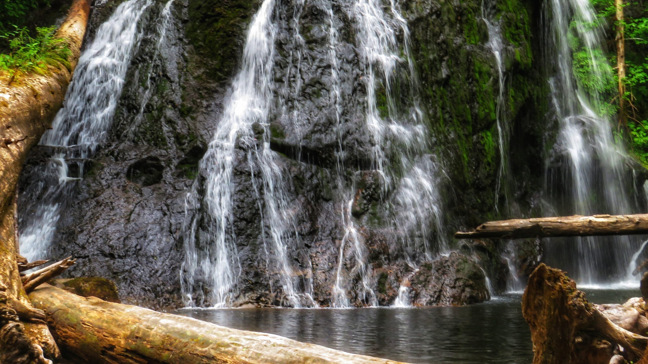
If you go to the LEFT at the trail split, you’ll eventually make your way to a fairly large waterfall, cascading down a rounded rock face. Use caution, though: To get to these falls, you must descend an extremely steep area that, in one area, is almost completely vertical. There are several sturdy ropes to assist you here. Once you make it down, however, it is only a short walk to the impressive falls.
It is not uncommon for people to linger here for many a moment and cool off under the cascading water. Once you’re finished admiring the serene beauty laid out before you, simply head back the way you came.
Getting to these waterfalls may be tricky (both in navigating the narrow logging roads and hiking), but it is well worth the effort. In both instances, the waterfalls are a mere 10 to 15 minutes off the road. In our view, the second waterfall, in particular, is the major highlight because of its size and relative ease of access; in fact, we’d even suggest it rivals the Dover Falls in Sandspit!
Again, though, keep in mind that you will be driving on active logging roads; thus, proper caution should be exercised. In addition, while a truck is not necessary to reach these sites, a standard vehicle is not ideal for these roads.
DIFFICULTY: Easy to Moderate TOTAL DISTANCE: 400 and 800 meters (return) TIME: 50 minutes (for both trails, out and back) TYPE: Out-and-Back ELEVATION GAIN: Minimal
MASSET CEMETERY ROAD BEACH ACCESS TRAIL: Access to North Beach Masset Cemetery
ABOUT
The aptly named Masset Cemetery Road Beach Access Trail is exactly as it says: It is located adjacent to Masset Cemetery and provides straightforward access to South Beach. In this regard, it isn’t much of a hiking trail but serves a functional purpose. The trail is wide and flat, taking you through compacted sand and a few scattered spruce trees before hitting the beach. In brief, there’s nothing much of note along this short trail. It’s all in the destination. . .
In our experience, most people don’t access this trail on foot. Instead, because it is so wide (and resembles a road more than a trail), ATVs and trucks are far more common. The few times we’ve hiked this route, ATVs and other vehicles have always been present – riding up and down the pebbly beach at quite the pace. But the vehicle use isn’t just for recreational fun: At certain times of the year, the Haida will access the beach in this area to harvest traditional foods.
As noted, it is highly unlikely one would visit this trail for recreational hiking purposes. Instead, we recommend doing the practical thing: Use it to access the beach – which itself is part of the larger Tl’ellan to Old Massett Trail – and go for a nice stroll alongside the powerful Pacific Ocean. As you amble about, keep an eye out for sea life, agates, and beach glass. There’s no telling what you might find!
Finally, since you’re in the area, we would also recommend visiting the Masset Cemetery: This is a truly unique space, unlike any cemetery we’ve visited. Haida Watchmen figures keep a close eye on some resting sites while mounds of agates and scallop shells can be found at others. In a large city, some of these “precious” items would quickly grow legs, but in a small community like Haida Gwaii, the house of the dead is deeply respected. Thus, if you do choose to visit the cemetery before or after walking the nearby beach, step quietly and cautiously. Someone – or something – is always watching 😉
The Dover Falls describes itself as a “hard trail” on its trail marker.
The bridge across the Haans Creek was built on top of a natural log bridge tree.
Haans Creek on a calm waters
LOUISE DOVER TRAIL FEATURES: Old Growth forest Culturally Modified Trees Dover Falls
ABOUT
The Louise Dover Trail is located adjacent to the Haans Creek bridge, just before entering Sandspit. Initially conceived in the mid-1990s, the trail is named after Louise Dover, an influential woman of Haida ancestry who lived in the community of Sandspit. In many respects, the trail is an apt memorial and tribute because it introduces hikers to key elements of Haida Gwaii: Important fish streams; unique flora and fauna; ancient Haida culture; rare geology and fossils; and, a larger appreciation for how everything depends upon everything else.
In 2008, the Dover Trail became part of the larger Damaxyaa Heritage Site and Conservancy. Encompassing some 829 hectares, the conservancy plays host to important fish-bearing streams – one of which is Haans Creek – and contains a high density of recorded culturally modified trees (CMTs), a few of which can be spied along the Dover Trail. Both in pre-history and the current day, Damaxyaa is an important place for the Haida in terms of food gathering, medicine and culture. A seasonal Haida camp known as Kil was originally located at the mouth of Haans Creek, but no evidence of this remains today.
Most official documentation on the Dover Trail clocks it in at 3.5km in length, but 4km is much more accurate. The first 200 meters are dubbed universal access, and bring you to a handsome viewing gazebo, thanks to significant upgrades completed in the autumn of 2020. After this, the trail becomes narrow and rough for most of the loop.
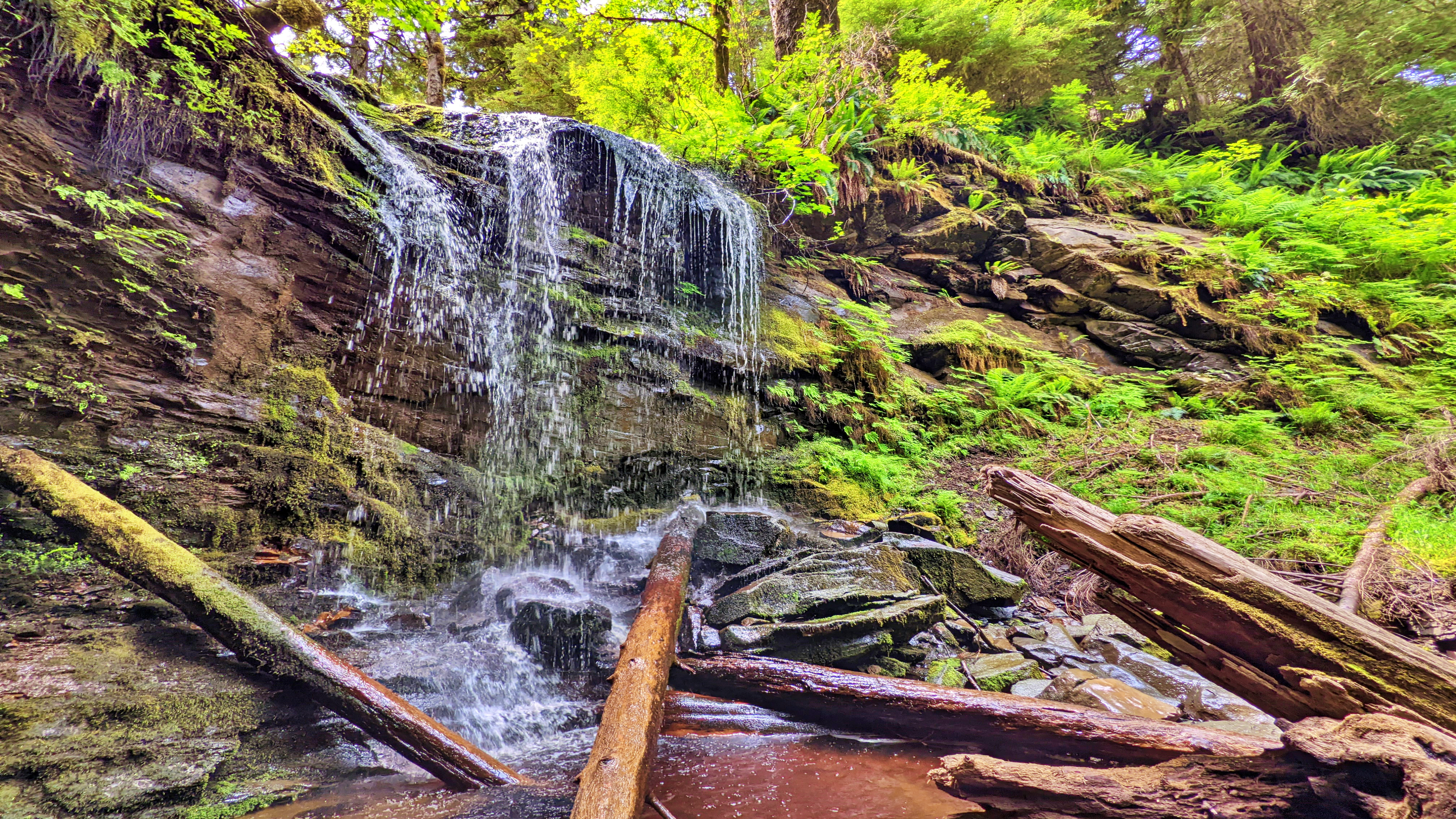
Expect a lot of “up, down, up down” for much of your hike. Once you hit the mid-way point of the Dover loop, you’ll see a marked side trail. This leads you to a lava bed and fossils – one of the trail’s key highlights. If you ignore this trail, though, and continue along the main Dover loop, the route climbs quite steeply away from Haans Creek. Near the end of your climb, a small stake in the ground indicates 400 meters of “hard” trail leads to a waterfall.
If you’re feeling ambitious, it’s certainly worth the effort; however, be advised that much of this side trail is steep and muddy with a couple of rope sections. Early in, you also have to get creative in getting over a fallen monumental cedar tree.
The final section of the Dover Trail loops back towards the road and trailhead, connecting with the trail you started near the natural log bridge at Haans Creek. Much of this trail is muddy, but home to many old-growth Sitka Spruce and Cedar trees. As you hike back towards the trailhead and Haans Creek, you’ll spy at least one CMT with a large “test hole” in it. You’ll also come across the “Skyline Trail,” which remains closed for whatever reason as of this writing.
Many who visit Haida Gwaii declare the Dover Trail to be their favourite overall hike. The terrain is varied; there are a number of side trails to visit and explore; it offers a glimpse into the old-growth forest and Haida culture; and, it represents a great way to reconnect with nature. Think of it as forest therapy.
DIFFICULTY: Moderate TOTAL DISTANCE: 4km (longer if exploring side trails) TIME: 3 hours TYPE: Loop ELEVATION GAIN: 106 meters
Cookie Consent
We use cookies to improve your experience on our site. By using our site, you consent to cookies.
Contains information related to marketing campaigns of the user. These are shared with Google AdWords / Google Ads when the Google Ads and Google Analytics accounts are linked together.
90 days
__utma
ID used to identify users and sessions
2 years after last activity
__utmt
Used to monitor number of Google Analytics server requests
10 minutes
__utmb
Used to distinguish new sessions and visits. This cookie is set when the GA.js javascript library is loaded and there is no existing __utmb cookie. The cookie is updated every time data is sent to the Google Analytics server.
30 minutes after last activity
__utmc
Used only with old Urchin versions of Google Analytics and not with GA.js. Was used to distinguish between new sessions and visits at the end of a session.
End of session (browser)
__utmz
Contains information about the traffic source or campaign that directed user to the website. The cookie is set when the GA.js javascript is loaded and updated when data is sent to the Google Anaytics server
6 months after last activity
__utmv
Contains custom information set by the web developer via the _setCustomVar method in Google Analytics. This cookie is updated every time new data is sent to the Google Analytics server.
2 years after last activity
__utmx
Used to determine whether a user is included in an A / B or Multivariate test.
18 months
_ga
ID used to identify users
2 years
_gali
Used by Google Analytics to determine which links on a page are being clicked
30 seconds
_ga_
ID used to identify users
2 years
_gid
ID used to identify users for 24 hours after last activity
24 hours
_gat
Used to monitor number of Google Analytics server requests when using Google Tag Manager