GOVERNMENT DOCKS FEATURES: Family-friendly Views of Masset & Skidegate Inlets Urban hike
ABOUT
It might seem silly to write about the three Haida Gwaii Government Docks as trails – and believe me, I do feel kind of silly – but they are identified as “trails” in the Haida Gwaii Trails Strategy document (2011). I suspect this was probably done for funding purposes and to inflate the number of trails on the archipelago, though I’m not sure why one would need to do that. Even if we went for a very loose definition of what constitutes a “trail,” I somehow doubt these would make the cut; after all, they are, as their name explicitly states, docks.
But let’s ignore that for a moment. Let’s presuppose that these three docks don’t just serve a specific function (as a place for boats to moor). Instead, let’s treat them as trails – a marked or established path to be followed.
The entrance to the Masset Docks
The side of the docks
Masset docks
Masset Government Dock
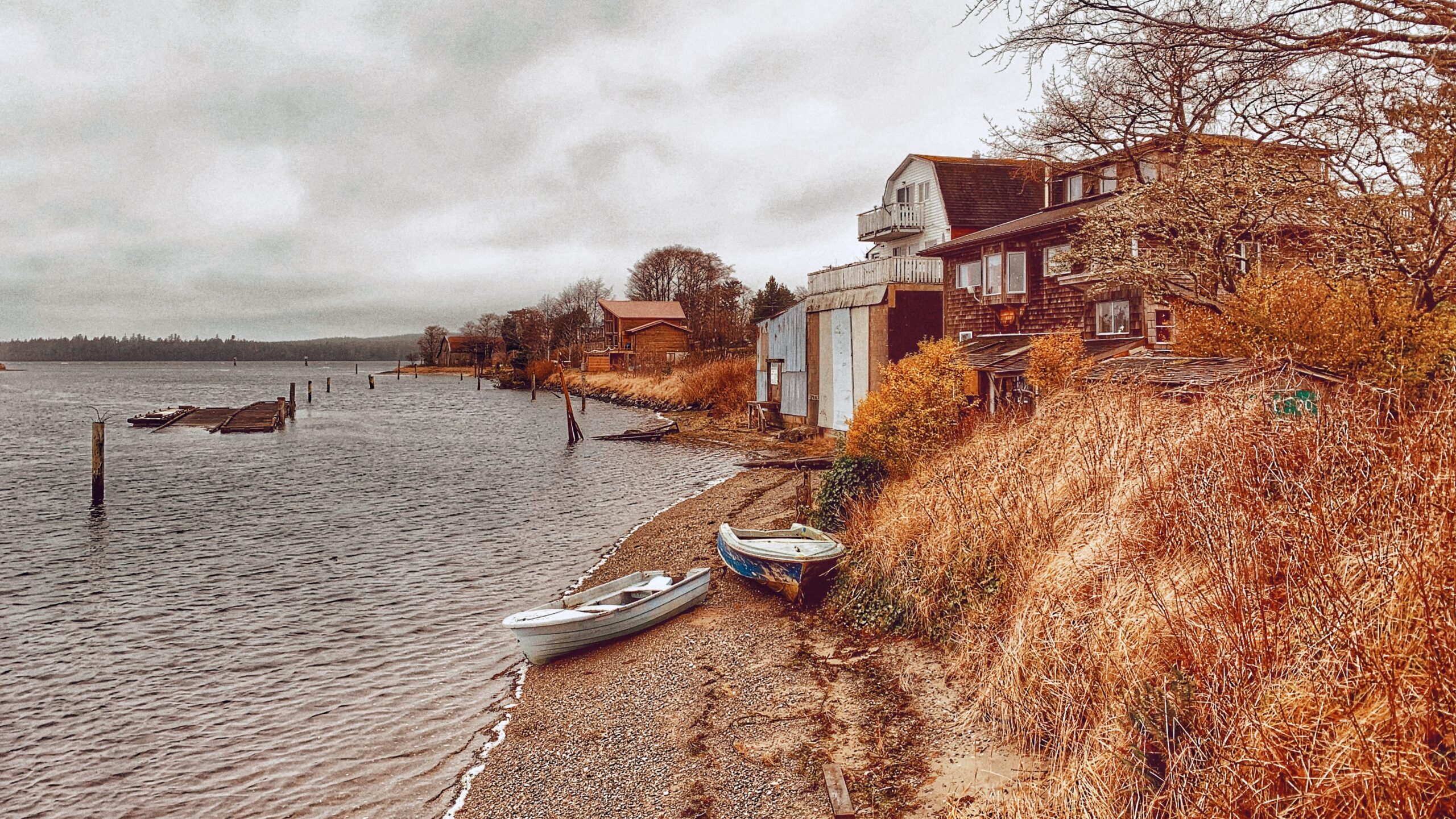
Located at the end of Collison Avenue, just off Delkatla Street, the Masset Government Dock is the shortest of the three, at least as far as the “main finger” goes, clocking in at approximately 100 meters long. From here, you can get nice views of both Delkatla and Massett Inlets; watch the busy harbour activity below; and, if you’re lucky, spy a few ducks swimming along the harbour docks.
The main Government Dock is wheelchair accessible; however, I would suggest that the boat moorage areas are not quite as friendly. Of note, this dock does feature a lovely “Little Library.” Interestingly, just down the road from the Masset Government Dock is the Village of Masset Wharf.
Located at the end of Main Street, this wharf is just under 200 meters in length and provides nice views of Massett Inlet. In addition, there is a small path at the head of the wharf which provides beach access. Be warned that the wharf is very slippery in some sections.
Port Clements Government Dock
Located along Bayview Drive, the Port Clements Government Dock is approximately 200 meters in length; provides nice views of Massett Inlet; is wheelchair accessible; and, features a couple of benches at its end. One thing I liked about this dock is the creative birdhouse tree located just off to its right.
The views you can get from this dock on a clear day are nice, but the endless activity of our feathered friends in the birdhouse tree can keep one occupied for a long time! Also, this dock is nicely lit up with Christmas lights during the holiday season!
Queen Charlotte Government Dock
This “trail” technically begins at the Queen Charlotte Visitors Centre, takes you through Spirit Square, and then along Wharf Street onto the dock, which affords you nice views of the adjacent harbour and inlet. As the Port Clements dock it is approximately 200 meters in length. Part of this “trail” may be a bit confusing because the Queen Charlotte Seawalk also starts at the Visitor Centre; however, the Seawalk moves in the opposite direction of the Government Dock.
All in all, the three Government Docks provide for a fairly uniform, if not unremarkable, experience. Despite being categorized as trails you will not find any trailhead markers indicating as such, which hardly surprising given their function and purpose. Still, if you’re looking for a quick and easy walk-in Queen Charlotte, Port Clements, or Masset, these docks may suffice. What they may lack in excitement, they kind of makeup for with the scenery surrounding them.
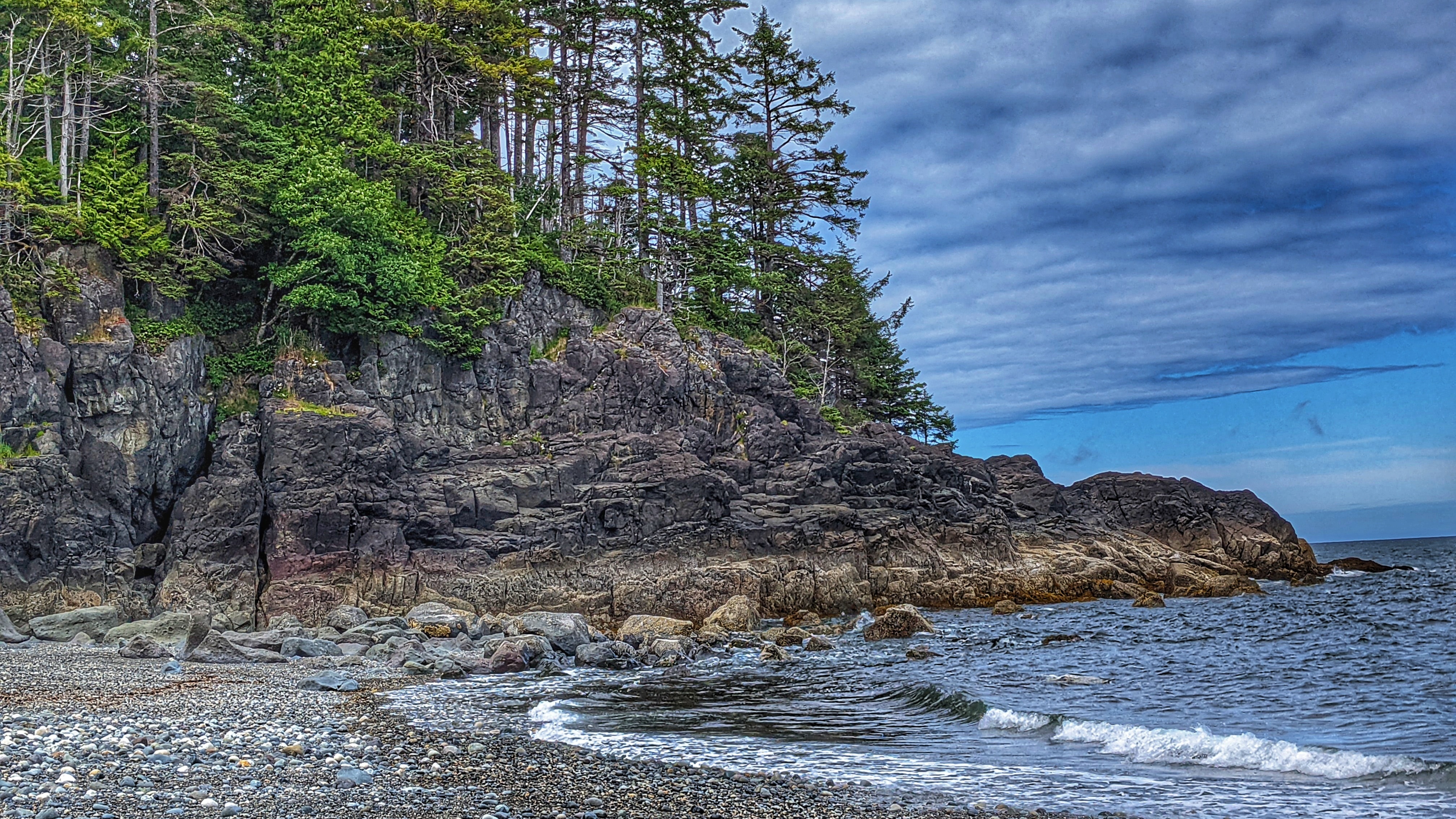
The Secret Cove trail ends on this lovely beach that is worth a picnic! (Jul 2021)
The vast beach is ideal for mindful skinny dipping (Jul 2021)
The lush forest spills into a beach clearing (Jul 2021)
A bit of water systems and puddles greet you along the trail (Jul 2021)
The forest parts can be scenic with mossy trees and root systems (Jul 2021)
The bridge that takes you to the trail (Jul 2021)
SECRET COVE TRAIL FEATURES Remote cove Nudist-friendly Kunxalas Conservancy
ABOUT
The Secret Cove Trail is located within the Kunxalas Heritage Site along the northeast coast of Moresby Island. To access this remote trail, you must drive approximately 25km southeast of Sandspit along the Copper Bay Mainline, Spur 20 Road, and, finally, Gray Bay Road.
The signed trailhead for Secret Cove comes about 1km before the Gray Bay Recreation Site. Once you park your vehicle, it’s a brief 600-meter hike (one way) to the aptly named Secret Cove.
The trail is decently maintained and features a marker designed by the late Ben Davidson. These beautiful yellow, black and white markers serve a multitude of purposes: 1) They help to keep you on the right trail (an informal trail shoots off Secret Cove and heads toward Dogfish Bay); 2) They reflect Haida heritage and culture; and, 3) They reinforce, within us, important values that help contextualize the space we’re exploring.
We should note, too, that you’ll see these trail markers on other important routes around Haida Gwaii, including Louise Dover Trail, White Creek, Cape Fife, and Pesuta/East Beach.
Secret Cove Trail is relatively flat and an easy hike. After making your way through lush ferns, alders, and beautiful spruce trees, you’ll come upon the trail’s namesake cove. Once here, take a dip in the Pacific Ocean; however, we do advise you to keep your clothes on!
When our party hiked this route, we did come upon a couple of nudists and their dogs. I think we spoiled their fun because they left as soon as they saw us! Party poopers!
Of course, if swimming nude isn’t your thing, you can explore the rocky coastline at low tide and marvel at the smooth rocks and walls polished by intense wave action. It’s not unusual to come across large beds of blue mussels hugging the boulders in this area.
I think, by itself, Secret Cove is not worth the long drive and journey. Instead, I would pair it with a larger exploration of the Kunxalas Heritage Site. By doing so, you can camp at Gray Bay, enjoy the sandy beach, go kayaking and learn even more about the unique and rich history of this place and space.
Contains information related to marketing campaigns of the user. These are shared with Google AdWords / Google Ads when the Google Ads and Google Analytics accounts are linked together.
90 days
__utma
ID used to identify users and sessions
2 years after last activity
__utmt
Used to monitor number of Google Analytics server requests
10 minutes
__utmb
Used to distinguish new sessions and visits. This cookie is set when the GA.js javascript library is loaded and there is no existing __utmb cookie. The cookie is updated every time data is sent to the Google Analytics server.
30 minutes after last activity
__utmc
Used only with old Urchin versions of Google Analytics and not with GA.js. Was used to distinguish between new sessions and visits at the end of a session.
End of session (browser)
__utmz
Contains information about the traffic source or campaign that directed user to the website. The cookie is set when the GA.js javascript is loaded and updated when data is sent to the Google Anaytics server
6 months after last activity
__utmv
Contains custom information set by the web developer via the _setCustomVar method in Google Analytics. This cookie is updated every time new data is sent to the Google Analytics server.
2 years after last activity
__utmx
Used to determine whether a user is included in an A / B or Multivariate test.
18 months
_ga
ID used to identify users
2 years
_gali
Used by Google Analytics to determine which links on a page are being clicked
30 seconds
_ga_
ID used to identify users
2 years
_gid
ID used to identify users for 24 hours after last activity
24 hours
_gat
Used to monitor number of Google Analytics server requests when using Google Tag Manager