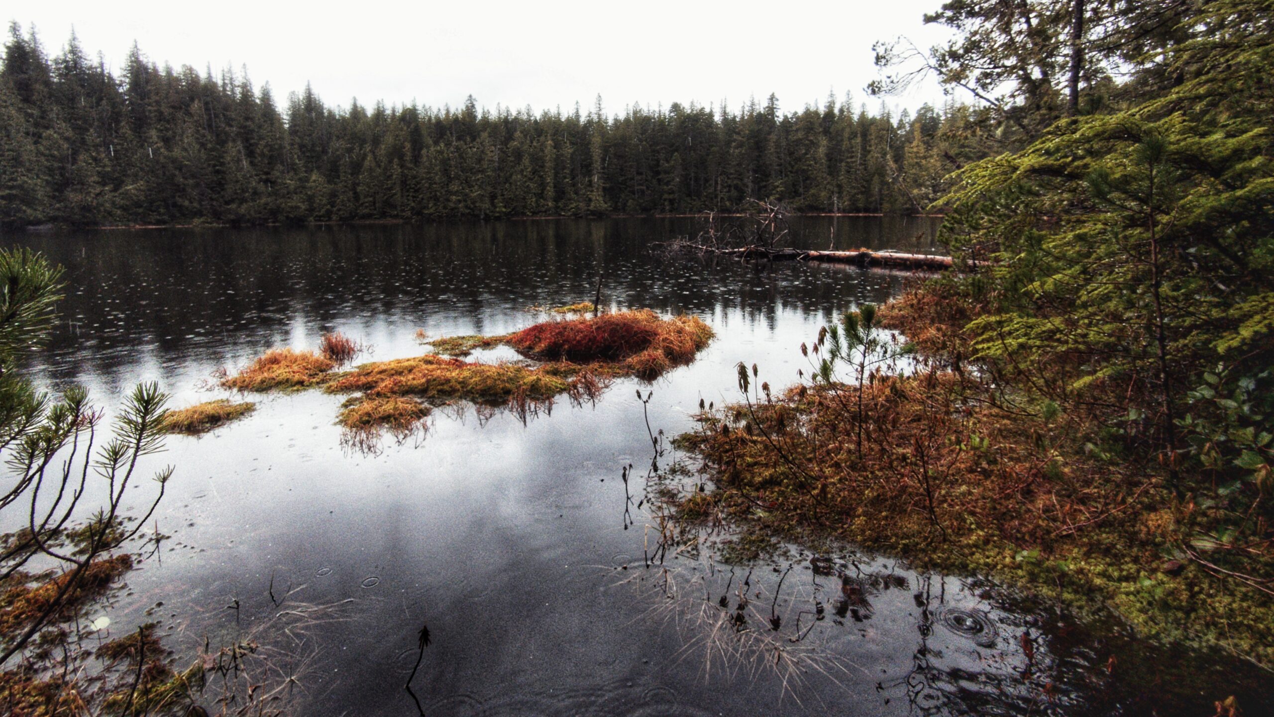
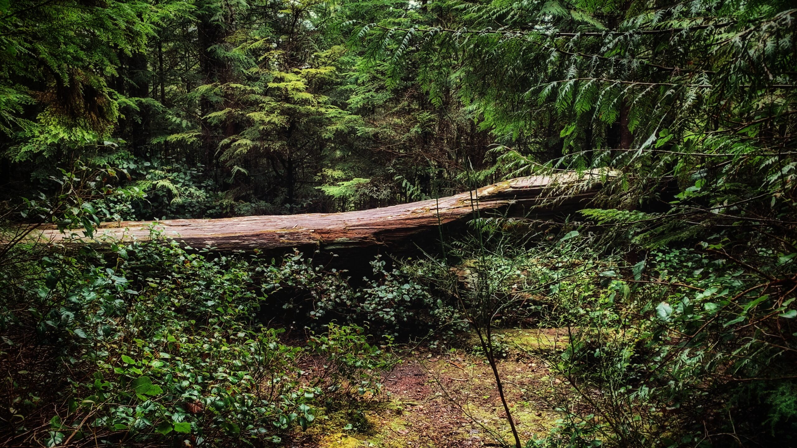
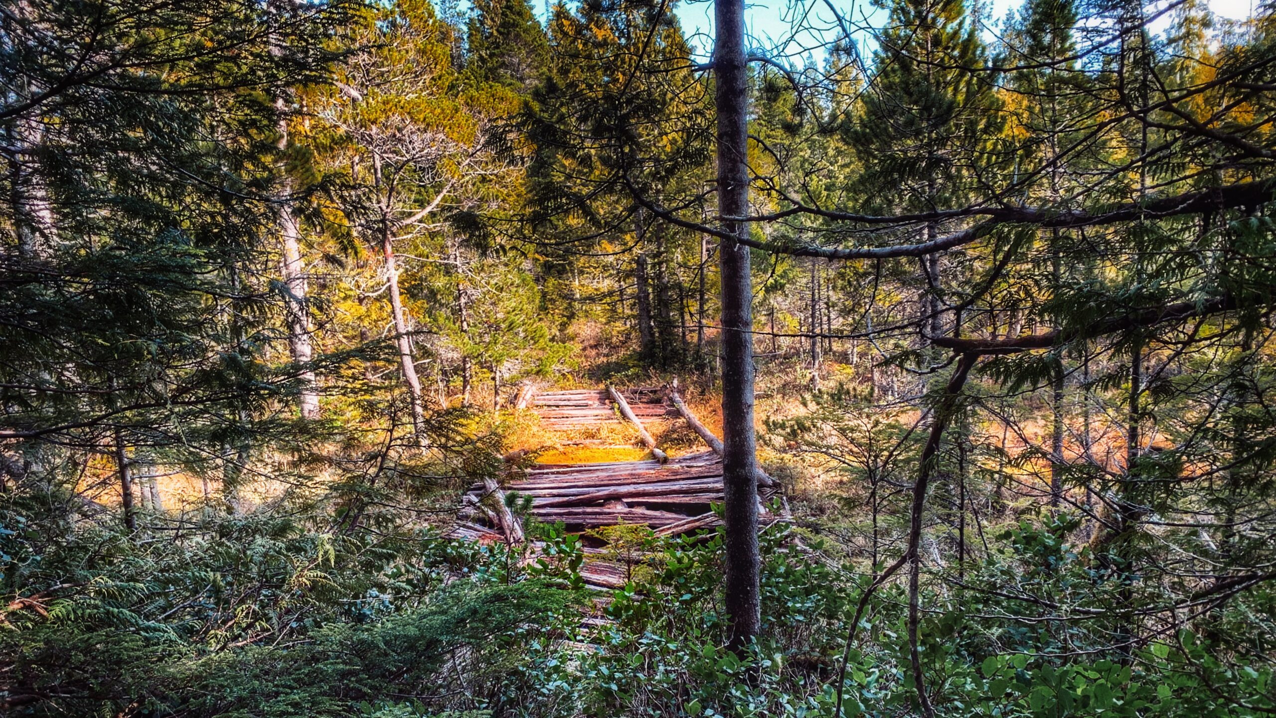
• Gold Creek Trail
  • Gold Creek Trail
  • Gold Creek Trail
  • Gold Creek Trail

Gold Creek Trail Features:
Muskeg terrain and flora
Winding creek
Entry to Mayer Lake
Homestead remnants


NOTE: Gold Creek often floods during the wet season, making the route inaccessible. We, therefore, recommend it as a summer-only hike.


ABOUT

Gold Creek Trail meanders through Muskeg, crosses the highway between Tlell and Port Clements (the old “Mexican Tom Trail”), and eventually flows into the south end of Mayer Lake via the Mayer River. The trail is informal – unmarked – and is typically begun at the Mayer Lake Day Use area; however, we decided to go against the grain and commenced our hike of this informal route at the “Gold Creek” bridge, just along Highway 16.

WHY GOLD CREEK TRAIL?

Unfortunately, you’re not too likely to find any gold along the banks of Gold Creek. According to Dalzell (1973), the name “Gold Creek” is simply a carry-over from the days when the Mayer River – which you’ll also pass by before reaching the south end of Mayer Lake – was called “Gold Creek” after an old prospector believed he’d found gold at the river’s mouth. The ungazetted name was given a bit of official status after the Department of Highways immortalized it on their bridge signage.

THE HIKE

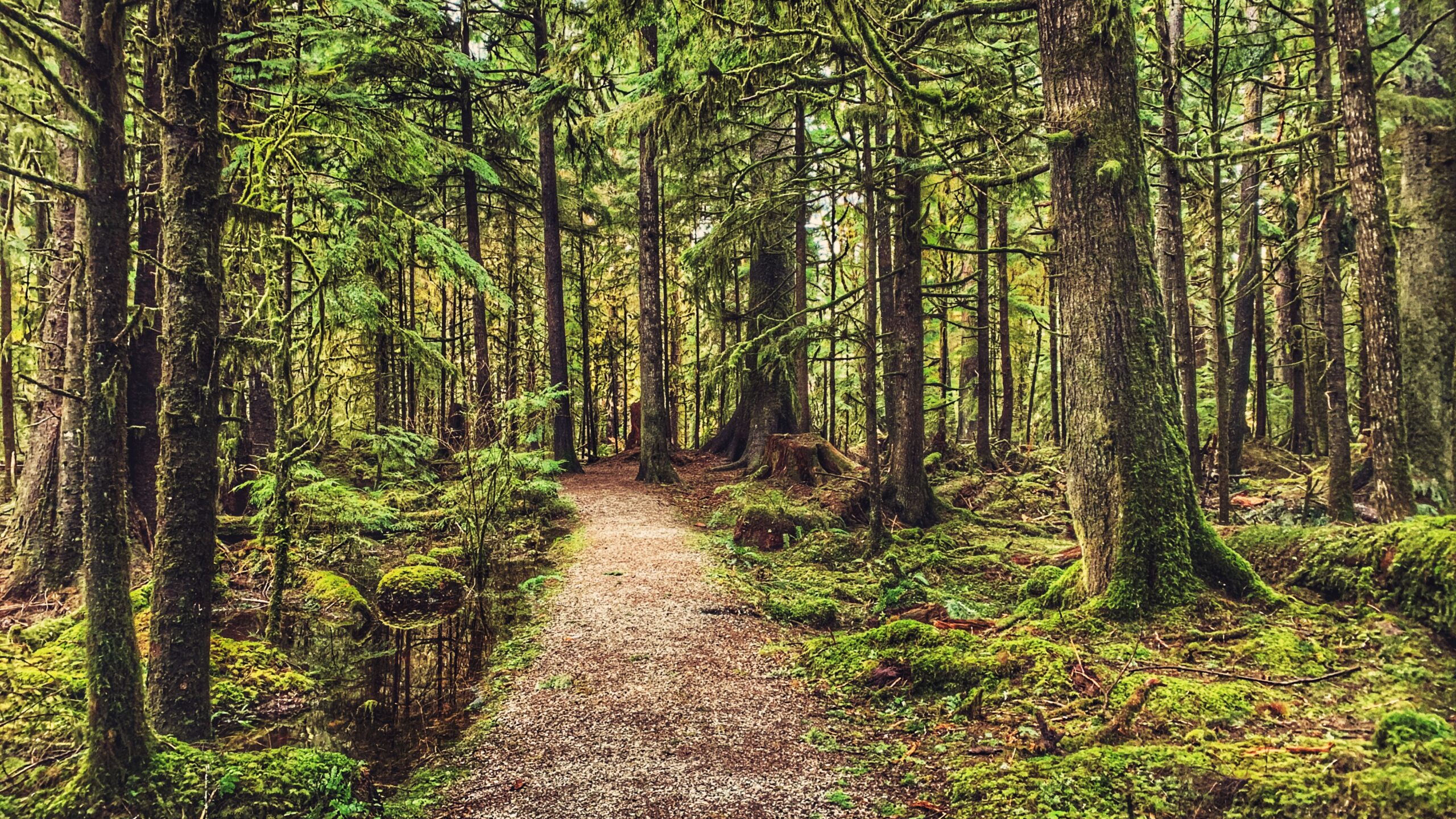
We parked our vehicle on the shoulder at Gold Creek Bridge and started hiking on the west (LEFT) side of the creek. As noted above, the trail is informal and sans marker, but all you have to do is follow the creek until you reach the south end of Mayer Lake. The area around the creek is delicate muskeg, so a good pair of boots or waterproof shoes is recommended.

As you amble about the meandering creek, pay close attention to the fragile environment in which you’re walking: Labrador Tea, Sundews and other bog flora are not uncommon. Quite early on in the hike – at around the 10-minute mark – you will also spy two fence posts, from days gone by, on either side of the creek. We wonder what these were used for.

After about an hour, we reached the “junction” where Gold Creek meets the Mayer River. At this point in the hike, you enter a small forested area before re-emerging at the point where the Mayer River meets the south end of Mayer Lake. As you walk along the shore of Mayer Lake, an actual trail is finally visible. You will also likely notice some deer exclosures on the forested side (to your left). These are quite new, having been installed in 2022 in an effort to restore and protect k’ay trees (Crab apple) – the only native fruit trees on Haida Gwaii.

We concluded our hike at the Mayer Lake Day Use Area just as the sun was setting. The serene calm was interrupted by a beaver splashing its tail in the lake. To save time, we walked back along the dirt road and along the highway to our vehicle at the Gold Creek Bridge.

Of course, most people who choose to do this hike are more likely to begin at the Mayer Lake Day Use Area. In that case, once you reach the Gold Creek Bridge, you can simply return the way you came or walk back to the Day Use site via the Highway. Regardless of where you begin, we encourage you to take your time along the banks of the creek: The environment is so unique and so calm that one cannot help but admire the natural beauty that surrounds you. On a clear day, the waters of Gold Creek resemble that of a mirror!

DIFFICULTY: Easy
TOTAL DISTANCE: 1.8km (one-way)
TIME: 1 hour and 20 minutes
TYPE: Out-and-Back
ELEVATION GAIN: None

OLD GROWTH ALLEY FEATURES:
• Riparian forest
• Old Growth trees
• Remote wilderness hike

ABOUT

The Old Growth Alley Trail is a complex beast. It is both a contradiction and a stinging example of what happens with haphazard, piecemeal funding.

When the trail was first developed by the Tlell Watershed Society (TWS) in 2004, they said it was “bound to be a new favourite trail for visitors and residents” of Haida Gwaii. Offering a unique window into the riparian forest of the lower Tlell River, the route had much to teach those willing to hike this challenging 9.5km point-to-point trail. Unfortunately, a lack of maintenance led to the trail’s quick decline. Now, in 2022, if you ask locals about the “Old Growth Alley Trail in Tlell,” almost all will shoot you a quizzical look and ask, “Where’s that?”

The question is fair because, although formal trailhead signage was erected in 2004, these have all been removed; thus, the trail lies hidden in plain sight. Because it is a point-to-point trail, it has two separate entrances, which are approximately 3 kilometres apart. The southern entrance is located along Highway 16, near hydro pole 805. If beginning your hike here, park your vehicle at a small grassy pullout on the “ocean side” of the highway and then walk across the road and northward for a few feet. You’ll eventually spy a small white sign to your left: “DANGER! Do Not Hike During HIGH WINDS.” This sign represents the Old Growth Alley southern trailhead. From here, it is a 3km walk to the Tlell River. The route is very overgrown and takes you through a bog environment. There’s also clear evidence of the Great Fire of the 1840s, but not much else of note.

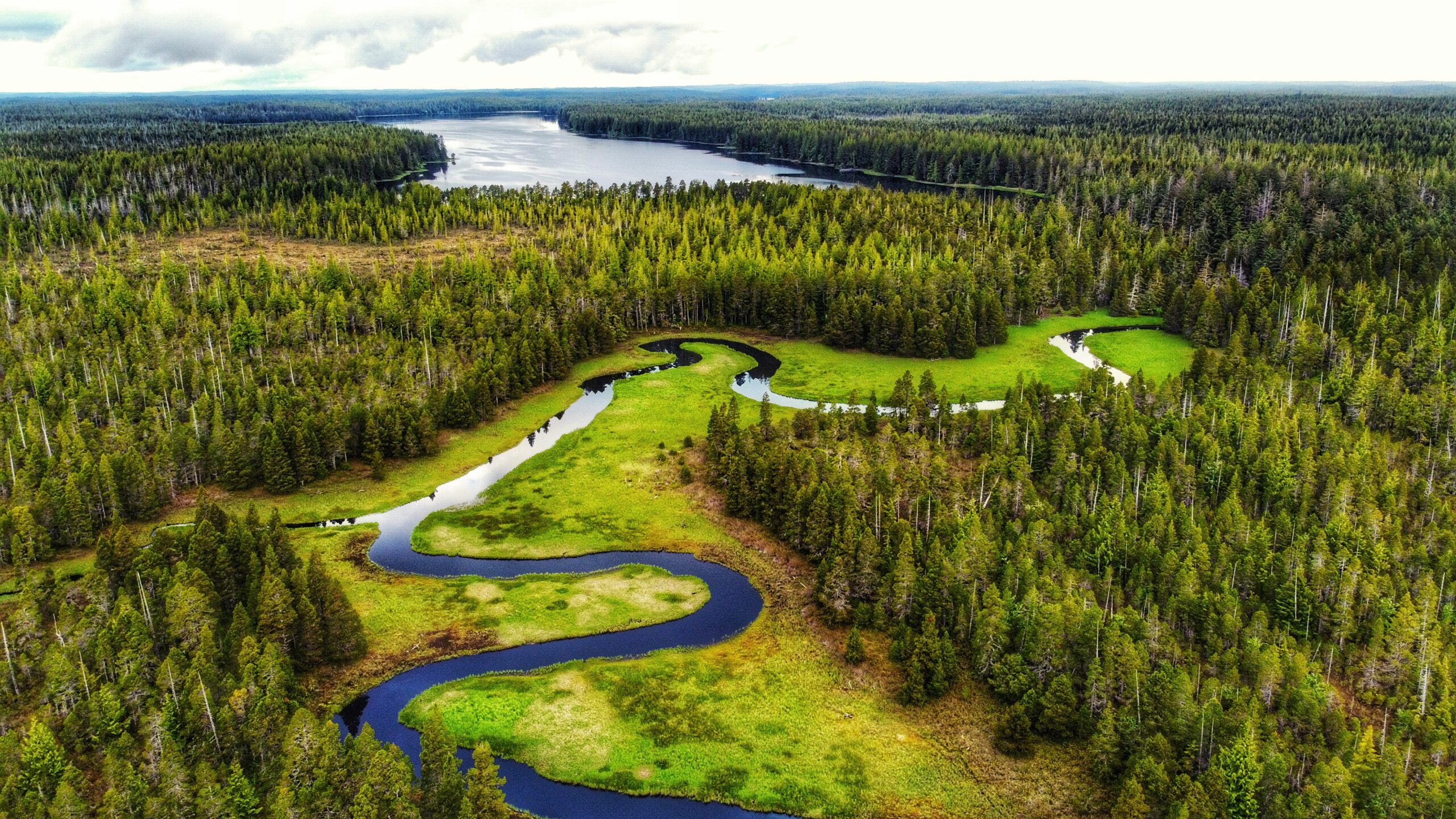
For those wishing to access the lower Tlell River and experience the old growth “alley” in a more expedient way and manner, then the northern entrance is the most convenient. To access this trailhead, turn up the short dirt road indicated by Tlell “Farmers Market” signage and then park your vehicle at the nearby soccer fields, just behind the Tlell Fire Hall. From this point, walk along the far northwest corner of the soccer field until you come upon a dense stand of young spruce trees. If you look closely you’ll spy a weathered, old piece of flagging tape. This represents the northern trailhead of Old Growth Alley.

From here, push your way through dense salal bushes and walk through second-growth forest for about 20 minutes before coming upon the Tlell River and the start of the old growth “alley.” It is here where the magic and importance of this trail really shines through.

Once you reach the river, the trail follows the main stem of the lower Tlell for about 6km before exiting at one of the two trailheads. Thankfully, a fair number of the blue arrow markers remain intact and guide you along the route. While this portion of the hike is mostly flat, be prepared for some minor hill climbs, significant blowdown, a couple of stream crossings and potentially slippery logs. As you meander along the tranquil, dark waters of the Tlell, be sure to admire the many “old growth” trees that hug the river bank. Large cedar and sitka spruce dominate this area. These trees, alone, highlight the importance of this route, but the old growth alley is about so much more.

Think about it. You’re walking the rough trail along the Tlell River. Beautiful old growth trees of Sitka and Cedar surround you, but what else do we see? The effects and importance of riparian wilderness areas in regulating water in the watershed; the importance of large woody debris; unique habitat for a variety of wildlife species; and, of course, the important role we all play in this. These are deeper observations, but they come readily when exploring such an isolated and relatively untouched area.

We said, above, that Old Growth Alley was a contradiction. It’s a contradiction because it was supposed to be a major trail popular for those seeking a day in the wilderness; however, it just sort of withered away. We also said this trail is a classic example of what happens with piecemeal funding: When it was developed nearly 20 years ago, it was likely still a challenging trail but definitely a lot easier to navigate.

Now, though, significant overgrowth and lack of maintenance has all but hidden the route – and this is unfortunate exactly because Old Growth Alley offers so much to those of us who hike it.

DIFFICULTY: Hard
TOTAL DISTANCE: 9.5km
TIME: 8 hours
TYPE: Point-to-point
ELEVATION GAIN: None

  • Haida Canoe Trail #2
  • Haida Canoe Trail #2
  • Haida Canoe Trail #2
  • Haida Canoe Trail #2

HAIDA CANOE TRAIL #2 FEATURES:
·       Ancient Haida canoe
·       Culturally Modified Trees
·       Late 20th century logging

ABOUT

This trail technically doesn’t have a name but, because it leads to another ancient Haida Canoe, the tendency has just been to call it “Haida Canoe Trail #2” – an interesting name choice since you actually come upon its trailhead BEFORE the “Haida Canoe Trail” that most everyone visits. 

How and why do most miss this trail? It isn’t marked, but we will try to spell it out. From Port Clements, the unmarked trailhead is approximately 11.5 kilometres away:

Drive 10 minutes, or 3.5 kilometres from Port Clements to the Golden Spruce trailhead pullout. The road turns from paved (Bayview Drive) to gravel. Once you hit the gravel Port Man Forest Service Road, please be aware that you’re on active logging roads.

From the Golden Spruce trailhead pullout, continue driving straight along the Forest Service road for approximately 7.5 kilometres. At this point, you should keep an eye out for an old single-track logging spur road on your LEFT. If you pass the “HAIDA CANOE” sign (Haida Canoe Trail), then you’ve driven too far. The old road essentially represents the trailhead.

From the old logging road, it is a one-kilometre stroll to the trail’s terminus point. The hike is largely unremarkable – as you pass through a lot of alders and young spruce – though you may encounter the odd grouse strutting about! At one point, you do come to a large fork in the road: Go to your RIGHT.

After a couple of minutes, you will come to the end of the road. Once here, look to your right. You should see what appears to be a deer trail going up a small incline through some fairly dense salal bushes. This part of the trail is only about 45 meters long and brings you to the reason you hiked this route: An ancient “blank” Haida canoe, carved circa the 1860s.

In our opinion, this site is far more interesting than the better-known “HAIDA CANOE” trail nearby. It provides a richer experience. As soon as you pass through the salal, you’re met with a cold chill and then you see everything in front of you: A culturally modified tree (CMT) – the stump of a large monumental cedar – greets you, demonstrating where the canoe below came from. To your left, another CMT with a large “test hole” can be seen. Then, down below, is the moss-covered Haida canoe. The early shaping of the canoe’s bow and stern is clearly evident, along with the flattening of the top of the log in preparation for its hollowing out. Maybe it’s the green moss or the stories attached to the site, but this canoe just “grabs” us far more than the other canoe trail.

We were introduced to this unmarked trail by Dale Lore. He’s the former Mayor of Port Clements and the current owner of Bayview Market. As Mayor, he made a historic move in siding with the Haida Nation over logging disputes on the islands. This was notable because Port Clements is a logging community and Dale himself spent the better part of 20 years building roads for M&B and Weyerhaeuser to extract resources. Now, he offers tours of unique sites along the Port Clements backroads – this Haida canoe site being one of them.

As Mr. Lore explained to us, this site was “discovered” in the mid-1990s. Logging companies were building the access road to, well, cut down some trees and make a profit. As the road was being built, the loggers stumbled upon this site. There was talk of sneaking the blank canoe out and continuing uninterrupted, but Mr. Lore notified the Haida Nation – advising them that they “need to see this.”

Subsequently, because logging is not permitted at culturally significant sites, the operation was halted and stopped. Back to that “chill” you feel: There is little doubt this site is full of energy. 

You feel it the moment you exit the salal. The ancient structures of the past speak to us and share their story. They have much to teach us if only we have but the eyes to see and ears to listen. On the one hand, they highlight all that was lost during the smallpox epidemic of the 1860s; on the other hand, they symbolize just how intelligently the Haida used (and use) the forest.

While you are visiting this site, or any other culturally significant area on Haida Gwaii, please practice Yahguudang (respect for all beings).

Note 1: It is possible to drive the old spur logging road, but we would only recommend doing this if you don’t mind getting your vehicle all scratched up from the trees reaching over onto the road.

Note 2: If you would like to book a tour with Dale Lore, drop by and visit him at Bayview Market or contact him via email: dalelore@gmail.com

DIFFICULTY: Easy
TOTAL DISTANCE: 2 kilometers (return)
TIME: 40 minutes
TYPE: Out-and-Back
ELEVATION GAIN: None

  • Haida Canoe Trail
  • Haida Canoe Trail
  • Haida Canoe Trail
  • Haida Canoe Trail

ANCIENT HAIDA CANOE TRAIL FEATURES:
·      160 year-old Haida canoe

ABOUT

Realistically one doesn’t have to travel very far if one wishes to see a Haida canoe while visiting Haida Gwaii. There are a number of beautiful examples at the Haida Heritage Centre, for example, including Bill Reid’s famous “Lootas.” Reid’s “wave eater” was originally carved from a single red cedar for Expo ’86. But what if we desire to see something older, something that harkens back to an earlier time?

It is possible to see a “blank” (unfinished) Haida canoe not far from the community of Port Clements. To get to it, you must hike the aptly named “Haida Canoe Trail.” How do you get to it?

The Haida Canoe Trail is roughly 8km past the Golden Spruce Trail, along the Port Man Forest Service Road. You will notice a large sign that says “HAIDA CANOE” on the left side of the road, at the “Y” before the Port Man turns into the QC Mainline. The sign is impossible to miss and it points you in the direction of the ancient Haida canoe. We would not recommend driving up the old road leading to the trailhead. It is not maintained and is full of deadfall – rather large branches – strewn across sections of the road. Instead, we’d recommend simply parking on the side of the main road and walking towards the trailhead. If you’re worried about traffic getting by your vehicle – don’t be. The Forest Service Road in this area is sufficiently wide for traffic to pass safely.

The Haida Canoe Trail is a brisk 400 meters in length from the signed trailhead, though it’s probably closer to 700 meters if you include the section of old road outside the HAIDA CANOE sign. Regardless, it is an easy hike – less than 10 minutes one-way. Once you reach the “Canoe Trail” signage, the route is single-track but well-maintained. After a little over 5 minutes, the dense forest opens up to the unfinished ancient Haida canoe. This canoe, now surrounded by thick salal bushes, is estimated to be around 150 years old. It’s quite remarkable that, even after all this time, you can still make out the shaping of the canoe’s bow and stern along with the flattening of the top in preparation for its hollowing out via steam.

Beyond being able to view this fantastic artifact in real-time, we appreciate the story it tells. This canoe, and others like it (there are dozens in the forests around Haida Gwaii), is a powerful reminder of all that was lost when the smallpox epidemic hit the Islands in the early 1860s. It’s not hard to imagine the carvers of this canoe succumbing to the disease, resulting in its abandonment in the forest. In the contemporary period, one could also suggest that this canoe and the story behind it help to explain why the residents of Haida Gwaii fought so hard to keep visitors away during the early stages of the COVID pandemic. History can teach us much if we have but the eyes to see and ears to listen.

DIFFICULTY: Easy
TOTAL DISTANCE: 1.4 kilometers (return, to logging road)
TIME: 20 minutes
TYPE: Out-and-Back
ELEVATION GAIN: None

  • Pure Lake Trail
  • Pure Lake Trail
  • Pure Lake Trail
  • Pure Lake Trail

PURE LAKE TRAIL FEATURES:
·       Picnicking
·       Swimming
·       Family-friendly

ABOUT

Pure Lake Provincial Park was created in 1981 and covers approximately 142 hectares, completely encompassing Pure Lake within its boundaries. Located about 19 kilometres south of Masset and 25 kilometres north of Port Clements, along Highway 16, the park is popular with tourists and locals alike because it provides such easy access to a beautiful, calm and shallow lake.

You will see signage indicating the pullout to Pure Lake as you drive along Highway 16. There’s ample parking here for several vehicles. A single pit toilet is nearby.

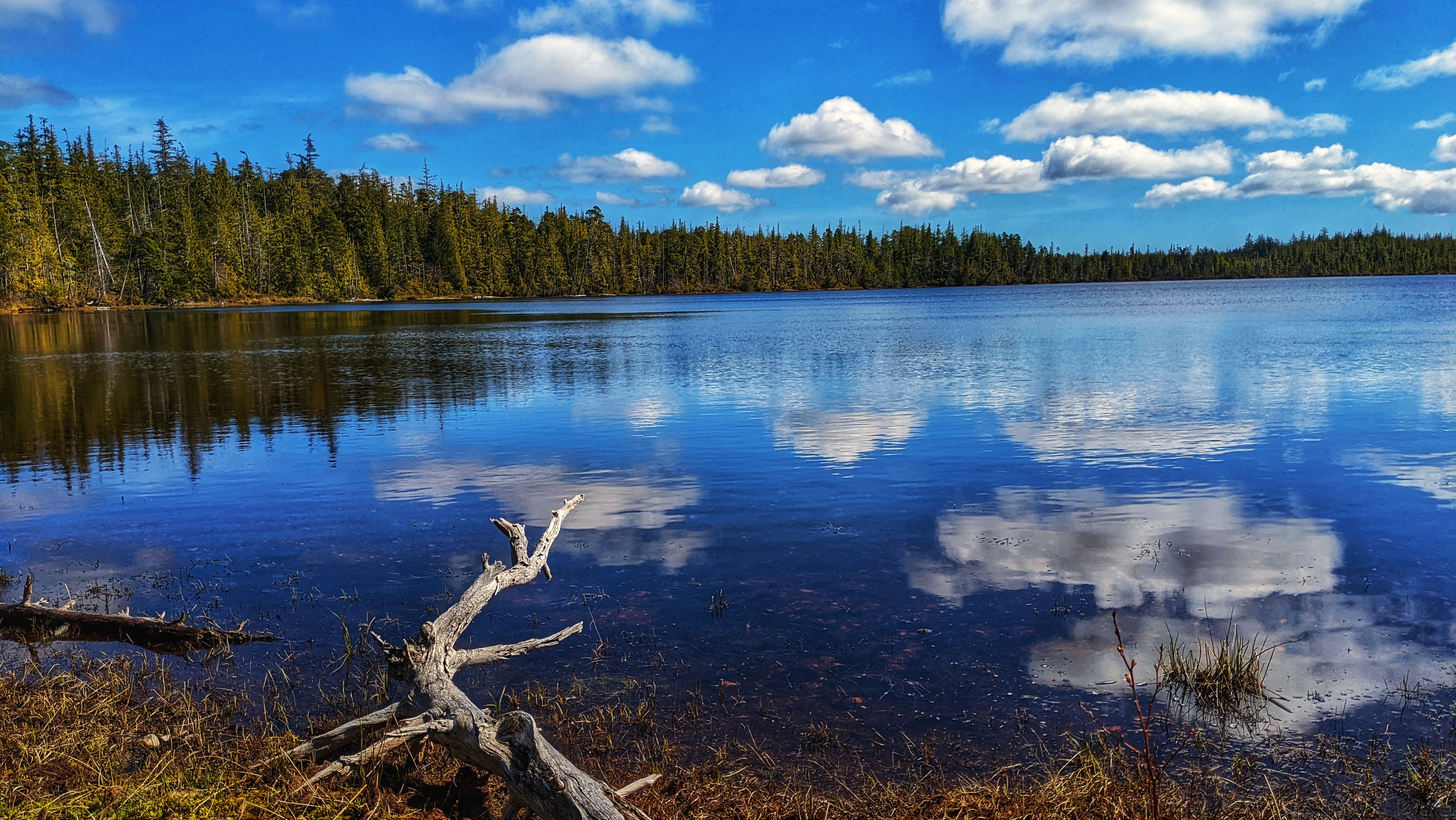
To access Pure Lake Trail, you must hike a short trail of approximately 329 meters (one-way). It only takes about 3 minutes to reach the lake, but please note that sections of this trail can and do get quite muddy – especially after some rainfall. Once you reach the terminus point of the trail, you’ll come upon a small sandy beach and, of course, the lake. This is a popular day-use area for picnics and swimming. As such, you’ll find 5 picnic tables and 2 fire pits. Unfortunately, there is no formal trail system allowing further exploration of the lake. Thick underbrush and salal dominate the immediate landscape.

While Pure Lake is wildly popular during the warmer summer months, it is also a destination during the cold winters. Because the lake is so shallow, it’s not uncommon for it to completely freeze over. If conditions are right, you can walk right out onto the lake! Locals will typically visit Pure Lake during the winter to ice skate.

DIFFICULTY: Easy
TOTAL DISTANCE: 658 meters (return)
TIME: 6 minutes (return)
TYPE: Out-and-Back
ELEVATION GAIN: None

  • Sunset Park Trail view
  • Sunset Park Trail Bird Watching Tower

SUNSET PARK TRAIL FEATURES
·       Evidence of early logging
·       Culturally Modified Trees
·       Bird-watching

ABOUT

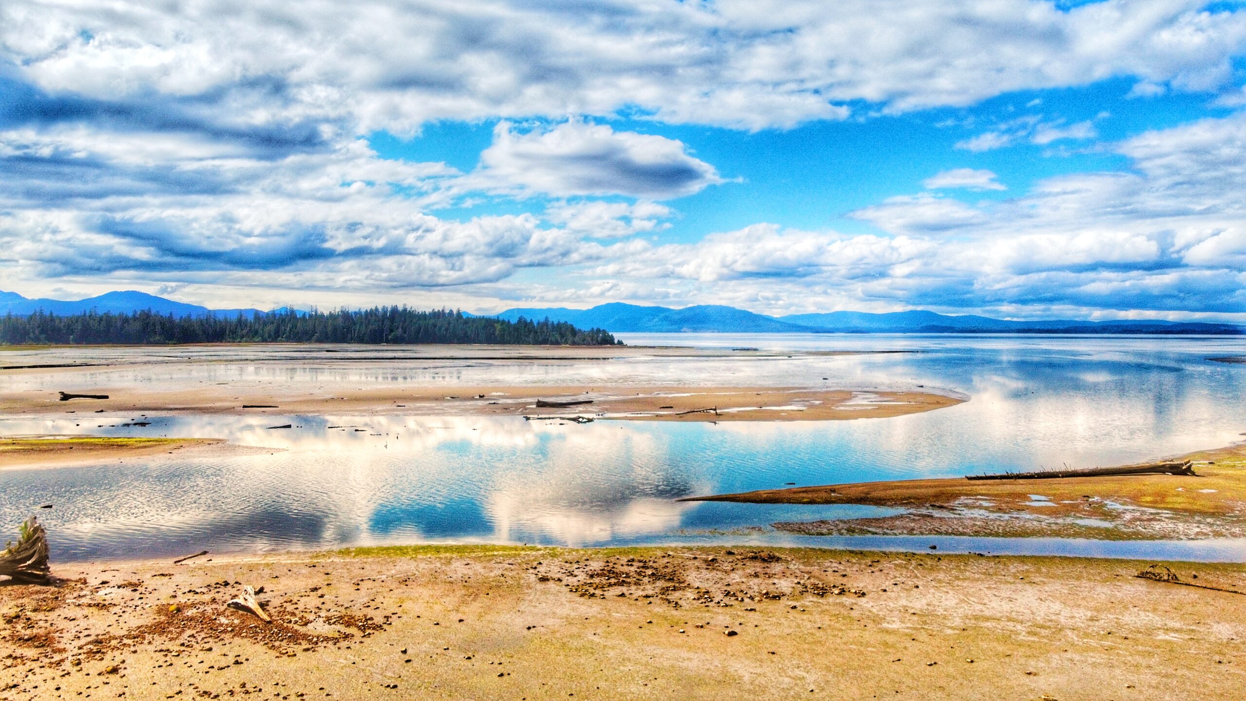
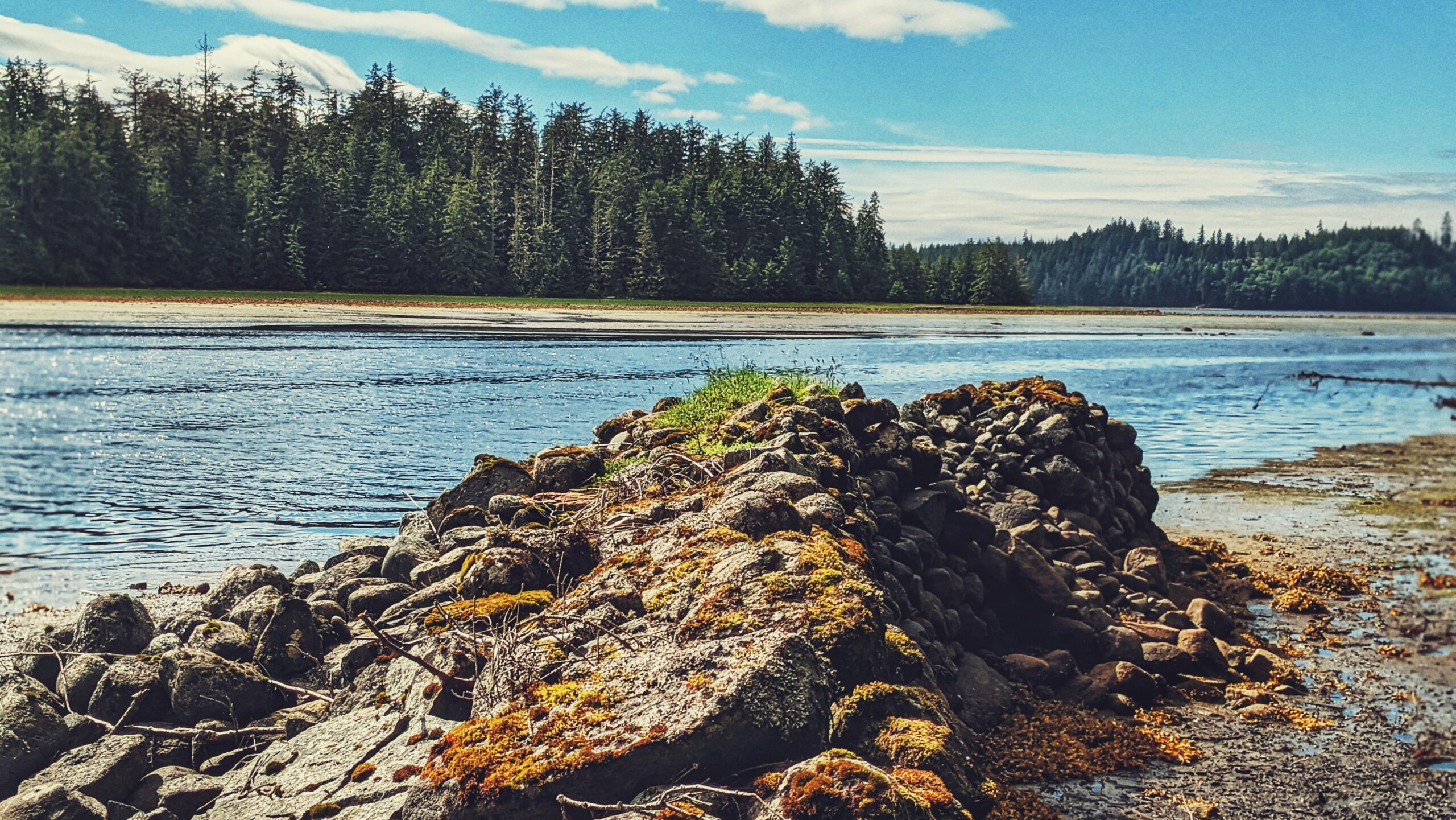
The Sunset Park Trail, located along Bayview Drive, is an easy 2.7km out-and-back trail in the Village of Port Clements. The terrain is flat and basically follows the Yakoun Estuary the entire way. The track is so flat, in fact, that Port Clements even suggests it is wheelchair friendly.

The scenery along the route is quite beautiful at low tide but is, I think, a little one-note if you’re walking the trail at high tide. As you stroll about the path, there are a few strategically placed benches facing the estuary so that one can fully take in and appreciate, the vivid scenes unfolding before them. In addition, there are a couple of interpretive signs along the trail, which link to Port’s early logging history.

For us, the highlight here is the clear evidence of springboard logging. It’s an interesting callback to the golden age of logging on Haida Gwaii.

At the trail’s terminus point, you will come upon a beautiful two-storey birdwatching tower. Climb the stairs (or walk the wheelchair ramp) to receive unobstructed views of Yakoun Bay and watch the Herons and Eagles frolic and play. On a clear day, it’s quite easy for one to get “lost” up here.

Once you’ve finished your Sunset Park Trail adventure, walk back the way you came or take one of the many exits out onto the main road for a more urban hike.

As far as trails on Haida Gwaii go, this one is definitely the easiest in terms of difficulty (well, this one and the Government Dock “trails”). In that respect, seasoned hikers – or even newbies – may find it a little underwhelming; however, there is no denying that it’s suitable for the whole family. 

The birding tower is a lot of fun and we enjoyed the references to logging’s glory years. We should note, by way of conclusion, that the Sunset Park Trail had an extension developed in 2016, which adds just over the original trail described above. The extension begins at the Sunset Park Trail parking lot, just off Bayview Drive. 

Once you park your vehicle, follow the well-manicured path to the right (besides a newly installed pit toilet). After about a minute or two, you must cross the road to continue the trail. The extension then follows alongside Bayview Drive for approximately 300 meters before going up a slight incline and snaking behind Yakoun, Tingley and Park Streets. 

At this point, you almost feel as if you’re trespassing because you come into such close proximity to private homes. The trail eventually passes by Port Clements’ Community Park (home to annual Canada Day celebrations) and follows Falcon Street before ducking into a wooded area and emerging at Bayview Drive, across from the Port Clements Museum.

Like the “original” Sunset Park Trail, the extension is also wheelchair friendly; however, in our view, the extension lacks the appeal of the original trail. It is far more urban and was developed more for locals as a quick way to navigate the community. As such, we’d recommend sticking to the “original” route.

DIFFICULTY: Easy
TOTAL DISTANCE: 7.6 kilometers return (incl. extension)
TIME: 2 hours
TYPE: Out-and-Back
ELEVATION GAIN: None

Evans Homestead Trail Features
·       Settler history and structures
·       100+-year-old Rhododendrons
·       Access to Kamdis Conservancy

ABOUT

Located within the 2,722-hectare Kamdis Heritage Site/Conservancy, the “Evans Homestead” Trail was first brought to our attention via a series of old photos taken in 1957 by Terry Annis, and posted by Go Haida Gwaii.

The ruins of the homestead, and the promise of massive rhododendrons, were most enticing. Unfortunately, directions towards this unmarked and unmaintained route are sparse.

Nevertheless, while the trail lacks formal upkeep and trail markers, it is still easy to locate and follow with a bit of effort. How do I get to the trailhead? You will find the Evans Homestead trailhead approximately 19 kilometres north of Port Clements, at the end of Nadu Road. Once you arrive at the terminus of Nadu Road, park your vehicle.

You will see two roads side-by-side. The one on the right, which looks to be built on large segments of clay, is used by the Mennonites and is private. You want the overgrown road beside it. This old skid road, once used for logging, represents the official start and trailhead of the “Evans Homestead” hike.

Follow the old skid road for approximately 1 kilometre. After hiking for about 15 minutes, you’ll have to use a natural log bridge to cross the Nadu River on your LEFT. It is important to keep a watchful eye for the crossing because the trail actually continues on past it to the mouth of Nadu River and Masset Inlet. On the plus side, if you do miss the turn-off and hike to the river’s mouth (as we did), you’ll be treated to a unique-looking old-growth cedar tree!

After crossing the log bridge, follow the trail out towards Masset Inlet. It’s clear someone uses this area as an access point because, when we hiked the route, a small table was set up near a skiff. Perhaps the boat is used to access nearby Kumdis Island?

Anyway, it’s at this point you’ll observe the first major piece of colonial history: An old rotting dock which, because of the moss and small trees growing on it, has become quite photogenic. At one point, from this dock, you could walk approximately 1.6 kilometres up an old road towards the remains of a peat moss plant (opened in 1967, after Bering Industries spent $1 million building it, it closed barely a year later).

Unfortunately, when we visited in June 2021, this part of the trail was marked as “closed” – probably due to the extreme overgrowth and lack of upkeep.

From the old dock, walk south along the beach and shoreline for 20 minutes and you’ll eventually come upon the ancient stone breakwater. After 110+ years, only a tiny portion has collapsed, speaking volumes as to the skill, care and craftsmanship that went into building structures at this site.

Finding the actual homestead site proved to be a little tricky, though. We knew the short trail up to the Evans Homestead was near the breakwater, but couldn’t pinpoint where exactly. We ambled around the breakwater for a good hour and a half pondering our next steps.

One of our team members eventually decided to explore the hillside behind the breakwater. He
returned after 15 minutes and reported that it was “nice and flat” up there but “just turned into a big swamp.”

His wife made her way up the steep and muddy embankment and discovered: The “big swamp” was what we were looking for! Thus, we scrambled up the muddy embankment!

As it turns out, the flat, slightly swampy area is the Evans Homestead: Here you will observe 100+-year-old rhododendron trees and remnants of the homestead originally built in 1911 by Edward Evans. From a historical perspective, the site is a real treat to visit and gives you a small taste of what early pioneering life must’ve been like.

While not many remain, the effort left behind impressive stonemasonry and beautiful rhododendrons. If you’d like to see the rhododendron trees in bloom, we’d recommend visiting this area in June or July.

Note: The beach section of this hike MUST be completed on a low or receding tide, so be sure to check the tide tables if you wish to reach the homestead.

DIFFICULTY: Easy
TOTAL DISTANCE: 4 kilometers (return)
TIME: 2 hours
TYPE: Out-and-Back
ELEVATION GAIN: Minimal

NADU HOMESTEAD TRAIL FEATURES
·       Bog environment
·       Settler remnants
·       Harvesting

ABOUT

We first became aware of the Nadu Homestead Trail thanks to “Backroad Mapbooks” (physical maps available at the Daajing Giids Visitor Centre). Really, if BRMB didn’t indicate the location of trails on Haida Gwaii we’d probably miss most of them because a good number don’t have any official signed trailheads. Of course, even with the guide, some trails can be a bit tricky to locate.

The trail is a case in point. When we learned of this route, I recall thinking, “huh? We’ve driven by Nadu Road and don’t recall seeing a trail just off the highway!”

The Nadu Homestead Trail – an old settler wagon road – is located approximately 20 kilometres east of Port Clements, heading towards Masset. Once you see the intersection for Nadu Road, you’ll know you’re in the right place – the trail is direct across the highway. 

Unfortunately, there’s no real parking available; so, if you wish to hike the trail, we’d recommend parking on the side of Nadu Road and then walking across Highway 16 to the trail. There is no formal trailhead marker, but you should be able to see the trail partially obstructed by thick salal.

Once you push your way through the thick salal bushes, the trail opens up into a visible wagon road. From here on out, the trail stretches just over 2 kilometres one-way and takes you through a unique bog environment and some old-growth corridors. Navigating the bog can be a bit delicate and very wet, so make sure you have waterproof footwear and be mindful of where you tread so as not to disturb the flora endemic to the area.

As we hiked the route, it became readily apparent that the trail is scarcely used anymore. There’s little in the way of markers along the trail; however, this shouldn’t dissuade potential hikers. The route is literally a straight line, so it’s difficult to get lost. Just make sure you don’t stray from the trail because parts are extremely overgrown and one could get easily disoriented.

The Nadu Homestead Trail essentially comes to an end at an old dilapidated bridge. While it is possible to cross using some creative techniques, we don’t feel it’s worth the effort (and risk) because the route ends a few minutes later, anyway, at what was likely the Hendersen homestead.

Why would one wish to hike this trail? Well, there’s the historical aspect: it’s an old settler wagon road, built circa 1910, to access parcels of land further inland. As such, you can see remnants of this early effort to “develop” Haida Gwaii: The clear evidence of the wagon road itself; the hand-dug ditches along the wagon road; old corduroy bridges (especially at the bog); and, vestiges of settler homesteads.

Indeed, it’s not difficult to use one’s imagination and transport yourself back to the early 20th century and picture ye olde horse and buggy ambling about these old roads!

Beyond history, the Nadu Homestead Trail also offers an opportunity to explore and experience unique flora: Labrador Tea, Cow Berry, bog rosemary, cloudberry, and fairly slippers, amongst a whole host of others, call this area home.

DIFFICULTY: Easy
TOTAL DISTANCE: 4.2 kilometers (return)
TIME: 2 hours
TYPE: Out-and-Back
ELEVATION GAIN: Minimal

  • Golden Spruce Trail
  • Golden Spruce Trail
  • Golden Spruce Trail
  • Golden Spruce Trail

GOLDEN SPRUCE TRAIL FEATURES:
·       Haida legend
·       Old growth trees
·       Access to Yaaguun Gandlaay Conservancy

ABOUT

The Golden Spruce Trail is located approximately 10 minutes (3.5 km) outside the community of Port Clements and represents a brisk 20-minute roundtrip walk. Up until January 1997, the end of this short well-manicured trail led to a viewpoint whereby you could see and admire Kiidk’yaas, the Golden
Spruce.

Golden Spruce Trail
An old photo of the Golden Spruce. Credit: Marla Abbott

The ancient tree, estimated to be about 300 years old, was a massive Sitka spruce known for its rare golden needles. It figured prominently in Haida stories. Unfortunately, in mid-January 1997, the tree was chopped down by the deranged “protester,” Grant Hadwin. His actions sparked international outrage; the tale is powerfully told in John Vaillant’s The Golden Spruce (2005), a must-read and primer for anyone wanting to walk this short trail. Context is essential to understanding and appreciating this sacred place.

I had the privilege of seeing the actual Golden Spruce in June of 1996, a mere 7 months before it was felled. The trail was a bit narrower back then, but still easy to navigate. Seeing and being surrounded by the massive old-growth forest was a fantastic experience, but nothing could compare to seeing Kiidk’yaas in person. Its golden foliage radiated in contrast to its greener relatives and the almost black Yakoun River at its base.

Currently, the Golden Spruce Trail has been widened and is accessible to those with mobility issues. The old-growth forest; the soft and lush moss; monumental trees and decaying nurse logs still maintain and hold their power over those who hike the trail. It is a very serene experience; one heightened even further by the plaques, designed by the late Ben Davidson, placed throughout highlighting the Haida’s spiritual, emotional, and practical attachment to the land.

Once you reach the end of the official trail, you come upon a viewpoint that, up until about 3 years ago, allowed you to view the skeleton of the Golden Spruce. Now, all that remains is a stump, which is difficult to see and identify. In a very real sense, the walk is both beautiful and tragic at the same time.

In death, however, we often find life. After the Golden Spruce fell in 1997, a number of cuttings were taken from the tree in hopes of planting “golden” offspring. One such cutting has indeed survived and is viewable in Port Clements’ Millennium Park. The golden needles shine bright and radiant.

While the official Golden Spruce Trail is only 400 meters one-way, it is possible to walk nearly an additional 2 kilometres along the “unmaintained” portion of the trail (indicated by signage at the end of
the “official” route). In our view, the reason you may wish to hike this route is for the golden opportunity it presents to explore more of the Yaaguun Gandlaay Conservancy. The Conservancy has been used by the Haida for at least 10,000 years and is rife with historic, cultural, social, and spiritual meaning – something very evident along this trail.

DIFFICULTY: Easy
TOTAL DISTANCE: 800 meters (official trail)
TIME: 20 minutes
TYPE: Out-and-Back
ELEVATION GAIN: None

  • watun-river-road-old-docks-remnants
  • watun-rive-road-spilling-to-masset-inlet

The Watun River Road, which has also been identified as a trail elsewhere, is accessible just off the Watun River Bridge, approximately 20 minutes south of Masset. The road is roughly 400 meters in length but is often muddy.

We would not recommend driving the length of the road unless you have a 4-wheel capable truck. If driving a standard vehicle, a safe alternative would be to pull off to the side of the bridge – where there’s ample parking for at least 3 mid-size vehicles – and walk the length of the road. It’s a brief and easy trek, taking only about 6 minutes to reach the mouth of Watun River and Masset Sound. As you walk this route, you can enjoy the scenic beauty that surrounds you. Western hemlock, ferns, and grasses dominate the trail landscape and are often blanketed by lush mosses.

Once you reach the terminus point of the trail/road, you’re treated to the unique wetlands protected by the Kamdis Conservancy. These intertidal shallows are rich in vegetation and sea life: sedges, grasses, and rushes abound thanks to the rich waterways and soils. If walking here at low tide, use caution as the area can be a bit slippery.


Beyond the wetland expanse, you’ll undoubtedly notice old wooden pillars off in the distance. These are all that remain of a primitive dock system that used to be in the area. Decaying and returning to nature, these columns have their own charm about them now. These old pillars might also be part of the Watun River Cannery that existed in the area from 1919- 1930.


As part of the Kamdis Conservancy site, the Watun River road/trail access is important for ecological and cultural purposes. Here you can get a glimpse of early settler development while also seeing but a small part of why Kamdis is a significant intertidal estuarine wetland complex. It’s a short hike (or an even shorter drive), but the rewards are many!

DIFFICULTY: Easy
LENGTH: Approximately 400 meters
TRAIL TYPE: Out and Back