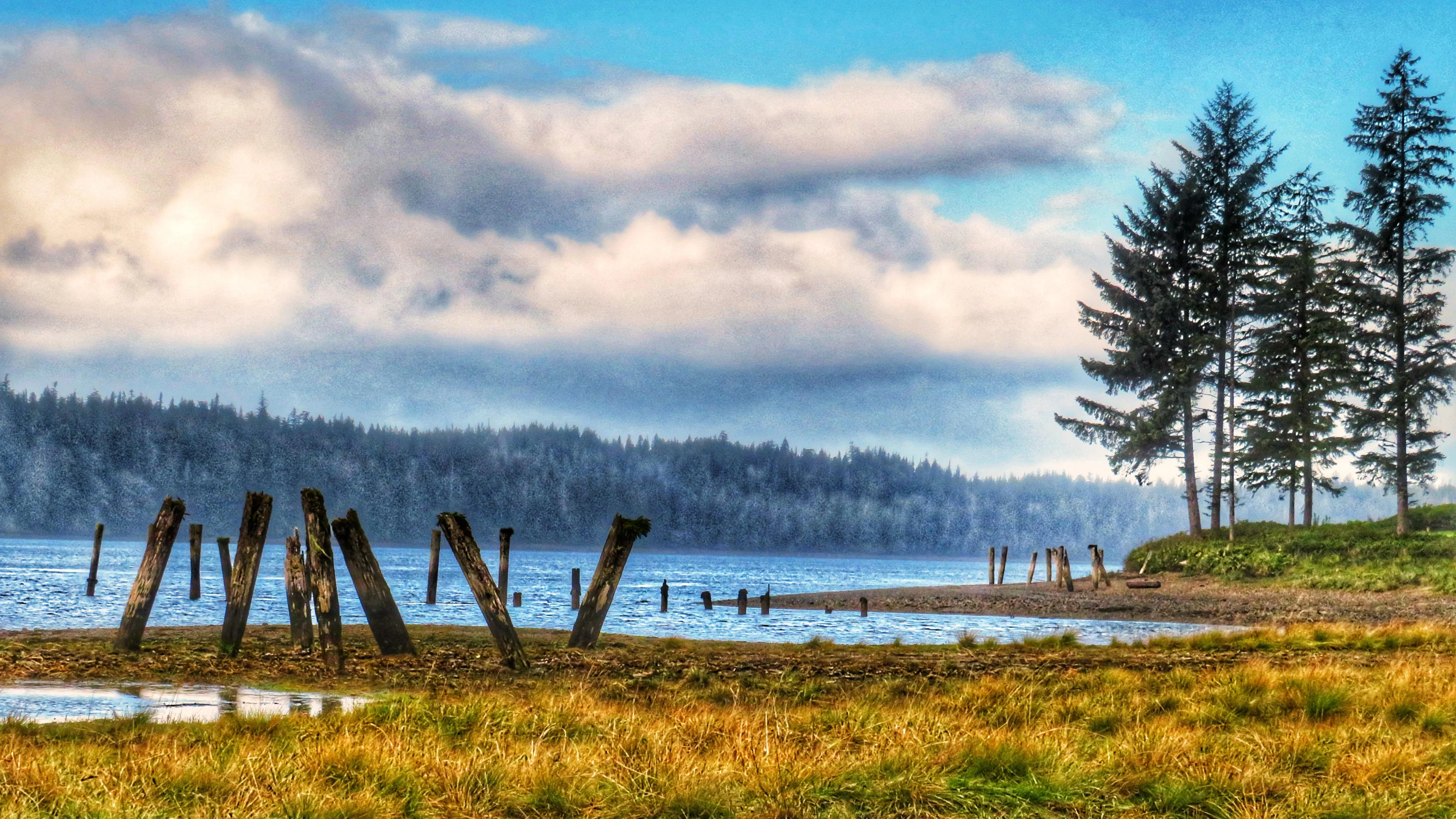
Lasting structures – remnants of the old docks at the end of the Watun River Road
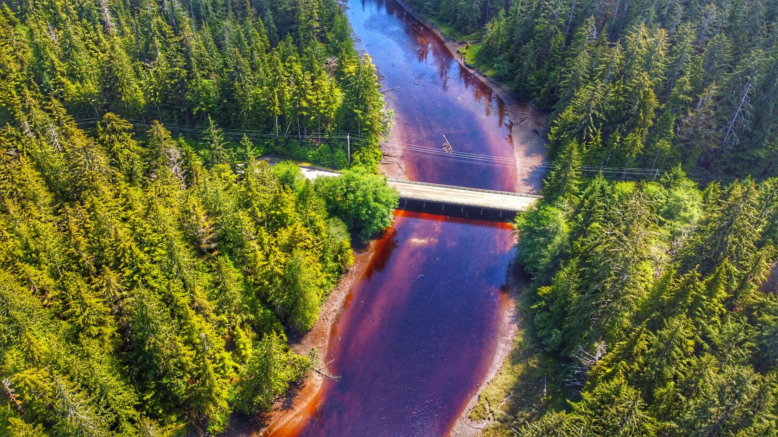
Watun River spilling over to the Masset Inlet
Top view of the remaining dock structures
Near the entrance of the road
Watun Road Features Historic remnants of a cannery Docks remains Fishing spots
ABOUT
The Watun River Road, which has also been identified as a trail elsewhere, is accessible just off the Watun River Bridge, approximately 20 minutes south of Masset. The road is roughly 400 meters in length but is often muddy.
We would not recommend driving the length of the road unless you have a 4-wheel capable truck. If driving a standard vehicle, a safe alternative would be to pull off to the side of the bridge – where there’s ample parking for at least 3 mid-size vehicles – and walk the length of the road. It’s a brief and easy trek, taking only about 6 minutes to reach the mouth of Watun River and Masset Sound. As you walk this route, you can enjoy the scenic beauty that surrounds you. Western hemlock, ferns, and grasses dominate the trail landscape and are often blanketed by lush mosses.
Once you reach the terminus point of the trail/road, you’re treated to the unique wetlands protected by the Kamdis Conservancy. These intertidal shallows are rich in vegetation and sea life: sedges, grasses, and rushes abound thanks to the rich waterways and soils. If walking here at low tide, use caution as the area can be a bit slippery.
Beyond the wetland expanse, you’ll undoubtedly notice old wooden pillars off in the distance. These are all that remain of a primitive dock system that used to be in the area. Decaying and returning to nature, these columns have their own charm about them now. These old pillars might also be part of the Watun River Cannery that existed in the area from 1919- 1930.
As part of the Kamdis Conservancy site, the Watun River road/trail access is important for ecological and cultural purposes. Here you can get a glimpse of early settler development while also seeing but a small part of why Kamdis is a significant intertidal estuarine wetland complex. It’s a short hike (or an even shorter drive), but the rewards are many!
DIFFICULTY: Easy LENGTH: Approximately 400 meters TRAIL TYPE: Out and Back
The logging barge and the river flow spilling into Masset inlet
The logging barge up close
KUMDIS RIVER TRAIL FEATURES: Environmental research Barge remnants Duck hunting grounds
ABOUT
The Kumdis River Trail is a short out-and-back route located approximately 2 kilometers outside the village of Port Clements. Like most trails on Haida Gwaii, the Kumdis River Trail lacks a formal trailhead; however, it is easy enough to find. As you drive along Yellowhead 16 towards Masset, you’ll come upon a small pullout to the immediate left of the Kumdis River Bridge. This short dirt road essentially represents the trailhead.
At the very beginning of the hike, you’re treated to lovely views of the Kumdis River and promised a flat trail to complete. The Kumdis River often acts like a mirror on a clear and calm day. The trees on the opposite side of the riverbank flawlessly reflect on the water. The end result is almost dream-like – quiet reflections hinting at what’s to come.
Walking the rest of this short trail is fairly uneventful and straightforward. For the first few minutes, you walk through a nice pocket of old growth filled with towering red cedar and thick Sitka spruce. You then pass through a grassy clearing before re-entering the forest. Finally, just before entering the grasslands and sedge at Kumdis Bay, you come upon what, in our view, is a highlight of this trail: Stunted and twisted trees covered in long, wispy old man’s beard lichen. It’s quite a sight and unlike most anything, you’ll see on Graham Island.
Once you enter the grassy lowlands of Kumdis Bay, you can take a few moments to explore and appreciate this unique environment. Part of the Kumdis River conservation area, it’s not uncommon to see the Council of the Haida Nation, in partnership with NCC, conducting necessary fieldwork. As an estuary, this area is home to a plethora of fish, invertebrates, and waterfowl, giving Kumdis high ecological importance.
It’s most curious (and even a little ironic), then, when you spot an old barge once used to transport logs resting on the river. It has been here so long – close to 100 years – that it’s now become part of the landscape. Moss, shrubs, and trees now dominate the structure. Nature is taking over!
BLACKWATER CREEK WATERFALL TRAILS FEATURES: · Relatively easy access to waterfalls · Challenging rope sections
ABOUT
The Blackwater Creek Waterfall Trails are a couple of hidden gems on Haida Gwaii. The two trails are short – clocking in at about 200 and 400 meters respectfully – and very remote; however, if one enjoys chasing waterfalls, these two routes are definitely worth the effort. As these trails are not well known, they do not appear in any of the literature available on Haida Gwaii. Here’s how you get to them:
1) Starting in Port Clements, drive south along Bayview Drive towards the Golden Spruce Trail.
2) Keep driving. Bayview Drive eventually turns into the Port Man Forest Service Road – an active logging road. At about the 11km mark from Port Clements, you’ll come upon signage for the “HAIDA CANOE” Trail. Then, 150 meters from this point you’ll spot a “Y” or split in the road. Turn RIGHT onto the New Mainline Road. You will then cross a bridge over the Mamin River before coming to another “Y.”
Keep left on the New Mainline Road for approximately 500 meters. You will then see a minor logging road to your LEFT. Turn here and drive for nearly 5 kilometres. Note that, from this point on, the road is narrow (single track) and does have a few low-hanging alder trees you’ll have to clear.
3) After driving along the road for nearly 5 kilometres, you’ll cross a small bridge over Blackwater Creek. Barely 100 meters past this bridge, you’ll come upon another “Y.” Turn RIGHT. Drive approximately 2 kilometres along this narrow road. If you’ve made it this far, you’ll spy the trailhead marker for the first waterfall. It is signified by pink and orange flagging tape hanging from young spruce trees.
The trail is short – approximately 200 meters one-way – but it is more reminiscent of a stroll through the bush than an actual trail. Expect to walk through dense forest, a lot of deadfalls and a few muddy sections. The good news, though, is the route is extremely well-marked: There is bright flagging tape every few feet, so it’s virtually impossible to get lost.
At the end of your hike, you’ll come upon a moderately steep section, which you must carefully descend in order to view the waterfall. The waterfall itself is quite nice; however, it is difficult to photograph on account of being obstructed by large logs. After enjoying the cascading falls and the sounds of nature, return the way you came.
4) To view the second waterfall, continue driving approximately 1.2 kilometres up the same narrow road. You will eventually see the trailhead markers – signified by candy cane patterned flagging tape – to your LEFT. A pullout, large enough for 2 vehicles, is just a few feet up the road. Unlike the first waterfall, the route to this second waterfall resembles a more traditional trail (albeit a little rough).
It, too, is extremely well marked with flagging tape. The total length of this trail is approximately 400 meters (one way), but that’s because, at the mid-point, it splits. If you go to the RIGHT, you’ll come upon the “top” of the falls, which is picturesque in its own right and features an attractive “kiddie pool” more than suitable for a swim.
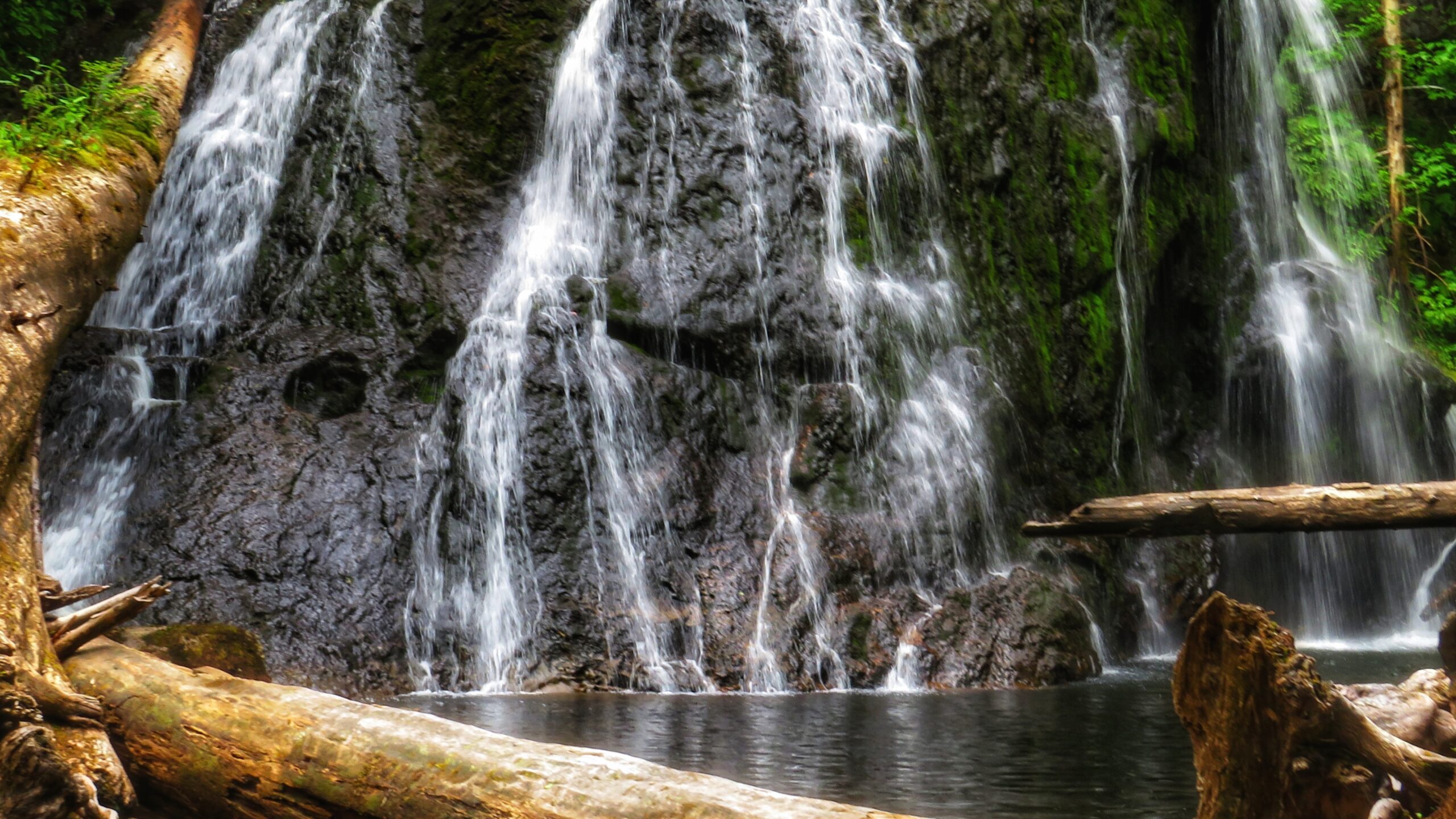
If you go to the LEFT at the trail split, you’ll eventually make your way to a fairly large waterfall, cascading down a rounded rock face. Use caution, though: To get to these falls, you must descend an extremely steep area that, in one area, is almost completely vertical. There are several sturdy ropes to assist you here. Once you make it down, however, it is only a short walk to the impressive falls.
It is not uncommon for people to linger here for many a moment and cool off under the cascading water. Once you’re finished admiring the serene beauty laid out before you, simply head back the way you came.
Getting to these waterfalls may be tricky (both in navigating the narrow logging roads and hiking), but it is well worth the effort. In both instances, the waterfalls are a mere 10 to 15 minutes off the road. In our view, the second waterfall, in particular, is the major highlight because of its size and relative ease of access; in fact, we’d even suggest it rivals the Dover Falls in Sandspit!
Again, though, keep in mind that you will be driving on active logging roads; thus, proper caution should be exercised. In addition, while a truck is not necessary to reach these sites, a standard vehicle is not ideal for these roads.
DIFFICULTY: Easy to Moderate TOTAL DISTANCE: 400 and 800 meters (return) TIME: 50 minutes (for both trails, out and back) TYPE: Out-and-Back ELEVATION GAIN: Minimal
Cookie Consent
We use cookies to improve your experience on our site. By using our site, you consent to cookies.
Contains information related to marketing campaigns of the user. These are shared with Google AdWords / Google Ads when the Google Ads and Google Analytics accounts are linked together.
90 days
__utma
ID used to identify users and sessions
2 years after last activity
__utmt
Used to monitor number of Google Analytics server requests
10 minutes
__utmb
Used to distinguish new sessions and visits. This cookie is set when the GA.js javascript library is loaded and there is no existing __utmb cookie. The cookie is updated every time data is sent to the Google Analytics server.
30 minutes after last activity
__utmc
Used only with old Urchin versions of Google Analytics and not with GA.js. Was used to distinguish between new sessions and visits at the end of a session.
End of session (browser)
__utmz
Contains information about the traffic source or campaign that directed user to the website. The cookie is set when the GA.js javascript is loaded and updated when data is sent to the Google Anaytics server
6 months after last activity
__utmv
Contains custom information set by the web developer via the _setCustomVar method in Google Analytics. This cookie is updated every time new data is sent to the Google Analytics server.
2 years after last activity
__utmx
Used to determine whether a user is included in an A / B or Multivariate test.
18 months
_ga
ID used to identify users
2 years
_gali
Used by Google Analytics to determine which links on a page are being clicked
30 seconds
_ga_
ID used to identify users
2 years
_gid
ID used to identify users for 24 hours after last activity
24 hours
_gat
Used to monitor number of Google Analytics server requests when using Google Tag Manager