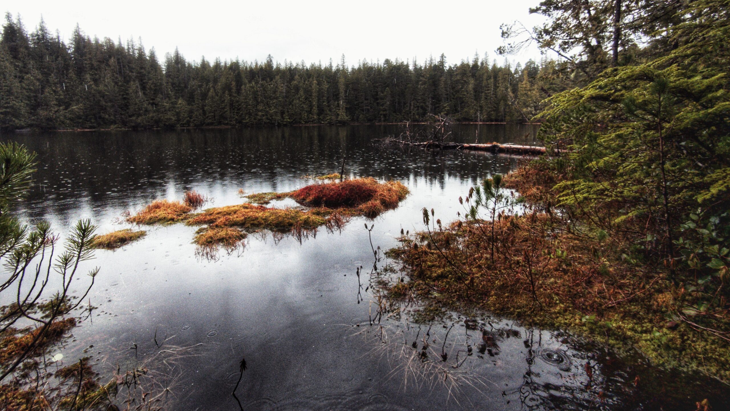
• Sleeping Beauty Trail
  • Sleeping Beauty Trail
  • Sleeping Beauty Trail
  • Sleeping Beauty Trail
  • Sleeping Beauty Trail

Sleeping Beauty Trail Features
Fantastic viewpoints
Challenging slope sections

ABOUT

The “Sleeping Beauty Trail” is one of Haida Gwaii’s most famous hikes, perhaps only next to the Tow
Hill/Blowhole
and Golden Spruce trails. With its varied terrain and expansive views, “Sleeping Beauty”
should be on every visitor’s bucket list if they’re looking for a challenging yet rewarding hike.
Unfortunately, though, this trail can be a little confusing – at least insofar as finding it. How come?
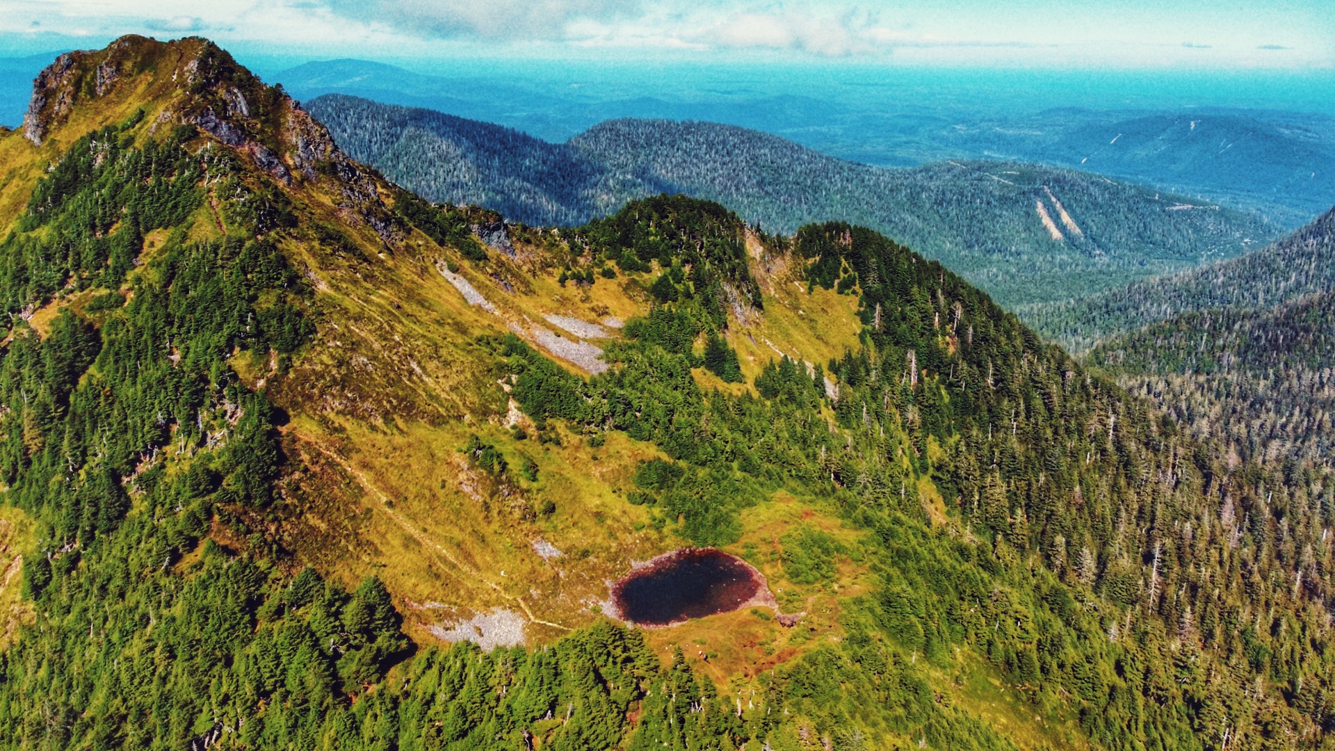
In brief, there is no trail on Haida Gwaii called “Sleeping Beauty.” The name “Sleeping Beauty” actually
refers to Mount Slatechuck and Mount Raymond – known collectively as the “Sleeping Beauty Trails”
because, when viewed from the Village of Daajing Giids, the mountains resemble a woman’s face when
laying in repose. What trail, then, are people referring to when they say they’re going to hike Sleeping
Beauty?

Generally, the hike most people are referring to is the Tarundl Trail, which brings you to the summit of
Mount Raymond. Of course, if you didn’t know this then locating “Sleeping Beauty” could prove
somewhat challenging. And that confusion is merited because the signage for “Sleeping Beauty” can be
confusing. We will try our best to reduce this befuddlement.

LOCATING THE TRAILHEAD

To locate the Tarundl Trail / Sleeping Beauty trailhead, follow these steps:

  • Drive west through the Village of Daajing Giids along Oceanview Drive until you come upon the intersection to the village cemetery and Haydn Turner campground.
  • Turn RIGHT onto the Honna Forest Service Road. Continue driving west for approximately 3.8 kilometers and turn RIGHT 400 meters past the Kagan Bay Recreation Site (you should see a “Sleeping Beauty” sign at this point).
  • Drive north for approximately 1.3 kilometers. You should see another “Sleeping Beauty” marker to your LEFT, leading you up a fairly rough and narrow road. Culvert upgrades were completed in early August 2024. A high clearance vehicle is recommended, but standard size vehicles could make it if driving with caution.
  • Drive about 3.5 kilometers. You will pass the first “Sleeping Beauty Trails” sign (leads to the Slatechuck Mountain trailhead). Drive just over a kilometer further and you will arrive at a small pullout. You should see the “Sleeping Beauty Trails” marker here. Welcome to the Tarundl Trail!

HIKING THE TRAIL

The Tarundl Trail hike begins easy enough as you cross a small footbridge over Tarundl Creek. The
path is grassy, flat and a little muddy. After trekking approximately 100 meters, you will come upon
the “Tarundl Tr” marker, which points into a dense and fairly young forest. At this point, the Tarundl
wastes no time in gaining elevation – onward and upward!

The climb up is straightforward and exceptionally well-marked with yellow circles and reflective
orange squares. You begin by navigating some tree roots before coming upon a series of high steps.
In many instances, the dense trees along this section of the trail serve as useful handgrips. After
about twenty minutes, you’ll come upon a rough ladder designed to help you up a small, steep
section of the trail. From here, the trail continues to climb along a well-worn, albeit muddy, path. Be
prepared for a few rope sections and minor blowdown along the way.

We took a hydration and snack break just past the mid-way point, alongside some beautiful old
growth cedar trees. Continuing on, the climb up was relentless, but gradual. As you begin entering
the alpine, the forest starts thinning out and the trees become more gnarled and stunted. Peering
through the trees, you also begin to get nice views of Bearskin Bay and Slatechuck Mountain.
Once in the “final stretch,” as you approach the verdant bowl of Mount Raymond, the trail gets a
little more scrambly and harder to follow as the markers thin out. First, you must climb some narrow
stone steps. After that, keep an eye out for a rope section that snakes under a fallen tree. We
missed this during our ascent and ended up climbing up and over a gnarled tree – only noticing the
rope on the opposite side after the fact! From here, climb up a rock face to a very narrow section of
trail with only a small rope railing to guide you. Once you clear this, ascend a little further through
some gnarled trees and you’ll reach the bowl. Home to the tarn known as “View Lake,” this flat area
is a popular place for hikers wishing to camp under the starry night sky.

For those wishing to climb to the zenith of Mount Raymond, and the “nose” of Sleeping Beauty, you
will need to trek onwards an additional 15 minutes. The path to the summit is well worn, but very
steep. On a clear day, you can expect to see breathtaking views of Rennell Sound, Yakoun Lake,
Stanley Lake, Daajing Giids, and much of the Queen Charlotte mountain range. Those wishing to
complete a loop trail can walk along the ridge between Mount Raymond and connect to the
Slatechuck Mountain trail.

While most report the descent down Mount Raymond to be quicker than the climb, it can actually
be more challenging due to loose rocks, mud and the abundant tree roots. Take your time as a
wipeout is certainly more likely here! Once back at the trailhead and parking lot, take a celebratory
swig of water and enjoy a nice meal back in Daajing Giids!

Note: Cellular service is available for most of the hike, less at the trailhead.

DIFFICULTY: Hard
TOTAL DISTANCE: 5.3 kilometers (one-way)
TIME: 3 hours (one-way)
TYPE: Out-and-Back
ELEVATION GAIN: 644 meters

  • Gregory Beach
  • Gregory Beach
  • Gregory Beach
  • Gregory Beach
  • Gregory Beach

Gregory Beach Features:
Easy access to Gregory Creek
Conehead view


NOTE: Rennell Sound is subject to variable weather conditions, heavy rainfall, and landslide risk, particularly from September thru May. Be prepared for emergencies and road closures during weather events.


ABOUT

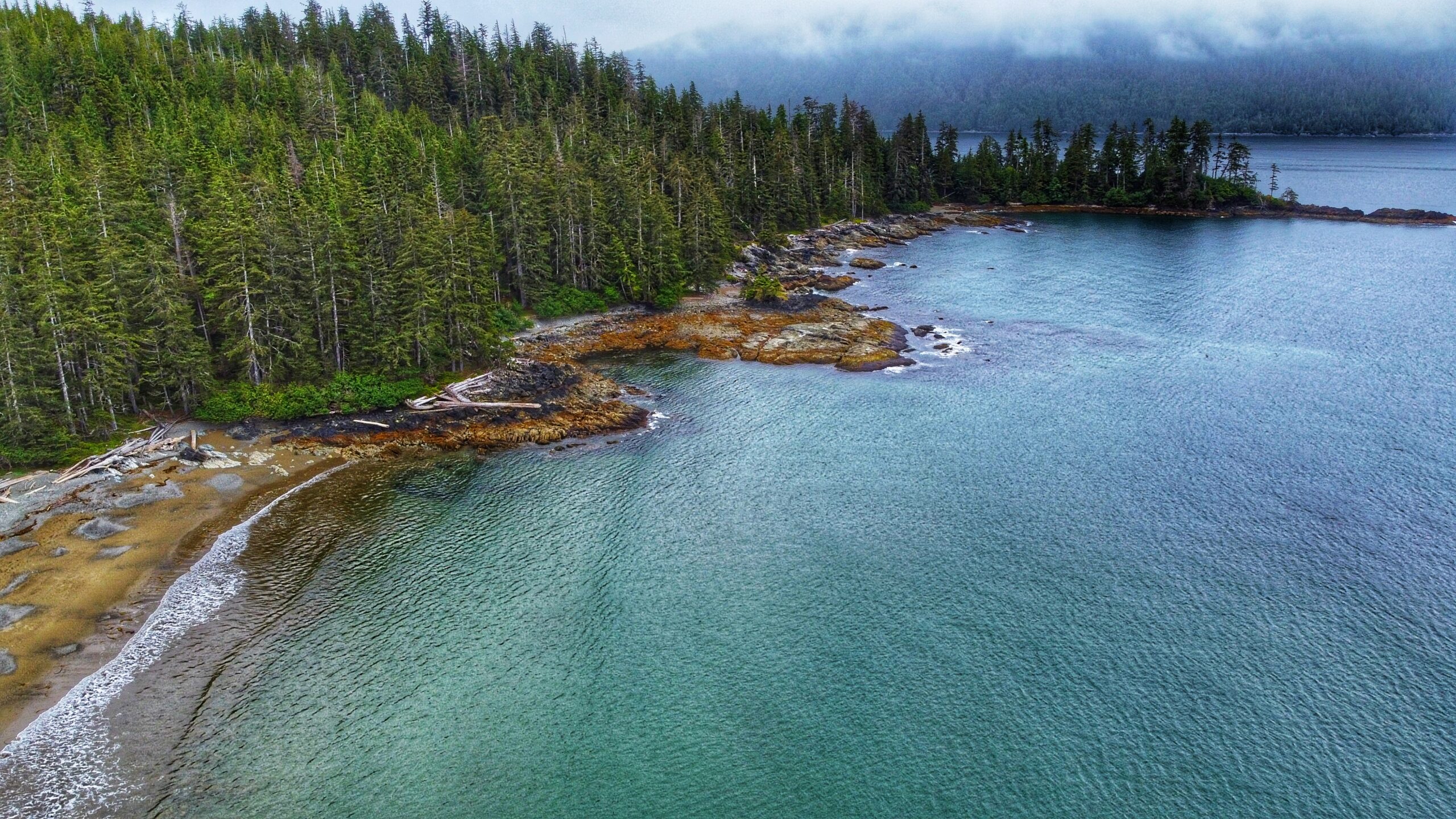
Located within the Duu Guusd Conservancy, Gregory Beach offers a lovely sand and pebble beach for
those wishing to relax and experience the dynamic environment that is Haida Gwaii’s rugged west coast. At the beach’s north end you will find Gregory Creek, which is home to spawning salmon in August and September. The small Gregory Beach campsite is located opposite the creek.

As described by Haida Hereditary Chief Gidansda, Duu Guusd “stands as a testament to the power of the earth” and “maintains all of the elements that spawned the Haida cultural heritage.” Indeed, the conservancy is huge, clocking in at 229,107 hectares in size (144,934 terrestrial and 84,173 foreshore), and stretching from the western side of Naden Harbour to Langara Island, and south to Rennell Sound. It should come as no surprise that Duu Guusd is an area rich in cultural values. 39 village sites or seasonal camps have been identified; 88 registered archaeological sites have been noted, including CMts, shell middens, habitation caves, burial sites, and blank canoes; the area is rich in unique geological formations from antiquity; and it is home to some of the most productive marine habitat on all of Haida Gwaii. The intertidal pools – prominent at the Conehead Recreational camping site – provide a beautiful and vivid example of this latter point.

To reach Gregory Beach, and others in the area, one requires a good deal of patience and a high clearance vehicle because the old logging road out to Rennell is in poor shape and rife with large potholes. Once you make it, however, you will be rewarded with some of the most beautiful beaches anywhere in the world.

If traveling from Daajing Giids, drive approximately 22 kilometers along the QC Mainline (use appropriate caution as these are active logging roads). You will come upon a blue sign with white text pointing you WEST towards the Duu Guusd Conservancy and Rennell Sound. You are now on the Rennell Sound Forest Service Road. From here, it is a 15 kilometer drive towards the Sound. Along the way, you will drive through Rennell Pass, including Rennell Hill with its steep 25% grade. While there is no longer active logging in this area, it is strongly recommended that you still drive with caution because the Rennell FSR is narrow and filled with significant potholes. For this reason, a high clearance vehicle is suggested.

LOCATING THE TRAILHEAD

Once at the bottom of Rennell Hill, you will come upon the Rennell Sound Recreation Site. From here, drive north for approximately 13 kilometers along the Rennell FSR. You will pass the trailhead signs for Five Mile Beach and Riley Creek before finally coming upon the Gregory Beach trailhead marker. There is a small pullout with enough room for two or three vehicles to park. Welcome to the Gregory Beach Trail!

HIKING THE TRAIL

The trail to Gregory Beach is brief at only 300 meters one-way. It should take approxim?ately 5 minutes to reach the beach. As you hike this brief path, which takes you through some nice shoreline forest, be cognizant of some muddy sections; otherwise, the single-file trail is mostly clear and an easy walk. It is also the only trail within Rennell Sound to feature the Ben Davidson Haida trail marker. Once you reach the beach, enjoy the rugged beauty of Haida Gwaii’s west coast: Surf the waves, swim in the ocean, comb the beach, or have a picnic (please pick up after yourself). As you relax in this oasis of calm, it is easy to lose all sense of time . . . and that’s okay.

DIFFICULTY: Easy
TOTAL DISTANCE: 300 meters (one-way)
TIME: 5 minutes
TYPE: Out-and-Back
ELEVATION GAIN: None

  • Riley Creek Trail
  • Riley Creek Trail
  • Riley Creek Trail
  • Riley Creek Trail

Riley Creek Trail Features:
Old Growth Trees
Multiple access to Riley Creek
Pristine beaches


NOTE: Rennell Sound is subject to variable weather conditions, heavy rainfall, and landslide risk, particularly from September thru May. Be prepared for emergencies and road closures during weather events.


ABOUT

Located within Rennell Sound and the Duu Guusd Conservancy, the Riley Creek Trail offers hikers a substantive walk through riparian old growth forest, which terminates at a secluded sand and pebble beach. According to Dalzell, Riley Creek was named after the engineer who “surveyed the proposed railway route to the west coast of Graham Island.” The trail is not formally maintained, so be prepared for potentially challenging conditions as a result of blowdown.

To reach the Riley Creek Trail, and other trails in the area, one requires a good deal of patience and a high clearance vehicle because the old logging road out to Rennell is in poor shape and rife with large potholes. Once you make it, however, you will be rewarded with some of the most beautiful beaches anywhere in the world.

If traveling from Daajing Giids, drive approximately 22 kilometers along the QC Mainline (use appropriate caution as these are active logging roads). You will come upon a blue sign with white text pointing you WEST towards the Duu Guusd Conservancy and Rennell Sound. You are now on the Rennell Sound Forest Service Road. From here, it is a 15 kilometer drive towards the Sound. Along the way, you will drive through Rennell Pass, including Rennell Hill with its steep 25% grade. While there is no longer active logging in this area, it is strongly recommended that you still drive with caution because the Rennell FSR is narrow and filled with significant potholes. For this reason, a high clearance vehicle is suggested.

LOCATING THE TRAILHEAD

Once at the bottom of Rennell Hill, you will come upon the Rennell Sound Recreation Site. From here, drive north for approximately 12 kilometers along the Rennell FSR. You will pass the trailhead sign for Five Mile Beach before coming upon the Riley Creek trailhead marker. There is a small pullout with enough room for two or three vehicles to park. Welcome to the Riley Creek Trail!

As you get ready for the hike, you will undoubtedly read the information contained on the trailhead sign. Please note that key information on this board is incorrect. First, while the trail is marked throughout, the Ben Davidson trail marker is not used; rather, it is a mix of flagging tape ad orange squares. Second, the stated length of the trail – 2.3km one way – is off by a significant margin. Other sources indicate the route to be 2 kilometers, 5 kilometers and 10 kilometers one-way; however, none of these are correct. The actual length of the trail, one way, is 3.44 kilometers. As such, one should ensure they’ve brought sufficient water and snacks for this trek through the forest.

HIKING THE TRAIL

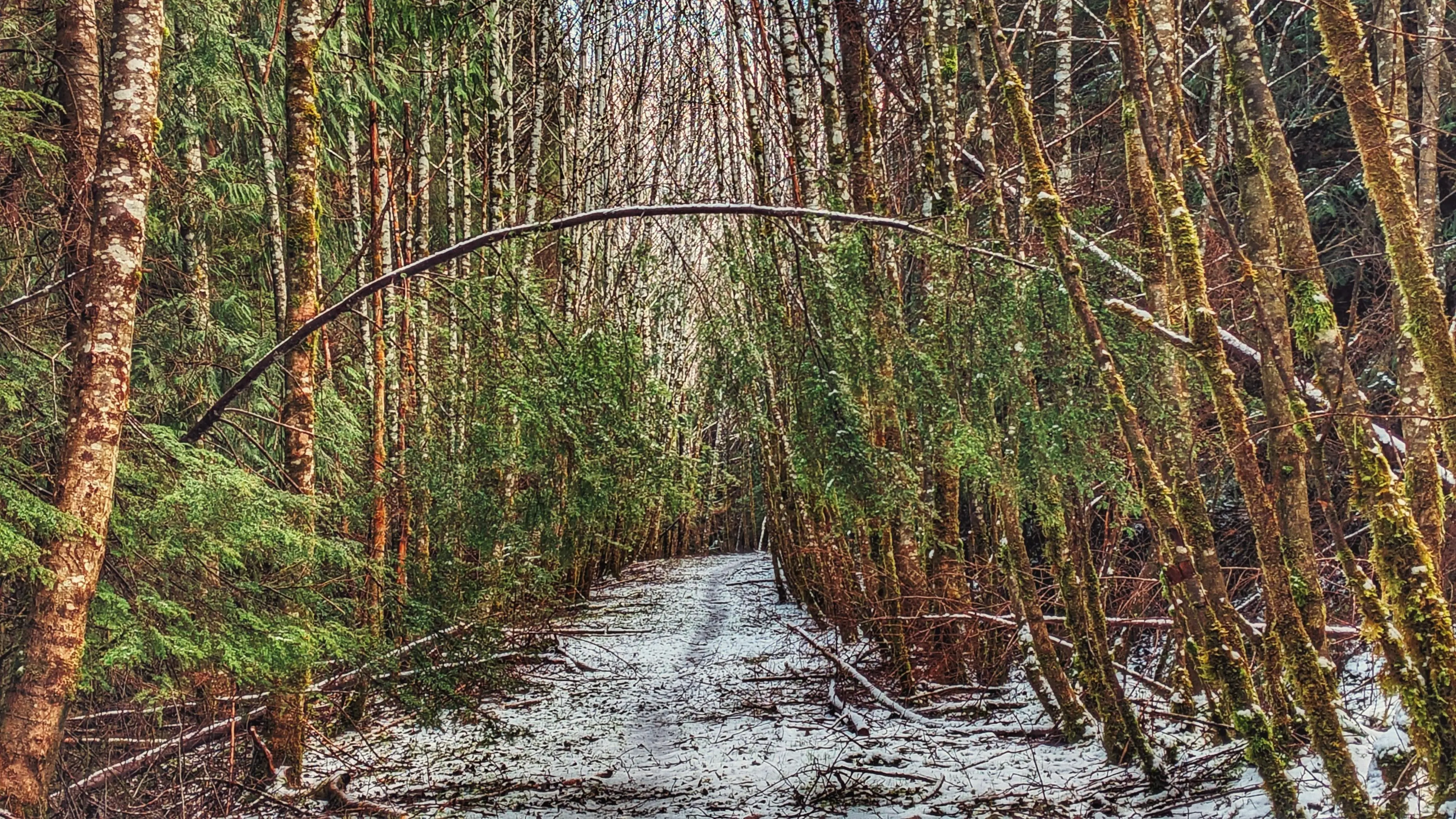
The Riley Creek Trail is the only substantive hiking trail within Rennell Sound where the trail itself functions as the attraction (with the other three, the trails are secondary to the beaches). While not formally maintained, the path is obvious and generally well-marked. When we hiked the route, there were only a couple of spots – just past the mid-way point – where we had to take a moment to locate the trail thanks to blowdown.

As you hike the riparian wilderness, take time to appreciate the lush flora that surrounds you. Much of the Riley Creek route is covered in thick green moss, which gives the environment a fairy-like atmosphere. Combine this with the gentle lull of the creek and you have all the ingredients necessary for a relaxing stroll through Haida Gwaii’s rainforest.

We should note that, even during dry conditions, parts of the trail can be quite miry. There are boardwalks and stepping blocks to assist with this, but even these should be used with caution. The boardwalks are old and some have been compromised; the stepping blocks, while solid, are extremely slippery and pose their own hazard. In addition, there are numerous sections of blowdown along the way. Most of it is minor and easy to navigate, but there are at least two areas with fairly significant deadfall on the trail: About 45 minutes in, while walking along a ridge, you’ll notice a large spruce has toppled over and ripped out a large section of the trail. We briefly thought about turning around at this point, but carefully navigated around the fallen tree and returned to the trail. Then, about 40 minutes later, you’ll come upon this area with a clutter of fallen alder and spruce. It’s easy enough to duck around these, but it does make the trail a little difficult to follow – at least momentarily.

About 500 meters out from Riley Beach, the trail splits. At this point, you have the option of crossing Riley Creek and continuing along the southern side of the creek towards the beach OR staying on the north side of Riley Creek and continuing to the beach via this route. One should only cross Riley Creek when water levels are low. If you choose not to cross the creek, you will still get to the beach. After such a lengthy and somewhat challenging trek through the woods, Riley Beach provides the perfect spot for a bite to eat and re-charge before hiking back to your vehicle.

DIFFICULTY: Moderate
TOTAL DISTANCE: 3.44km (one-way)
TIME: 5 hours (return)
TYPE: Out-and-Back
ELEVATION GAIN: 25 meters

  • Five Mile Trail
  • Five Mile Creek
  • Five Mile Trail
  • Five Mile Trail
  • Five Mile Trail

Five Mile Beach Trail Features
– Five Mile Island view
-Conehead view


NOTE: Rennell Sound is subject to variable weather conditions, heavy rainfall, and landslide risk, particularly from September thru May. Be prepared for emergencies and road closures during weather events.


ABOUT

The Five Mile Beach Trail is located in Rennell Sound, just outside the Duu Guusd Conservancy. To reach this trail, and others in the area, one requires a good deal of patience and a high clearance vehicle because the old logging road out to Rennell is in poor shape and rife with large potholes. Once you make it, however, you will be rewarded with some of the most beautiful beaches anywhere in the world.

If traveling from Daajing Giids, drive approximately 22 kilometers along the QC Mainline (use appropriate caution as these are active logging roads). You will come upon a blue sign with white text pointing you WEST towards the Duu Guusd Conservancy and Rennell Sound. You are now on the Rennell Sound Forest Service Road. From here, it is a 15 kilometer drive towards the Sound. Along the way, you will drive through Rennell Pass, including Rennell Hill with its steep 25% grade. While there is no longer active logging in this area, it is strongly recommended that you still drive with caution because the Rennell FSR is narrow and filled with significant potholes. For this reason, a high clearance vehicle is suggested.

LOCATING THE TRAILHEAD

Once at the bottom of Rennell Hill, you will come upon the Rennell Sound Recreation Site, which is rustic but features a boat launch, camping sites, and outhouses (no potable water). There are also beautiful views of the surrounding mountainscape. From here, drive approximately 3.7 kilometers north along the Rennell FSR. Once past the former dryland sort, you should spy the “5 Mile Beach BC Forest Recreation Trail” sign to your LEFT. A small pullout with space for two or three vehicles is immediately behind the trailhead marker. Welcome to the Five Mile Beach Trail!

HIKING THE TRAIL

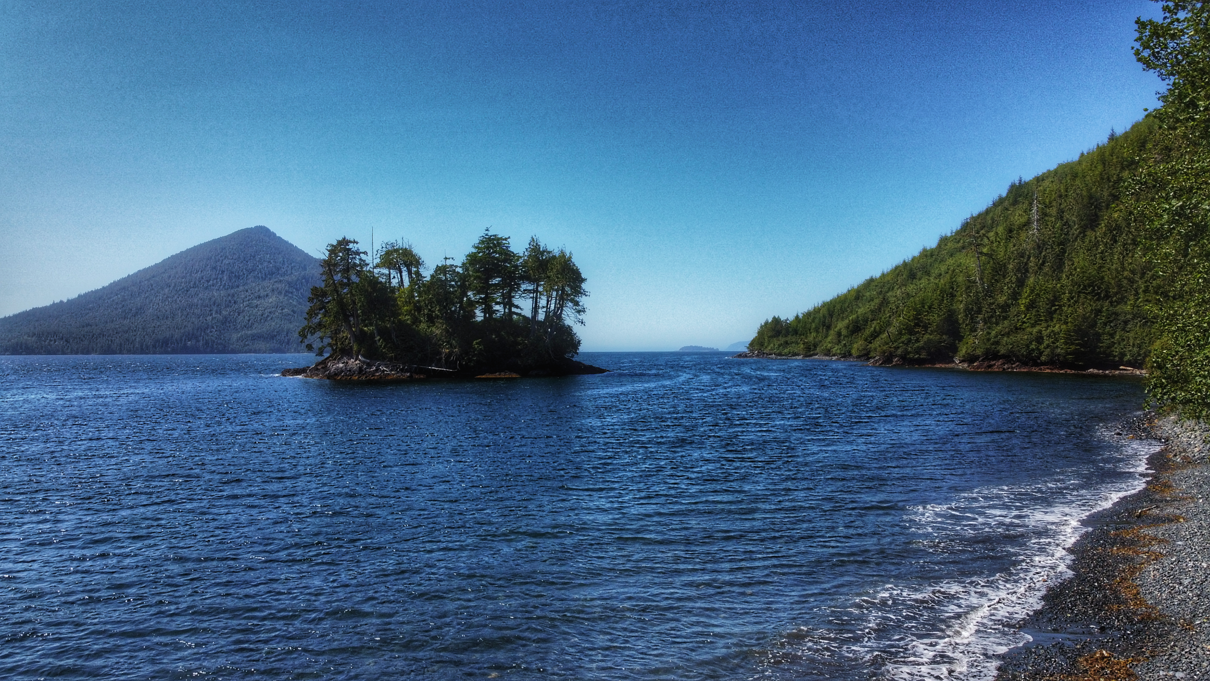
The Five Mile Beach Trail is short and straightforward. Clocking in at just 180 meters, it should take no more than a few minutes to reach the rocky beach. The trail, while not formally maintained, is clear. Step with caution as you near the beach, however, because there are some minor tree roots to watch out for. Once at the beach, take some time to admire the rocky shore, the surrounding mountains, and the eye-catching Five Mile Island. For those wishing to camp, there is space to set up a small tent just off the trail, adjacent the beach.

DIFFICULTY: Easy
TOTAL DISTANCE: 180 meters (one-way)
TIME: Less than 5 minutes
TYPE: Out-and-Back
ELEVATION GAIN: None

  • Bonanza Beach Haida Gwaii
  • Bonanza Beach Haida Gwaii
  • Bonanza Beach Haida Gwaii
  • Bonanza Beach Haida Gwaii
  • Bonanza Beach Haida Gwaii
  • Bonanza Beach Haida Gwaii

Bonanza Beach Features:
Pristine sandy beaches
Interesting tidal pools
Surfer waves


NOTE: Rennell Sound is subject to variable weather conditions, heavy rainfall, and landslide risk, particularly from September thru May. Be prepared for emergencies and road closures during weather events.


ABOUT

Located within Rennell Sound and the Duu Guusd Conservancy, Bonanza Beach offers perhaps the finest sandy beach on all of Haida Gwaii. At the beach’s south end you will find Bonanza Creek, which is home to spawning salmon in August and September. While remote and difficult to get to, Bonanza Beach is worth the effort and should be on everybody’s Haida Gwaii-themed bucket list.

If traveling from Daajing Giids, drive approximately 22 kilometers along the QC Mainline (use appropriate caution as these are active logging roads). You will come upon a blue sign with white text pointing you WEST towards the Duu Guusd Conservancy and Rennell Sound.

You are now on the Rennell Sound Forest Service Road. From here, it is a 15 kilometer drive towards the Sound. Along the way, you will drive through Rennell Pass, including Rennell Hill with its steep 25% grade (one of the steepest public roads in all of Canada). While there is no longer active logging in this area, it is strongly recommended that you still drive with caution because the Rennell FSR is narrow and filled with significant potholes. For this reason, a high clearance vehicle is suggested.

LOCATING THE TRAILHEAD

Once at the bottom of Rennell Hill, you will come upon the Rennell Sound Recreation Site. From here, drive north for approximately 14 kilometers along the Rennell FSR. You will pass the trailhead signs for Five Mile Beach, Riley Creek and Gregory Beach before coming upon the Bonanza River Bridge. While the bridge has been closed since August 2022 “for safety issues,” locals have pushed the barricade aside to allow for vehicle access. The bridge remains structurally sound but, for those wishing to err on the side of caution, you can park your vehicle here and walk the 650 meters to the Bonanza Beach trailhead. Welcome to the Bonanza Beach Trail!

HIKING THE TRAIL

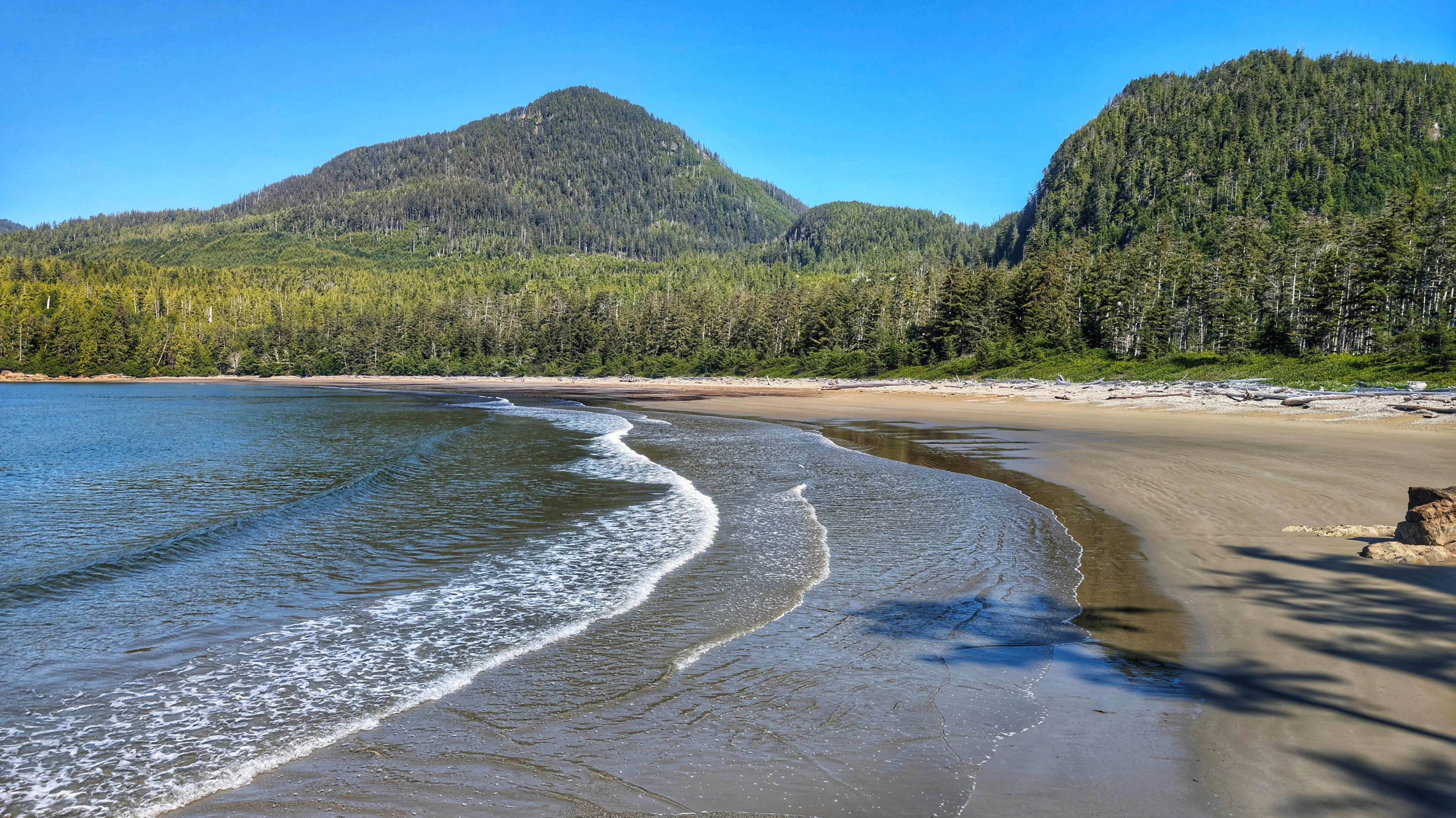
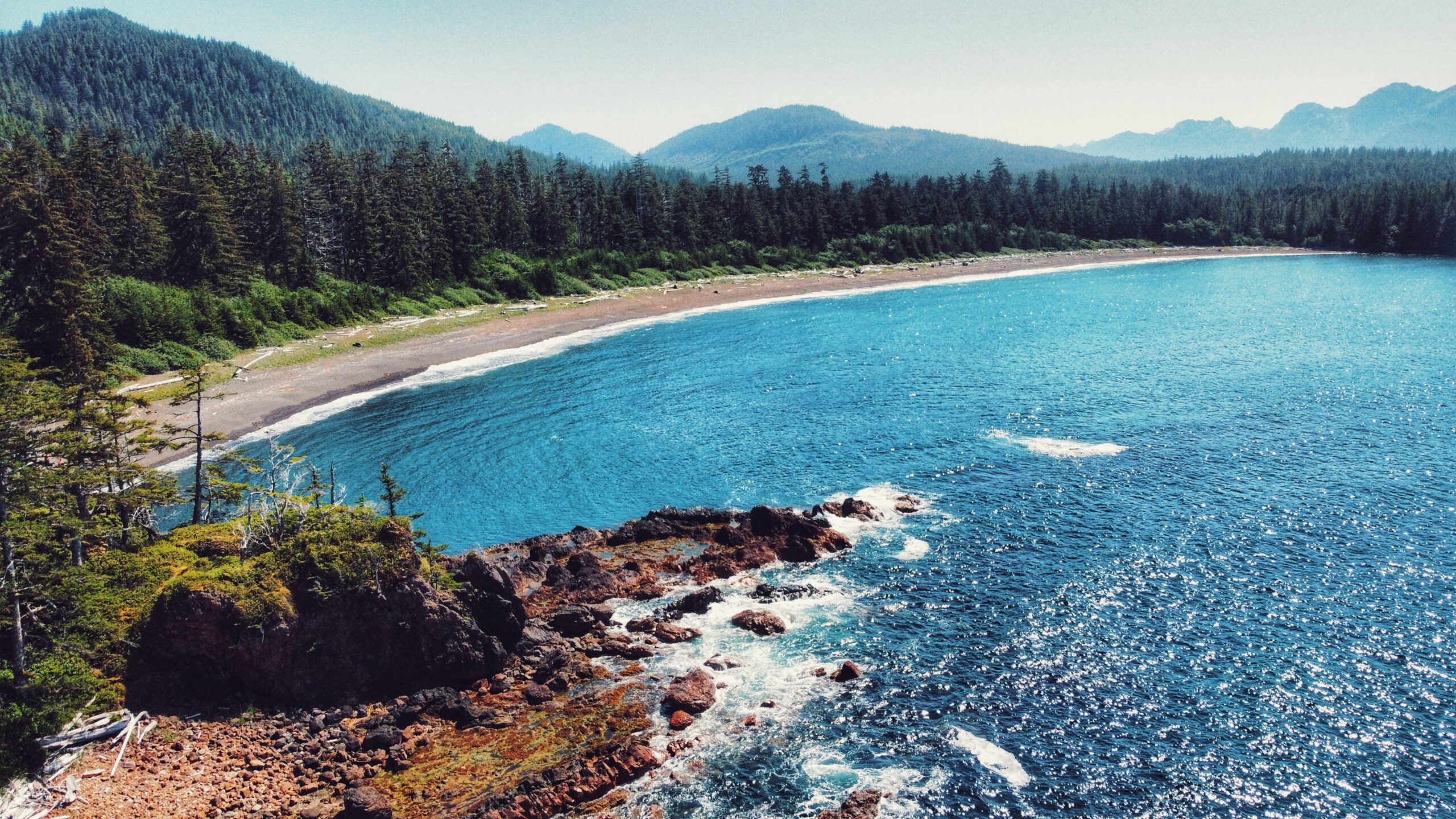
The trail to Bonanza Beach is brief @ only 400 meters one-way. As you hike towards the beach, you will be treated to second-growth forest, giant spruce burls, dense salal, and some beautiful old growth cedars as you approach the beach. It should take less than ten minutes for one to reach one of Haida Gwaii’s crown jewels: Bonanza Beach.

Once you emerge from the dense salal, it’s easy to see why the Daily Hive (2018), Love Exploring (2021) and MSN (2023), amongst others, have all listed Bonanza Beach as one of the top beaches in Canada. With its attractive crescent shape, Bonanza Beach is exposed to the powerful waves of the open Pacific Ocean. The relentless wave action has resulted in some of the finest sand on any beach in the world. It has also made this area attractive for surfers and beachcombers. Because Bonanza Beach is quite literally the “last stop” on the way to Japan, it is not uncommon to find unique items along Bonanza’s shore, including the much sought after glass floats from Japanese fishing vessels.

Lastly, we’d be remiss if we failed to mention the tidal pools: On very low tides, Bonanza Beach is home to many attractive tidal pools, each teaming with life, including colourful sea anemones, beach crabs, mussels, life-giving seaweed and kelp. Indeed, the tidal pools offer a stunning microcosm of Duu Guusd’s complex and rich marine environment.

Bonanza Beach is – undoubtedly – a special place. For us, it highlights some of the best to be found within Duu Guusd: A short hiking trail with second and old growth forest; Haida cultural values; pristine
beaches; epic views of Conehead and the open Pacific; and bountiful marine life, including salmon, King Fishers, bald eagles and even the odd seal. Having the opportunity to relax on the beach or swim in the ocean is just the icing on the cake.

DIFFICULTY: Easy
TOTAL DISTANCE: 400 meters (one-way)
TIME: 7 minutes
TYPE: Out-and-Back
ELEVATION GAIN: None

  • Yakoun Old Growth Spruce Grove
  • Yakoun Old Growth Spruce Grove
  • Yakoun Old Growth Spruce Grove

Yakuon Old Growth Sitka Spruce Grove Features:
Yakuon River fishing spots
Old growth trees

ABOUT

Yakoun Old Growth Sitka Spruce Grove – this grove of beautiful old growth trees is situated along the Yakoun River, near the “30 mile” marker. Together these trees give a small glimpse of what was common place in Haida Gwaii’s forests before unfettered logging practices destroyed large areas of old growth on the archipelago.

Perhaps the most famous of the old growth trees in this area is the one known as the “Bellis Spruce,” which is named after Skil Q’uas Dick Bellis. A self-described “BSer,” Mr. Bellis spent most of his working life in the forest industry as a heavy duty mechanic. He was also a notable carver. Perhaps his most well-known piece is an eagle sculpture carved in 1993 in memory of his brother, Ted. The eagle sculpture sat at Jungle Beach, next to the Black Bear, carved by Ted, until it mysteriously vanished in 2001 (the aging Black Bear vanished in 2023). Thought to be lost forever, the sculpture was found in Prince George in 2009 and returned to the Bellis family. In his later years, Dick Bellis served as a guide for tourists visiting Haida Gwaii. Along with jaunts to Rennell Sound, Bellis often took his guests to the Yakoun River to view the giant Sitka Spruce, which he’d say was “the biggest tree they’ll ever see.” And he was probably right.

Estimated to be approximately 750 years old (BC Forest Services does not have an increment bore large enough for a more accurate age), with a circumference of 45 feet and a height of just over 68 metres, the “Bellis Spruce” puts everything into perspective and highlights, in microcosm, the essence of Haida Gwaii. The giant Sitka Spruce gained significant attention in 2009 when it was officially recognized as the largest Sitka Spruce in BC – a title it held for a couple of years. Unfortunately, the “Bellis Spruce” was declared dead in 2011; however, it is still standing and leaves those lucky enough to find it in awe.

LOCATING THE TRAILHEAD

There is no formal trailhead marker for this short trek into the Yakoun Old Growth Sitka Spruce Grove. If you wish to locate the Bellis Spruce and its surrounding grove of giants, you must drive approximately 30 kilometers outside of Daajing Giids along the QC Mainline logging road. At this point, the Yakoun River will be clearly visible on your RIGHT. Look for a suitable place to pull over, walk through the woods, and safely cross the Yakoun River. About a decade ago, a large log functioned as a natural “bridge,” but it has since washed away. As such, one should only try crossing the Yakoun when the river is low – typically during the late summer months.

HIKING THE TRAIL

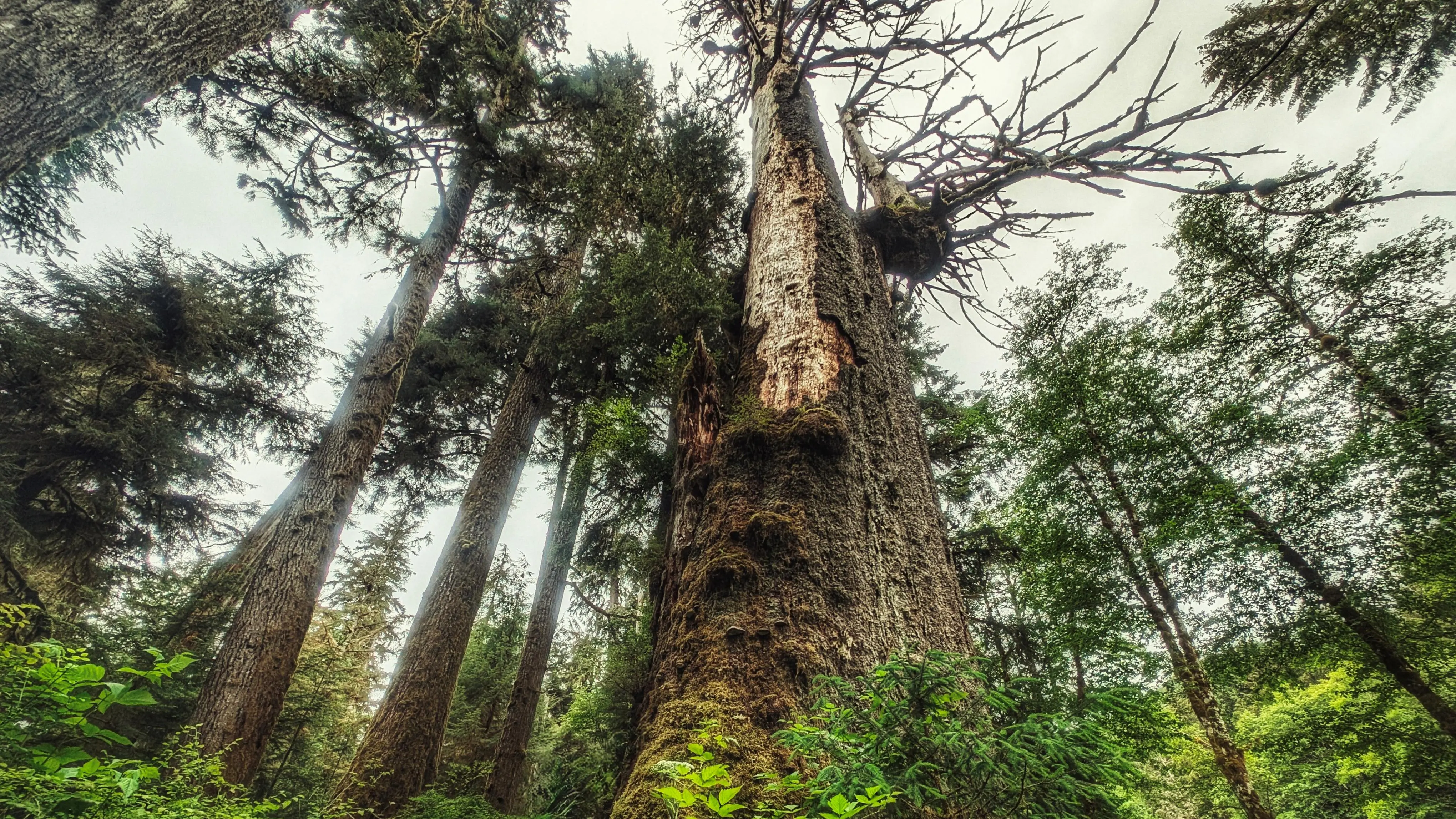
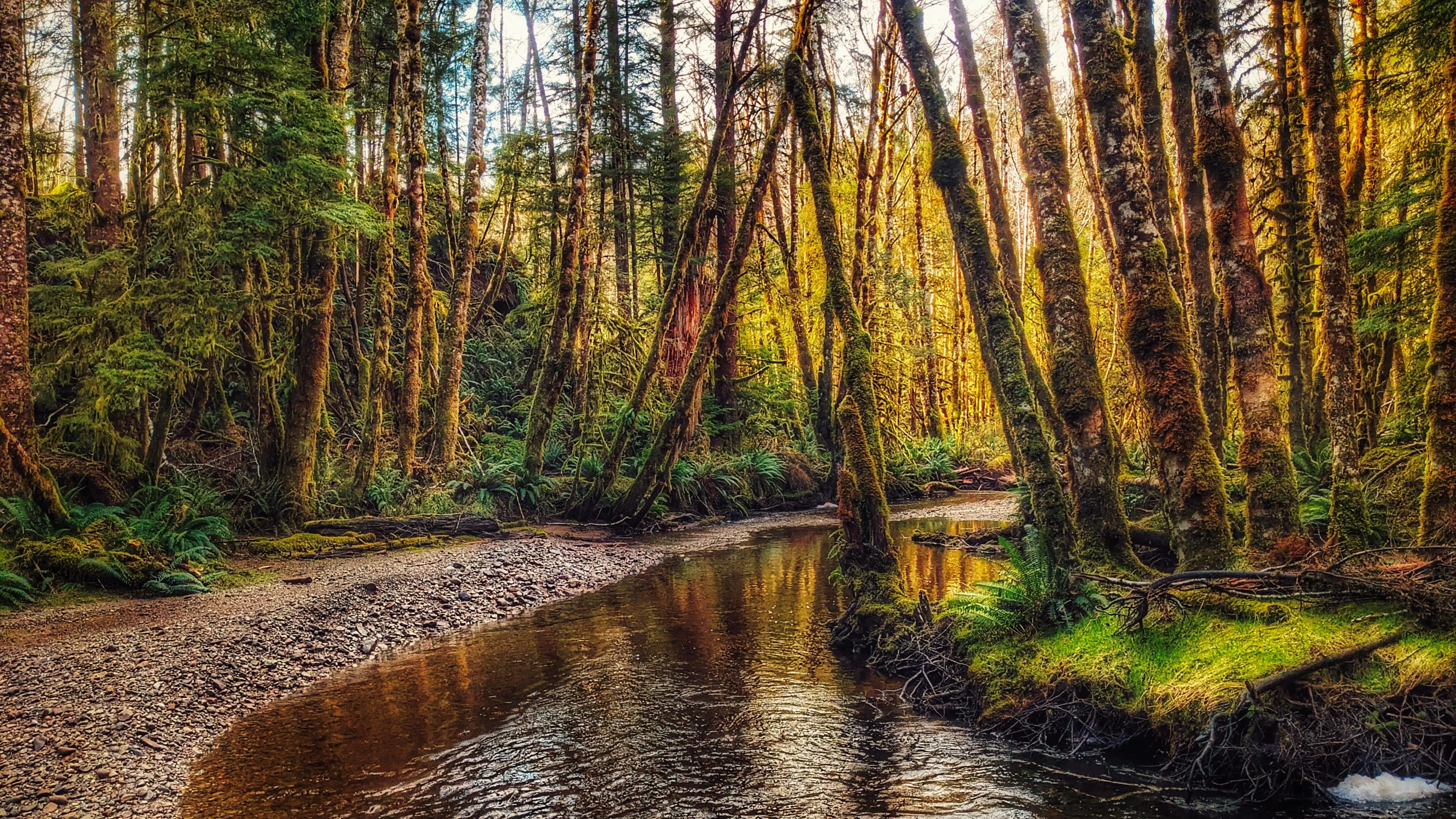
As noted, this is not a formal trail of the Yakoun Old Growth Sitka Spruce Grove; however, you should see a vague path once you cross the river. It will lead you to an old de-activated road. The grove of old growth Spruce is facing the river. Take your time and explore these monumental trees. You will feel dwarfed in their presence, but this is forest therapy in the best sense of that term! Use caution as it is often difficult to see where you are stepping.

DIFFICULTY: Moderate
TOTAL DISTANCE: Variable
TIME: 30 minutes
TYPE: Out-and-Back
ELEVATION GAIN: None

  • Tarundl Lookout Trail
  • Tarundl Lookout Trail
  • Tarundl Lookout Trail
  • Tarundl Lookout Trail
  • Tarundl Lookout Trail
  • Tarundl Lookout Trail

Tarundl Lookout Trail Features
– Views of Bear Skin Bay
-Challenging Rope Sections
-View of the Tarundl Flats

ABOUT

The Tarundl Lookout Trail, located west of Daajing Giids (less than 10-minutes by car), and along the Honna Service road, you will find the Kagan Bay Day Use Recreation Site at about the 2-kilometer mark. The site features a picnic table, fire ring and beach access. At low tide, one could walk quite a distance onto the beach. Here you will also find the Tarundl Creek network of trails (see our earlier write-up here). It is also at this site where you can park your vehicle to begin a moderate-level hike towards an attractive and compelling lookout.

TRAILHEAD

Unlike the more popular Tarundl Creek loop trail, the Tarundl Lookout Trail does not have formal trailhead signage; however, it is easy enough to find:

  • Park your vehicle at the Kagan Bay Day Use Site.
  • Walk directly across the Honna Forest Service Road from the Day Use Site.
  • You should see some candy cane-patterned tree tape, which signifies the start of the trail.

Welcome to the Tarundl Lookout Trail!

HIKING THE TRAIL

While the trail is fairly short at just over 1 kilometer in length, it is a steady uphill climb the entire way. The trail begins with a gentle slope, but this gets steeper further on. The route is a little rough, but is well marked with orange tree tape the entire way. Hiking through the ferns, young hemlock, and
occasional spruce, the terrain reminds us of the Jags Trail @ Spirit Lake. As you hike, use caution because the trail is also muddy and slippery in some areas.

Be prepared for six rope sections. Most of these are short, and designed to help you over minor obstacles, but the final two – just before you reach the zenith – are essential in helping you reach the viewpoint safely. Once at the top, follow the narrow trail to a couple of viewpoints of the Tarundl Flats
and bays down below. Please use caution while you are here as there are no ropes in place as a safety measure. After taking in the view, return the way you came!

DIFFICULTY: Moderate
TOTAL DISTANCE: 1.05 kilometers (one-way)
TIME: 40 minutes (one-way)
TYPE: Out-and-Back
ELEVATION GAIN: 126 meters

  • Hatchery Loop Trail
  • Hatchery Loop Trail
  • Hatchery Loop Trail
  • Hatchery Loop Trail
  • Hatchery Loop Trail

Hatchery Loop Trail Features
Connects to numerous trails in area
Trailblazed by Remi Gauthier
Old logging road

ABOUT

The Hatchery Loop Trail is another route developed by local hero and trail-builder, Remi Gauthier. The trail takes hikers along the “high road,” an old deactivated logging road, and gives the adventure-minded many options for completing the route: You can treat it as a large loop and come back hugging the highway; or, you can use the Hatchery Trail as a “connector” and branch out to other routes, including the Sachs Creek Trail, Around the Pond and Onward Point, amongst others.

We initially came upon this trail by chance in the summer of 2022. En route to an enjoyable repast at Raincoast Breads, we spied a small white marker on the side of Alliford Bay Road denoting “Fish
Hatchery Trail.” We observed no safe place to park at the time given the marker was near a soft corner. It wasn’t until the end of 2023, while reading the newly updated Sandspit Community Society’s “Hikes and walks” page, that this trail starts near the Sandspit Salmon Enhancement Society’s hatchery building.

LOCATING THE TRAILHEAD

The trailhead marker for the Hatchery Loop Trail is fairly understated and is, therefore, somewhat easy to miss if you’re not already looking for it. First, park your vehicle at the hatchery building. As per the Sandspit Community Society, “1 or 2 vehicles can park max” and “Please leave the hatchery accessible to volunteers and helpers.” Once settled, walk back out onto the main highway and trek south (LEFT) for about 80 meters. At this point, you will see an old road to your left with a white rectangle marker on a nearby alder tree. Welcome to the start of the Hatchery Loop Trail!

HIKING THE TRAIL

Most of the route follows a deactivated logging road; so, it’s fairly easygoing. It had snowed the night before our planned hike; as a result, much of the road was covered in a thin layer of snow and ice but this did not detract from the experience. Just a few feet in from the trailhead, you will note a series of
white markers: Some pointing east and others pointing south. Going south will take you along a rough, but short trail to what we’ve called the Sandspit Waterfall. Trekking east will continue taking you along the Fish Hatchery route.

At about the 200-meter mark, you will see another directional trail marker. It points north (or LEFT) to “Jason’s Mill Rd” and south (or RIGHT) to Sachs Creek. Walking south for about a kilometre will
eventually connect you to the informal Sachs Creek Trail; however, if you wish to hike the Hatchery Trail, you must trek north along “Jason’s Mill Rd,” also known as the “high road.” From this point, you follow the old road north for just over 3.5 kilometres. The hike is easy – peaceful – and takes you through a variety of forests and trees, though the primary types observed include alder and spruce trees. The hike promised “some views of Skidegate Inlet through the trees,” but we did not observe this at any point because the trees along the road, and on the forest trail, were too dense.

While the hike is pretty straightforward, we do recommend hiking this route with an app like BRMB. Once you start trekking north from the “Jason’s Mill Rd” marker, there are no further trail markers along
the route until you’re about ready to re-emerge onto the highway and shoreline. The app will help you stay on the correct road – there are at least four “forks” along the trail that could potentially lead you astray (the last of these is another “connector” towards the Around the Pond/Onward Point network of
trails).

According to the map available on the Sandspit Community Society webpage, there are two options for completing the loop trail: A forest hike that hugs the highway or a much easier trek along the shoreline.
We chose the latter as we were unable to locate any trail markers for the forest route. In any event, as you complete the loop along the shoreline, you will spy at least two “Fish Hatchery” trail signs along the Highway – these take you through the forest, re-connecting to the old road. Regardless of which route you take, you will end up back at the fish hatchery!

Note: The Hatchery Loop Trail route is outlined on Gaia GPS. You can view the route online by activating “public trails” on the Gaia GPS website. Unfortunately, as of 2024, the “Overlays” function does not appear to include “public trails” in the app version of Gaia GPS anymore.

DIFFICULTY: Moderate
TOTAL DISTANCE: 7km
TIME: 2 hours
TYPE: Loop
ELEVATION GAIN: 73 meters

  • Sachs Creek Trail
  • Sachs Creek Trail
  • Sachs Creek Trail
  • Sachs Creek Trail

Sachs Creek Trail Features
Fishing spots
Endemic tree frog sighting

ABOUT

Located roughly 1.6 kilometers east of the Moresby ferry waiting area, and just off Highway 16, you will find the informal Sachs Creek Trail. The trail is unmarked and isn’t primarily used as a recreational hiking route; however, it is nevertheless listed in the Haida Gwaii Trails Strategy and Backroad Mapbooks (the latter resource is available at the Daajing Giids Visitor Centre). In the early 1980s, Sachs Creek was utilized as part of a UBC project that used tandem V-shaped gabion weirs for improving spawning habitat for pink and chum salmon. In more recent times, the creek has been used with some regularity by university students in environmental studies programs. Today Sachs Creek remains an important salmon-spawning creek. 

LOCATING THE TRAILHEAD

Because the trail is unmarked, getting to the trailhead can be a little tricky. If you are using the Backroad Mapbooks app, it will tell you to “look for a road branching south off the Highway 8km before Kwuna Point Road.” Ignore this advice. The road it refers to is deactivated and so overgrown that it is unrecognizable as a road. Instead, if coming from the Kwuna ferry, drive approximately 600 meters along Highway 16. Shortly after crossing the Sachs Creek Bridge, you will see a narrow dirt road to your right. If you are driving a truck, it is possible to drive the 1.08 kilometers along this road to the unmarked Sachs Creek Trailhead; however, we recommend parking your vehicle on the wide curb and walking to the trailhead. There is no signage indicating you are on the Sachs Creek Trail. Instead, you will see an old logging road to your left and some alders and ferns to your right that lead down to Sachs Creek. The trail is characterized as a loop – albeit a rough and informal one – so it doesn’t matter which route you take.

HIKING THE TRAIL

As of 2024, the area that encompasses the Sachs Creek Trail has become an active logging zone. As such, the tree tape you see along the old road, and in the forest along the creek, is unreliable; it does not denote the hiking route. In fact, the entire Sachs Creek Trail is unmarked. Thus, while 90% of the route follows old logging roads, the remaining 10% that brings you into the forest and along the creek can be challenging to navigate if you don’t know where you’re going. It is easy to get disoriented in the forest. For that reason, we don’t recommend hiking this route unless you are using an app like BRMB, which contains an outline of the informal trail (note its rough heart shape!).

Hiking along the old roads is a little one-note. If you choose to hike this informal trail, we recommend spending most of your time trekking along Sachs Creek and enjoying the rich flora and fauna of its banks and waters. Rich in nutrients and life, the creek remains important to the area. Depending upon the time of year, you might get lucky and spy schools of salmon swimming up the creek en route to their spawning grounds. Use caution, though, as taan (black bear) frequent the area.

Note: With the area now an active logging zone, it may not be publicly accessible during working days of the week. As you walk the route, you will undoubtedly see clear evidence of the logging operations underway – many trees bear scars and it’s a sad sight to see.

DIFFICULTY: Moderate
TOTAL DISTANCE: 3.5 kilometers
TIME: 2 hours
TYPE: Loop
ELEVATION GAIN: 40 meters

  • Moresby Waterfall Trail
  • Moresby Waterfall Trail
  • Moresby Waterfall Trail
  • Moresby Waterfall Trail

Moresby Waterfall Trail Feature:
Along the highway access
Less than five minutes hike
Gorgeous waterfall

ABOUT

The Moresby Waterfall Trail first came to our attention a couple of years ago. We were given a map of Moresby-area trails and one of them identified a “waterfall” just off the side of the highway between the BC Ferries waiting area and Sandspit. Eager to explore and find this waterfall, we set out in mid-Autumn 2021.

Unfortunately, the coordinates were a little off and we just ended up trudging through the bush before calling it a day and photographing Fall foliage in Sandspit as a consolation prize. Fast-forward to the end of 2023.

LOCATING THE TRAILHEAD

Haida Gwaii had endured a series of winter storms, which took down several trees. As we drove towards Sandspit, we spied a glimpse of the waterfall from the road! Deciding the hike wouldn’t be long (nothing more than a few minutes), we pulled off to the side of the road and hiked the short trail toward what we’ve called the Moresby Waterfall.

There are no notable landmarks to help identify where the trailhead is. If you’re not already looking for it, chances are you’ll drive right on by. Please refer to the GPS coordinates below. Once you park safely off the side of the road, you should spy two alder trees behind a group of feisty ferns. One of the trees features a double white diamond marking with some yellow tape attached to the lower diamond. Welcome to the Moresby Waterfall trailhead!

HIKING THE TRAIL

Surprisingly, the short trail is denoted with white diamond-shaped markers all the way through, which leads us to believe this route was created by local trailblazer Remi. Follow the white markers the length of the trail towards the waterfall. At about the mid-way point, there is an option to cross a small creek and visit the eastern side of the waterfall; however, because we lacked proper footwear (this was an
impromptu stop), we opted to stay on the western side of the creek. After walking a mere five minutes, your efforts are rewarded with a beautiful cascading waterfall – up close and personal. Just be sure to use caution when walking the path near the waterfall as it is quite slippery and muddy.

The trail, while very short, is informal and user-maintained. There is plenty of deadfall to navigate en route to the falls; however, it is nothing major. While here, take a few moments to enjoy the slight rumble of the falls and the comforting silence of the forest that surrounds you. Forest therapy 101!

Note: The waterfall may not be as prominent during extended periods of drought.

DIFFICULTY: Easy
TOTAL DISTANCE: 180 meters (one-way)
TIME: 10 minutes (return)
TYPE: Out-and-Back
ELEVATION GAIN: Minimal