


Sachs Creek Trail Features
Fishing spots
Endemic tree frog sighting
ABOUT
Located roughly 1.6 kilometers east of the Moresby ferry waiting area, and just off Highway 16, you will find the informal Sachs Creek Trail. The trail is unmarked and isn’t primarily used as a recreational hiking route; however, it is nevertheless listed in the Haida Gwaii Trails Strategy and Backroad Mapbooks (the latter resource is available at the Daajing Giids Visitor Centre). In the early 1980s, Sachs Creek was utilized as part of a UBC project that used tandem V-shaped gabion weirs for improving spawning habitat for pink and chum salmon. In more recent times, the creek has been used with some regularity by university students in environmental studies programs. Today Sachs Creek remains an important salmon-spawning creek.
LOCATING THE TRAILHEAD
Because the trail is unmarked, getting to the trailhead can be a little tricky. If you are using the Backroad Mapbooks app, it will tell you to “look for a road branching south off the Highway 8km before Kwuna Point Road.” Ignore this advice. The road it refers to is deactivated and so overgrown that it is unrecognizable as a road. Instead, if coming from the Kwuna ferry, drive approximately 600 meters along Highway 16. Shortly after crossing the Sachs Creek Bridge, you will see a narrow dirt road to your right. If you are driving a truck, it is possible to drive the 1.08 kilometers along this road to the unmarked Sachs Creek Trailhead; however, we recommend parking your vehicle on the wide curb and walking to the trailhead. There is no signage indicating you are on the Sachs Creek Trail. Instead, you will see an old logging road to your left and some alders and ferns to your right that lead down to Sachs Creek. The trail is characterized as a loop – albeit a rough and informal one – so it doesn’t matter which route you take.
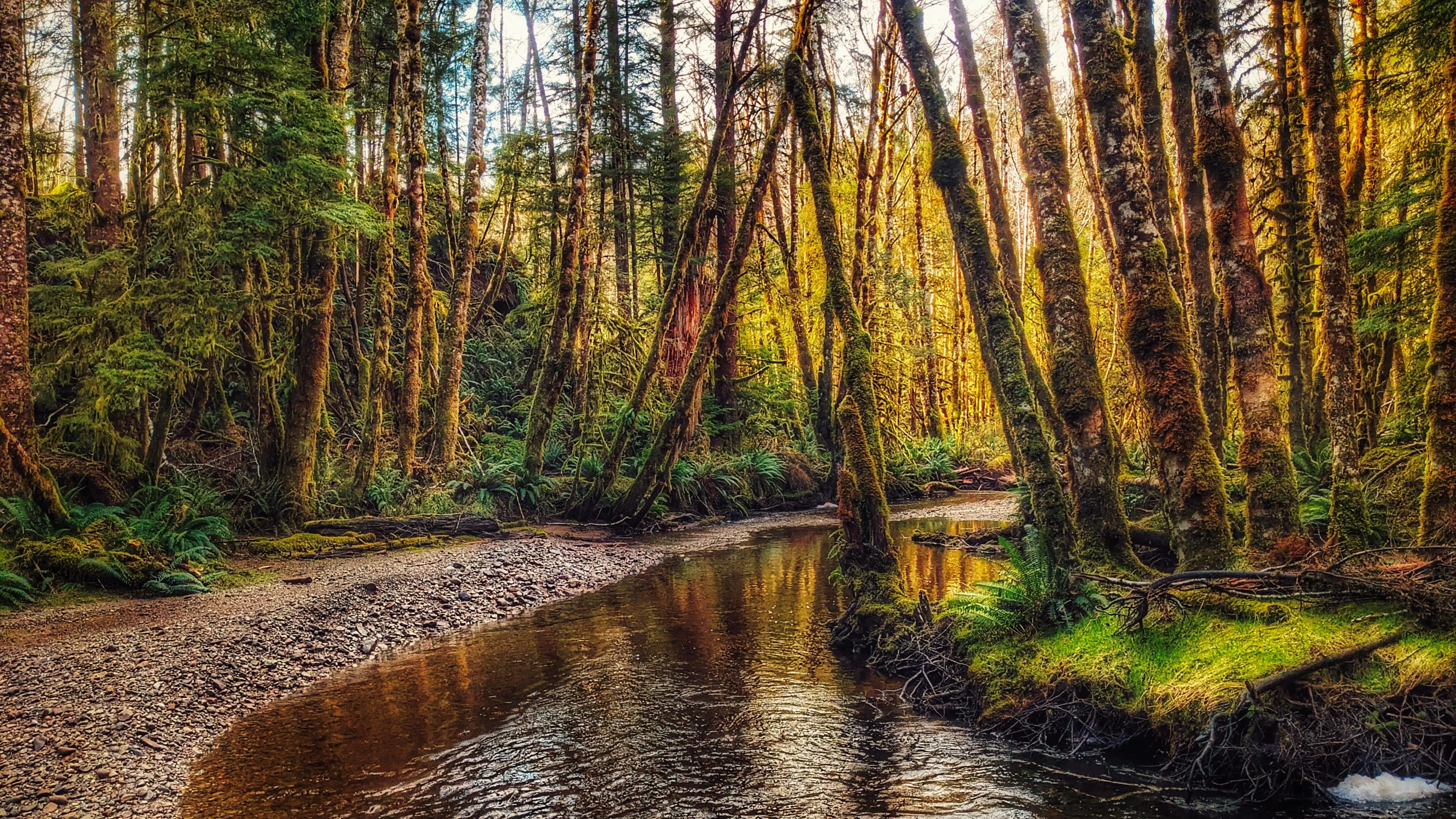
HIKING THE TRAIL
As of 2024, the area that encompasses the Sachs Creek Trail has become an active logging zone. As such, the tree tape you see along the old road, and in the forest along the creek, is unreliable; it does not denote the hiking route. In fact, the entire Sachs Creek Trail is unmarked. Thus, while 90% of the route follows old logging roads, the remaining 10% that brings you into the forest and along the creek can be challenging to navigate if you don’t know where you’re going. It is easy to get disoriented in the forest. For that reason, we don’t recommend hiking this route unless you are using an app like BRMB, which contains an outline of the informal trail (note its rough heart shape!).
Hiking along the old roads is a little one-note. If you choose to hike this informal trail, we recommend spending most of your time trekking along Sachs Creek and enjoying the rich flora and fauna of its banks and waters. Rich in nutrients and life, the creek remains important to the area. Depending upon the time of year, you might get lucky and spy schools of salmon swimming up the creek en route to their spawning grounds. Use caution, though, as taan (black bear) frequent the area.
Note: With the area now an active logging zone, it may not be publicly accessible during working days of the week. As you walk the route, you will undoubtedly see clear evidence of the logging operations underway – many trees bear scars and it’s a sad sight to see.
DIFFICULTY: Moderate
TOTAL DISTANCE: 3.5 kilometers
TIME: 2 hours
TYPE: Loop
ELEVATION GAIN: 40 meters