

The flow of Three Mile Creek makes silky waters 
There is no clear evidence of a trail left 
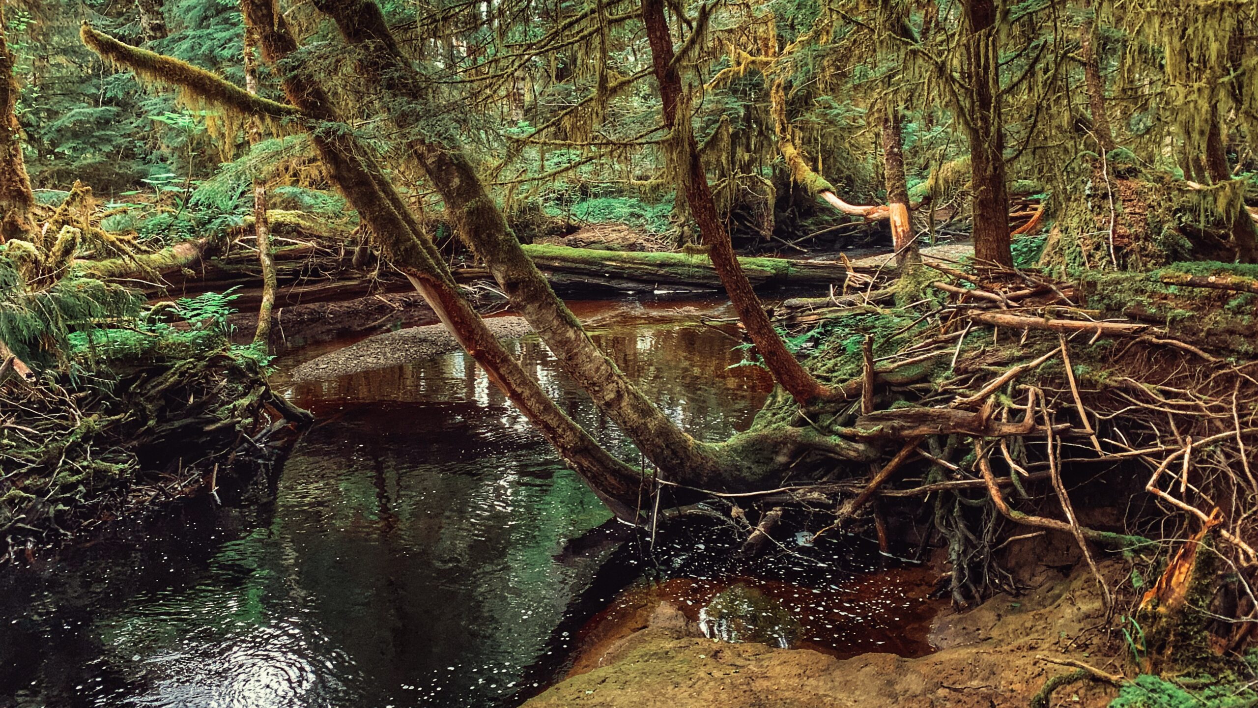
Some clear parts of the creek Going down from the bridge and road The trail is covered by overgrown foilage The Three Mile Creek trail is showing a bit of erosion There are some minimal trail markers but the safe route is to follow the creek back to the bridge The creek has a lot of dead falls and flooding debris


THREE MILE CREEK TRAIL FEATURES:
Salmon spawning creek
Cascade
Tlall Conservancy
ABOUT
The Three Mile Creek Trail is found deep within the Tlall Conservancy. Accessing it in the current day requires a bit of effort because the original point of entry – Survey Forest Service Road – was formally decommissioned in 2016 after years of disuse.
Now, if you wish to visit this trail, you’ll have to drive nearly 1.5 hours along the Daajing Giids backroads: First, drive approximately 20 minutes along the QC Mainline (passing the decommissioned Survey Forest Service Road) until you come upon the un-signed junction for Lakes Main Road to your RIGHT.
Take this turn and follow Lakes Main for nearly an hour – you will eventually connect to what’s left of the Survey Forest Service Road. Once here, you’ll spy a bridge that crosses Three Mile Creek.
If you’ve come all this way to hike the trail, do NOT cross the bridge because the unsigned trailhead for Three Mile Creek Trail is just before the bridge on your RIGHT.
Lack of maintenance for nearly two decades has made the route difficult to see but the faint outline of a trail is there. Descend the minor slope and begin your trek!
In the late 1990s and early 2000s, Three Mile Creek Trail – along with the nearby Monique Creek Trail – was promoted in an interpretive booklet by the Tlell Watershed Society. Evidence of their “wilderness interpretive route” narrative can still be found near the start of the trail. Look up at an alder tree near the Three Mile Creek bridge – you’ll spy signage explaining the creek’s role as an important area for spawning coho and steelhead salmon. I suspect there were more signs like this along the trail, but we didn’t see any on our hike. Time and the elements have likely eliminated them.
While the trail is only 1 kilometre in length, expect to take at least an hour to complete the full route. Three Mile Creek hasn’t seen any maintenance for nearly 2 decades – well before the decommissioning of Survey Forest Road – and it shows. Almost right out of the gate, the trail is difficult to find and follow.
The path is mostly overgrown and significant deadfall litters the trail. The odd trail marker can still be found, and they help somewhat, but we still lost the trail for brief moments. I guess the best thing to keep in mind is that the route basically follows Three Mile Creek for its duration.
As we hiked along the creek, we admired the old-growth Sitka Spruce and Red Cedar. We did not encounter any wildlife; however, we did spy on elk tracks and bear dung along the way.
Why might someone wish to come into the backcountry and hike this trail? I can posit a couple of reasons: 1) To explore an important tributary to the Tlell River Watershed; and, 2) To probe deeper into the Tlall Conservancy beyond what’s available near the community of Tlell. Either way, getting here and hiking the trail are certainly adventures in their own right!
DIFFICULTY: Moderate
TOTAL DISTANCE: 2km (return)
TIME: Approximately 2 hours, depending on skill level
TYPE: Out-and-Back
ELEVATION GAIN: None