


LOUISE DOVER TRAIL FEATURES:
Old Growth forest
Culturally Modified Trees
Dover Falls
ABOUT
The Louise Dover Trail is located adjacent to the Haans Creek bridge, just before entering Sandspit. Initially conceived in the mid-1990s, the trail is named after Louise Dover, an influential woman of Haida ancestry who lived in the community of Sandspit. In many respects, the trail is an apt memorial and tribute because it introduces hikers to key elements of Haida Gwaii: Important fish streams; unique flora and fauna; ancient Haida culture; rare geology and fossils; and, a larger appreciation for how everything depends upon everything else.
In 2008, the Dover Trail became part of the larger Damaxyaa Heritage Site and Conservancy. Encompassing some 829 hectares, the conservancy plays host to important fish-bearing streams – one of which is Haans Creek – and contains a high density of recorded culturally modified trees (CMTs), a few of which can be spied along the Dover Trail. Both in pre-history and the current day, Damaxyaa is an important place for the Haida in terms of food gathering, medicine and culture. A seasonal Haida camp known as Kil was originally located at the mouth of Haans Creek, but no evidence of this remains today.
Most official documentation on the Dover Trail clocks it in at 3.5km in length, but 4km is much more accurate. The first 200 meters are dubbed universal access, and bring you to a handsome viewing gazebo, thanks to significant upgrades completed in the autumn of 2020. After this, the trail becomes narrow and rough for most of the loop.
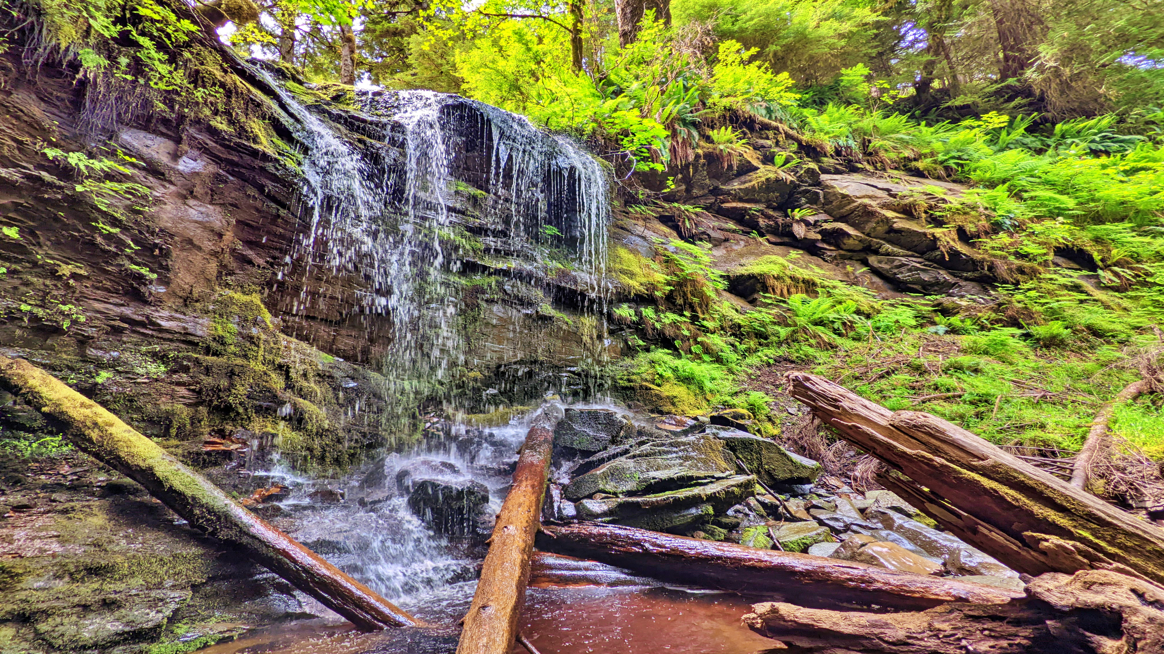
Expect a lot of “up, down, up down” for much of your hike. Once you hit the mid-way point of the Dover loop, you’ll see a marked side trail. This leads you to a lava bed and fossils – one of the trail’s key highlights. If you ignore this trail, though, and continue along the main Dover loop, the route climbs quite steeply away from Haans Creek. Near the end of your climb, a small stake in the ground indicates 400 meters of “hard” trail leads to a waterfall.
If you’re feeling ambitious, it’s certainly worth the effort; however, be advised that much of this side trail is steep and muddy with a couple of rope sections. Early in, you also have to get creative in getting over a fallen monumental cedar tree.
The final section of the Dover Trail loops back towards the road and trailhead, connecting with the trail you started near the natural log bridge at Haans Creek. Much of this trail is muddy, but home to many old-growth Sitka Spruce and Cedar trees. As you hike back towards the trailhead and Haans Creek, you’ll spy at least one CMT with a large “test hole” in it. You’ll also come across the “Skyline Trail,” which remains closed for whatever reason as of this writing.
Many who visit Haida Gwaii declare the Dover Trail to be their favourite overall hike. The terrain is varied; there are a number of side trails to visit and explore; it offers a glimpse into the old-growth forest and Haida culture; and, it represents a great way to reconnect with nature. Think of it as forest therapy.
DIFFICULTY: Moderate
TOTAL DISTANCE: 4km (longer if exploring side trails)
TIME: 3 hours
TYPE: Loop
ELEVATION GAIN: 106 meters