


FOUR CORNERS TRAILS
Naikoon Provincial Park
Early Settler history
ABOUT
Four Corners Trail is located immediately east of the Hiellen River Bridge in Naikoon Provincial Park. The route is a settler wagon road, established initially circa 1910, to access parcels of land further inland. To access this trail, begin at the Cape Fife Trailhead and follow that route for approximately 5 minutes.
You will come upon an information board detailing the Cape Fife route. A marker to your left will signify the continuance of the 10 km-long Cape Fife trail. If you look to your RIGHT, you will see an unmarked but obvious trail – this is the beginning of the Four Corners route.
The full length of the Four Corners Trail is approximately 5 kilometres; however, today, only the first 2.5 kilometres or so can be safely hiked. Significant blowdown and overgrowth make walking the full route – eventually connecting with the more popular White Creek Trail and Carr-Whittle routes – hazardous. The first part of the trail, however, makes for a pleasantly short hike.
The old settler wagon road is now fringed with tall trees and thick mosses, giving an almost otherworldly appearance. Some massive cedar trees line the route, their low-hanging branches reminiscent of a scene from Sleepy Hollow! As we hiked the trail, we kept an eye out for previous human habitation.
Unfortunately, besides the old wagon road, the only evidence of previous human development we saw was some old machinery near the start of Four Corners and the old drainage ditches, which were all dug with pick and spade. As you observe these scenes, it’s not difficult to imagine what life might’ve been like in the early 20th century, as settlers attempted to establish roots and carve new routes.
About mid-way along the hike-able portion of the trail, you’ll round a corner and enter an area we’ve dubbed “cedar alley” due to the significant number of large cedar trees that line this section of the route. Keep a close eye on these special trees because a few of them are CMTs – they were “culturally modified” by the Haida hundreds of years ago. It is a powerful reminder that you’re treading on ancient Haida territory.
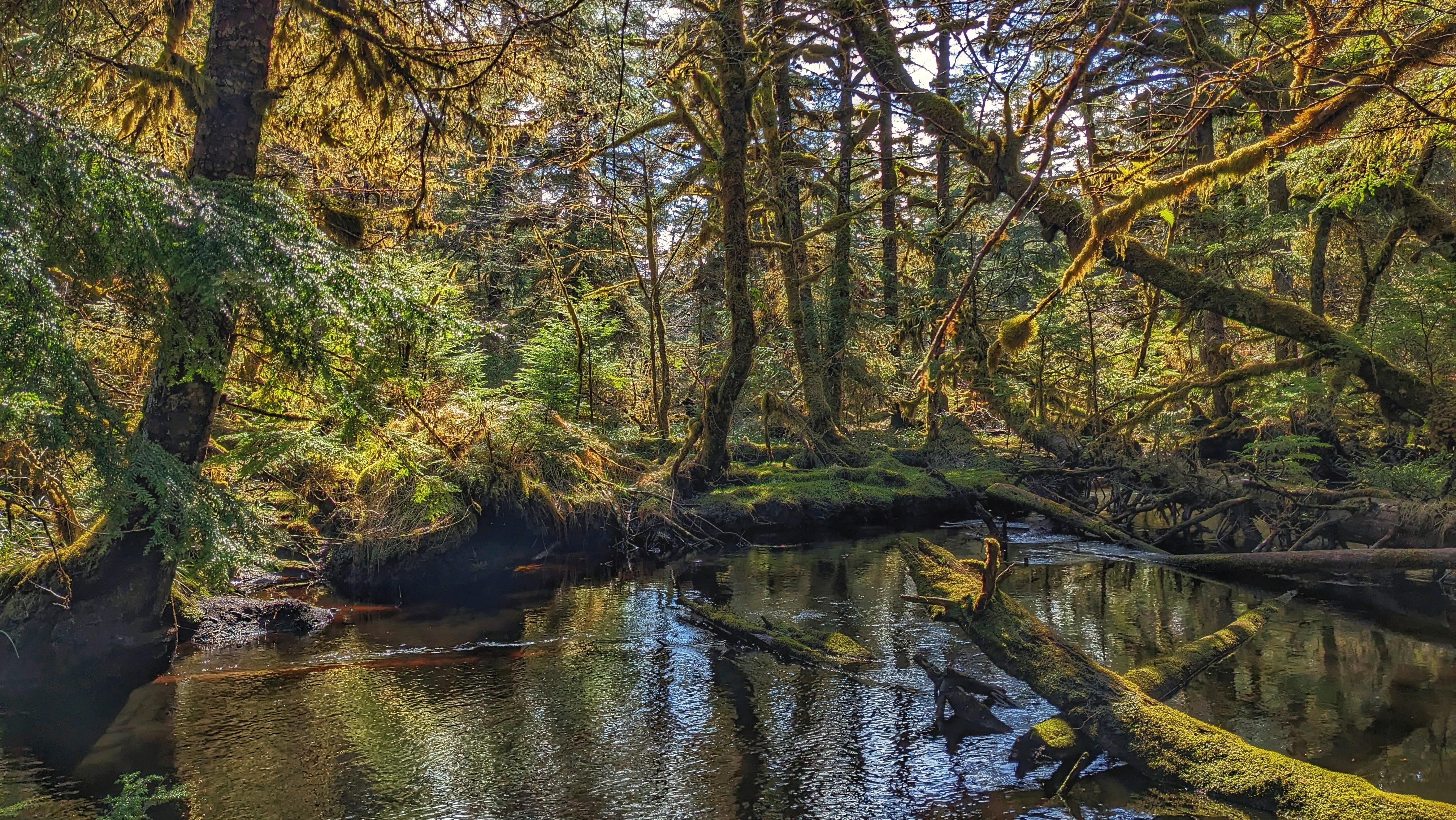
You will eventually come upon Swan Creek, which is a tributary of the Hiellen River. Of note, in her important book, Queen Charlotte Islands Trail Hikes and Beach Walks (1978), Fern Henderson reported that the bridge over Swan Creek was “very precarious and may not be usable.” 45 years later the man-made bridge is all but gone.
As such, this is the logical end-point of the Four Corners route. We say “logical” because while it is possible to go beyond the creek using a narrow natural log bridge, this is ill-advised for those not steady on their feet!
If you wish to hike this trail, parking is available in the nearby Tow Hill parking lot. It is advisable to bring a compass and/or use an app like BRMB or AllTrails as this is an unmarked/unmaintained route that is quite overgrown.
DIFFICULTY: Moderate
TOTAL DISTANCE: 5km return (hikeable portion)
TIME: 2.5 hours
TYPE: Out-and-Back
ELEVATION GAIN: None