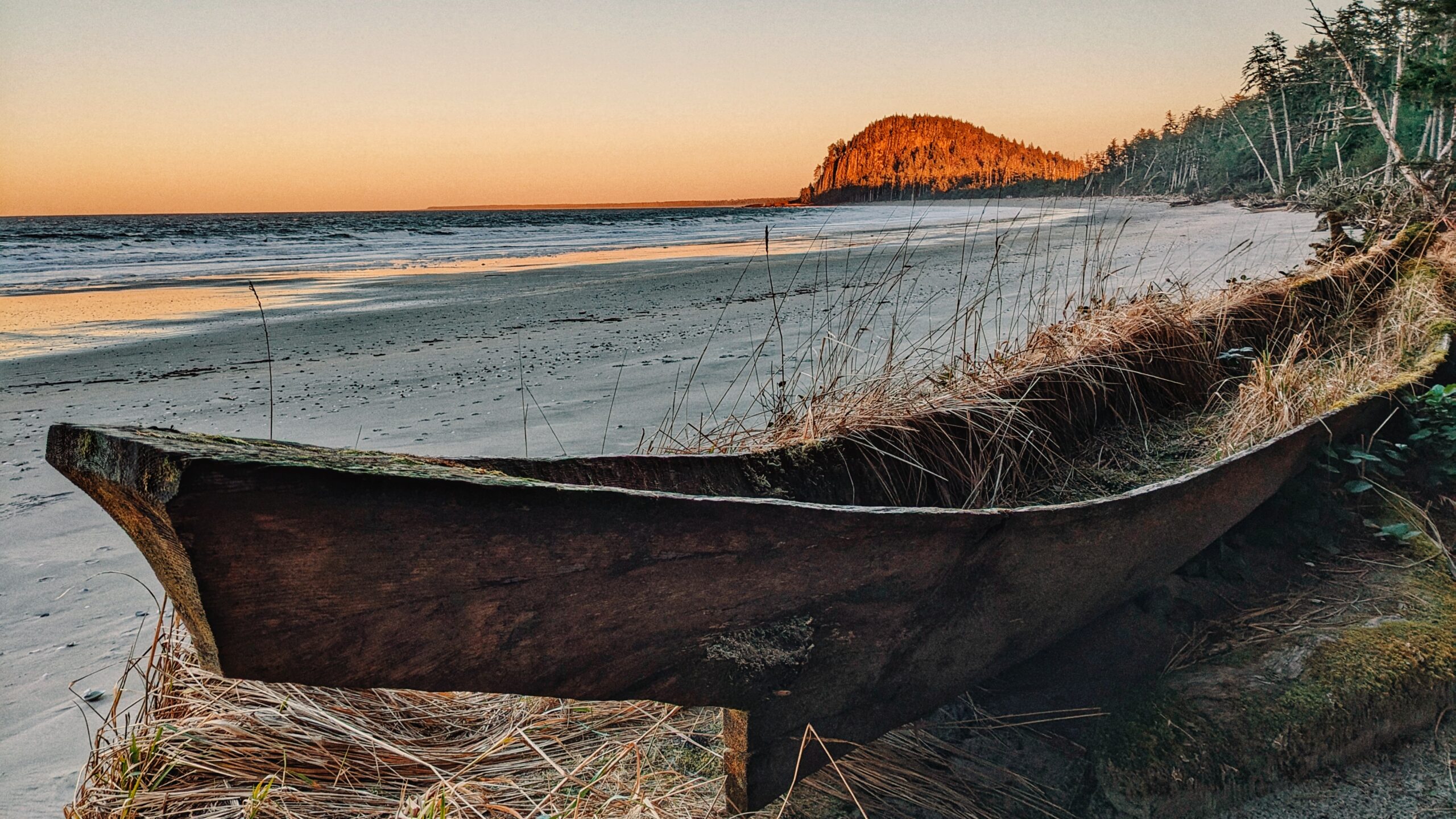
The “Naikoon Canoe Trail” is very short at just 140 meters one-way. It is also unmarked, but well worth the effort to find. Having seen and witnessed many blank or old Haida Canoes over the last few years, we were both keen and curious to locate this one after having seen it in some tourist photos.
“Where was it?” we pondered. Indeed, we knew the canoe was in Naikoon Provincial Park – and not too far from Tow Hill – because existing pictures made that plainly obvious. We initially thought we’d have to walk west to the end of Agate Beach but, as we discovered during a long day of hiking, that wasn’t necessary.
After hiking the Tow Hill/Blow Hole loop and Four Corners Trail, we began returning to Masset. As we drove past Agate Beach, we spied a small pullout on the right-hand side of the road (if COMING from Masset, the pull-out will be on your left, approximately 450 meters AFTER the road to Yakan Point). There’s enough room here for two vehicles to fit rather snuggly.
Once parked, you’ll see a small ramp and a short trail lined with clam shells. This is the trail to the “Naikoon Canoe.” It’s an easy walk, suitable for all ages, and only takes about two minutes to complete. At the trail’s terminus point, you’ll see a beautiful set-up: A number of pews and an archway, with the ancient Haida Canoe resting behind them.
The space has obviously been established for important celebrations like weddings, and it is picture-perfect! Imagine tying the knot on a clear day: An old Haida Canoe mere feet away and Tow Hill functioning as an epic backdrop. The trickster Raven chuckles in the background or a majestic eagle flying overhead.
The short trail obviously isn’t used for recreational hiking, but it serves an essential functional purpose. And, hey, if you’re not coming here to get married, at least you can take in a stunning photo and some history without travelling too far off the beaten path.
DIFFICULTY: Easy TOTAL DISTANCE: 280 meters (return) TIME: Less than 10 minutes TYPE: Out-and-Back ELEVATION GAIN: None
The waterfall can be surprisingly photogenic for its size (January 2023)
The bushes in winter (January 2021)
The short trail from the road (June 2021)
The usually unnoticed sign of the waterfall (June 2021)
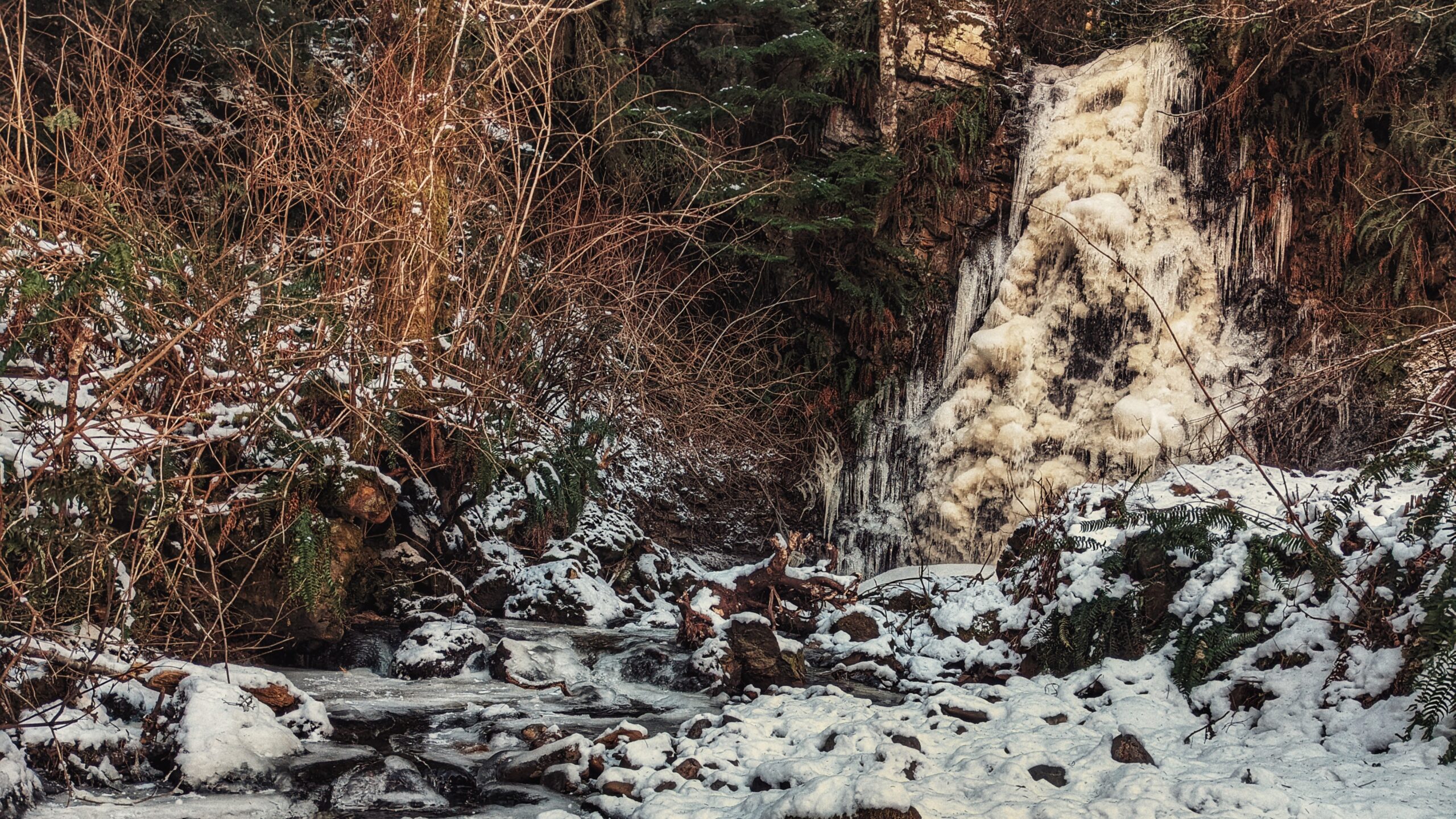
Frozen version of the waterfalls in winter (December 2021)
Spring time version of the waterfalls (May 2022)
Rock Sitting Creek Feature: Easy access to waterfall
ABOUT
HlGaa K’aayhlina Gandlaay, or Rock Sitting Creek, is something of a hidden gem hiding in plain sight – as it features Rock Sitting Creek Waterfall along its path.
Because of its close proximity to the far more popular Balance Rock, this little waterfall is often overlooked. And that’s unfortunate because the water cascading down the rock cliff can be impressive – especially after a significant amount of rainfall.
You can certainly take some awe-inspiring frozen waterfalls photos in the winter months when the creek freezes in negative temperatures. Summertime does not showcase Rock Sitting Creek Waterfall flowing abundantly as it usually dries up to a trickling sight.
Not many locals are aware Skidegate has this waterfall or most likely just have passed it by following one of the village roads close to Highway 16. The waterfalls are usually overshadowed by either the Spirit Lake Trail or the nearby Balance Rock at the beach.
Accessing this waterfall is easy. If exiting Skidegate and heading north towards Masset, drive past Balance Rock. Shortly after passing the famous glacial erratic rock, you’ll come upon Balance Rock Road on your LEFT. Turn onto Balance Rock Road and, as you round the slight corner, you’ll see a small pullout and signage indicating the waterfall.
Up until the end of 2021, you had to walk a short trail of about 30 meters to reach the waterfall. Early in 2022, however, village maintenance cleared the bushy terrain and essentially eliminated any evidence of a formal trail. Now one could easily see the waterfall from the small parking area; or, if you wish to get close, simply walk the cleared terrain up to the magnificent Rock Sitting Creek Waterfall.
While the short trail might now be a thing of the past, the sublime roar of the falls still beckons and calls to those who chase waterfalls.
Pesuta Shipwrek – the trail is a mix of beach walks, river side, and forested parts
The root system on the trail is a good massage to your soles (April 2021)
The Geiki Creek Bridge (April 2021)
The mouth of the Tllel River spilling to the ocean (May 2021)
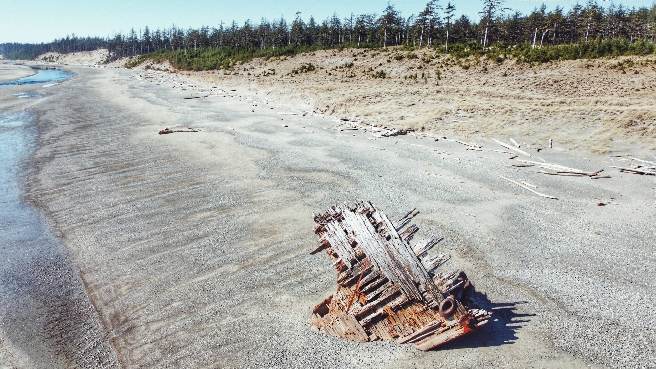
The shipwreck has been slowly being buried in the beach (Aug 2021)
Pesuta Shipwreck Trail Features Shipwreck East Beach access Sand dunes
ABOUT
When travelling to Haida Gwaii, one will inevitably come across images of the Pesuta Shipwreck: It’s featured in tourist publications, there are beautiful pictures of it on BC Ferries, and countless bloggers have written about it online.
It’s become a symbol of the Islands similar to Balance Rock or the fallen Golden Spruce. Because of that, tourists seek it out and ensure it is part of an itinerary.
What is it about the Pesuta that draws so many? The story/context isn’t all that exciting. Basically, the Pezuta was built as a wood-hulled steam freighter during World War I and, after the war, she was sent to Seattle for “liquidation.”
In 1927, the Pezuta was converted into a 264-foot log barge capable of carrying an impressive 800,000 feet of logs. In December of 1928, the tugboat towing Pezuta struggled against a powerful storm in Hecate Strait; the big barge broke free and ran aground on East Beach, near the mouth of the Tlell River.
After nearly 100 years, just the bow remains to jut out from the sand; however, what’s left is extremely photogenic and eye-catching on a number of levels.
By the way, did you notice what we did there? Pezuta vs. Pesuta? At some point after the ship had run aground, the name got misspelled as “Pesuta” and that’s what ended up sticking. History can be funny at times.
The Pesuta Shipwreck Trail is probably the third-most-popular hiking trail on Haida Gwaii, only behind Tow Hill and the Blowhole. At 6 kilometres one-way (the posted signage at the trailhead says 5 km, but this doesn’t seem right), we’d suggest making this hike a nice day trip so as to truly enjoy the forest, river, beach and remnants of Pesuta.
When we hiked the route, it took about 2 hours and 35 minutes, one-way – and that was moving at a fairly leisurely pace. The trail is good for all skill levels because the route is mostly flat, with very little elevation gain.
To access the Pesuta Shipwreck Trail, simply visit the Tlell River Day Use area adjacent to the Tlell River Bridge. Here, you’ll see a few picnic tables and signage indicating the route. There’s also a pit toilet available.
We should also note that this site represents the start of the multi-day East Beach Trail hiking adventure. One day, when the Pesuta has completely gone back to nature, the “Pesuta Shipwreck Trail” will cease and only the East Beach Trail will remain.
The hike out to Pesuta is pretty straightforward. After passing the pit toilet, the trail splits in two – one path leads down to the river while the other heads up into the forest. Some have suggested taking the “tree portion” one-way and the “beach/river trail back,” but this is not advised because the riverbank near the Day Use area is mostly slippery silt for at least 1.5 kilometres. Trust us when we say it’s not fun to walk on!
Instead, follow the East Beach Trail signage (forest). The first 2 kilometres take you through a beautiful old-growth forest of Sitka Spruce, Cedar and lush, green moss.
During Spring, it is possible to observe Fairy Slippers in the moss. Indeed, this portion of the trail is well-marked and easy to navigate. For most of it, you walk along a ridge high above the Tlell River before briefly moving inland to cross Geikie creek.
We’d only advise using a bit of caution when walking along the ridge because the many tree roots do have the potential to trip you up! After clearing the forest, you spend the remaining 4 kilometres walking alongside the Tlell River until it empties into the Pacific Ocean.
From here, the Pesuta is visible in the distance, just a few hundred meters further up East Beach. On a clear day, this portion of the hike can be quite beautiful, especially as you walk past abandoned cabins and massive sand dunes. At the same time, it’s surprisingly hard on the feet!
Once you reach the Pesuta, it’s not uncommon to spend a fair amount of time here. We visited the wreck for a good hour, examining it and taking photos before making our way back to the trailhead (we lacked the stamina to walk the remaining 80+km up East Beach!).
The wreckage has a ghostly beauty to it: A visual memorial of humankind’s technology pitted against Mother Nature. The ship has sat here for nearly a century, getting beaten by waves and wind, and yet it’s still here – for now.
The little lovely details makes this cabin memorable
Across the back of Remi’s cabin is the Smuggler’s Cove
Well-built Remi’s cabin
Remi’s cabin with the red door
The front of the cabin is a secluded beach cove
Rock formation
Fern young growth forest leads to the beach
Ferns, ferns, ferns!
Some sections require some ropes
The trail also opens to the rocky beach facing Graham Island
The trails skirts around the beach
The Alliford Bay section where the Kwuna Point Trail begins
The trail head has a commemorative tribute
Kwuna Point Trail Features: Remi’s Cabin Private Beach Cove Rocky beach facing Graham Island
ABOUT
Kwuna Point Trail is located on Moresby Island at Alliford Bay. To find it, assuming you’re driving off the Kwuna ferry, turn LEFT onto Kwuna Point Road and drive to the end of the road. You will see a small parking lot and dock – park here.
Like most trails on Haida Gwaii, Kwuna Point does not have formal trailhead signage; however, it is clearly signified by the Stranraer 935 Memorial.
The trail is essentially a loop and takes you around Kwuna Point before exiting back onto Kwuna Point Road, approximately 300 meters from the parking lot. Trail markers are sporadically placed throughout, but the trail is easy enough to follow, so there’s practically no chance of getting disoriented.
Above all else, what we appreciated about this short hike was the varied terrain you pass through: Lush ferns, thick moss, rocky beach and young forest of cedar and Sitka spruce. If you pass through this trail in late May or early June you’ll also get to spy many a lovely fairy slipper. While Kwuna Point Trail is mostly flat, there are a few steep sections – two of which have ropes to assist – so good footwear is recommended.
Not far from the trail’s end point, a short side trail also leads to a small cabin – built by a grandfather for his grandson. This cabin is nestled in a protected beach cove that faces Graham Island. In low tide, the beach is a safe place to do some beach combing. You can enter and visit the cabin (there is a guestbook), but please leave it as you found it.
From the cabin, look across to nearby Smuggler’s Cove! We can imagine this is also a good spot for kayaking, paddle boarding, and with a wet suite swimming in the summertime.
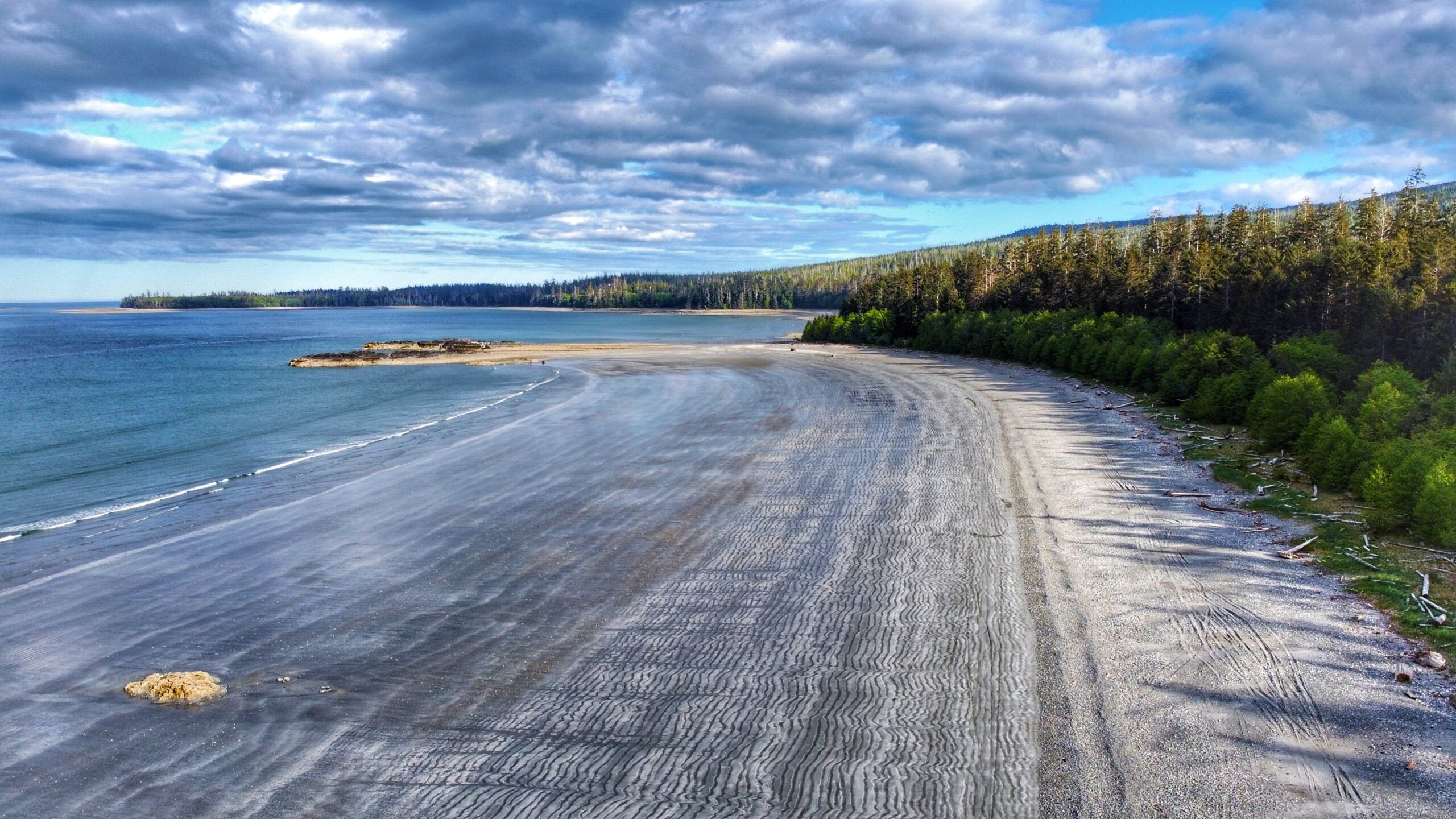
Gray Bay – its beach boasting the grey fine sands on the coastline
The seascape views are indescribable
Gray Bay beach in low tide reflects the blue skies on the water reflection
Endless beach at Gray Bay with the camping grounds along the shoreline
The other side of the beach shoreline
In low tide, you can walk on these small sand spits on the beach
The logging road sign leading up to the camping ground of Gray Bay
The deep forests opposite the beach cradle the camping grounds
Gray Bay Features Fine gray sands RV camping grounds Mountain views
ABOUT
The Gray Bay Recreation Site is located within the Kunxalas Conservancy and is a true wilderness beach area. To access Gray Bay, you must travel approximately 25 kilometres from Sandspit: First, along Copper Bay Road; second, along the Copper Bay Mainline; third, along Spur 20; and, finally, Gray Bay Road.
Please note that once you depart the paved Copper Bay Road you will be driving along active logging roads, so proper precautions should be taken. Nevertheless, the drive out to Gray Bay is well worth the effort.
As you drive along the Copper Bay Mainline, you’ll eventually come upon the seasonal Copper Bay village, which is used by the Haida between April and May during the annual sockeye salmon run.
The area features a mix of old and modern cabins, which are inhabited during the all-too-short fishing season. If you happen to visit during this time, the Copper River becomes a proverbial beehive of activity as the Haida gather their traditional food to roast on an open fire, smoke (fish) and prepare gilgii (dried fish).
In many respects, this short period of time highlights, only too clearly, important cultural traditions and demonstrates how they’ve continued to thrive over thousands of years.
After you leave Copper Bay, the logging road gets significantly rougher – lots of deep potholes – and so progress could be slow depending upon the vehicle type. Keep an eye out for posted signage indicating the direction towards Kunxalas and the Gray Bay Recreation Site.
Once you reach the recreation area, you’ll observe there are 20 campsites (available on a first come-first serve basis). All are fairly spacious and offer easy access to Gray Bay beach. Picnic tables, fire pits and outhouses are also available; however, there is no potable water on-site and there is no internet service.
In this respect, Gray Bay, because of its remoteness and limited amenities, allows you a golden opportunity to connect with nature and experience Haida Gwaii at its best. Instead of watching YouTube or texting with friends, get in tune with nature, and enjoy the supernatural forest and its interconnectivity with the nearby Pacific Ocean.
Besides camping, the major attraction at the Gray Bay Recreation area is, obviously, Gray Bay Beach. This crescent-shaped 3km stretch of pebbly beach and compact sand is an absolute delight and is, in our opinion, one of the best beaches on Haida Gwaii.
At low tide, one could seemingly walk for miles along the unique “wavy” gray sand, admire the delicate sea life in nearby tidal pools, beach comb, ride an ATV, kayak or enjoy a nice dip in the ocean. If hiking is more your thing, the 12km (one-way) Cumshewa Head Trail can be found at the south end of Gray Bay. Please note, though, that a lack of maintenance has resulted in this trail becoming very overgrown in recent years.
If nothing else, do observe how Gray Bay is a microcosm of the ancient Haida philosophy that everything is connected to everything else: The ocean, taan (black bear) and forest all depend on one another. And we depend on them. If you have the time, the Secret Cove Trail is just nearby this recreation site.
DIFFICULTY: Easy TOTAL DISTANCE: 3km (one-way) TIME: Approximately 40 minutes TYPE: Beach walk ELEVATION GAIN: None
The man-made beach crow’s nest can have a nice vista view
Low tide view of Jungle Beach
Jungle Beach Features Beach access Picnic & Swimming Family-friendly
ABOUT
Located approximately 20 kilometers north of Skidegate, Jungle Beach is a popular swimming destination for locals and tourists alike. Its ease of access – just off the highway – concomitant with the roughly 2 kilometers of sandy beach makes for an appealing day out.
The beach is clearly marked with posted signage, so it’s difficult to miss. Secondary beach parking is indicated by a carved black bear, which has definitely seen better days. In the last ten years, its arms have rotted away and, well, we wouldn’t be surprised if it’s fallen over in the next five. In any event, an outhouse is also available here. Jungle Beach is accessible via a short path.
Primary parking at Jungle Beach is located at the next pullout, just a few feet north of the black bear. Here, you’ll spy a covered shelter – perfect for picnicking – and a “fort” right near the entrance to the beach.
The fort, which has been in place for just over 20 years, is made primarily of driftwood and beach rock and features a unique spiral staircase. Once at its zenith, enjoy great views of the beach and horizon beyond! Many an imaginative child has likened this fort to a ship at sail in the sea!
At low tide, you could seemingly walk for miles along Jungle Beach before hitting the ocean for a cool swim. The beach, with its silky smooth sand, is perfect for a little outdoor therapy: Stroll with a loved one, explore the tidal pools, or take out the croquet balls and enjoy a game with the family! As the day winds down, relax on the beach and listen to the waves lapping at the shore.
But, you may be wondering, why “Jungle Beach”? Apparently, an early owner of the Premier Hotel bestowed the “Jungle Beach” name upon this place. How’d that come about?
The generally accepted story is that each winter, Haida Gwaii’s vicious storms cast such a mass of logs upon the beach’s entrance that it reminded folks of a “jungle.” A more recent theory – and one that sounds far more appealing – is that the dark waters of Jungle Creek and the forest immediately behind Jungle Beach serve as inspiration for the name.
Indeed, if you take a walk in the forest directly across the road from the carved black bear (start of the Drain Lake Trail), you’ll see what we mean!
DIFFICULTY: Easy TOTAL DISTANCE: The beach is approximately 2km in length TIME: 40 minutes TYPE: Beach walk ELEVATION GAIN: None
Tarundl Creek passing by the flat meadows (Jan 2023)
Mouth towards Kagan Bay (Jan 2023)
The trail head of the Tarundle Loops
The fern filled forest is part of the trail
The small trail path in the forest
The Flood Plains greet you after the forest parts
Tarundl Creek flood plains
Sunset on the flood plains
Tree along the creek
Tarundle Creek (Low Tide) Jan 2021
Dead falls and moss along the trail
Tarundle Creek calm in low tide
Coming out of the forest back into the Honna Road
The trail sign showing the trail terminates to Honna Road
Tarundl Creek Trail Features Access to the Flood Plains Near Kagan Bay Recreation Site Three Trail loops to explore
ABOUT
Tarundl Creek is part of the bigger Kagan Bay Recreation Site. Located west of Daajing Giids (less than 10 minutes by car), and along the Honna Service road, the Kagan Bay Recreation Site offers a host of activities for all members of the family to enjoy. The site has everything whether you want to go fishing, kayaking, hiking, or camping. Indeed, the rugged recreation area,which has Sleeping Beauty as a backdrop, offers us a reprieve from the hurly-burly of daily life while concomitantly providing an opportunity to better appreciate nature.
As you drive along the Honna Service road, you will come upon the Kagan Bay Day Use Area at about the 2 kilometre mark. The site features a picnic table, fire ring and beach access. At low tide, one could walk quite a distance onto the beach; however, we find it a little too “sinky” for our liking.
For us, the big attraction of the day-use area is the Tarundl Creek Trail. Of the local village trails, this one is by far the easiest – but that’s not to suggest it’s stale by any means. Clocking in at 1.5 kilometres in length, the trail takes you through the lush rainforest and rich floodplain.
In this respect, it allows one to see the unique interplay between forest and ocean and how those two systems depend upon one another. Indeed, it is little wonder higher education societies often use Tarundl as a learning ground in the Fall when salmon are spawning and the bears are gathering nutrients for winter: Gina ‘waadluxan gud ad kwaagid.
That said, the yellow markers along Tarundl Creek Trail can be challenging to find at times. As you start out on the trail, you will follow an old skid road, which will lead onto the floodplain. Once here, keep to the right and you will see the path returning to the forest (of course, at low tide, take some time to explore the plain – it’s lovely).
Once back in the forest, you will see a Y on the trail. We recommend going to the LEFT for a richer and far more rewarding hike; otherwise, if you take the path on the right, your hike will end in short order – less than 10 minutes – and you’ll quickly find yourself back on the Honna Road.
While the Village of Daajing Giids identifies the Tarundl Creek Trail as a loop trail, it is more appropriately described as an out-and-back route because the start and end points are completely different points; however, we suppose you could call this a “loop” if you follow the Honna Road back to the Kagan Bay Day Use Area.
Pebbles and rocks on the beach makes a beach walk interesting
Top view of the beach trail
Mists over calm waters
The other side of the beach trail going towards the “Beach Access”
Kagan Bay Beach Trail Oysters on the shore Camping grounds with fire pits Water activities
ABOUT
Located west of Daajing Giids, and approximately 3 kilometres along the Honna Forest Service road, is the Kagan Bay Beach Trail. The Kagan Bay Beach recreational site offers six user-maintained campsites, all of which face the beach.
Each site features a picnic table and fire ring (perfect for roasting hotdogs or marshmallows!), and there is a single – very basic – outhouse meant to service all 6 sites.
At low tide, it’s not uncommon to see Great Blue Herons on the pebbly beach, or locals harvesting luscious bivalves like oysters and clams. The area is ideal for kayakers and those looking to get out into nature, but not too far into the wild. Right across the beach on any of the campsites, there was a supposed oyster farm that used to operate in the area. It has now since been discontinued, but the chances of anyone finding oysters are not uncommon.
Of interest to hikers and beachcombers, the Haida Gwaii Trails Strategy identifies this area as the informal “Kagan Bay Beach Trail.” This rough, unmaintained route basically follows the shoreline and acts primarily as a link to the six campsites.
In that regard, we wouldn’t really call it a recreational trail – it’s more functional – but one could walk beyond the campsites and explore more of the rugged coastal terrain if they so wished. In fact, on a low tide, if you’re feeling really adventurous, it is possible to hike around the point (the official “end” of the Kagan Beach Trail) for another 770 meters and link up to Tarundl.
We should note that the Kagan Bay Recreation Area basically ends at the Kagan Log Sort. When you arrive at this part of the road, you will see a sign indicating the route for “Public Beach Access.” It is not advisable to drive beyond the Sort without a 4×4 vehicle.
DIFFICULTY: Easy TOTAL DISTANCE : 2.7 kilometres (return) TIME: 1 hour TYPE: Out and back ELEVATION GAIN: None
The Haydn Turner Beach trail shale rock formation makes for some picturesque terrain
The trail head entrance going into the beach trail
The other side of the beach trail looping back to the camp grounds
One of the many spider trails along the beach
Magical misty day makes the trail mystical
On the beach trail
The other entrance of the trail loop – near the campgrounds
A bit of forest walk
The Crabapple Creek spilling into the sea
Interesting tree roots in the loop
The road towards the camping grounds
HAYDN TURNER BEACH TRAIL Views of Daajing Giids Municipal Cemetery Beach combing
Note: If camping in the area, please respect your surroundings and place garbage in the appropriate receptacle and extinguish all campfires!
ABOUT
The Haydn Turner Beach Trail is located at the end of Oceanview Drive, towards the western end of Daajing Giids. Once at the terminus of Oceanview Drive, you’ll spy Haydn Turner campground signage at the head of a narrow road.
Following this road will bring you into the campground and, at its end, the village cemetery. The beach trail is accessible at a few points here – all of which are clearly denoted with “BEACH TRAIL” markers.
While the trail is designed to be a major feature of Haydn Turner Campground and its guests, this easy stroll along the pebbly beach is typically enjoyed by locals as well. It’s not unusual to see people walking their dogs here.
A mix of course sand and black shale rock, the Haydn Turner Beach Trail packs a varied terrain in its short 1 kilometer. On the one hand, you’re treated to beautiful views of nearby Sleeping Beauty Mountain; on the other hand, Bearskin Bay and Skidegate Inlet beckon and call.
When the tide is low, the sandy beach is visible; however, we would not advise walking down here because the sand is very “sinky” and could get you in some trouble rather quickly. Instead, if you must venture beyond the rocky shore, do so on a kayak as this place represents a popular jumping-off point for those keen to get onto the water.
Haydn Turner, as a campground, features 8 sheltered RV sites and 2 walk-in tent sites, the latter of which hug the pebbly shores. Picnic tables, fire pits, and a couple of pit toilets are also available. We should note that the campsite basically sits at the doorstep of Daajing Giids cemetery while the beach trail loops around it (with a couple of small “spider trails” hugging the woods).
Some may find this unsettling while still others might find a sense of peace and calm – especially if you happen to be walking the beach during a misty afternoon.
DIFFICULTY: Easy TOTAL DISTANCE: 1 Kilometer TIME: 20 Minutes TYPE: Loop ELEVATION GAIN: None
DELKATLA NATURE SANCTUARY TRAIL KEY FEATURES Delkatla Bird-watching Dog-walking
ABOUT
Described by the Village of Masset as “one of [its] main attractions,” the Delkatla Nature Sanctuary Trail was established in 1969 and is a 290-hectare intertidal wetland area that serves as a “critical migratory stopover for birds during spring and fall migration, an important wintering waterfowl area and home to many summer nesting species.” Since its establishment, some 50 years ago, over 140 species of bird have been observed here. We think the Nature Sanctuary is best appreciated as a two-part experience.
The first part of the Delkatla experience is the Nature Centre, which is located at Trumpeter Drive. Admission is a very reasonable $2. The Centre is a place of orientation: Here you can learn a good deal about the local flora and fauna by observing a number of detailed write-ups on flowers, plants, and muskeg. The Centre also features a few “stuffed” examples of birds from the area. It’s a small space, but it provides a wealth of information.
The second part of the Delkatla experience is the actual nature walk itself. The walk is approximately 5 kilometers in length and takes you on a mix of trails and roadside. Depending on your purpose, you may or may not find this segment of the experience somewhat dull because a fair length of the route is actually on roads. In fact, if you wanted, you could “cheat” and drive along a significant portion of the sanctuary without diluting one’s overall enjoyment – many of the viewing platforms are along the road, or just off it.
If beginning your hike at the Nature Sanctuary, walk north along Trumpeter Drive for approximately 700 meters until you hit Northwest Drive. From here, you leave the paved road and start walking northeast along a gravel dike road, bringing you deeper into the sanctuary and its unique wetland environment.
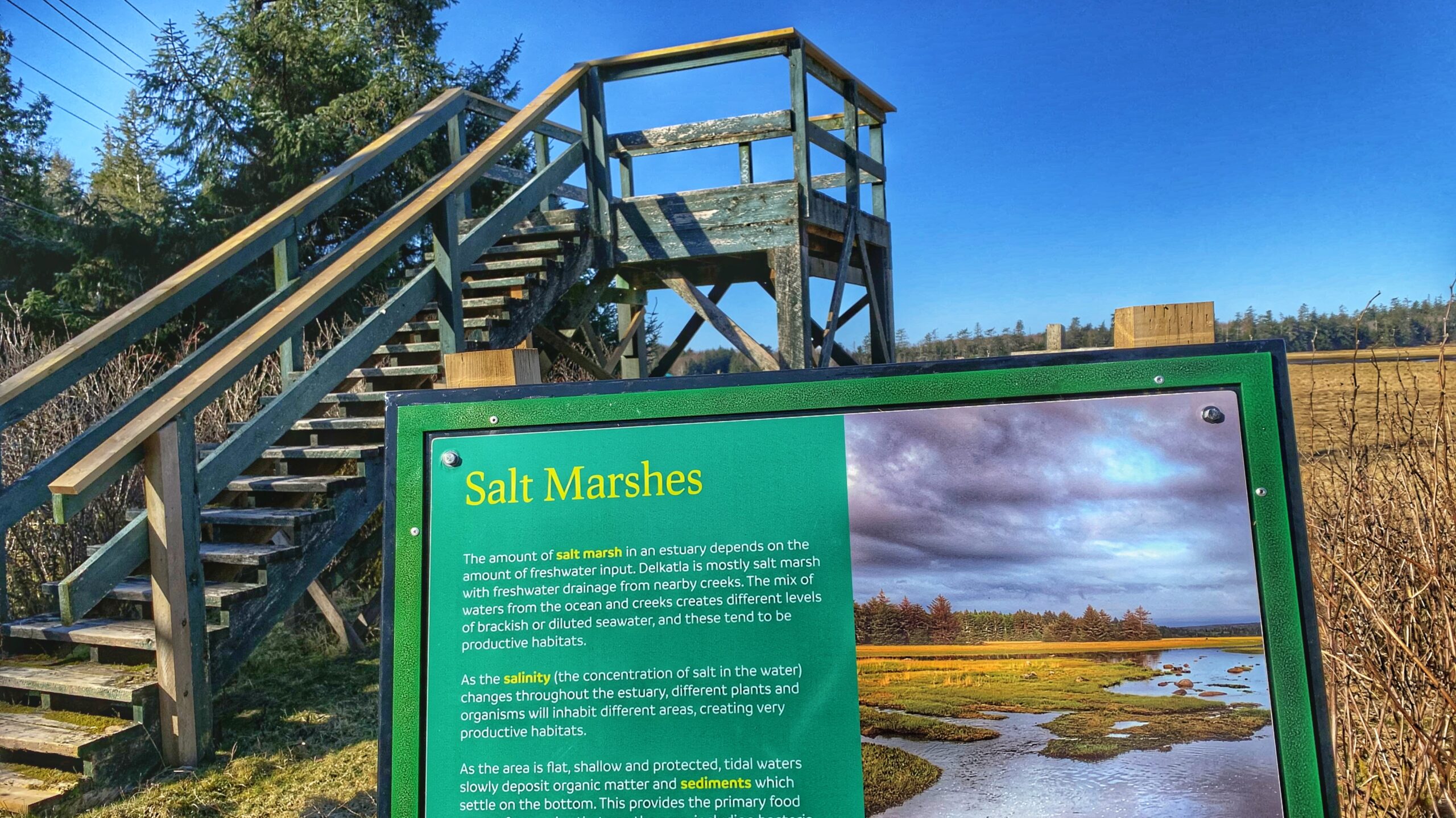
Of note for birders, a viewing tower can be found in this area. Keep a keen and watchful eye for lovely sandhill cranes, blue herons, Canada Geese, ravens, and seagulls.
Of historical note: This section of the route is also known as the “Stepping Stones Trail” because, once upon a time, the road you’re walking on was made up of stepping stones to help people cross the intertidal slough.
After hiking approximately 1.4 kilometers, you will come upon Masset Cemetery Road. From here, you can hike south along the road and connect up with the Simpson Tower Trail, which will bring you near the end of Cemetery Road. Or, you can walk roughly 750 meters north towards Masset Cemetery and its Beach Access Trail.
Assuming you chose to hike south along the Simpson Tower Trail – which also provides beautiful viewing opportunities of Delkatla Sanctuary – you’ll eventually come upon the end of Cemetery Road. From here, walk west along Tow Hill Road back towards Masset. Along the way, you’ll come upon another viewing tower. Read the information boards on site and then continue your walk back into Masset.
Indeed, from a hiking perspective, Delkatla and its network of trails make for a good family walk; however, those wishing to explore more of Haida Gwaii’s wild side might be a little underwhelmed. Birders, on the other hand, should enjoy this experience at all times of the year. It truly is a birdwatcher’s delight!
Contains information related to marketing campaigns of the user. These are shared with Google AdWords / Google Ads when the Google Ads and Google Analytics accounts are linked together.
90 days
__utma
ID used to identify users and sessions
2 years after last activity
__utmt
Used to monitor number of Google Analytics server requests
10 minutes
__utmb
Used to distinguish new sessions and visits. This cookie is set when the GA.js javascript library is loaded and there is no existing __utmb cookie. The cookie is updated every time data is sent to the Google Analytics server.
30 minutes after last activity
__utmc
Used only with old Urchin versions of Google Analytics and not with GA.js. Was used to distinguish between new sessions and visits at the end of a session.
End of session (browser)
__utmz
Contains information about the traffic source or campaign that directed user to the website. The cookie is set when the GA.js javascript is loaded and updated when data is sent to the Google Anaytics server
6 months after last activity
__utmv
Contains custom information set by the web developer via the _setCustomVar method in Google Analytics. This cookie is updated every time new data is sent to the Google Analytics server.
2 years after last activity
__utmx
Used to determine whether a user is included in an A / B or Multivariate test.
18 months
_ga
ID used to identify users
2 years
_gali
Used by Google Analytics to determine which links on a page are being clicked
30 seconds
_ga_
ID used to identify users
2 years
_gid
ID used to identify users for 24 hours after last activity
24 hours
_gat
Used to monitor number of Google Analytics server requests when using Google Tag Manager