• Five Mile Trail
  • Five Mile Creek
  • Five Mile Trail
  • Five Mile Trail
  • Five Mile Trail

Five Mile Beach Trail Features
– Five Mile Island view
-Conehead view


NOTE: Rennell Sound is subject to variable weather conditions, heavy rainfall, and landslide risk, particularly from September thru May. Be prepared for emergencies and road closures during weather events.


ABOUT

The Five Mile Beach Trail is located in Rennell Sound, just outside the Duu Guusd Conservancy. To reach this trail, and others in the area, one requires a good deal of patience and a high clearance vehicle because the old logging road out to Rennell is in poor shape and rife with large potholes. Once you make it, however, you will be rewarded with some of the most beautiful beaches anywhere in the world.

If traveling from Daajing Giids, drive approximately 22 kilometers along the QC Mainline (use appropriate caution as these are active logging roads). You will come upon a blue sign with white text pointing you WEST towards the Duu Guusd Conservancy and Rennell Sound. You are now on the Rennell Sound Forest Service Road. From here, it is a 15 kilometer drive towards the Sound. Along the way, you will drive through Rennell Pass, including Rennell Hill with its steep 25% grade. While there is no longer active logging in this area, it is strongly recommended that you still drive with caution because the Rennell FSR is narrow and filled with significant potholes. For this reason, a high clearance vehicle is suggested.

LOCATING THE TRAILHEAD

Once at the bottom of Rennell Hill, you will come upon the Rennell Sound Recreation Site, which is rustic but features a boat launch, camping sites, and outhouses (no potable water). There are also beautiful views of the surrounding mountainscape. From here, drive approximately 3.7 kilometers north along the Rennell FSR. Once past the former dryland sort, you should spy the “5 Mile Beach BC Forest Recreation Trail” sign to your LEFT. A small pullout with space for two or three vehicles is immediately behind the trailhead marker. Welcome to the Five Mile Beach Trail!

HIKING THE TRAIL

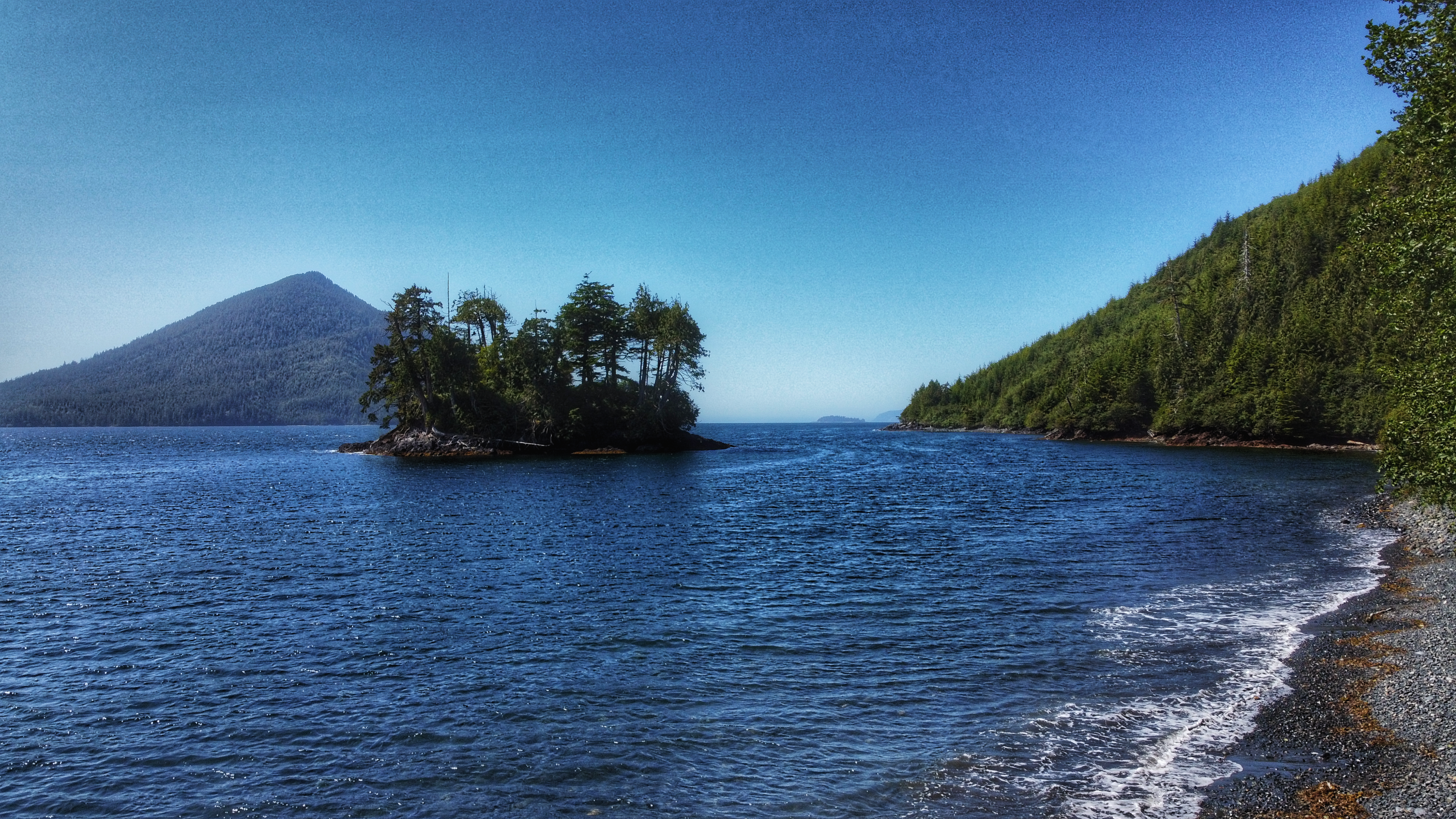
The Five Mile Beach Trail is short and straightforward. Clocking in at just 180 meters, it should take no more than a few minutes to reach the rocky beach. The trail, while not formally maintained, is clear. Step with caution as you near the beach, however, because there are some minor tree roots to watch out for. Once at the beach, take some time to admire the rocky shore, the surrounding mountains, and the eye-catching Five Mile Island. For those wishing to camp, there is space to set up a small tent just off the trail, adjacent the beach.

DIFFICULTY: Easy
TOTAL DISTANCE: 180 meters (one-way)
TIME: Less than 5 minutes
TYPE: Out-and-Back
ELEVATION GAIN: None

  • Yakoun Old Growth Spruce Grove
  • Yakoun Old Growth Spruce Grove
  • Yakoun Old Growth Spruce Grove

Yakuon Old Growth Sitka Spruce Grove Features:
Yakuon River fishing spots
Old growth trees

ABOUT

Yakoun Old Growth Sitka Spruce Grove – this grove of beautiful old growth trees is situated along the Yakoun River, near the “30 mile” marker. Together these trees give a small glimpse of what was common place in Haida Gwaii’s forests before unfettered logging practices destroyed large areas of old growth on the archipelago.

Perhaps the most famous of the old growth trees in this area is the one known as the “Bellis Spruce,” which is named after Skil Q’uas Dick Bellis. A self-described “BSer,” Mr. Bellis spent most of his working life in the forest industry as a heavy duty mechanic. He was also a notable carver. Perhaps his most well-known piece is an eagle sculpture carved in 1993 in memory of his brother, Ted. The eagle sculpture sat at Jungle Beach, next to the Black Bear, carved by Ted, until it mysteriously vanished in 2001 (the aging Black Bear vanished in 2023). Thought to be lost forever, the sculpture was found in Prince George in 2009 and returned to the Bellis family. In his later years, Dick Bellis served as a guide for tourists visiting Haida Gwaii. Along with jaunts to Rennell Sound, Bellis often took his guests to the Yakoun River to view the giant Sitka Spruce, which he’d say was “the biggest tree they’ll ever see.” And he was probably right.

Estimated to be approximately 750 years old (BC Forest Services does not have an increment bore large enough for a more accurate age), with a circumference of 45 feet and a height of just over 68 metres, the “Bellis Spruce” puts everything into perspective and highlights, in microcosm, the essence of Haida Gwaii. The giant Sitka Spruce gained significant attention in 2009 when it was officially recognized as the largest Sitka Spruce in BC – a title it held for a couple of years. Unfortunately, the “Bellis Spruce” was declared dead in 2011; however, it is still standing and leaves those lucky enough to find it in awe.

LOCATING THE TRAILHEAD

There is no formal trailhead marker for this short trek into the Yakoun Old Growth Sitka Spruce Grove. If you wish to locate the Bellis Spruce and its surrounding grove of giants, you must drive approximately 30 kilometers outside of Daajing Giids along the QC Mainline logging road. At this point, the Yakoun River will be clearly visible on your RIGHT. Look for a suitable place to pull over, walk through the woods, and safely cross the Yakoun River. About a decade ago, a large log functioned as a natural “bridge,” but it has since washed away. As such, one should only try crossing the Yakoun when the river is low – typically during the late summer months.

HIKING THE TRAIL

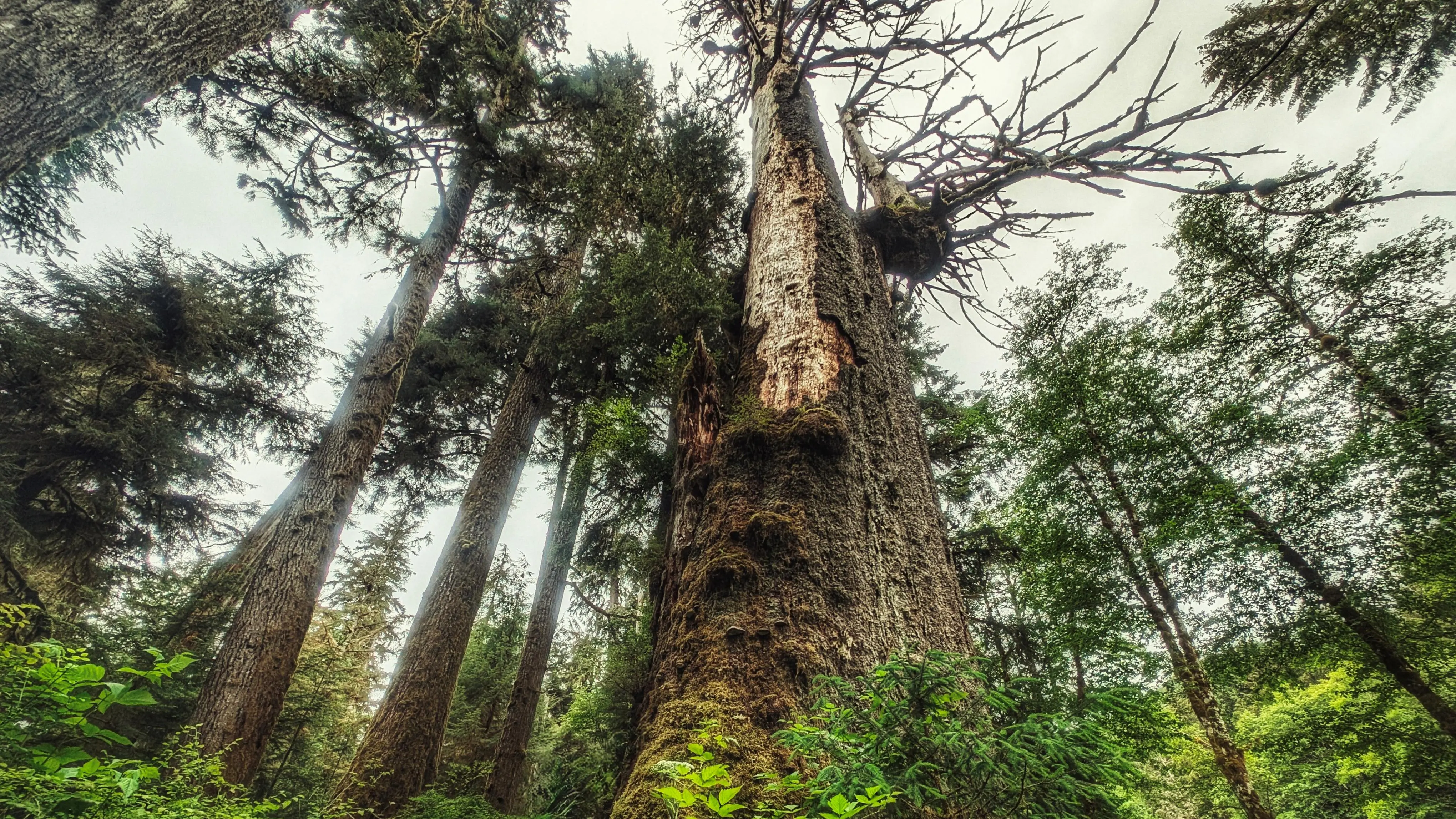
As noted, this is not a formal trail of the Yakoun Old Growth Sitka Spruce Grove; however, you should see a vague path once you cross the river. It will lead you to an old de-activated road. The grove of old growth Spruce is facing the river. Take your time and explore these monumental trees. You will feel dwarfed in their presence, but this is forest therapy in the best sense of that term! Use caution as it is often difficult to see where you are stepping.

DIFFICULTY: Moderate
TOTAL DISTANCE: Variable
TIME: 30 minutes
TYPE: Out-and-Back
ELEVATION GAIN: None

  • Sachs Creek Trail
  • Sachs Creek Trail
  • Sachs Creek Trail
  • Sachs Creek Trail

Sachs Creek Trail Features
Fishing spots
Endemic tree frog sighting

ABOUT

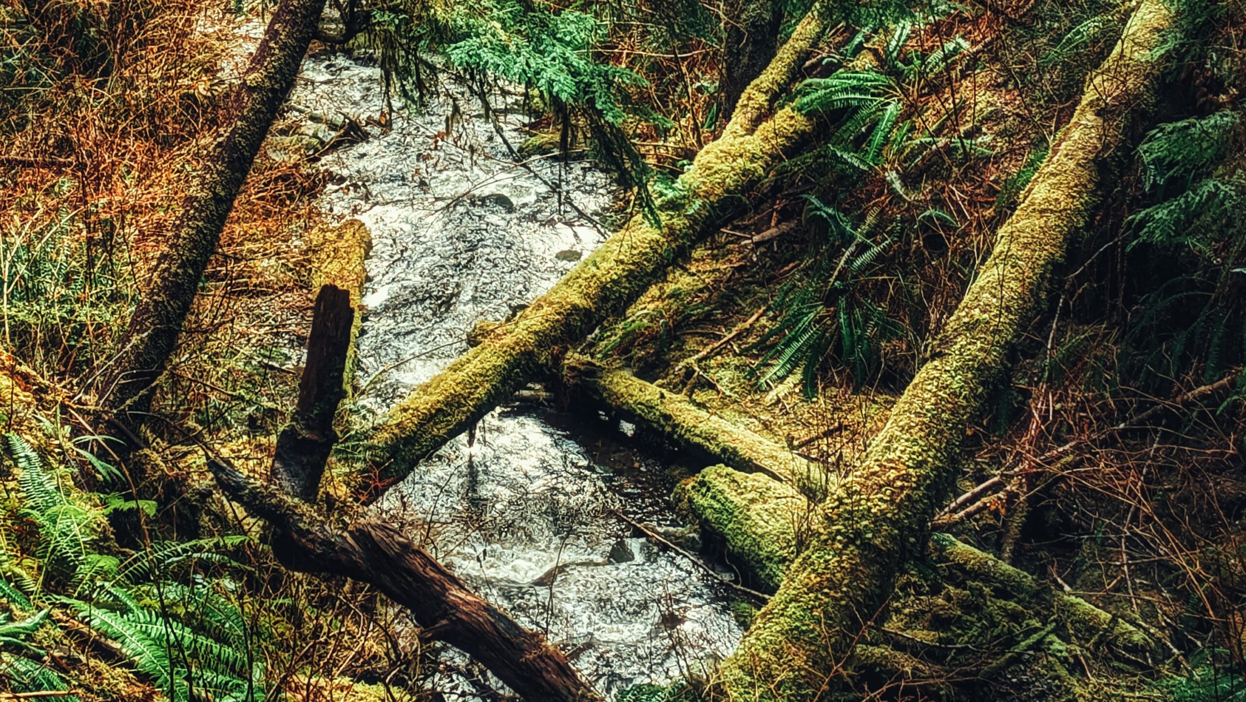
Located roughly 1.6 kilometers east of the Moresby ferry waiting area, and just off Highway 16, you will find the informal Sachs Creek Trail. The trail is unmarked and isn’t primarily used as a recreational hiking route; however, it is nevertheless listed in the Haida Gwaii Trails Strategy and Backroad Mapbooks (the latter resource is available at the Daajing Giids Visitor Centre). In the early 1980s, Sachs Creek was utilized as part of a UBC project that used tandem V-shaped gabion weirs for improving spawning habitat for pink and chum salmon. In more recent times, the creek has been used with some regularity by university students in environmental studies programs. Today Sachs Creek remains an important salmon-spawning creek. 

LOCATING THE TRAILHEAD

Because the trail is unmarked, getting to the trailhead can be a little tricky. If you are using the Backroad Mapbooks app, it will tell you to “look for a road branching south off the Highway 8km before Kwuna Point Road.” Ignore this advice. The road it refers to is deactivated and so overgrown that it is unrecognizable as a road. Instead, if coming from the Kwuna ferry, drive approximately 600 meters along Highway 16. Shortly after crossing the Sachs Creek Bridge, you will see a narrow dirt road to your right. If you are driving a truck, it is possible to drive the 1.08 kilometers along this road to the unmarked Sachs Creek Trailhead; however, we recommend parking your vehicle on the wide curb and walking to the trailhead. There is no signage indicating you are on the Sachs Creek Trail. Instead, you will see an old logging road to your left and some alders and ferns to your right that lead down to Sachs Creek. The trail is characterized as a loop – albeit a rough and informal one – so it doesn’t matter which route you take.

HIKING THE TRAIL

As of 2024, the area that encompasses the Sachs Creek Trail has become an active logging zone. As such, the tree tape you see along the old road, and in the forest along the creek, is unreliable; it does not denote the hiking route. In fact, the entire Sachs Creek Trail is unmarked. Thus, while 90% of the route follows old logging roads, the remaining 10% that brings you into the forest and along the creek can be challenging to navigate if you don’t know where you’re going. It is easy to get disoriented in the forest. For that reason, we don’t recommend hiking this route unless you are using an app like BRMB, which contains an outline of the informal trail (note its rough heart shape!).

Hiking along the old roads is a little one-note. If you choose to hike this informal trail, we recommend spending most of your time trekking along Sachs Creek and enjoying the rich flora and fauna of its banks and waters. Rich in nutrients and life, the creek remains important to the area. Depending upon the time of year, you might get lucky and spy schools of salmon swimming up the creek en route to their spawning grounds. Use caution, though, as taan (black bear) frequent the area.

Note: With the area now an active logging zone, it may not be publicly accessible during working days of the week. As you walk the route, you will undoubtedly see clear evidence of the logging operations underway – many trees bear scars and it’s a sad sight to see.

DIFFICULTY: Moderate
TOTAL DISTANCE: 3.5 kilometers
TIME: 2 hours
TYPE: Loop
ELEVATION GAIN: 40 meters

  • Boulton Lake Trail
  • Boulton Lake Trail
  • Boulton Lake Trail

BOULTON LAKE TRAIL FEATURES:
·       Bog environment
·    Water activities

ABOUT

Boulton Lake Trail is located approximately 28 kilometres south of Masset and 14.6 kilometres north of Port Clements, along Highway 16. The trailhead is unmarked but is signified by a small dirt pullout directly across from hydro pole 330. The pullout has enough room for two small vehicles.


After you’ve parked your vehicle, you should be able to see the trailhead through some dense salal bushes. Once you’ve pushed through these, the trail opens up very briefly before becoming overgrown with tall, thick salal bushes again. You’ll be pushing blindly through these for a few moments before entering much shorter stands of salal and a few skinny bog cedars.

While you’ll no longer be blinded by tall salal, the trail remains overgrown, but the path is easy enough to follow. After about two minutes or so, you’ll come upon a very muddy/boggy section that’s often flooded. If you’re not wearing boots, try your best to step on the roots or deadfall to minimize getting wet feet. After you clear this obstacle, you’ll emerge onto the unique bog environment with its thick mosses and stunted trees. The impressive, but shallow, Boulton Lake is just steps away.


Because it only takes five minutes to walk this trail (one-way), it isn’t really used for recreational hiking; rather, the lake is multi-use: People have used Boulton Lake for kayaking and simply relaxing on the water. It’s also occasionally used for research. The Unarmoured Threespine Stickleback is endemic to this lake and has been subject to studies by the Federal Government.


If you’re here exploring the delicate bog environment or admiring the calm waters of Boulton, it can be tricky relocating the trail and finding your way back to the highway. A lot of the stunted trees look the same. Our pro tip? To head back towards the trailhead, line yourself up with the aluminum skiff resting at the edge of Boulton Lake. Walk towards the treeline from here – the boat is perfectly aligned with the unmarked trail.

DIFFICULTY: Easy
TOTAL DISTANCE: 300 meters (return)
TIME: 10 minutes
TYPE: Out-and-Back
ELEVATION GAIN: None

  • Crabapple Creek Trail
  • Crabapple Creek Trail
  • Crabapple Creek Trail

CRABAPPLE CREEK TRAIL FEATURES:
  ·    Evidence of early logging
·       Fish-bearing creek

ABOUT

Crabapple Creek Trail is another of the Daajing Giids’ “community trails.” It is approximately 1 kilometre in length (one-way) and is, in our view, one of the easiest of the local trails, only behind the Tarundl loops at Kagan Bay. Unlike a lot of trails on Haida Gwaii, Crabapple Creek is clearly denoted with formal trailhead markers and is, therefore, easy to find.
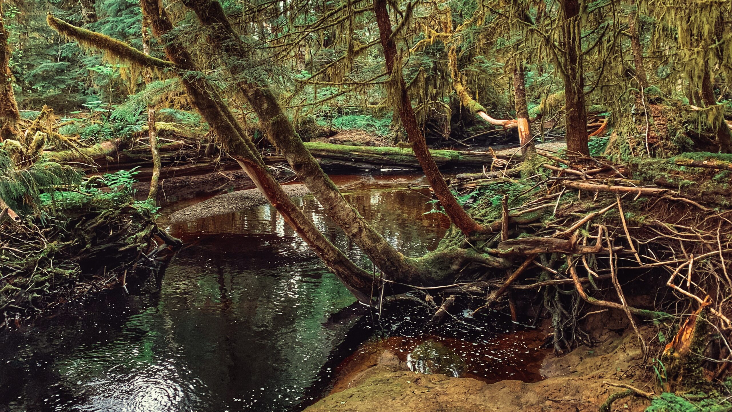
You may access the Crabapple Creek trail in two locations: 1) The west end of 2nd Avenue at the cul-de-sac; and, 2) At the old M&B site, near the start of the road to Rennell Sound.

As with most of the Daajing Giids community trails, the topography meanders between a mix of flat ground, occasional side hills and muddy sections all while passing through beautiful forest. For us, a key highlight of this trail included the lovely views one gets off the inlet about mid-way through the hike.

Peering through the trees at the landscape below – a mix of the natural and industrial – helps to provide one with a “refreshed” perspective of this place. Indeed, you could almost say it offers a space for deep contemplation thanks to the unintentional proximity to logging as represented by the old M&B structures at the trail’s eastern terminus point.

Of course, if philosophy isn’t really your thing, you can still enjoy this lovely short trail. The trees, lush ferns, fungus and angry squirrels give it much character. Sadly, though, you won’t actually encounter any crabapple trees on this hike. 

In the village’s literature, Crabapple Creek is described as a loop trail, but this is incorrect. The trail is properly described as a “point-to-point” route because the start and end points are at least a kilometre apart. Thus, one may prefer to simply go back the way you came rather than, say, exit at the M&B site and walk along the road all the way back to 2nd Avenue.

Nevertheless, we found Crabapple Creek a most enjoyable trail to hike. It’s shorter than the nearby Gore Brook, but it’s also less strenuous. In addition, the unique juxtaposition of logging with the natural world makes for some fun discussion.

The total hike time was a quick 15 minutes one-way along the marked primary route, which is denoted by white diamonds.

Please note that Crabapple Creek offers two hiking routes. If you start your trek at 2nd Avenue, you will come to a fork in the trail about a minute in. Going LEFT will take you along the formally marked and maintained route promoted by the village; however, if you choose to go RIGHT, you will be treated to a longer hike – and one that actually takes you along Crabapple Creek for much of the route.

There’s a little more in terms of elevation gain, but the lovely cascade of the creek + small waterfall make it worth the added effort. We suspect this was the original trail – you can still see the odd “red arrow” markers along the way. This route, while longer, still connects to the main trail at the “big tire.” The total hike time for this alternate hike is about 45 minutes one-way.

Be advised that the Crabapple Creek Trail connects and links with other trails in the area, including the still-being-developed Dempsey Collinson Memorial Trail, Gore Brook Trail, and the informal Backyard Trail system.

DIFFICULTY: Easy
TOTAL DISTANCE: 2 kilometres (return, depending on the route taken)
TIME: 30 minutes to 1.5 hours (return)
TYPE: Point-to-Point
ELEVATION GAIN: 40 meters


    Wiggins Road Trail Features
Popular fishing access
Access to Tlall Conservancy

ABOUT

A note of caution: One should avoid hiking this trail after heavy rainfall. Sometimes the banks of the Tlell River will overflow, flooding sections of the trail and making them virtually impassable.

The Wiggins Road trail is an unmaintained 1.5km out-and-back route that follows the Tlell River south along the river’s bank. While the trail is unmarked, it’s still relatively easy to follow until you begin entering the Tlall Conservancy area. At this point, the rough trail gets harder to make out and, at times, feels more like a trudge through the forest. Still, the hike has its rewards: At numerous points throughout, one can marvel at the Sitka spruce before them, the lush mosses, and the mighty Tlell.

While the trail can be used for a recreational hike, its primary purpose is to provide access to the Tlell River for steelhead fishing. It is not uncommon to see locals along the banks reeling in their catch in late Summer or early Fall. Further to this, the trail does provide numerous side paths to the river for fishing purposes.

From a hiking perspective, Wiggins Road trail can be classified as an easy to moderate hike, depending upon one’s fitness level. Much of the trail is flat, though there are some significant areas of mud, roots and deadfall. In addition, the Wiggins Road trail does provide an opportunity for a much grander adventure:

If you do hike the 1.5km (one-way) from the trailhead, you will eventually connect to the far more popular Anvil Trail, which is a 5km loop trail that takes you on a beautiful Wilderness Interpretive hike.

It should be noted that the Wiggins Road trail does fall on privately held land for much of its length, so those visiting should be respectful of posted signage.

To access this trail, turn onto Wiggins Rd and simply follow the road to its terminus point – a cul-de-sac.

Here you will spy the unmarked trailhead, which leads you down to the Tlell River. NOTE: As you walk down the slight incline at the trailhead, you will see a log fence to your left. You will have to crawl through the fence opening to access the rest of the trail – don’t let this dissuade you!

DIFFICULTY: Easy
TOTAL DISTANCE: 3km (return)
TIME: Approximately 1 hour
TYPE: Out-and-Back
ELEVATION GAIN: None

THREE MILE CREEK TRAIL FEATURES:
·       Salmon spawning creek
·       Cascade
·       Tlall Conservancy

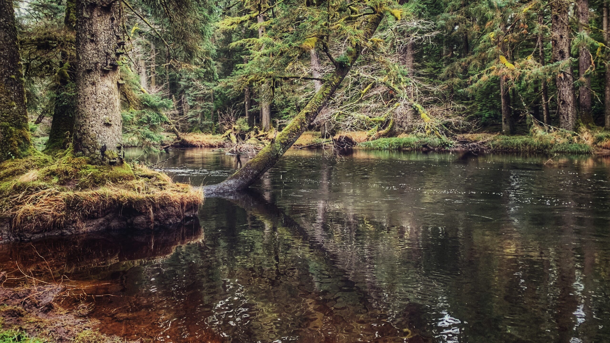
The Three Mile Creek Trail is found deep within the Tlall Conservancy. Accessing it in the current day
requires a bit of effort because the original point of entry – Survey Forest Service Road – was formally
decommissioned in 2016 after years of disuse.

Now, if you wish to visit this trail, you’ll have to drive nearly 1.5 hours along the Daajing Giids backroads: First, drive approximately 20 minutes along the QC Mainline (passing the decommissioned Survey Forest Service Road) until you come upon the un-signed junction for Lakes Main Road to your RIGHT.

Take this turn and follow Lakes Main for nearly an hour – you will eventually connect to what’s left of the Survey Forest Service Road. Once here, you’ll spy a bridge that crosses Three Mile Creek.

If you’ve come all this way to hike the trail, do NOT cross the bridge because the unsigned trailhead for Three Mile Creek Trail is just before the bridge on your RIGHT.

Lack of maintenance for nearly two decades has made the route difficult to see but the faint outline of a
trail is there. Descend the minor slope and begin your trek!

In the late 1990s and early 2000s, Three Mile Creek Trail – along with the nearby Monique Creek Trail
was promoted in an interpretive booklet by the Tlell Watershed Society. Evidence of their “wilderness
interpretive route” narrative can still be found near the start of the trail. Look up at an alder tree near
the Three Mile Creek bridge – you’ll spy signage explaining the creek’s role as an important area for
spawning coho and steelhead salmon. I suspect there were more signs like this along the trail, but we
didn’t see any on our hike. Time and the elements have likely eliminated them.

While the trail is only 1 kilometre in length, expect to take at least an hour to complete the full route.
Three Mile Creek hasn’t seen any maintenance for nearly 2 decades – well before the decommissioning of Survey Forest Road – and it shows. Almost right out of the gate, the trail is difficult to find and follow.

The path is mostly overgrown and significant deadfall litters the trail. The odd trail marker can still be
found, and they help somewhat, but we still lost the trail for brief moments. I guess the best thing to
keep in mind is that the route basically follows Three Mile Creek for its duration.

As we hiked along the creek, we admired the old-growth Sitka Spruce and Red Cedar. We did not encounter any wildlife; however, we did spy on elk tracks and bear dung along the way.

Why might someone wish to come into the backcountry and hike this trail? I can posit a couple of
reasons: 1) To explore an important tributary to the Tlell River Watershed; and, 2) To probe deeper into
the Tlall Conservancy beyond what’s available near the community of Tlell. Either way, getting here and
hiking the trail are certainly adventures in their own right!

DIFFICULTY: Moderate
TOTAL DISTANCE: 2km (return)
TIME: Approximately 2 hours, depending on skill level
TYPE: Out-and-Back
ELEVATION GAIN: None