Category: Feature Spots

  • Finding the Three Falls in the Blackwater Creek Waterfall Trails

    Finding the Three Falls in the Blackwater Creek Waterfall Trails

    • Blackwater Creek Waterfall Trails
    • Blackwater Creek Waterfall Trails
    • Blackwater Creek Waterfall Trails

    BLACKWATER CREEK WATERFALL TRAILS FEATURES:
    ยท Relatively easy access to waterfalls
    ยท Challenging rope sections


    ABOUT

    The Blackwater Creek Waterfall Trails are a couple of hidden gems on Haida Gwaii. The two trails are short โ€“ clocking in at about 200 and 400 meters respectfully โ€“ and very remote; however, if one enjoys chasing waterfalls, these two routes are definitely worth the effort. As these trails are not well known, they do not appear in any of the literature available on Haida Gwaii. Hereโ€™s how you get to them:

    1) Starting in Port Clements, drive south along Bayview Drive towards the Golden Spruce Trail.

    2) Keep driving. Bayview Drive eventually turns into the Port Man Forest Service Road โ€“ an active logging road. At about the 11km mark from Port Clements, youโ€™ll come upon signage for the โ€œHAIDA CANOEโ€ Trail. Then, 150 meters from this point youโ€™ll spot a โ€œYโ€ or split in the road. Turn RIGHT onto the New Mainline Road. You will then cross a bridge over the Mamin River before coming to another โ€œY.โ€

    Keep left on the New Mainline Road for approximately 500 meters. You will then see a minor logging road to your LEFT. Turn here and drive for nearly 5 kilometres. Note that, from this point on, the road is narrow (single track) and does have a few low-hanging alder trees youโ€™ll have to clear.

    3) After driving along the road for nearly 5 kilometres, youโ€™ll cross a small bridge over Blackwater Creek. Barely 100 meters past this bridge, youโ€™ll come upon another โ€œY.โ€ Turn RIGHT. Drive approximately 2 kilometres along this narrow road. If youโ€™ve made it this far, youโ€™ll spy the trailhead marker for the first waterfall. It is signified by pink and orange flagging tape hanging from young spruce trees.

    The trail is short โ€“ approximately 200 meters one-way โ€“ but it is more reminiscent of a stroll through the bush than an actual trail. Expect to walk through dense forest, a lot of deadfalls and a few muddy sections. The good news, though, is the route is extremely well-marked: There is bright flagging tape every few feet, so itโ€™s virtually impossible to get lost.

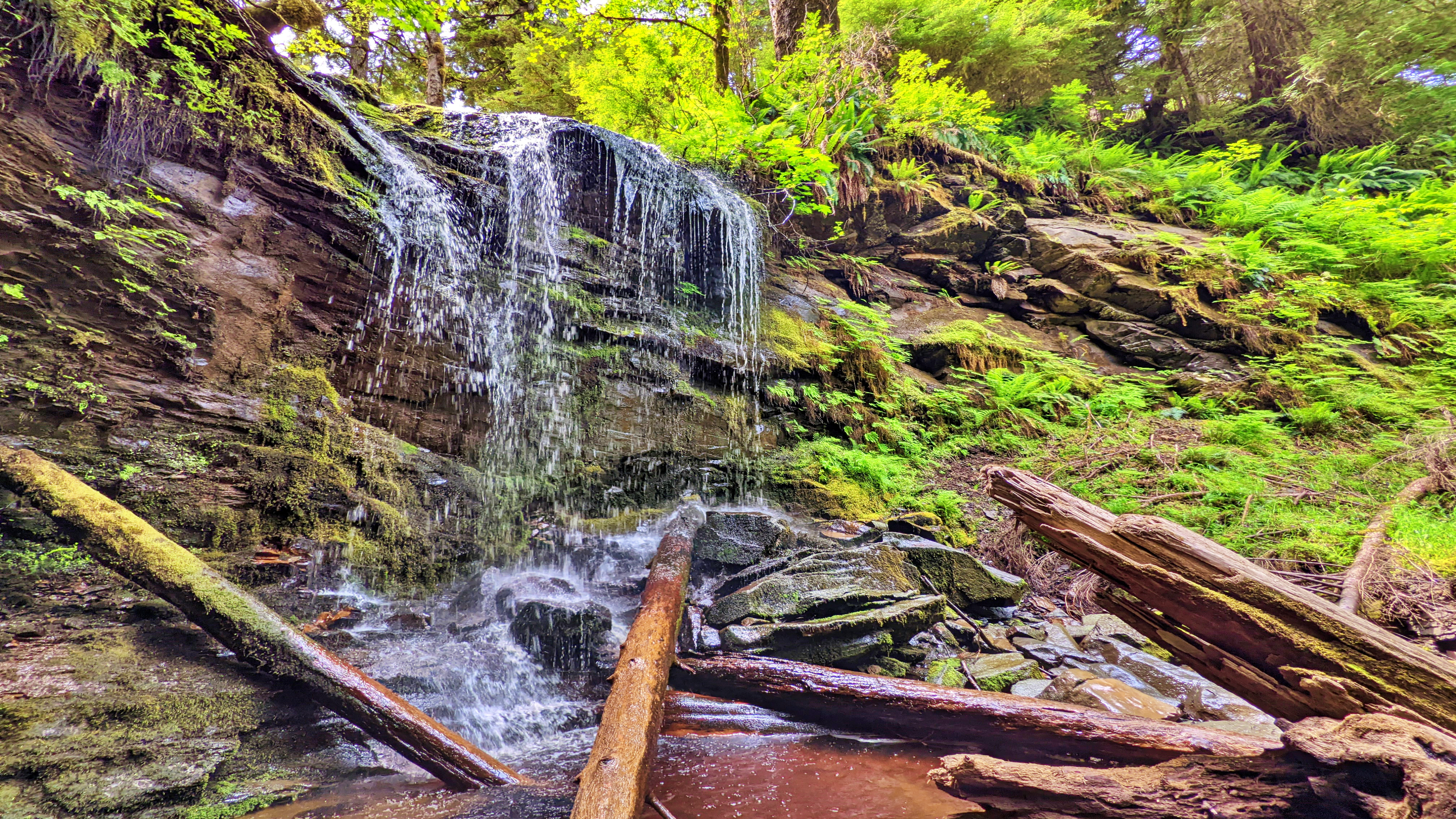
    At the end of your hike, youโ€™ll come upon a moderately steep section, which you must carefully descend in order to view the waterfall. The waterfall itself is quite nice; however, it is difficult to photograph on account of being obstructed by large logs. After enjoying the cascading falls and the sounds of nature, return the way you came.

    4) To view the second waterfall, continue driving approximately 1.2 kilometres up the same narrow road. You will eventually see the trailhead markers โ€“ signified by candy cane patterned flagging tape โ€“ to your LEFT. A pullout, large enough for 2 vehicles, is just a few feet up the road. Unlike the first waterfall, the route to this second waterfall resembles a more traditional trail (albeit a little rough).

    It, too, is extremely well marked with flagging tape. The total length of this trail is approximately 400 meters (one way), but thatโ€™s because, at the mid-point, it splits. If you go to the RIGHT, youโ€™ll come upon the โ€œtopโ€ of the falls, which is picturesque in its own right and features an attractive โ€œkiddie poolโ€ more than suitable for a swim.

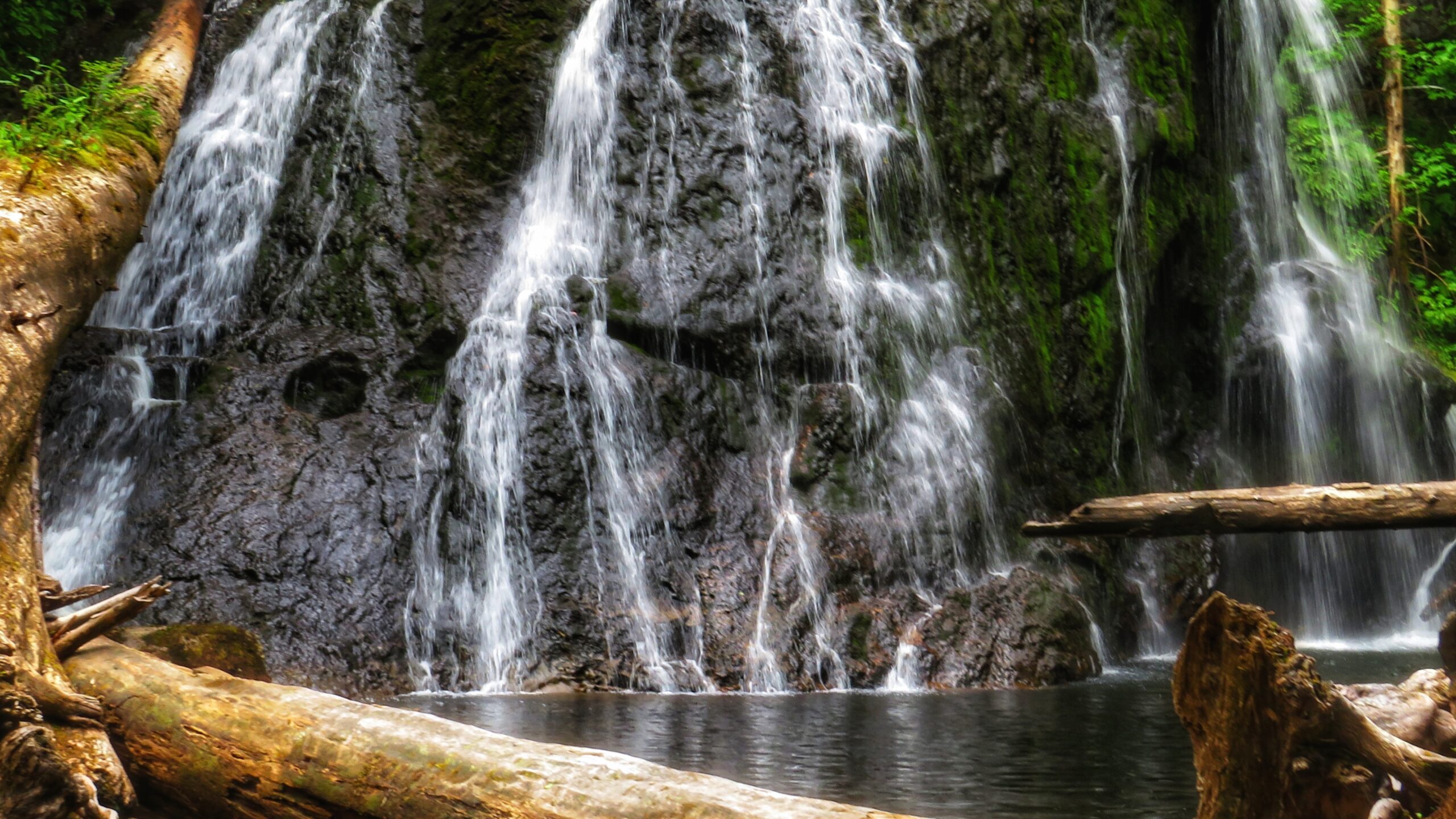
    If you go to the LEFT at the trail split, youโ€™ll eventually make your way to a fairly large waterfall, cascading down a rounded rock face. Use caution, though: To get to these falls, you must descend an extremely steep area that, in one area, is almost completely vertical. There are several sturdy ropes to assist you here. Once you make it down, however, it is only a short walk to the impressive falls.

    It is not uncommon for people to linger here for many a moment and cool off under the cascading water. Once youโ€™re finished admiring the serene beauty laid out before you, simply head back the way you came.

    Getting to these waterfalls may be tricky (both in navigating the narrow logging roads and hiking), but it is well worth the effort. In both instances, the waterfalls are a mere 10 to 15 minutes off the road. In our view, the second waterfall, in particular, is the major highlight because of its size and relative ease of access; in fact, weโ€™d even suggest it rivals the Dover Falls in Sandspit!

    Again, though, keep in mind that you will be driving on active logging roads; thus, proper caution should
    be exercised. In addition, while a truck is not necessary to reach these sites, a standard vehicle is not ideal for these roads.


    DIFFICULTY: Easy to Moderate
    TOTAL DISTANCE: 400 and 800 meters (return)
    TIME: 50 minutes (for both trails, out and back)
    TYPE: Out-and-Back
    ELEVATION GAIN: Minimal

  • Masset Cemetery Road Beach Access Trail

    Masset Cemetery Road Beach Access Trail

    • Masset Cemetery Road Beach Access Trail
    • Masset Cemetery Road Beach Access Trail
    • Masset Cemetery Road Beach Access Trail

    MASSET CEMETERY ROAD BEACH ACCESS TRAIL:
    Access to North Beach
    Masset Cemetery


    ABOUT

    The aptly named Masset Cemetery Road Beach Access Trail is exactly as it says: It is located adjacent to Masset Cemetery and provides straightforward access to South Beach. In this regard, it isnโ€™t much of a hiking trail but serves a functional purpose. The trail is wide and flat, taking you through compacted sand and a few scattered spruce trees before hitting the beach. In brief, thereโ€™s nothing much of note along this short trail. Itโ€™s all in the destination. . .

    In our experience, most people donโ€™t access this trail on foot. Instead, because it is so wide (and resembles a road more than a trail), ATVs and trucks are far more common. The few times weโ€™ve hiked this route, ATVs and other vehicles have always been present โ€“ riding up and down the pebbly beach at quite the pace. But the vehicle use isnโ€™t just for recreational fun: At certain times of the year, the Haida will access the beach in this area to harvest traditional foods.

    As noted, it is highly unlikely one would visit this trail for recreational hiking purposes. Instead, we recommend doing the practical thing: Use it to access the beach โ€“ which itself is part of the larger Tlโ€™ellan to Old Massett Trail โ€“ and go for a nice stroll alongside the powerful Pacific Ocean. As you amble about, keep an eye out for sea life, agates, and beach glass. Thereโ€™s no telling what you might find!

    Finally, since youโ€™re in the area, we would also recommend visiting the Masset Cemetery: This is a truly unique space, unlike any cemetery weโ€™ve visited. Haida Watchmen figures keep a close eye on some resting sites while mounds of agates and scallop shells can be found at others. In a large city, some of these โ€œpreciousโ€ items would quickly grow legs, but in a small community like Haida Gwaii, the house of the dead is deeply respected. Thus, if you do choose to visit the cemetery before or after walking the nearby beach, step quietly and cautiously. Someone โ€“ or something โ€“ is always watching ๐Ÿ˜‰


    DIFFICULTY: Easy
    TOTAL DISTANCE: 400 meters (return)
    TIME: 10 minutes
    TYPE: Out-and-back
    ELEVATION GAIN: None

  • Exploring Damaxyaa Conservancy – Louise Dover Trail

    Exploring Damaxyaa Conservancy – Louise Dover Trail

    • Louise Dover Trail
    • Louise Dover Trail

    LOUISE DOVER TRAIL FEATURES:
    Old Growth forest
    Culturally Modified Trees
    Dover Falls


    ABOUT

    The Louise Dover Trail is located adjacent to the Haans Creek bridge, just before entering Sandspit. Initially conceived in the mid-1990s, the trail is named after Louise Dover, an influential woman of Haida ancestry who lived in the community of Sandspit. In many respects, the trail is an apt memorial and tribute because it introduces hikers to key elements of Haida Gwaii: Important fish streams; unique flora and fauna; ancient Haida culture; rare geology and fossils; and, a larger appreciation for how everything depends upon everything else.

    In 2008, the Dover Trail became part of the larger Damaxyaa Heritage Site and Conservancy. Encompassing some 829 hectares, the conservancy plays host to important fish-bearing streams โ€“ one of which is Haans Creek โ€“ and contains a high density of recorded culturally modified trees (CMTs), a few of which can be spied along the Dover Trail. Both in pre-history and the current day, Damaxyaa is an important place for the Haida in terms of food gathering, medicine and culture. A seasonal Haida camp known as Kil was originally located at the mouth of Haans Creek, but no evidence of this remains today.

    Most official documentation on the Dover Trail clocks it in at 3.5km in length, but 4km is much more accurate. The first 200 meters are dubbed universal access, and bring you to a handsome viewing gazebo, thanks to significant upgrades completed in the autumn of 2020. After this, the trail becomes narrow and rough for most of the loop.

    Expect a lot of โ€œup, down, up downโ€ for much of your hike. Once you hit the mid-way point of the Dover loop, youโ€™ll see a marked side trail. This leads you to a lava bed and fossils โ€“ one of the trailโ€™s key highlights. If you ignore this trail, though, and continue along the main Dover loop, the route climbs quite steeply away from Haans Creek. Near the end of your climb, a small stake in the ground indicates 400 meters of โ€œhardโ€ trail leads to a waterfall.

    If youโ€™re feeling ambitious, itโ€™s certainly worth the effort; however, be advised that much of this side trail is steep and muddy with a couple of rope sections. Early in, you also have to get creative in getting over a fallen monumental cedar tree.

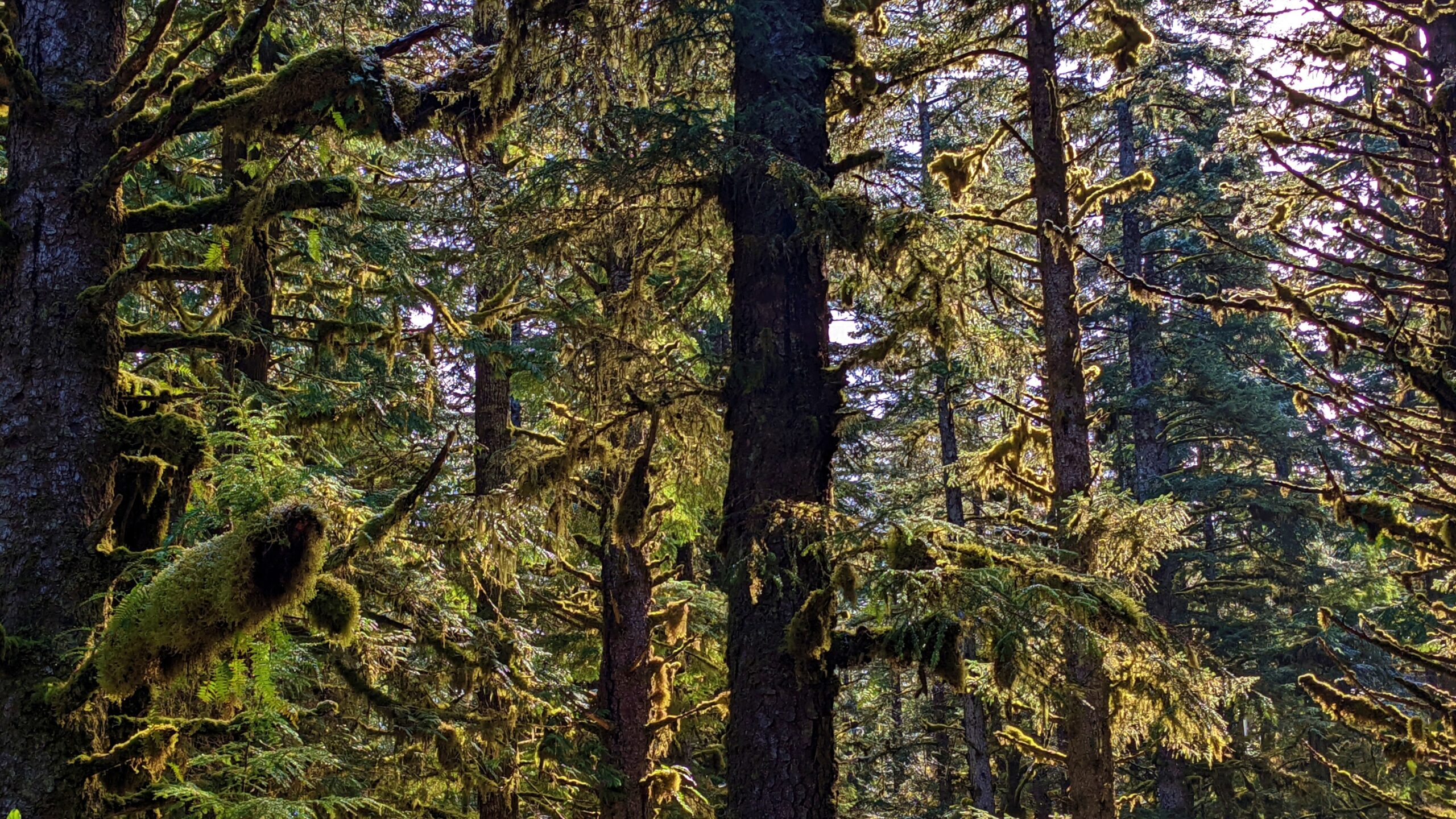
    The final section of the Dover Trail loops back towards the road and trailhead, connecting with the trail you started near the natural log bridge at Haans Creek. Much of this trail is muddy, but home to many old-growth Sitka Spruce and Cedar trees. As you hike back towards the trailhead and Haans Creek, youโ€™ll spy at least one CMT with a large โ€œtest holeโ€ in it. Youโ€™ll also come across the โ€œSkyline Trail,โ€ which remains closed for whatever reason as of this writing.

    Many who visit Haida Gwaii declare the Dover Trail to be their favourite overall hike. The terrain is varied; there are a number of side trails to visit and explore; it offers a glimpse into the old-growth forest and Haida culture; and, it represents a great way to reconnect with nature. Think of it as forest therapy.


    DIFFICULTY: Moderate
    TOTAL DISTANCE: 4km (longer if exploring side trails)
    TIME: 3 hours
    TYPE: Loop
    ELEVATION GAIN: 106 meters