• Rose Spit
  • Rose Spit
  • Rose Spit
  • Rose Spit

ROSE SPIT FEATURES
  · Edge of the World
· Haida Creation Story
· Crab and clam harvesting

ABOUT

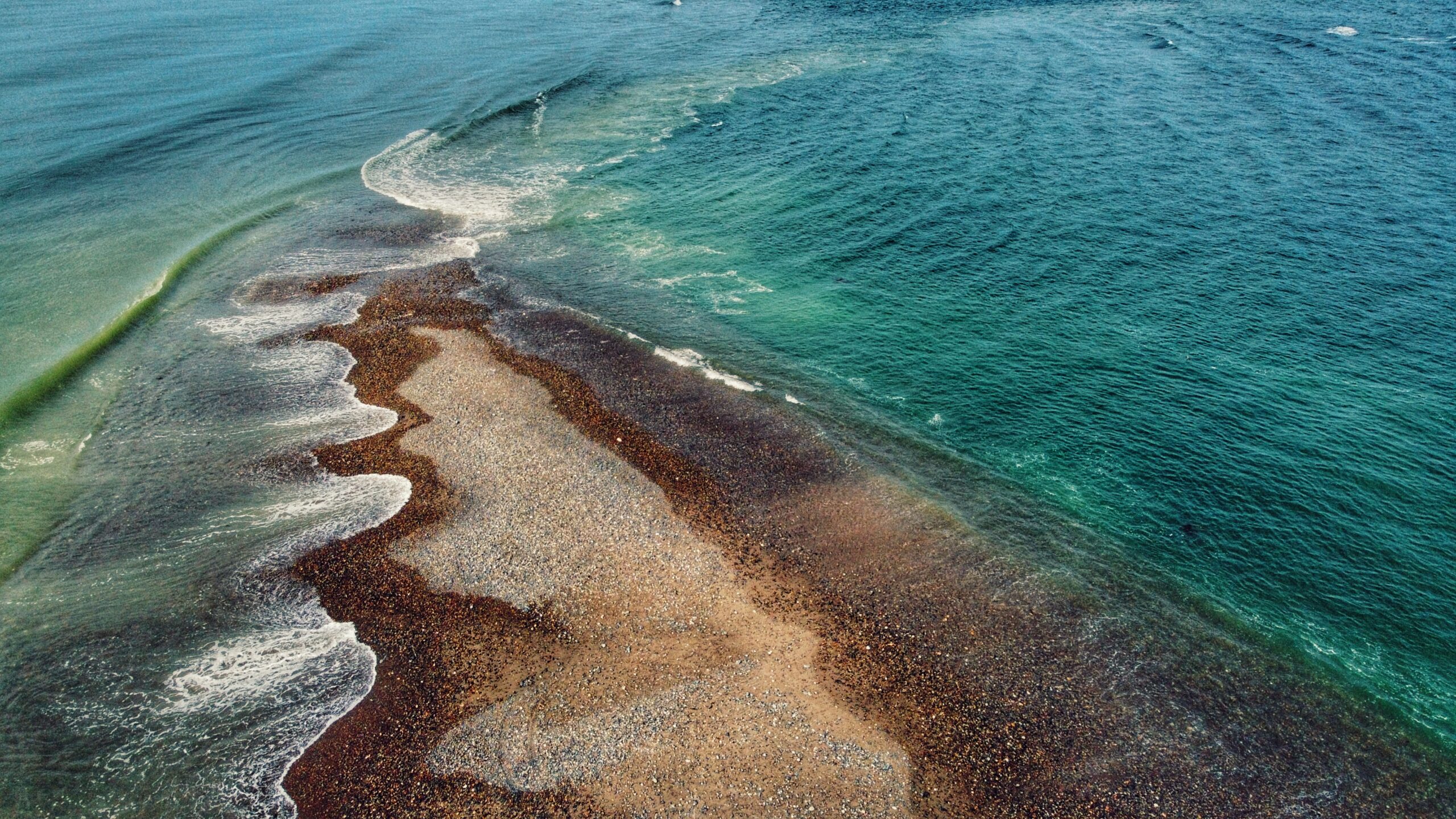
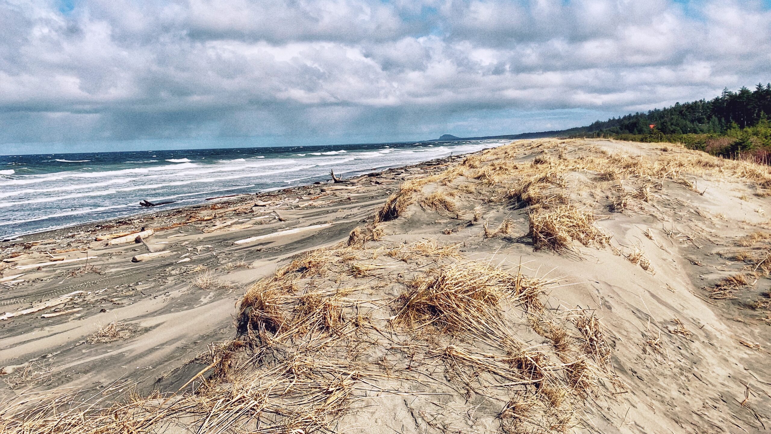
Located on the northeastern tip of Graham Island, and wholly within Naikoon Provincial Park, Rose Spit is perhaps best described as a long beach walk rather than a trail hike. 

To begin your North Beach trek towards “the Spit,” walk down the dirt road from the Hiellen Cabins and onto the beach: You are now at the trailhead/start of your epic walk to Rose Spit. 

At 18 kilometres one-way, a proper walk out to the precipice should be well timed on a falling tide because the last few kilometres do get submerged by the waves on a high tide. Thus, walk only as far as you believe to be reasonable – you are completely at the mercy of the tides here!

While the hike to Rose Spit is entirely on flat ground, the hard sand and, later, pebbly beach are surprisingly tough on one’s feet! Be sure to wear comfortable footwear, otherwise, the long hike back to Towhill Road and the Hiellen Cabins could be a rather painful affair. Still, the hike is well worth the effort because there’s surprisingly a lot to see.

As you walk along North Beach, you’ll undoubtedly notice plenty of vehicle traffic. The majority will be trucks and ATVs, but it’s not uncommon to see standard-size vehicles on the beach as well! Most are joyriding – enjoying the endless kilometres of sandy beach – but some are also gathering traditional foods like cockles, razor clams and Dungeness crab. If you’re lucky, one of the locals just might show you how to catch a deceptively speedy razor clam, or offer up a freshly caught crab – true gifts of the sea!

At about the 5-kilometre mark, you’ll come upon one of this area’s unnatural attractions: The small shipwreck of the Kelly Ruth, which has been here since 1994. Like the larger Pesuta along East Beach, the Kelly Ruth is surprisingly photogenic, offering many unique angles and contrasts with the natural landscape. 

It is also at this point, if you’ve chosen to drive onto the beach using a small vehicle, that we’d advise you stop and walk the rest of the way to Rose Spit because the compact sand begins to give way to a pebbly beach much more suited to ATVs and 4×4 trucks.

Approaching the end of Rose Spit, things begin to come into perspective. Turn around and view Tow Hill: It looks so small off in the distance. Now, turn back around and look at the edge of the world. Roughly a kilometre wide at the forest’s edge, Rose Spit narrows to just a few feet before disappearing beneath the waves of the Pacific Ocean. 

As you stand here at the precipice of Haida Gwaii, you have the wind at your back; Dixon Entrance and North Beach on your left; and, the Hecate Strait and East Beach on your right. The pebbly Spit, wet sand and unique agates rest at your feet. When you’re out here, it’s easy to enjoy the cool sea breeze and rejuvenating wind . . . and then you notice a clam shell at your feet.

Rose Spit is a place of high cultural significance to the Haida. The area figures prominently in their creation stories. As told in the story “Raven and the First Man,” Raven found himself alone day, flying over Rose Spit. 

Landing on the beach, Raven noticed “an extraordinary clamshell at his feet, and protruding from it were a number of small creatures.” He coaxed them out of the shell and, even though some were hesitant, “they emerged from the partly open clamshell to become the first Haida.” 

This important creation story is beautifully captured in Bill Reid’s “Raven and the First Men” carving at the UBC Museum of Anthropology.

Knowing the Haida Creation Story adds a layer of complexity to one’s Rose Spit experience. For us, it makes this so much more than a beach walk or a place to observe rare plants like Sea Bluebells. 

It brings into synthesis Haida culture, history, myth and physical geography. Standing at the tip of Rose Spit and looking back toward Tow Hill, we cannot help but come to a stark realization: No matter how imperfect we are, we each have a place in this world and we owe it to ourselves to protect it.

DIFFICULTY: Moderate
TOTAL DISTANCE: 36 kilometers (return)
TIME: 12 hours
TYPE: Out-and-Back
ELEVATION GAIN: None

  • Spit Walk Trail
  • Spit Walk Trail
  • Spit Walk Trail
  • Spit Walk Trail
  • Spit Walk Trail
  • Spit Walk Trail
  • Spit Walk Trail
  • Spit Walk Trail
  • Spit Walk Trail
  • Spit Walk Trail
  • Spit Walk Trail
  • Spit Walk Trail
  • Spit Walk Trail

SPIT WALK TRAIL FEATURES:
·       Access to Sand Spit
·       Running & Biking
·       Family-friendly

ABOUT

The “Spit Walk Trail” is something of a surprise on at least two fronts. First, we were flabbergasted to learn of this trail’s existence. Despite spending a significant amount of time on Haida Gwaii, we’d never once heard of this trail. It was only after reading a brief write-up from Ocean Sound 

Kayaking and spying on the route on a detailed map of Haida Gwaii by BRMB that our veil of ignorance was lifted. Second, the Spit Walk was surprising in that it was basically hiding in plain sight.

On the one hand, it is kind of surprising we didn’t know of this trail given that it’s basically a 5-kilometre loop around the perimeter of Sandspit Airport (BRMB erroneously says 10KM); thus, it’s hardly a brief walk easily missed. 

On the other hand, we could argue it’s not terribly surprising because, like most trails on Haida Gwaii, no explicit trailhead signage exists. It seems like you just have to “know” about it. Then again, Ocean Sound Kayaking – the only piece of literature we’ve seen on this trail – does say it’s a “locals trail,” indicating those who live here certainly know about it.

The Spit Walk can be accessed at two major points – along Tacan Road or Beach Road. If you want to do this hike, we’d recommend starting at Beach Road adjacent to Lon Sharp’s “Spirit of Sandspit” (giant salmon) sculpture because there’s parking available at the site of the former government wharf. 

If you choose to start at Tacan Road, you’ll have a hard time with parking unless you park in the nearby SuperValu lot. So, for the sake of argument, let’s assume you’re starting from the “Spirit of Sandspit.”

From here, just walk along the perimeter fence of Sandspit Airport (YZP). The trail is wide, flat and clearly visible. It may seem a bit daunting going straight on such flat land for lengths at a time, but there are benches strewn about to allow for some rest. 

Just note that because this trail is largely exposed to the elements, it is not advisable to hike or jog this route during high winds.

In addition, if you wish to break up the monotony, there are a few little side paths that provide access to the rocky beach. If you’re visiting at low tide, we’d strongly recommend detouring off the Spit Walk and enjoying the Sand Spit (Sandspit’s namesake). 

There’s just something peaceful about being able to walk so far out from the mainland and using the ocean’s calm to clear one’s head. Not to mention, “the Spit” is home to some of the best clam-digging on Haida Gwaii! Just make sure, if you do hike out to the actual “Spit,” you do so at a low or receding tide so as not to get caught by the incoming tide. 

If you exclude an excursion to the beach, the physical landscape of the Spit Walk is largely grassy and flat. Daisies, Buttercups and Yarrow abound. However, given the flatness of the route, it’s easy to see why many a local enjoys running or biking along this loop – makes for some good exercise.

As you finish this easy walk and emerge onto Tacan Road, the only thing to watch out for is vehicle traffic since this part of the “trail” as you walk along the side of an active road until you loop back to Beach Road. Besides that, there really is nothing to be wary of on the trail except for the odd low-flying aircraft (haha), winds and angry squirrels in the bushes.

Overall, the Spit Walk is an enjoyable excursion suitable for the whole family. Along with the added benefit of some nice exercise, it affords us the opportunity to explore a little more of Sandspit. All of that said, this trail certainly isn’t for everybody. If you’re an adventure seeker or want to spend time in the forest, the Spit Walk may be a little boring or even one-note. If, however, you want to inhale that fresh sea air, then you’ll enjoy this easy hike!

DIFFICULTY: Easy
TOTAL DISTANCE: 5 kilometers
TIME: 2 hours
TYPE: Loop
ELEVATION GAIN: None

  • Piper Creek Trail

PIPER CREEK TRAIL FEATURES:
·       Monumental trees
·       Foraging

ABOUT

The Piper Creek Trail is located approximately 3 kilometres west of Sandspit, adjacent to the “Piper Creek” bridge, heading towards the Kwuna ferry line-up. There is no formal parking; however, there is enough space on the shoulder of Piper Creek Bridge for two small cars. The trailhead is indicated by a small white marker a few feet from the bridge.

While there is minor elevation gain, we would classify Piper Creek Trail as easy. The route is mostly flat and well-marked for its duration. The trail, which winds through a mix of alder, spruce and cedar, basically follows Piper Creek upstream for about a kilometre before terminating at a small ravine adjacent to the creek. The dense forest part of the trail heading to the creek access is a relaxing experience and it is encouraged to take the time to savour forest walking.

Indeed, the trail is short, but it also connects to other routes like Around the Pond and Onward Point, making for a more robust hike. The connecting trail towards Onward Point, notably, takes you through a stand of monumental cedar trees sure to delight the tree-lover in all of us.

Along with being a relatively popular hiking trail, Piper Creek is also used for local foraging. The outstanding Raincoast Breads, for example, will come here and forage, Woodruff, Oyster mushrooms and even “aromatic” stones. We’ve also witnessed some large “Chicken of the Woods” growing near the entrance of this route.

Note: There is also a short trail directly across Highway 16, opposite the Piper Creek trailhead. Just look out for blue flagging tape. This brief route, which clocks in at about 250 meters one-way, takes you to the mouth of Piper Creek, through the trees and down to the beach.

DIFFICULTY: Easy
TOTAL DISTANCE: 2 kilometers (return)
TIME: 40 minutes
TYPE: Out-and-Back
ELEVATION GAIN: 46 meters

Evans Homestead Trail Features
·       Settler history and structures
·       100+-year-old Rhododendrons
·       Access to Kamdis Conservancy

ABOUT

Located within the 2,722-hectare Kamdis Heritage Site/Conservancy, the “Evans Homestead” Trail was first brought to our attention via a series of old photos taken in 1957 by Terry Annis, and posted by Go Haida Gwaii.

The ruins of the homestead, and the promise of massive rhododendrons, were most enticing. Unfortunately, directions towards this unmarked and unmaintained route are sparse.
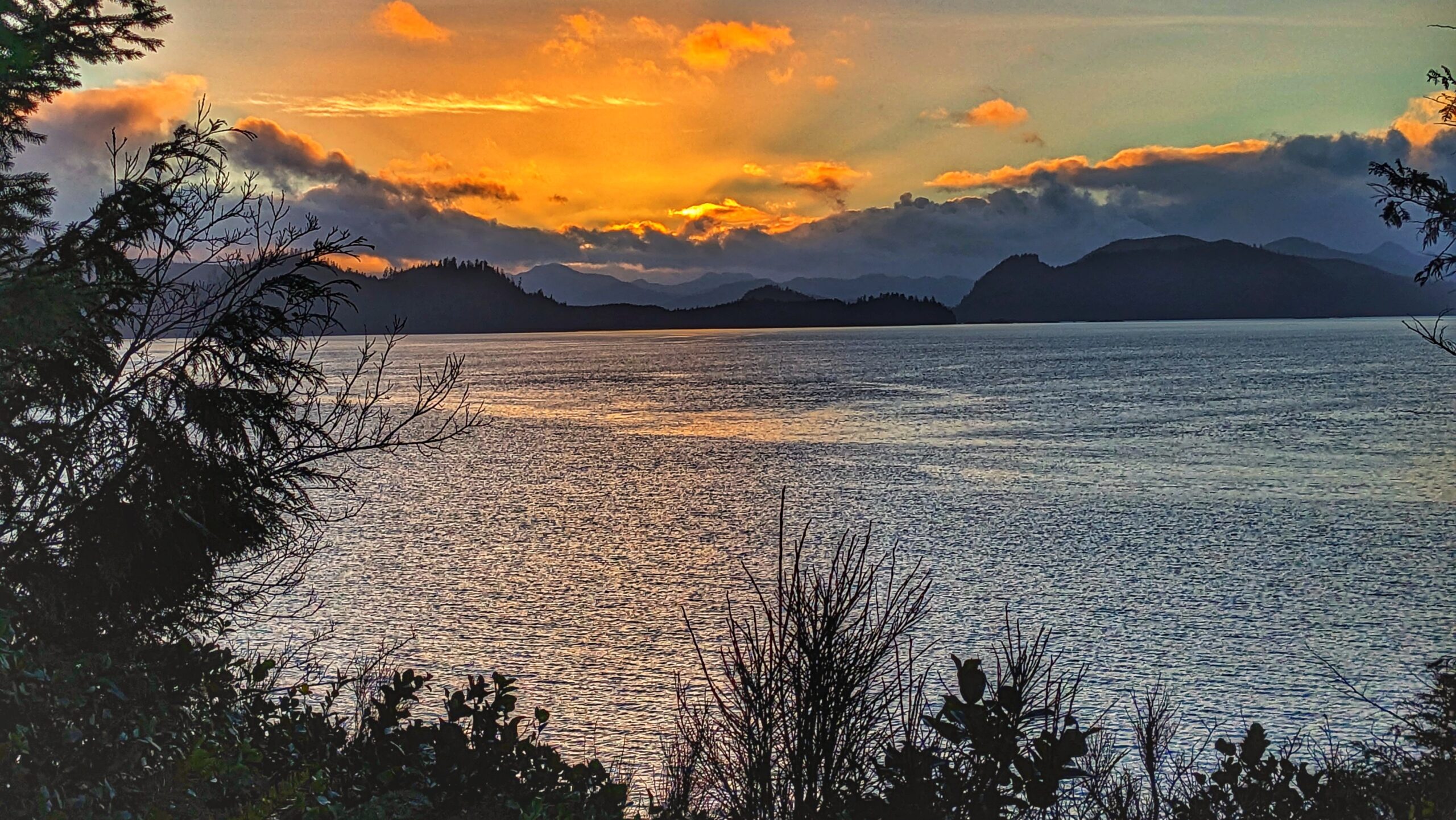
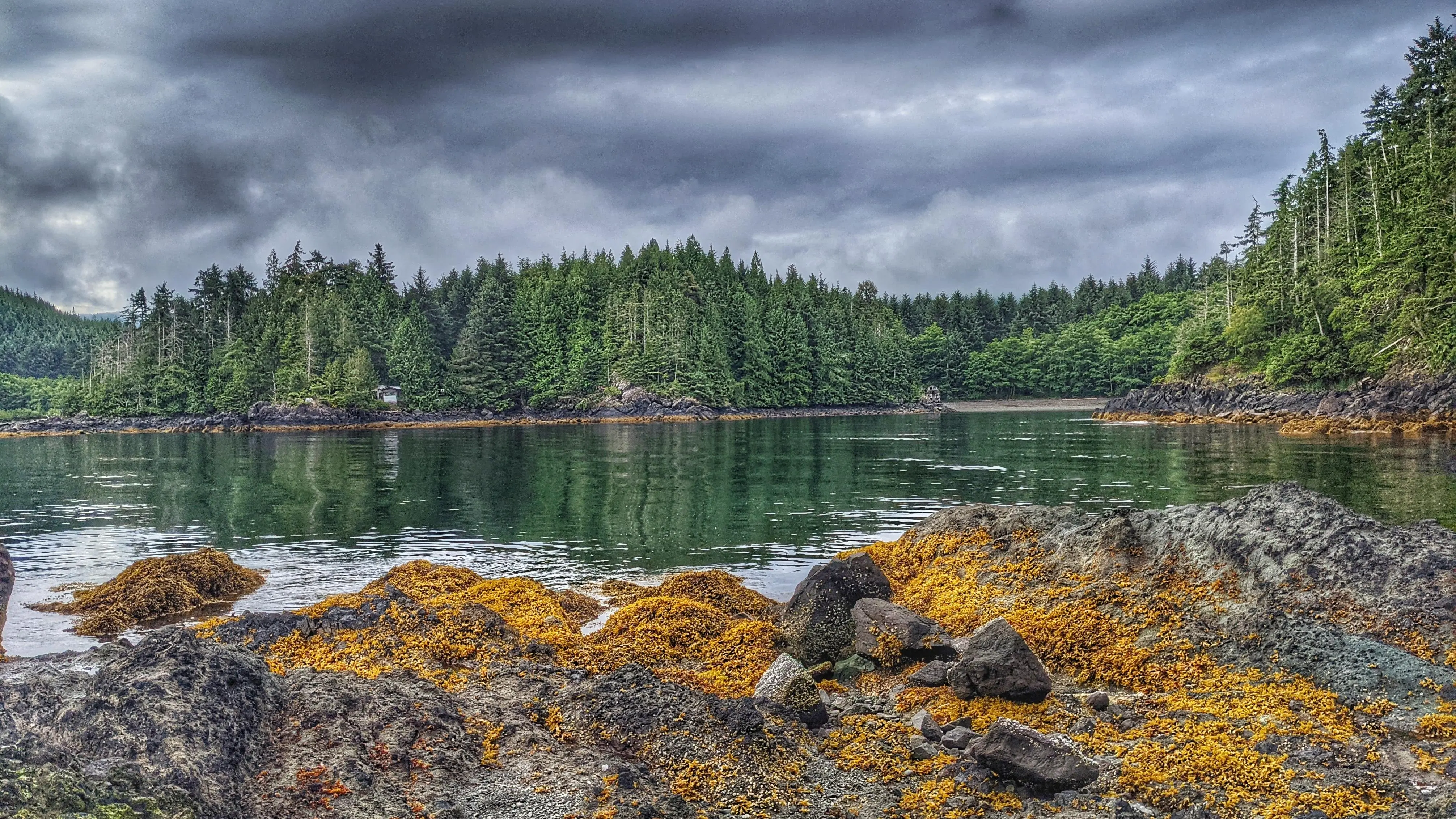
Nevertheless, while the trail lacks formal upkeep and trail markers, it is still easy to locate and follow with a bit of effort. How do I get to the trailhead? You will find the Evans Homestead trailhead approximately 19 kilometres north of Port Clements, at the end of Nadu Road. Once you arrive at the terminus of Nadu Road, park your vehicle.

You will see two roads side-by-side. The one on the right, which looks to be built on large segments of clay, is used by the Mennonites and is private. You want the overgrown road beside it. This old skid road, once used for logging, represents the official start and trailhead of the “Evans Homestead” hike.

Follow the old skid road for approximately 1 kilometre. After hiking for about 15 minutes, you’ll have to use a natural log bridge to cross the Nadu River on your LEFT. It is important to keep a watchful eye for the crossing because the trail actually continues on past it to the mouth of Nadu River and Masset Inlet. On the plus side, if you do miss the turn-off and hike to the river’s mouth (as we did), you’ll be treated to a unique-looking old-growth cedar tree!

After crossing the log bridge, follow the trail out towards Masset Inlet. It’s clear someone uses this area as an access point because, when we hiked the route, a small table was set up near a skiff. Perhaps the boat is used to access nearby Kumdis Island?

Anyway, it’s at this point you’ll observe the first major piece of colonial history: An old rotting dock which, because of the moss and small trees growing on it, has become quite photogenic. At one point, from this dock, you could walk approximately 1.6 kilometres up an old road towards the remains of a peat moss plant (opened in 1967, after Bering Industries spent $1 million building it, it closed barely a year later).

Unfortunately, when we visited in June 2021, this part of the trail was marked as “closed” – probably due to the extreme overgrowth and lack of upkeep.

From the old dock, walk south along the beach and shoreline for 20 minutes and you’ll eventually come upon the ancient stone breakwater. After 110+ years, only a tiny portion has collapsed, speaking volumes as to the skill, care and craftsmanship that went into building structures at this site.

Finding the actual homestead site proved to be a little tricky, though. We knew the short trail up to the Evans Homestead was near the breakwater, but couldn’t pinpoint where exactly. We ambled around the breakwater for a good hour and a half pondering our next steps.

One of our team members eventually decided to explore the hillside behind the breakwater. He
returned after 15 minutes and reported that it was “nice and flat” up there but “just turned into a big swamp.”

His wife made her way up the steep and muddy embankment and discovered: The “big swamp” was what we were looking for! Thus, we scrambled up the muddy embankment!

As it turns out, the flat, slightly swampy area is the Evans Homestead: Here you will observe 100+-year-old rhododendron trees and remnants of the homestead originally built in 1911 by Edward Evans. From a historical perspective, the site is a real treat to visit and gives you a small taste of what early pioneering life must’ve been like.

While not many remain, the effort left behind impressive stonemasonry and beautiful rhododendrons. If you’d like to see the rhododendron trees in bloom, we’d recommend visiting this area in June or July.

Note: The beach section of this hike MUST be completed on a low or receding tide, so be sure to check the tide tables if you wish to reach the homestead.

DIFFICULTY: Easy
TOTAL DISTANCE: 4 kilometers (return)
TIME: 2 hours
TYPE: Out-and-Back
ELEVATION GAIN: Minimal

ONWARD POINT TRAIL KEY FEATURES
·       Whale-viewing
·       Beach access
·       Gazebo

Located on Moresby Island, and approximately 10 minutes from the Kwuna ferry landing, the Onward Point Trail represents a leisurely, brief hike – just over 5 minutes one-way – to a beautiful cedar gazebo.

While at the gazebo, gaze out towards Skidegate Inlet and view the mighty seagulls as they dive for food; the abundant seals as they float about and cause mischief; and the graceful eagles as they soar overhead. If you’re lucky, you may even spy a grey whale or an orca in springtime. 

After spending some time admiring the flora, continue along the loop back toward your vehicle.

Indeed, the Onward Point Trail is pretty straightforward. Once you reach the trailhead, you’ll observe signage identifying the route as “moderate difficulty.” 

We think this is only partly true. As you begin your hike, you’ll immediately notice that the trail splits into a Y (the loop). We recommend going counterclockwise – to the right – as it’s the easier route. There is some deadfall along the way, but the trail is relatively flat and takes you through some nice spruce, ferns and cedar trees. 

If you continue along the loop, from the gazebo, the trail does increase in difficulty but only because the earth is soft in some areas. If you wish to avoid this, simply go back to the way you came.

The Onward Point Trail is a nice break from modernity and offers a serene moment for reflection, thanks to the gazebo and the presence of fairy slippers in spring. If you wish to explore the rocky beach below, there is an informal trail leading down to the beach from the gazebo; however, use caution because the rocks below are often slippery.

Please note the Onward Point Trail does connect with the “Around the Pond” trail extension. If hiking the Onward Point loop counterclockwise, you’ll see the trail to your right about a minute or two into your hike.

DIFFICULTY: Easy
TOTAL DISTANCE: 400 meters
TIME: 10 minutes
TYPE: Loop
ELEVATION GAIN: None

  • Tow Hill
  • Blow Hole
  • Tow Hill
  • Two Hill

TRAIL FEATURES
Haida legend
Basalt rock formations
Unobstructed views


ABOUT

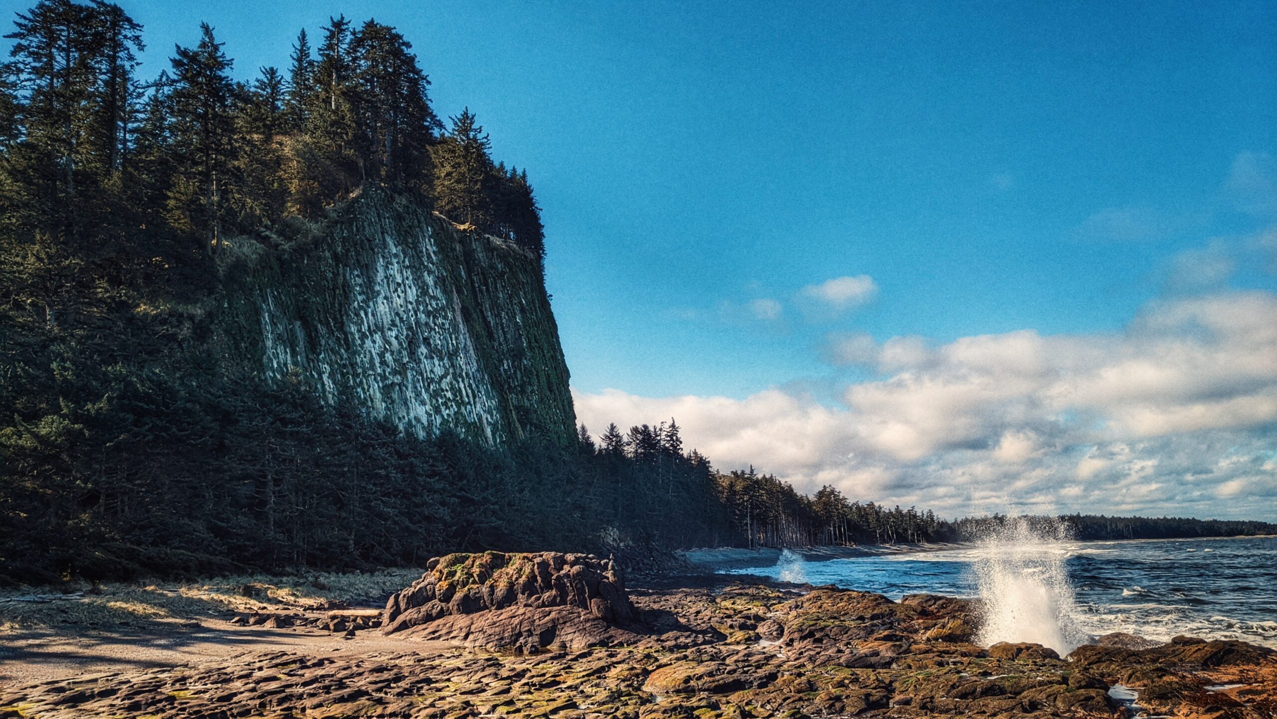
Probably the most quintessential and well-known of Naikoon Provincial Park’s attractions, the Tow Hill and Blow Hole Trails hiking routes are easy and family-friendly, thanks to boardwalks that go their entire length. At the trailhead, which is approximately 26 kilometres east of Masset, you’ll be greeted by two small Haida totems, both of whom sit on either side of a large infographic. This interpretive panel helps set the context for the hike you’re about to embark on.

It enunciates important cultural, historic and environmental information. Notably, and keeping in line with the “accessible” theme, the information board includes colour contrasts and braille. The images can also be “read” with your fingertips.

From the trailhead, hike a little over 200 meters along the wide, hard-packed dirt path. Along the way, you’ll come upon another important feature: A four-track solar-panelled talking sign: Hear a traditional Haida welcome, a Haida song, and the legend of the “Big Spider.”

Indeed, this network of trails – perhaps more than any other on Haida Gwaii – does much to entrench you in this space and this place; that is, Haida territory.

Once you hit the beautifully constructed boardwalk – a partnership between Parks and Old Massett Village Council – you have two options: A hike up to the Tow Hill viewing area (just over 900 meters) or a hike towards the beach and blow hole (just over 700 meters). Each trail, from this point, takes approximately 30 minutes and 15 minutes, respectively.


Tow Hill Trail

Steeped in Haida lore, Tow Hill, or Taaw Tldáaw, is a magnificent volcanic plug formed from eruptions of molten lava some 2 million years ago. Jutting out of the ocean, it is, unquestionably, the most distinguishing geographic feature of Naikoon Provincial Park. Standing at nearby Agate Beach, or North Beach, it dwarfs you with its size; in fact, you can even see it off in the distance while hiking White Creek or enjoying the epic Tl’ellan to Old Massett beach route. Because of its prominence in literature and advertising, Taaw Tldáaw is an iconic image and is synonymous with Haida Gwaii.


Besides its awe-inspiring natural beauty, and deep connection to Haida lore, Taaw Tldáaw and the surrounding area also make for some of Haida Gwaii’s best hiking. Once you reach the boardwalk, go LEFT to continue hiking toward Tow Hill’s zenith.

As noted, the hike is easy, but the incline does increase the higher you go. Along the way, you’ll cross over some minor boggy sections and luxuriantly green moss-covered trees. Take your time to fully appreciate the natural and supernatural beauty of Haida Gwaii as it surrounds and enchants you with its lush rainforest, light mist and heavy cultural traditions.

At about the mid-way point, you come upon the first viewing platform. From here, you can look out onto North Beach, towards Rose Spit – another place steeped in Haida tradition. Once you reach the summit of Taaw Tldáaw, take a moment to breathe in the fresh sea air. From your perch, some 125 meters high, you can see Agate Beach below; the expanses of Naikoon Provincial Park; Dixon Entrance; and, on a clear day, even the shores of Alaska.

Be warned, though, that it is generally quite windy at the top of Tow Hill – something clearly in evidence by the wind-swept trees just outside the viewing platform! Once you’ve had your fill, descend the trail until you come upon a connector to the Blow Hole.


Blow Hole Trail

For our purposes, let’s assume you’re starting your hike from the Tow Hill/Blow Hole trailhead. Again, walk about 200 meters alongside the Hiellen River to the boardwalk. This time, go RIGHT towards the Blowhole. The hike is short – about 15 minutes – and provides some nice ground-level views of the Hiellen River, Christian White’s monumental pole, and North Beach. Lush mosses and a fairly dense forest greets you opposite Oceanside.

Once you reach the end of the short Blow Hole Trail, you’ll find detailed information boards on the origins of “Tow” and how he separated from his brother “Towustain.” The Haida history we’re privy to at this site – combined with nearby Rose Spit and Hiellen – enriches the overall experience and improves our appreciation of this mystical place. In this regard, Tow Hill and the surrounding area are a definite “must-visit” on Haida Gwaii.

Descending the stairs from the boardwalk, you’re treated to a magical space: A coastline covered in lava rock formations, imposing rock cliffs and intense wave action, battering the shoreline. On a rising tide, you will see the “blow hole” in action – a truly special sight! A word of caution: We advise that you steer clear of the rock’s edge on stormy days. The waves are larger and stronger and it is not uncommon for the odd rogue wave to hit this area.


DIFFICULTY: Easy
TOTAL DISTANCE: 2 kilometers return (Tow Hill); 1.8 kilometers return (Blow Hole)
TIME: 1.5 hours
ELEVATION GAIN: 125 meters


HYDRO POLE 97 TRAIL FEATURES
Sand dunes
Access to North Beach

ABOUT

The Hydro Pole 97 Trail Beach Access is pretty self-explanatory. It is one of many such trails in and around Naikoon Provincial Park that provides beach access; however, this one seems to receive special treatment, at least insofar as being mentioned in a couple of publications: The Haida Gwaii Trails Strategy (2011) and Backroad Mapbooks (available at the Daajing Giids Visitor Centre).

While we find this rather curious, it is nevertheless a nice, albeit very short, trail. The trail does not have formal trailhead signage, but it is easy enough to find. As you’re driving along Tow Hill Road, just keep an eye out for Hydro Pole 97. If you’re driving north from Masset, the pole will be on your LEFT. The unmarked trailhead will be obvious and almost immediately beside the hydro pole.

If you wish to access the trail, you’ll have to park along the side of the road. While not formally maintained, this short trail is in good shape. The first part of the route takes you through a mix of young spruce and alder trees before entering the sand dune environment.

Once you hit the sandy dunes, you’ll notice some old fence posts – remnants of an earlier time. Please tread lightly along the dunes as these are very fragile environments home to unique flora.

Because the Hydro Pole 97 trail is so short (approximately 235 meters one-way), it is not used primarily as a hiking trail; rather, as the name implies, people use it more for the easy access it provides to the south beach.

The beach is often windy but, during low tides, you have miles upon miles of compact grey sand at your disposal. Once here, you can relax, and enjoy the sun and roar of the waves; or, you can use this as a jumping-off point to partake in the epic 50km Tl’lellan to Old Massett beach hiking route.

Having visited this short route numerous times, we’ve been impressed with how quickly the landscape changes from year to year. The erosion at the sand dunes has been quite pronounced over the last few years. It is inching ever closer to the tree line!

DIFFICULTY: Easy
TOTAL DISTANCE: 470 meters (return)
TIME: 5 minutes
TYPE: Out-and-Back
ELEVATION GAIN: None

NAIKOON CANOE TRAIL FEATURES
Haida Canoe
Agate Beach Views
Venue Amenities

ABOUT

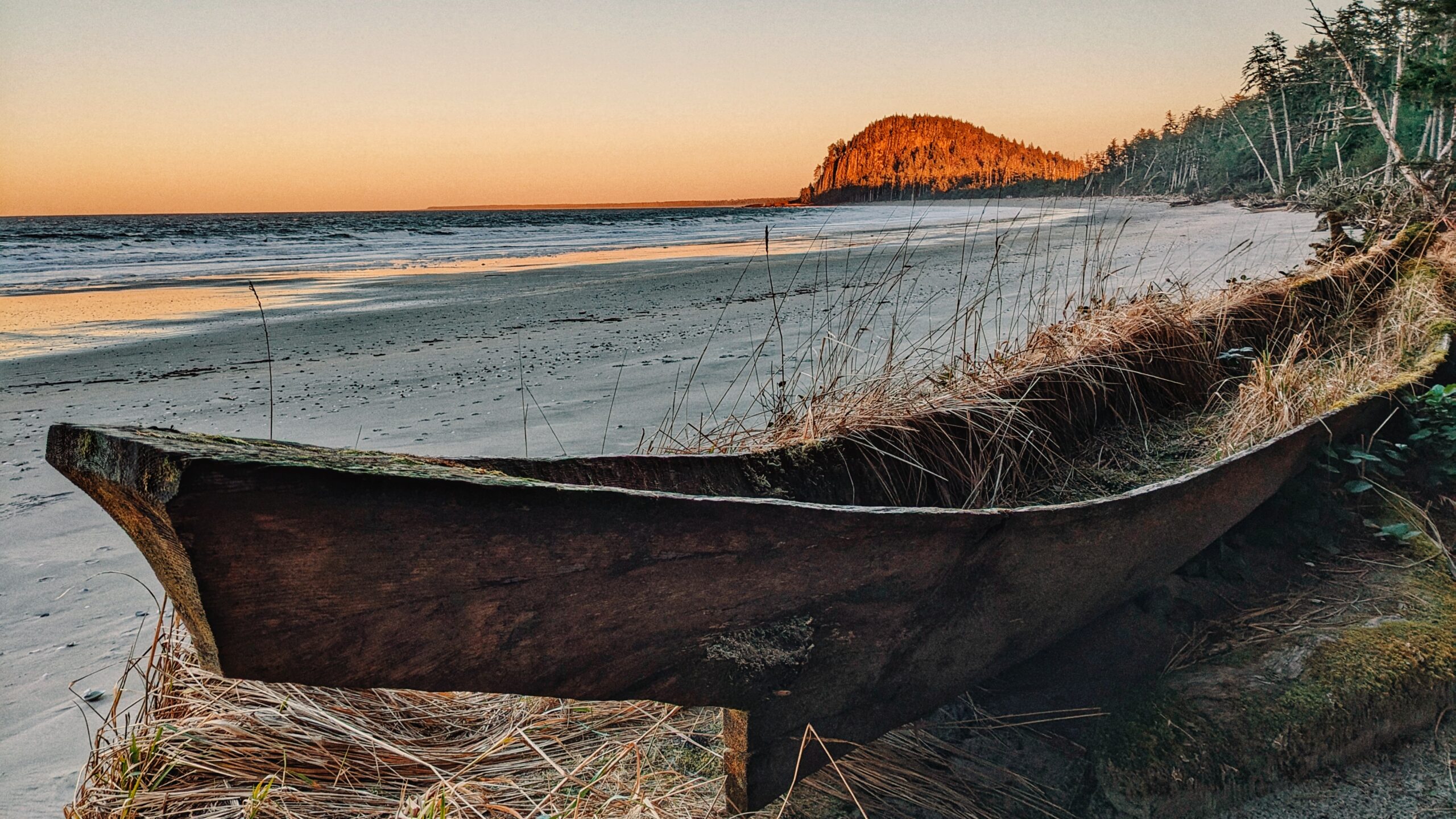
The “Naikoon Canoe Trail” is very short at just 140 meters one-way. It is also unmarked, but well worth the effort to find. Having seen and witnessed many blank or old Haida Canoes over the last few years, we were both keen and curious to locate this one after having seen it in some tourist photos.

“Where was it?” we pondered. Indeed, we knew the canoe was in Naikoon Provincial Park – and not too far from Tow Hill – because existing pictures made that plainly obvious. We initially thought we’d have to walk west to the end of Agate Beach but, as we discovered during a long day of hiking, that wasn’t necessary.

After hiking the Tow Hill/Blow Hole loop and Four Corners Trail, we began returning to Masset. As we drove past Agate Beach, we spied a small pullout on the right-hand side of the road (if COMING from Masset, the pull-out will be on your left, approximately 450 meters AFTER the road to Yakan Point). There’s enough room here for two vehicles to fit rather snuggly.

Once parked, you’ll see a small ramp and a short trail lined with clam shells. This is the trail to the “Naikoon Canoe.” It’s an easy walk, suitable for all ages, and only takes about two minutes to complete. At the trail’s terminus point, you’ll see a beautiful set-up: A number of pews and an archway, with the ancient Haida Canoe resting behind them.

The space has obviously been established for important celebrations like weddings, and it is picture-perfect! Imagine tying the knot on a clear day: An old Haida Canoe mere feet away and Tow Hill functioning as an epic backdrop. The trickster Raven chuckles in the background or a majestic eagle flying overhead.

The short trail obviously isn’t used for recreational hiking, but it serves an essential functional purpose. And, hey, if you’re not coming here to get married, at least you can take in a stunning photo and some history without travelling too far off the beaten path.

DIFFICULTY: Easy
TOTAL DISTANCE: 280 meters (return)
TIME: Less than 10 minutes
TYPE: Out-and-Back
ELEVATION GAIN: None


Pesuta Shipwreck Trail Features

Shipwreck
East Beach access
 Sand dunes

ABOUT

When travelling to Haida Gwaii, one will inevitably come across images of the Pesuta Shipwreck: It’s featured in tourist publications, there are beautiful pictures of it on BC Ferries, and countless bloggers have written about it online. 

It’s become a symbol of the Islands similar to Balance Rock or the fallen Golden Spruce. Because of that, tourists seek it out and ensure it is part of an itinerary.

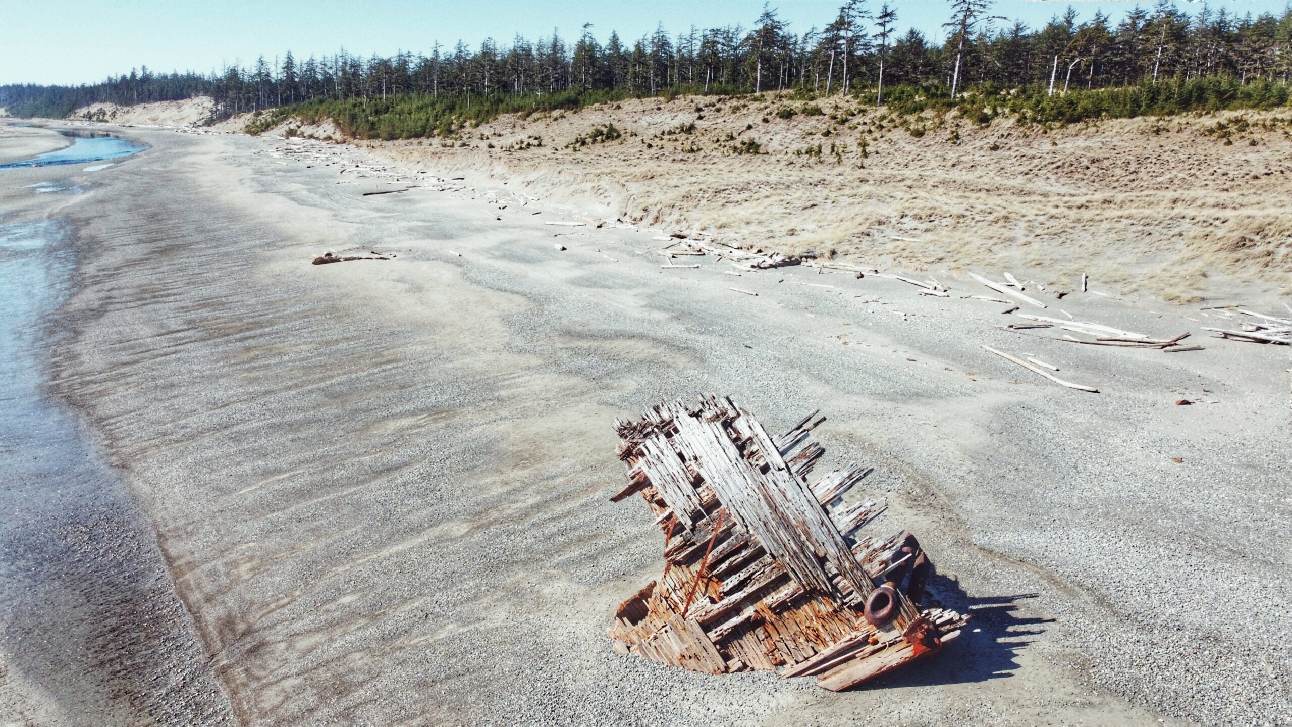
What is it about the Pesuta that draws so many? The story/context isn’t all that exciting. Basically, the Pezuta was built as a wood-hulled steam freighter during World War I and, after the war, she was sent to Seattle for “liquidation.” 

In 1927, the Pezuta was converted into a 264-foot log barge capable of carrying an impressive 800,000 feet of logs. In December of 1928, the tugboat towing Pezuta struggled against a powerful storm in Hecate Strait; the big barge broke free and ran aground on East Beach, near the mouth of the Tlell River.

After nearly 100 years, just the bow remains to jut out from the sand; however, what’s left is extremely photogenic and eye-catching on a number of levels.

By the way, did you notice what we did there? Pezuta vs. Pesuta? At some point after the ship had run aground, the name got misspelled as “Pesuta” and that’s what ended up sticking. History can be funny at times.

The Pesuta Shipwreck Trail is probably the third-most-popular hiking trail on Haida Gwaii, only behind Tow Hill and the Blowhole. At 6 kilometres one-way (the posted signage at the trailhead says 5 km, but this doesn’t seem right), we’d suggest making this hike a nice day trip so as to truly enjoy the forest, river, beach and remnants of Pesuta.

When we hiked the route, it took about 2 hours and 35 minutes, one-way – and that was moving at a fairly leisurely pace. The trail is good for all skill levels because the route is mostly flat, with very little elevation gain.

To access the Pesuta Shipwreck Trail, simply visit the Tlell River Day Use area adjacent to the Tlell River Bridge. Here, you’ll see a few picnic tables and signage indicating the route. There’s also a pit toilet available.

We should also note that this site represents the start of the multi-day East Beach Trail hiking adventure. One day, when the Pesuta has completely gone back to nature, the “Pesuta Shipwreck Trail” will cease and only the East Beach Trail will remain.

The hike out to Pesuta is pretty straightforward. After passing the pit toilet, the trail splits in two – one path leads down to the river while the other heads up into the forest. Some have suggested taking the “tree portion” one-way and the “beach/river trail back,” but this is not advised because the riverbank near the Day Use area is mostly slippery silt for at least 1.5 kilometres. Trust us when we say it’s not fun to walk on!

Instead, follow the East Beach Trail signage (forest). The first 2 kilometres take you through a beautiful old-growth forest of Sitka Spruce, Cedar and lush, green moss.

During Spring, it is possible to observe Fairy Slippers in the moss. Indeed, this portion of the trail is well-marked and easy to navigate. For most of it, you walk along a ridge high above the Tlell River before briefly moving inland to cross Geikie creek. 

We’d only advise using a bit of caution when walking along the ridge because the many tree roots do have the potential to trip you up! After clearing the forest, you spend the remaining 4 kilometres walking alongside the Tlell River until it empties into the Pacific Ocean.

From here, the Pesuta is visible in the distance, just a few hundred meters further up East Beach. On a clear day, this portion of the hike can be quite beautiful, especially as you walk past abandoned cabins and massive sand dunes. At the same time, it’s surprisingly hard on the feet!

Once you reach the Pesuta, it’s not uncommon to spend a fair amount of time here. We visited the wreck for a good hour, examining it and taking photos before making our way back to the trailhead (we lacked the stamina to walk the remaining 80+km up East Beach!).

The wreckage has a ghostly beauty to it: A visual memorial of humankind’s technology pitted against Mother Nature. The ship has sat here for nearly a century, getting beaten by waves and wind, and yet it’s still here – for now.

DIFFICULTY: Easy
TOTAL DISTANCE: 12 kilometers (return)
TIME: 5 hours
TYPE: Out-and-Back
ELEVATION GAIN: Minimal

ABOUT

Kwuna Point Trail is located on Moresby Island at Alliford Bay. To find it, assuming you’re driving off the Kwuna ferry, turn LEFT onto Kwuna Point Road and drive to the end of the road. You will see a small parking lot and dock – park here. 

Like most trails on Haida Gwaii, Kwuna Point does not have formal trailhead signage; however, it is clearly signified by the Stranraer 935 Memorial.

The trail is essentially a loop and takes you around Kwuna Point before exiting back onto Kwuna Point Road, approximately 300 meters from the parking lot. Trail markers are sporadically placed throughout, but the trail is easy enough to follow, so there’s practically no chance of getting disoriented. 

Above all else, what we appreciated about this short hike was the varied terrain you pass through: Lush ferns, thick moss, rocky beach and young forest of cedar and Sitka spruce. If you pass through this trail in late May or early June you’ll also get to spy many a lovely fairy slipper. While Kwuna Point Trail is mostly flat, there are a few steep sections – two of which have ropes to assist – so good footwear is recommended.

Not far from the trail’s end point, a short side trail also leads to a small cabin – built by a grandfather for his grandson. This cabin is nestled in a protected beach cove that faces Graham Island. In low tide, the beach is a safe place to do some beach combing. You can enter and visit the cabin (there is a guestbook), but please leave it as you found it. 

From the cabin, look across to nearby Smuggler’s Cove! We can imagine this is also a good spot for kayaking, paddle boarding, and with a wet suite swimming in the summertime.

DIFFICULTY: Easy

TOTAL DISTANCE: 900 meters

TIME: 1 hour

TYPE: Loop

ELEVATION GAIN: Minimal