The still existing head trail sign of the Onward Point Trail (May 2020)
The steps that leads to the gazebo (Jan 2023)
Onward Point gazebo on a sunset (Jan 2023)
The forest greets your hike (May 2020)
Onward Point is a place to watch the fiery sunsets (Jan 2023)
ONWARD POINT TRAIL KEY FEATURES Whale-viewing Beach access Gazebo
ABOUT
Located on Moresby Island, and approximately 10 minutes from the Kwuna ferry landing, the Onward Point Trail represents a leisurely, brief hike – just over 5 minutes one-way – to a beautiful cedar gazebo.
While at the gazebo, gaze out towards Skidegate Inlet and view the mighty seagulls as they dive for food; the abundant seals as they float about and cause mischief; and the graceful eagles as they soar overhead. If you’re lucky, you may even spy a grey whale or an orca in springtime.
After spending some time admiring the flora, continue along the loop back toward your vehicle.
Indeed, the Onward Point Trail is pretty straightforward. Once you reach the trailhead, you’ll observe signage identifying the route as “moderate difficulty.”
We think this is only partly true. As you begin your hike, you’ll immediately notice that the trail splits into a Y (the loop). We recommend going counterclockwise – to the right – as it’s the easier route. There is some deadfall along the way, but the trail is relatively flat and takes you through some nice spruce, ferns and cedar trees.
If you continue along the loop, from the gazebo, the trail does increase in difficulty but only because the earth is soft in some areas. If you wish to avoid this, simply go back to the way you came.
The Onward Point Trail is a nice break from modernity and offers a serene moment for reflection, thanks to the gazebo and the presence of fairy slippers in spring. If you wish to explore the rocky beach below, there is an informal trail leading down to the beach from the gazebo; however, use caution because the rocks below are often slippery.
Please note the Onward Point Trail does connect with the “Around the Pond” trail extension. If hiking the Onward Point loop counterclockwise, you’ll see the trail to your right about a minute or two into your hike.
Tow Hill and the beginnings of Agate Beach (Jan 2023)
Tow Hill and Blow Hole trails (Apr 2022)
Blow Hole wave drama effects (Apr 2022)
The boardwalk in Tow Hill makes it a manageable accent to the cliffs (Jan 2023)
Surfer’s dream waves up North (Jan 2023)
TOW HILL & BLOW HOLE TRAIL FEATURES Haida legend Basalt rock formations Unobstructed views
ABOUT
Probably the most quintessential and well-known of Naikoon Provincial Park’s attractions, the Tow Hill and Blow Hole Trails hiking routes are easy and family-friendly, thanks to boardwalks that go their entire length. At the trailhead, which is approximately 26 kilometres east of Masset, you’ll be greeted by two small Haida totems, both of whom sit on either side of a large infographic. This interpretive panel helps set the context for the hike you’re about to embark on.
It enunciates important cultural, historic and environmental information. Notably, and keeping in line with the “accessible” theme, the information board includes colour contrasts and braille. The images can also be “read” with your fingertips.
From the trailhead, hike a little over 200 meters along the wide, hard-packed dirt path. Along the way, you’ll come upon another important feature: A four-track solar-panelled talking sign: Hear a traditional Haida welcome, a Haida song, and the legend of the “Big Spider.”
Indeed, this network of trails – perhaps more than any other on Haida Gwaii – does much to entrench you in this space and this place; that is, Haida territory.
Once you hit the beautifully constructed boardwalk – a partnership between Parks and Old Massett Village Council – you have two options: A hike up to the Tow Hill viewing area (just over 900 meters) or a hike towards the beach and blow hole (just over 700 meters). Each trail, from this point, takes approximately 30 minutes and 15 minutes, respectively.
Tow Hill Trail
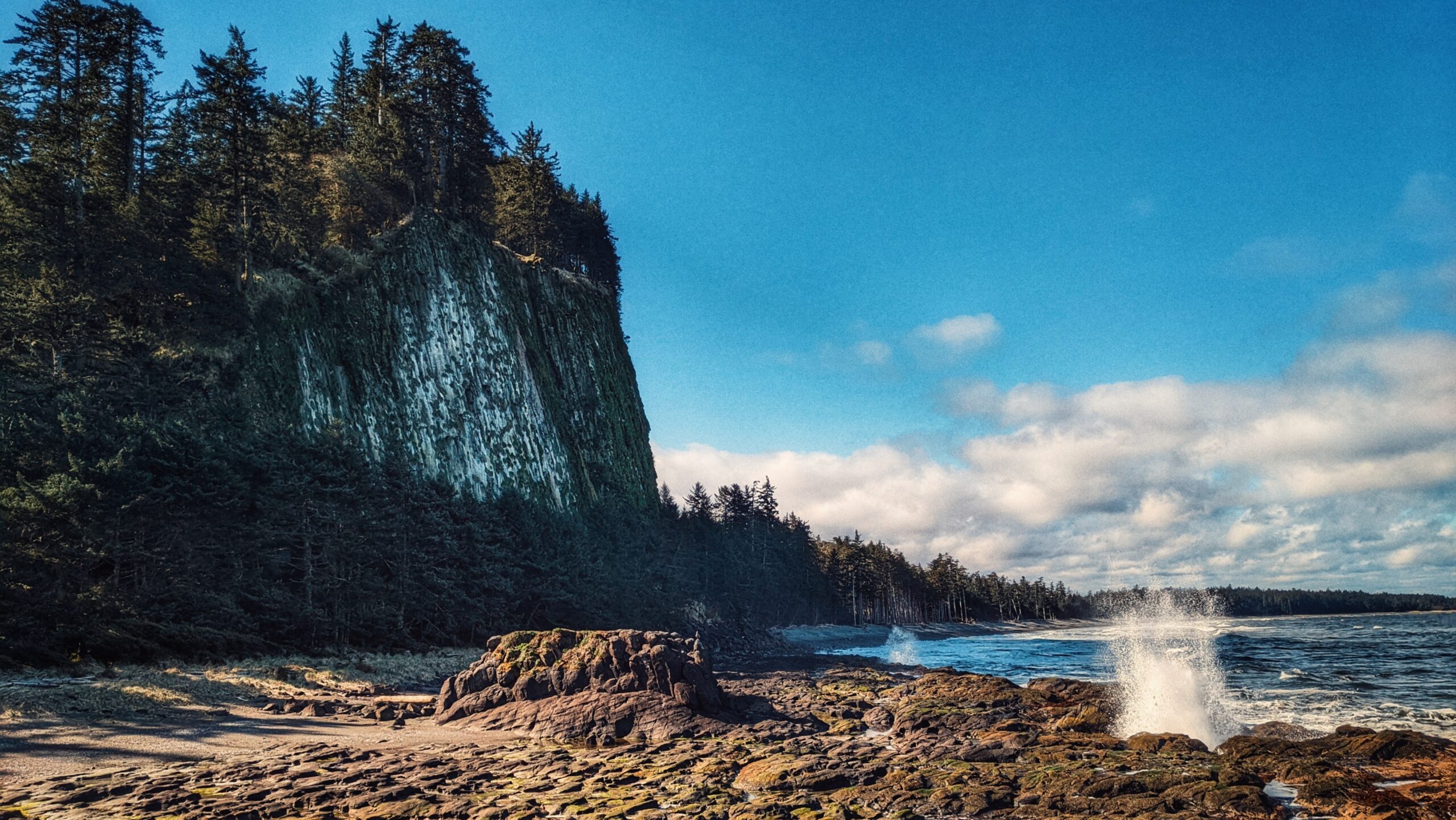
Steeped in Haida lore, Tow Hill, or Taaw Tldáaw, is a magnificent volcanic plug formed from eruptions of molten lava some 2 million years ago. Jutting out of the ocean, it is, unquestionably, the most distinguishing geographic feature of Naikoon Provincial Park. Standing at nearby Agate Beach, or North Beach, it dwarfs you with its size; in fact, you can even see it off in the distance while hiking White Creek or enjoying the epic Tl’ellan to Old Massett beach route. Because of its prominence in literature and advertising, Taaw Tldáaw is an iconic image and is synonymous with Haida Gwaii.
Besides its awe-inspiring natural beauty, and deep connection to Haida lore, Taaw Tldáaw and the surrounding area also make for some of Haida Gwaii’s best hiking. Once you reach the boardwalk, go LEFT to continue hiking toward Tow Hill’s zenith.
As noted, the hike is easy, but the incline does increase the higher you go. Along the way, you’ll cross over some minor boggy sections and luxuriantly green moss-covered trees. Take your time to fully appreciate the natural and supernatural beauty of Haida Gwaii as it surrounds and enchants you with its lush rainforest, light mist and heavy cultural traditions.
At about the mid-way point, you come upon the first viewing platform. From here, you can look out onto North Beach, towards Rose Spit – another place steeped in Haida tradition. Once you reach the summit of Taaw Tldáaw, take a moment to breathe in the fresh sea air. From your perch, some 125 meters high, you can see Agate Beach below; the expanses of Naikoon Provincial Park; Dixon Entrance; and, on a clear day, even the shores of Alaska.
Be warned, though, that it is generally quite windy at the top of Tow Hill – something clearly in evidence by the wind-swept trees just outside the viewing platform! Once you’ve had your fill, descend the trail until you come upon a connector to the Blow Hole.
Blow Hole Trail
For our purposes, let’s assume you’re starting your hike from the Tow Hill/Blow Hole trailhead. Again, walk about 200 meters alongside the Hiellen River to the boardwalk. This time, go RIGHT towards the Blowhole. The hike is short – about 15 minutes – and provides some nice ground-level views of the Hiellen River, Christian White’s monumental pole, and North Beach. Lush mosses and a fairly dense forest greets you opposite Oceanside.
Once you reach the end of the short Blow Hole Trail, you’ll find detailed information boards on the origins of “Tow” and how he separated from his brother “Towustain.” The Haida history we’re privy to at this site – combined with nearby Rose Spit and Hiellen – enriches the overall experience and improves our appreciation of this mystical place. In this regard, Tow Hill and the surrounding area are a definite “must-visit” on Haida Gwaii.
Descending the stairs from the boardwalk, you’re treated to a magical space: A coastline covered in lava rock formations, imposing rock cliffs and intense wave action, battering the shoreline. On a rising tide, you will see the “blow hole” in action – a truly special sight! A word of caution: We advise that you steer clear of the rock’s edge on stormy days. The waves are larger and stronger and it is not uncommon for the odd rogue wave to hit this area.
The Wiggins Road Trail takes you along the Tlell River banks with scenic forest views
The moss covered trees along the river makes it so relaxing (Jan 2021)
The mossy banks of the Tllel River makes it an interesting hike (Jan 2021)
The “official” head trail (May 2021)
Wiggins Road Trail Features Popular fishing access Access to Tlall Conservancy
A note of caution: One should avoid hiking this trail after heavy rainfall. Sometimes the banks of the Tlell River will overflow, flooding sections of the trail and making them virtually impassable.
ABOUT
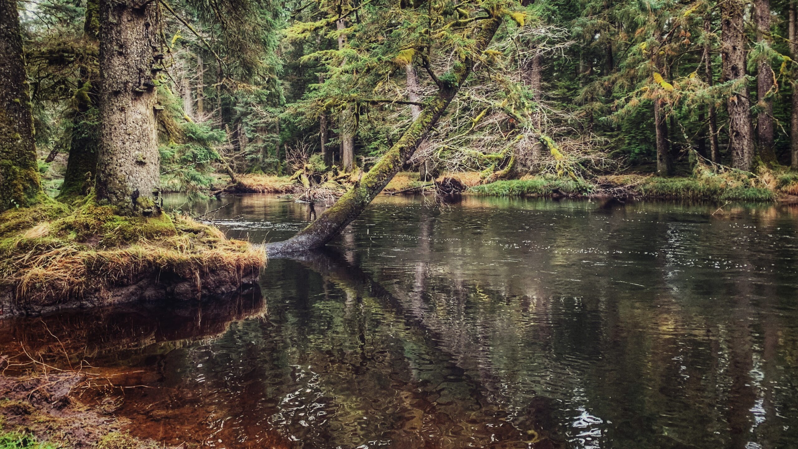
The Wiggins Road trail is an unmaintained 1.5km out-and-back route that follows the Tlell River south along the river’s bank. While the trail is unmarked, it’s still relatively easy to follow until you begin entering the Tlall Conservancy area. At this point, the rough trail gets harder to make out and, at times, feels more like a trudge through the forest. Still, the hike has its rewards: At numerous points throughout, one can marvel at the Sitka spruce before them, the lush mosses, and the mighty Tlell.
While the trail can be used for a recreational hike, its primary purpose is to provide access to the Tlell River for steelhead fishing. It is not uncommon to see locals along the banks reeling in their catch in late Summer or early Fall. Further to this, the trail does provide numerous side paths to the river for fishing purposes.
From a hiking perspective, Wiggins Road trail can be classified as an easy to moderate hike, depending upon one’s fitness level. Much of the trail is flat, though there are some significant areas of mud, roots and deadfall. In addition, the Wiggins Road trail does provide an opportunity for a much grander adventure:
If you do hike the 1.5km (one-way) from the trailhead, you will eventually connect to the far more popular Anvil Trail, which is a 5km loop trail that takes you on a beautiful Wilderness Interpretive hike.
It should be noted that the Wiggins Road trail does fall on privately held land for much of its length, so those visiting should be respectful of posted signage.
To access this trail, turn onto Wiggins Rd and simply follow the road to its terminus point – a cul-de-sac.
Here you will spy the unmarked trailhead, which leads you down to the Tlell River. NOTE: As you walk down the slight incline at the trailhead, you will see a log fence to your left. You will have to crawl through the fence opening to access the rest of the trail – don’t let this dissuade you!
DIFFICULTY: Easy TOTAL DISTANCE: 3km (return) TIME: Approximately 1 hour TYPE: Out-and-Back ELEVATION GAIN: None
Slightly elevated part of the trail with helpful cut logs to help you up
Part of the beach you see at end of trail
The open horizon leading up o the beach
ANDREWS PLACE ROAD TRAIL FEATURES: Beach Access Access to Naikoon Provincial Park
ABOUT
The Andrews Place Road Trail is a short out-and-back route located at the end of, well, Andrews Place Road in Tlell. The trailhead is not formally marked; however, it can be seen adjacent to a hydro pole at the end of the cul-de-sac, next to Sandy House. At just 250 meters in length, it only takes 5 minutes to complete this trail and emerge, first, onto the flat sand dunes and then the pebbly beach below.
Because of its short length, I suspect this trail was created more for functional reasons – beach access – than recreational hiking. As such, proper hiking gear is not required. The path is user-maintained and the terrain is mostly flat; however, there are some roots to watch out for as well as some potentially slippery steps to climb en route to the beach.
For the first three minutes of the hike, you walk through fairly dense salal bushes and young Sitka Spruce. Beautiful green moss carpets areas of the forest floor. Just before reaching a set of stairs, you’ll spy a heavily worn and faded sign pointing “to the beach.” After climbing the stairs, you’ll come upon a beautiful memorial bench that sits at the junction of forest and sand dunes. From here, it’s a short two- minute walk towards the beach.
In late Spring and early Summer, the sand dunes in this area – and throughout Naikoon Provincial Park are rife with life. As you walk, be sure to keep an eye out for delicious wild strawberries! At times, the sweet aroma is enough to envelop the mind!
At high tide the beach in this area is pebbly and rough; however, low tide exposes the smooth, packed sand. Most who visit this area either do so for a refreshing dip in the Pacific Ocean or to walk along the shoreline – technically part of the larger Misty Meadows Loop Trail – toward the mouth of the Tlell River. On a clear day, the expanse of beach and sand dunes can, and do, appear most welcoming.
BLACKWATER CREEK WATERFALL TRAILS FEATURES: · Relatively easy access to waterfalls · Challenging rope sections
ABOUT
The Blackwater Creek Waterfall Trails are a couple of hidden gems on Haida Gwaii. The two trails are short – clocking in at about 200 and 400 meters respectfully – and very remote; however, if one enjoys chasing waterfalls, these two routes are definitely worth the effort. As these trails are not well known, they do not appear in any of the literature available on Haida Gwaii. Here’s how you get to them:
1) Starting in Port Clements, drive south along Bayview Drive towards the Golden Spruce Trail.
2) Keep driving. Bayview Drive eventually turns into the Port Man Forest Service Road – an active logging road. At about the 11km mark from Port Clements, you’ll come upon signage for the “HAIDA CANOE” Trail. Then, 150 meters from this point you’ll spot a “Y” or split in the road. Turn RIGHT onto the New Mainline Road. You will then cross a bridge over the Mamin River before coming to another “Y.”
Keep left on the New Mainline Road for approximately 500 meters. You will then see a minor logging road to your LEFT. Turn here and drive for nearly 5 kilometres. Note that, from this point on, the road is narrow (single track) and does have a few low-hanging alder trees you’ll have to clear.
3) After driving along the road for nearly 5 kilometres, you’ll cross a small bridge over Blackwater Creek. Barely 100 meters past this bridge, you’ll come upon another “Y.” Turn RIGHT. Drive approximately 2 kilometres along this narrow road. If you’ve made it this far, you’ll spy the trailhead marker for the first waterfall. It is signified by pink and orange flagging tape hanging from young spruce trees.
The trail is short – approximately 200 meters one-way – but it is more reminiscent of a stroll through the bush than an actual trail. Expect to walk through dense forest, a lot of deadfalls and a few muddy sections. The good news, though, is the route is extremely well-marked: There is bright flagging tape every few feet, so it’s virtually impossible to get lost.
At the end of your hike, you’ll come upon a moderately steep section, which you must carefully descend in order to view the waterfall. The waterfall itself is quite nice; however, it is difficult to photograph on account of being obstructed by large logs. After enjoying the cascading falls and the sounds of nature, return the way you came.
4) To view the second waterfall, continue driving approximately 1.2 kilometres up the same narrow road. You will eventually see the trailhead markers – signified by candy cane patterned flagging tape – to your LEFT. A pullout, large enough for 2 vehicles, is just a few feet up the road. Unlike the first waterfall, the route to this second waterfall resembles a more traditional trail (albeit a little rough).
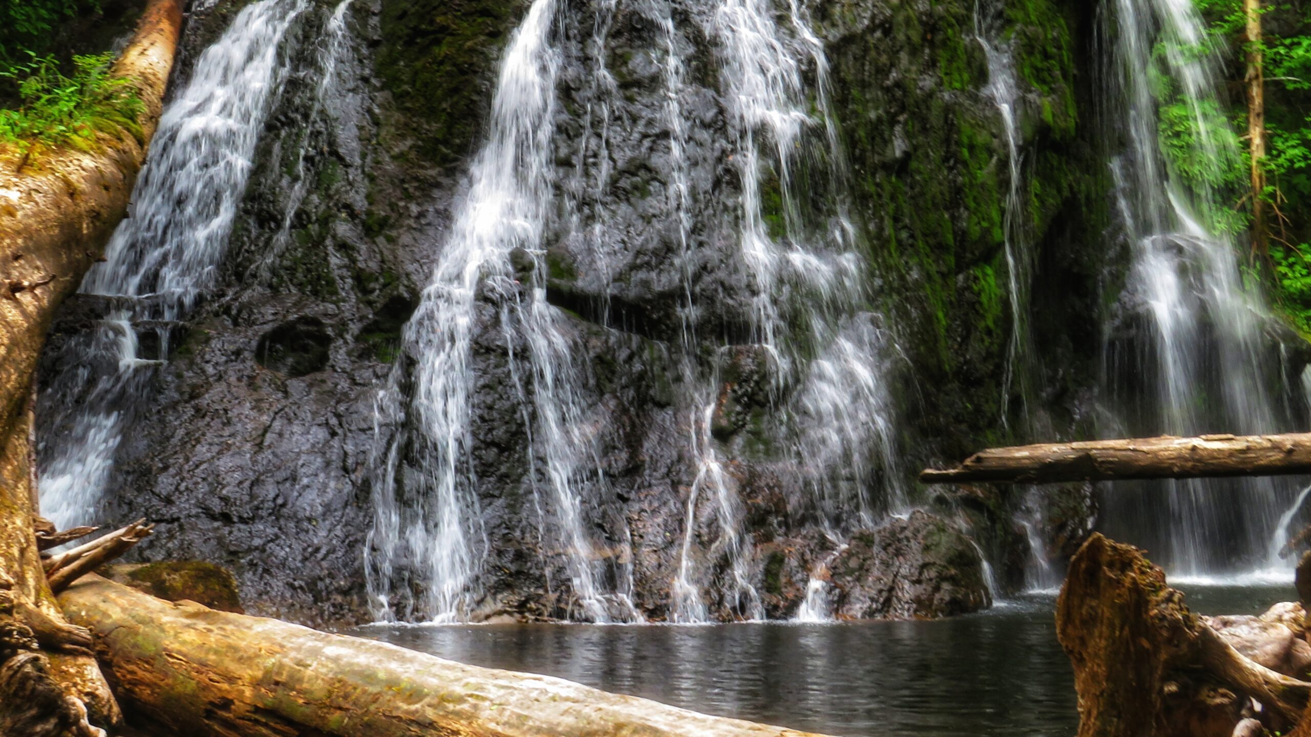
It, too, is extremely well marked with flagging tape. The total length of this trail is approximately 400 meters (one way), but that’s because, at the mid-point, it splits. If you go to the RIGHT, you’ll come upon the “top” of the falls, which is picturesque in its own right and features an attractive “kiddie pool” more than suitable for a swim.
If you go to the LEFT at the trail split, you’ll eventually make your way to a fairly large waterfall, cascading down a rounded rock face. Use caution, though: To get to these falls, you must descend an extremely steep area that, in one area, is almost completely vertical. There are several sturdy ropes to assist you here. Once you make it down, however, it is only a short walk to the impressive falls.
It is not uncommon for people to linger here for many a moment and cool off under the cascading water. Once you’re finished admiring the serene beauty laid out before you, simply head back the way you came.
Getting to these waterfalls may be tricky (both in navigating the narrow logging roads and hiking), but it is well worth the effort. In both instances, the waterfalls are a mere 10 to 15 minutes off the road. In our view, the second waterfall, in particular, is the major highlight because of its size and relative ease of access; in fact, we’d even suggest it rivals the Dover Falls in Sandspit!
Again, though, keep in mind that you will be driving on active logging roads; thus, proper caution should be exercised. In addition, while a truck is not necessary to reach these sites, a standard vehicle is not ideal for these roads.
DIFFICULTY: Easy to Moderate TOTAL DISTANCE: 400 and 800 meters (return) TIME: 50 minutes (for both trails, out and back) TYPE: Out-and-Back ELEVATION GAIN: Minimal
MASSET CEMETERY ROAD BEACH ACCESS TRAIL: Access to North Beach Masset Cemetery
ABOUT
The aptly named Masset Cemetery Road Beach Access Trail is exactly as it says: It is located adjacent to Masset Cemetery and provides straightforward access to South Beach. In this regard, it isn’t much of a hiking trail but serves a functional purpose. The trail is wide and flat, taking you through compacted sand and a few scattered spruce trees before hitting the beach. In brief, there’s nothing much of note along this short trail. It’s all in the destination. . .
In our experience, most people don’t access this trail on foot. Instead, because it is so wide (and resembles a road more than a trail), ATVs and trucks are far more common. The few times we’ve hiked this route, ATVs and other vehicles have always been present – riding up and down the pebbly beach at quite the pace. But the vehicle use isn’t just for recreational fun: At certain times of the year, the Haida will access the beach in this area to harvest traditional foods.
As noted, it is highly unlikely one would visit this trail for recreational hiking purposes. Instead, we recommend doing the practical thing: Use it to access the beach – which itself is part of the larger Tl’ellan to Old Massett Trail – and go for a nice stroll alongside the powerful Pacific Ocean. As you amble about, keep an eye out for sea life, agates, and beach glass. There’s no telling what you might find!
Finally, since you’re in the area, we would also recommend visiting the Masset Cemetery: This is a truly unique space, unlike any cemetery we’ve visited. Haida Watchmen figures keep a close eye on some resting sites while mounds of agates and scallop shells can be found at others. In a large city, some of these “precious” items would quickly grow legs, but in a small community like Haida Gwaii, the house of the dead is deeply respected. Thus, if you do choose to visit the cemetery before or after walking the nearby beach, step quietly and cautiously. Someone – or something – is always watching 😉
Contains information related to marketing campaigns of the user. These are shared with Google AdWords / Google Ads when the Google Ads and Google Analytics accounts are linked together.
90 days
__utma
ID used to identify users and sessions
2 years after last activity
__utmt
Used to monitor number of Google Analytics server requests
10 minutes
__utmb
Used to distinguish new sessions and visits. This cookie is set when the GA.js javascript library is loaded and there is no existing __utmb cookie. The cookie is updated every time data is sent to the Google Analytics server.
30 minutes after last activity
__utmc
Used only with old Urchin versions of Google Analytics and not with GA.js. Was used to distinguish between new sessions and visits at the end of a session.
End of session (browser)
__utmz
Contains information about the traffic source or campaign that directed user to the website. The cookie is set when the GA.js javascript is loaded and updated when data is sent to the Google Anaytics server
6 months after last activity
__utmv
Contains custom information set by the web developer via the _setCustomVar method in Google Analytics. This cookie is updated every time new data is sent to the Google Analytics server.
2 years after last activity
__utmx
Used to determine whether a user is included in an A / B or Multivariate test.
18 months
_ga
ID used to identify users
2 years
_gali
Used by Google Analytics to determine which links on a page are being clicked
30 seconds
_ga_
ID used to identify users
2 years
_gid
ID used to identify users for 24 hours after last activity
24 hours
_gat
Used to monitor number of Google Analytics server requests when using Google Tag Manager