Tag: haida gwaii beach trails

  • Andrews Place Road Trail: Easy Access to Naikoon Provincial Park

    • Andrews Place Road Trail
    • Andrews Place Road Trail
    • Andrews Place Road Trail
    • Andrews Place Road Trail
    • Andrews Place Road Trail

    ANDREWS PLACE ROAD TRAIL FEATURES:
    Beach Access
    Access to Naikoon Provincial Park


    ABOUT

    The Andrews Place Road Trail is a short out-and-back route located at the end of, well, Andrews Place Road in Tlell. The trailhead is not formally marked; however, it can be seen adjacent to a hydro pole at the end of the cul-de-sac, next to Sandy House. At just 250 meters in length, it only takes 5 minutes to complete this trail and emerge, first, onto the flat sand dunes and then the pebbly beach below.

    Because of its short length, I suspect this trail was created more for functional reasons โ€“ beach access – than recreational hiking. As such, proper hiking gear is not required. The path is user-maintained and the terrain is mostly flat; however, there are some roots to watch out for as well as some potentially slippery steps to climb en route to the beach.

    For the first three minutes of the hike, you walk through fairly dense salal bushes and young Sitka Spruce. Beautiful green moss carpets areas of the forest floor. Just before reaching a set of stairs, youโ€™ll spy a heavily worn and faded sign pointing โ€œto the beach.โ€ After climbing the stairs, youโ€™ll come upon a beautiful memorial bench that sits at the junction of forest and sand dunes. From here, itโ€™s a short two-
    minute walk towards the beach.

    In late Spring and early Summer, the sand dunes in this area โ€“ and throughout Naikoon Provincial Park are rife with life. As you walk, be sure to keep an eye out for delicious wild strawberries! At times, the sweet aroma is enough to envelop the mind!

    At high tide the beach in this area is pebbly and rough; however, low tide exposes the smooth, packed sand. Most who visit this area either do so for a refreshing dip in the Pacific Ocean or to walk along the shoreline โ€“ technically part of the larger Misty Meadows Loop Trail โ€“ toward the mouth of the Tlell River. On a clear day, the expanse of beach and sand dunes can, and do, appear most welcoming.


    DIFFICULTY: Easy
    TOTAL DISTANCE: 500 meters (return)
    TIME: 10 minutes
    TYPE: Out-and-Back
    ELEVATION GAIN: None

  • Exploring Damaxyaa Conservancy – Louise Dover Trail

    Exploring Damaxyaa Conservancy – Louise Dover Trail

    • Louise Dover Trail
    • Louise Dover Trail

    LOUISE DOVER TRAIL FEATURES:
    Old Growth forest
    Culturally Modified Trees
    Dover Falls


    ABOUT

    The Louise Dover Trail is located adjacent to the Haans Creek bridge, just before entering Sandspit. Initially conceived in the mid-1990s, the trail is named after Louise Dover, an influential woman of Haida ancestry who lived in the community of Sandspit. In many respects, the trail is an apt memorial and tribute because it introduces hikers to key elements of Haida Gwaii: Important fish streams; unique flora and fauna; ancient Haida culture; rare geology and fossils; and, a larger appreciation for how everything depends upon everything else.

    In 2008, the Dover Trail became part of the larger Damaxyaa Heritage Site and Conservancy. Encompassing some 829 hectares, the conservancy plays host to important fish-bearing streams โ€“ one of which is Haans Creek โ€“ and contains a high density of recorded culturally modified trees (CMTs), a few of which can be spied along the Dover Trail. Both in pre-history and the current day, Damaxyaa is an important place for the Haida in terms of food gathering, medicine and culture. A seasonal Haida camp known as Kil was originally located at the mouth of Haans Creek, but no evidence of this remains today.

    Most official documentation on the Dover Trail clocks it in at 3.5km in length, but 4km is much more accurate. The first 200 meters are dubbed universal access, and bring you to a handsome viewing gazebo, thanks to significant upgrades completed in the autumn of 2020. After this, the trail becomes narrow and rough for most of the loop.

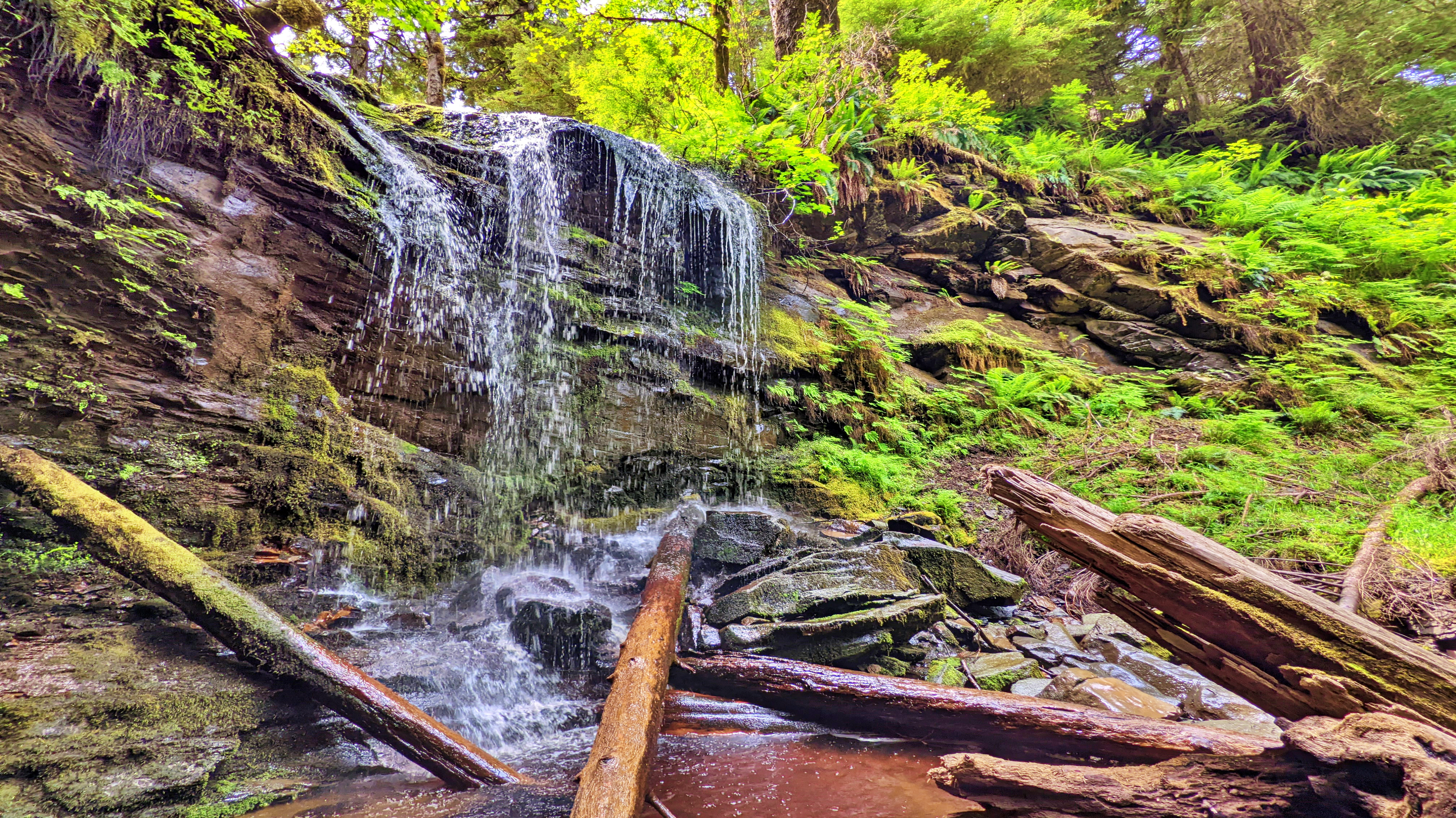
    Expect a lot of โ€œup, down, up downโ€ for much of your hike. Once you hit the mid-way point of the Dover loop, youโ€™ll see a marked side trail. This leads you to a lava bed and fossils โ€“ one of the trailโ€™s key highlights. If you ignore this trail, though, and continue along the main Dover loop, the route climbs quite steeply away from Haans Creek. Near the end of your climb, a small stake in the ground indicates 400 meters of โ€œhardโ€ trail leads to a waterfall.

    If youโ€™re feeling ambitious, itโ€™s certainly worth the effort; however, be advised that much of this side trail is steep and muddy with a couple of rope sections. Early in, you also have to get creative in getting over a fallen monumental cedar tree.

    The final section of the Dover Trail loops back towards the road and trailhead, connecting with the trail you started near the natural log bridge at Haans Creek. Much of this trail is muddy, but home to many old-growth Sitka Spruce and Cedar trees. As you hike back towards the trailhead and Haans Creek, youโ€™ll spy at least one CMT with a large โ€œtest holeโ€ in it. Youโ€™ll also come across the โ€œSkyline Trail,โ€ which remains closed for whatever reason as of this writing.

    Many who visit Haida Gwaii declare the Dover Trail to be their favourite overall hike. The terrain is varied; there are a number of side trails to visit and explore; it offers a glimpse into the old-growth forest and Haida culture; and, it represents a great way to reconnect with nature. Think of it as forest therapy.


    DIFFICULTY: Moderate
    TOTAL DISTANCE: 4km (longer if exploring side trails)
    TIME: 3 hours
    TYPE: Loop
    ELEVATION GAIN: 106 meters

  • Smugglers Cove: A Delightful Beach

    Smugglers Cove: A Delightful Beach

    • Smugglers Cove
    • Smugglers Cove
    • Smugglers Cove
    • Smugglers Cove cabin

    SMUGGLERS COVE FEATURES:
    Picnic spot
    Swimming


    ABOUT

    We came upon Smugglers Cove quite by accident. We were en route to the Kwuna Point Trail when we spied this lovely little cove just 250 meters up Kwuna Point Road in Sandspit. Youโ€™ll see a small pullout suitable for one vehicle when you reach it. With its serene and peaceful setting, it called to us; thus, after hiking Kwuna Point, we decided to enjoy a few moments of zen at Smugglers Cove.

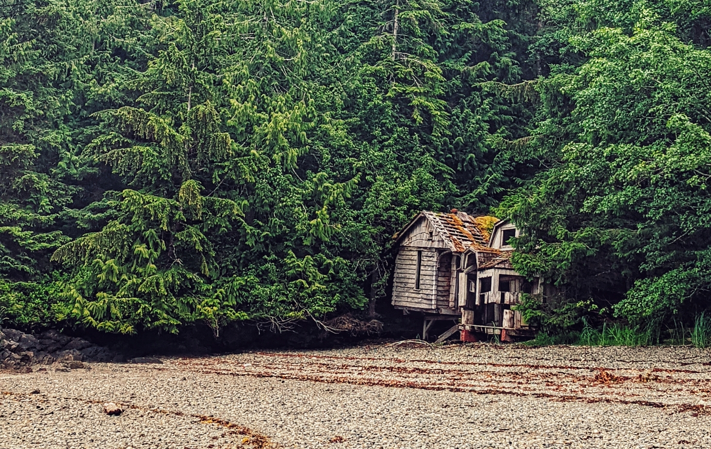
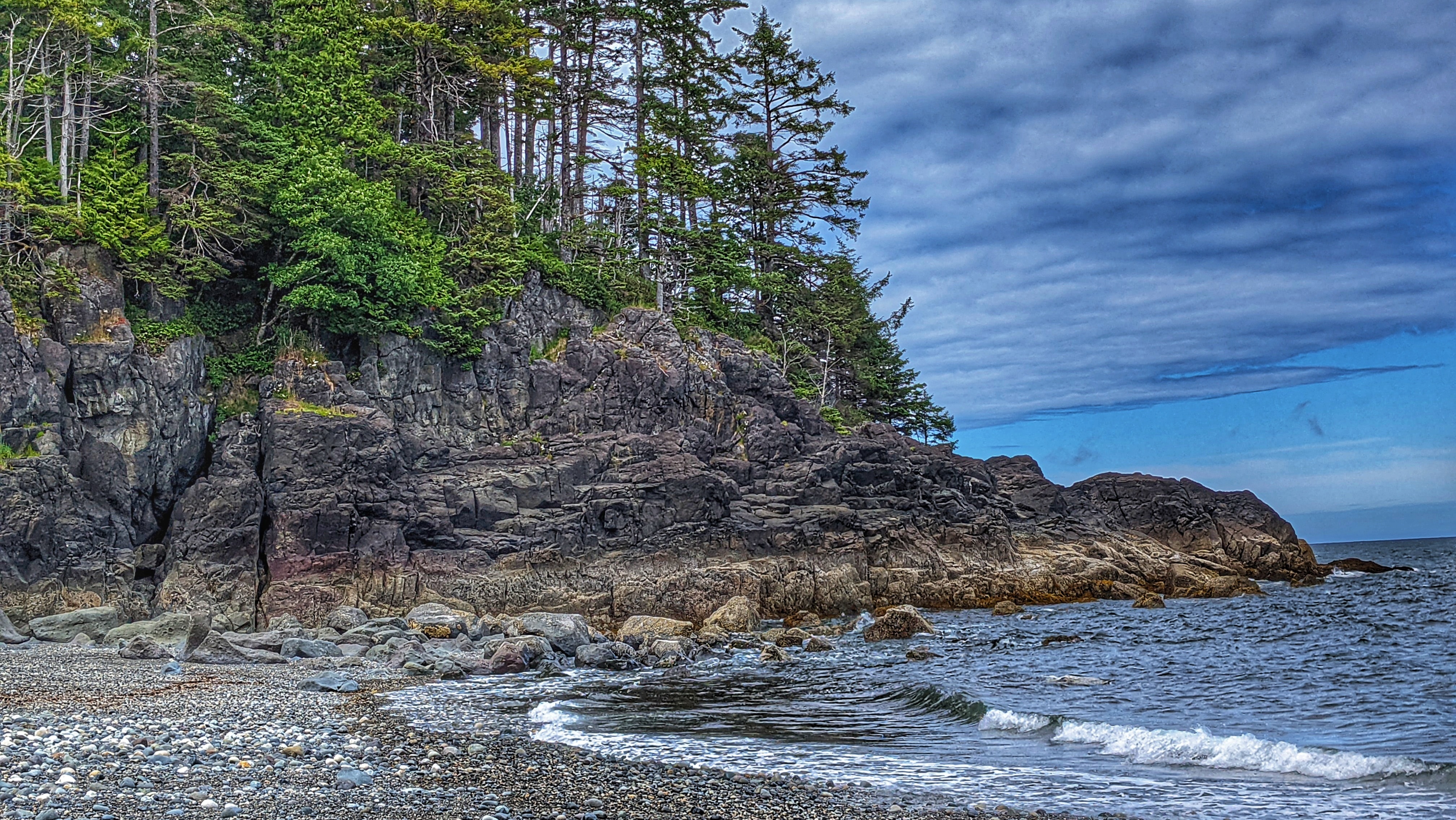
    As noted, Smugglers Cove is tiny but its ease of access makes it far more attractive, in our view than the more popular Secret Cove. Smugglers Cove is literally right off the road whereas, with Secret Cove, you have to drive nearly an hour on rough logging roads and then hike a short trail. Its physical geography is also similar to that of Secret Cove: The beach is primarily made up of small stones while each side of the cove features a rocky shoreline replete with a variety of stunning sea life. Keep an eye peeled for small beach crabs! Smugglers Cove is also home to some old cabin remnants, which makes for a unique photo opportunity!

    While it is possible to take a dip in the ocean, we think Smugglers Cove is far more suitable for a picnic or relaxation on the pebbly beach. The cold water from the open ocean can be challenging if you do not have a wetsuit even on a hot summer day. It is also recommended you have a pair of strong sandals when dipping in the water as the sharp little rocks can be hard to navigate. As you sit here and marvel at Haida Gwaiiโ€™s natural beauty, you just might spy โ€œRemiโ€™s Cabinโ€ in the distance!


    DIFFICULTY: Easy
    TOTAL DISTANCE: N/A
    TIME: N/A
    TYPE: Beach walk
    ELEVATION GAIN: None

     
  • Hidden Beach Paradise – Secret Cove Trail

    Hidden Beach Paradise – Secret Cove Trail

    • Secret Cove Trail beach
    • Secret Cove Trail bridge

    SECRET COVE TRAIL FEATURES
    Remote cove
    Nudist-friendly
    Kunxalas Conservancy


    ABOUT

    The Secret Cove Trail is located within the Kunxalas Heritage Site along the northeast coast of Moresby Island. To access this remote trail, you must drive approximately 25km southeast of Sandspit along the Copper Bay Mainline, Spur 20 Road, and, finally, Gray Bay Road.

    The signed trailhead for Secret Cove comes about 1km before the Gray Bay Recreation Site. Once you park your vehicle, itโ€™s a brief 600-meter hike (one way) to the aptly named Secret Cove.

    The trail is decently maintained and features a marker designed by the late Ben Davidson. These beautiful yellow, black and white markers serve a multitude of purposes: 1) They help to keep you on the right trail (an informal trail shoots off Secret Cove and heads toward Dogfish Bay); 2) They reflect Haida heritage and culture; and, 3) They reinforce, within us, important values that help contextualize the space weโ€™re exploring.

    We should note, too, that youโ€™ll see these trail markers on other important routes around Haida Gwaii, including Louise Dover Trail, White Creek, Cape Fife, and Pesuta/East Beach.

    Secret Cove Trail is relatively flat and an easy hike. After making your way through lush ferns, alders, and beautiful spruce trees, youโ€™ll come upon the trailโ€™s namesake cove. Once here, take a dip in the Pacific Ocean; however, we do advise you to keep your clothes on!

    When our party hiked this route, we did come upon a couple of nudists and their dogs. I think we spoiled their fun because they left as soon as they saw us! Party poopers!

    Of course, if swimming nude isnโ€™t your thing, you can explore the rocky coastline at low tide and marvel at the smooth rocks and walls polished by intense wave action. Itโ€™s not unusual to come across large beds of blue mussels hugging the boulders in this area.

    I think, by itself, Secret Cove is not worth the long drive and journey. Instead, I would pair it with a larger exploration of the Kunxalas Heritage Site. By doing so, you can camp at Gray Bay, enjoy the sandy beach, go kayaking and learn even more about the unique and rich history of this place and space.


    DIFFICULTY: Easy
    TOTAL DISTANCE: 1.2km (return)
    TIME: 30 minutes
    TYPE: Out-and-Back
    ELEVATION GAIN: None