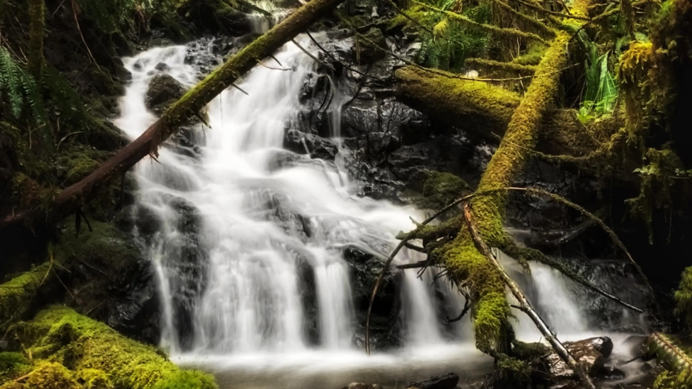
5-Mile Marker Waterfalls Trail
Quick & easy to access
Relaxing spot

ABOUT

While there are a number of nice waterfalls on Haida Gwaii, most are either extremely remote and/or
require a bit of effort to get to – some are some exceptions like the 5-Mile Marker Waterfall Trail. Then there are a select few that are relatively easy to access – even with a standard vehicle.


To access this small waterfall, simply drive approximately five kilometres along the QC Mainline. As you
approach the “5 Mile Marker,” you should see the cascade to your RIGHT just off the side of the road.
Once here, you can admire it from the safety of your vehicle or pull off the road as much as possible and
then walk down to the waterfall.

If the road maintenance is decent, any SUV or standard car can be able to drive the stretch without no issues. Since it is a logging road, caution is always good on days logging trucks are actively using the QC Mainline roads.

Someone has marked the small creek with tape – no doubt to signify this lovely attraction! Once we’d meandered down to the base of these minor falls, we couldn’t help but be drawn into it – raw and beautiful nature at its best. We stood and admired the falls for several minutes; the rushing water relaxing against the pitter-patter of falling rain.


We should end this entry by offering a couple of important notes:
1) This waterfall, like most small waterfalls on Haida Gwaii, is best viewed either during or after significant rainfall. Viewing the falls during the dry season will likely yield disappointment.
2) Always remember that you are driving on active logging roads. If you don’t have a VHF radio to call
out your position, give plenty of space and use caution while driving.

DIFFICULTY: Easy
TOTAL DISTANCE: N/A
TIME: However long you want 😉
TYPE: Out-and-Back
ELEVATION GAIN: None

  • Tarundle Creek

ABOUT

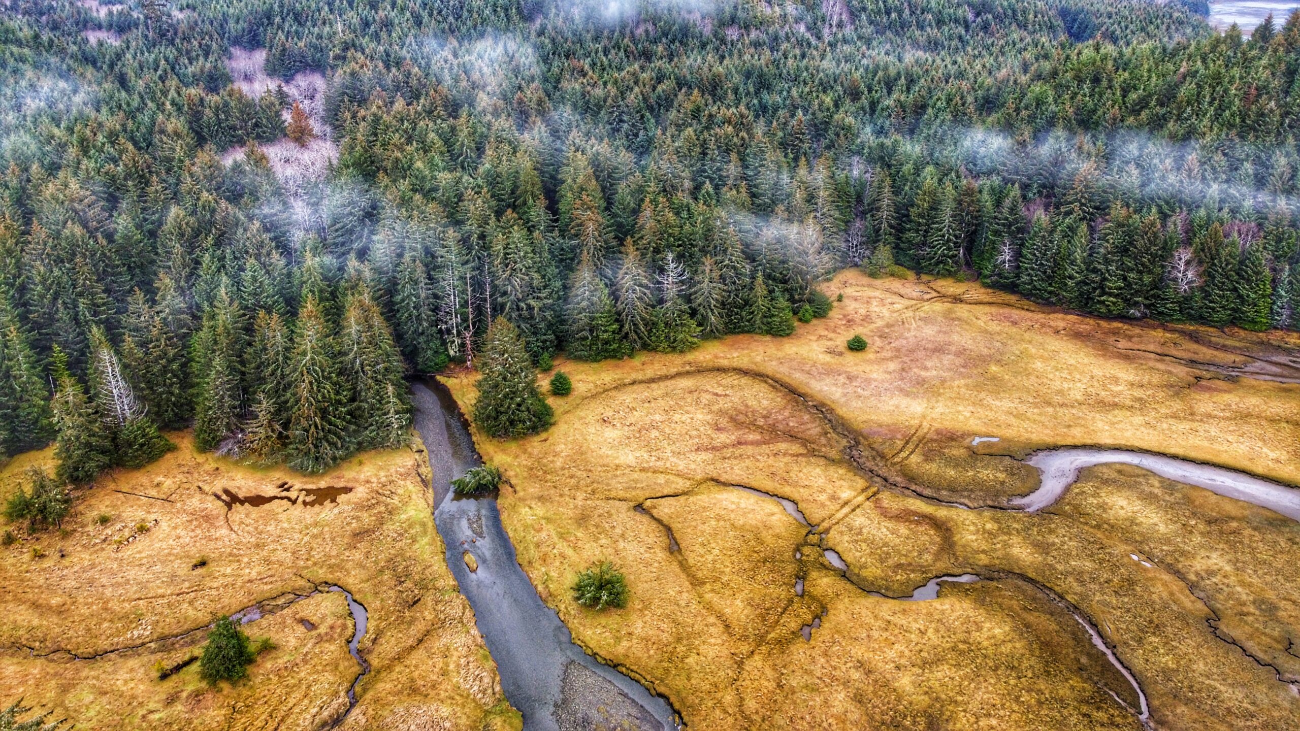
Tarundl Creek is part of the bigger Kagan Bay Recreation Site. Located west of Daajing Giids (less than 10 minutes by car), and along the Honna Service road, the Kagan Bay Recreation Site offers a host of activities for all members of the family to enjoy. The site has everything whether you want to go fishing, kayaking, hiking, or camping. Indeed, the rugged recreation area, which has Sleeping Beauty as a backdrop, offers us a reprieve from the hurly-burly of daily life while concomitantly providing an opportunity to better appreciate nature.


As you drive along the Honna Service road, you will come upon the Kagan Bay Day Use Area at about the 2 kilometre mark. The site features a picnic table, fire ring and beach access. At low tide, one could walk quite a distance onto the beach; however, we find it a little too “sinky” for our liking.

For us, the big attraction of the day-use area is the Tarundl Creek Trail. Of the local village trails, this one is by far the easiest – but that’s not to suggest it’s stale by any means. Clocking in at 1.5 kilometres in length, the trail takes you through the lush rainforest and rich floodplain.

In this respect, it allows one to see the unique interplay between forest and ocean and how those two systems depend upon one another. Indeed, it is little wonder higher education societies often use Tarundl as a learning ground in the Fall when salmon are spawning and the bears are gathering nutrients for winter: Gina ‘waadluxan gud ad kwaagid.

That said, the yellow markers along Tarundl Creek Trail can be challenging to find at times. As you start out on the trail, you will follow an old skid road, which will lead onto the floodplain. Once here, keep to the right and you will see the path returning to the forest (of course, at low tide, take some time to explore the plain – it’s lovely).

Once back in the forest, you will see a Y on the trail. We recommend going to the LEFT for a richer and far more rewarding hike; otherwise, if you take the path on the right, your hike will end in short order – less than 10 minutes – and you’ll quickly find yourself back on the Honna Road.

While the Village of Daajing Giids identifies the Tarundl Creek Trail as a loop trail, it is more
appropriately described as an out-and-back route because the start and end points are completely
different points; however, we suppose you could call this a “loop” if you follow the Honna Road back to
the Kagan Bay Day Use Area.

DIFFICULTY: Easy
TOTAL DISTANCE: 1.5 kilometers (one-way)
TIME: 30 minutes
TYPE: Out-and-Back
ELEVATION GAIN: None

ABOUT

The Haydn Turner Beach Trail is located at the end of Oceanview Drive, towards the western end of
Daajing Giids. Once at the terminus of Oceanview Drive, you’ll spy Haydn Turner campground signage at the head of a narrow road.

Following this road will bring you into the campground and, at its end, the village cemetery. The beach trail is accessible at a few points here – all of which are clearly denoted with “BEACH TRAIL” markers.


While the trail is designed to be a major feature of Haydn Turner Campground and its guests, this easy
stroll along the pebbly beach is typically enjoyed by locals as well. It’s not unusual to see people walking their dogs here.

A mix of course sand and black shale rock, the Haydn Turner Beach Trail packs a varied terrain in its short 1 kilometer. On the one hand, you’re treated to beautiful views of nearby Sleeping Beauty Mountain; on the other hand, Bearskin Bay and Skidegate Inlet beckon and call.


When the tide is low, the sandy beach is visible; however, we would not advise walking down here
because the sand is very “sinky” and could get you in some trouble rather quickly. Instead, if you must
venture beyond the rocky shore, do so on a kayak as this place represents a popular jumping-off point
for those keen to get onto the water.


Haydn Turner, as a campground, features 8 sheltered RV sites and 2 walk-in tent sites, the latter of
which hug the pebbly shores. Picnic tables, fire pits, and a couple of pit toilets are also available. We
should note that the campsite basically sits at the doorstep of Daajing Giids cemetery while the beach
trail loops around it (with a couple of small “spider trails” hugging the woods).

Some may find this unsettling while still others might find a sense of peace and calm – especially if you happen to be walking the beach during a misty afternoon.


Note: If camping in the area, please respect your surroundings and place garbage in the appropriate
receptacle and extinguish all campfires!

DIFFICULTY

Easy

TOTAL DISTANCE

1 Kilometer

TIME

20 Minutes

TYPE

Loop

ELEVATION GAIN

None

Locating the Scout Lake Trailhead marker is an adventure in itself. To find this trail, you first have to hike the full Charlie Hartie Trail, which clocks in at approximately 800 meters one way and has an elevation gain of 160 meters. After about an hour of hiking, you’ll come upon the official terminus point of the Charlie Hartie Trail, as indicated by a fork and some signage. One arrow points left towards “Charlie Hardie,” but blowdown and lack of maintenance have made this route towards the creek virtually unnavigable. The right-pointing arrow, on the other hand, indicates the route to Scout Lake and, in effect, represents the trailhead. From this point onwards, it’s an uphill climb – of just over 1 kilometer in the distance – towards the small lake. Blue tape indicates your path.

The Scout Lake Trail, much like the Charlie Hartie that precedes it, is rough, narrow, miry, and quite steep in some places. For much of the climb, you’ll be making your way through dense forest, but there are a few monumental cedars along the way. Seeing these giants up close really helps to put things into perspective and highlights, only too clearly, why protecting our forests is important.

Just before reaching the zenith of your climb, you will have to descend into a small ravine and cross Templeton Creek before climbing again and finally reaching the flat bog lands. This part of the trek is fairly straightforward in summer, but if you hike the route during winter be prepared to deal with plenty of packed snow and ice.

Once you reach the bog, the ground is mostly flat and it’s an easy hike to Scout Lake from here. Just make sure you’re wearing good waterproof gear and be cautious of the numerous small pools dotting
the landscape. DO NOT step in these. They may look shallow but they’re deceptively deep!

As you close in on Scout Lake, you’ll come across one of this hike’s more interesting features – a sign that looks like it came right out of a Dr. Seuss book! It points every which way and nowhere in particular. The wooden sign gives general distances to Scout Lake, Regier Lake, Chinukundl Creek, and Queen Charlotte. We’ve wondered if it’s possible to hike towards Regier Lake from here.

Once you reach the Dr. Seuss sign, Scout Lake will be to your left (or west) – a little over 5 minutes away. Just follow the pink tape on what looks like a deer trail and you’ll eventually reach your destination. When we saw Scout Lake, it was still partially frozen, which added to its charm.

All in all, Scout Lake is a good, albeit challenging, hike. It is more scenic than the Charlie Hartie, though we say that only because Scout Lake actually leads somewhere rather than ending at a random point (as
the existing “Charlie” does). Hiking to Scout Lake, you encounter beautiful green mosses; monumental cedars; and a unique bog environment, featuring salal, Labrador Tea, and a host of other flora. In brief, it’s a challenging but rewarding hiking adventure!

Note that in some literature Scout Lake is also referred to as “Charlie Hardie South Lake Trail.”

DIFFICULTY: Hard
TOTAL DISTANCE: 3.5 kilometers return (including Charlie Hartie Trail)
TIME: 2 hours one-way
TYPE: Out-and-Back
ELEVATION GAIN: 395 meters

ABOUT

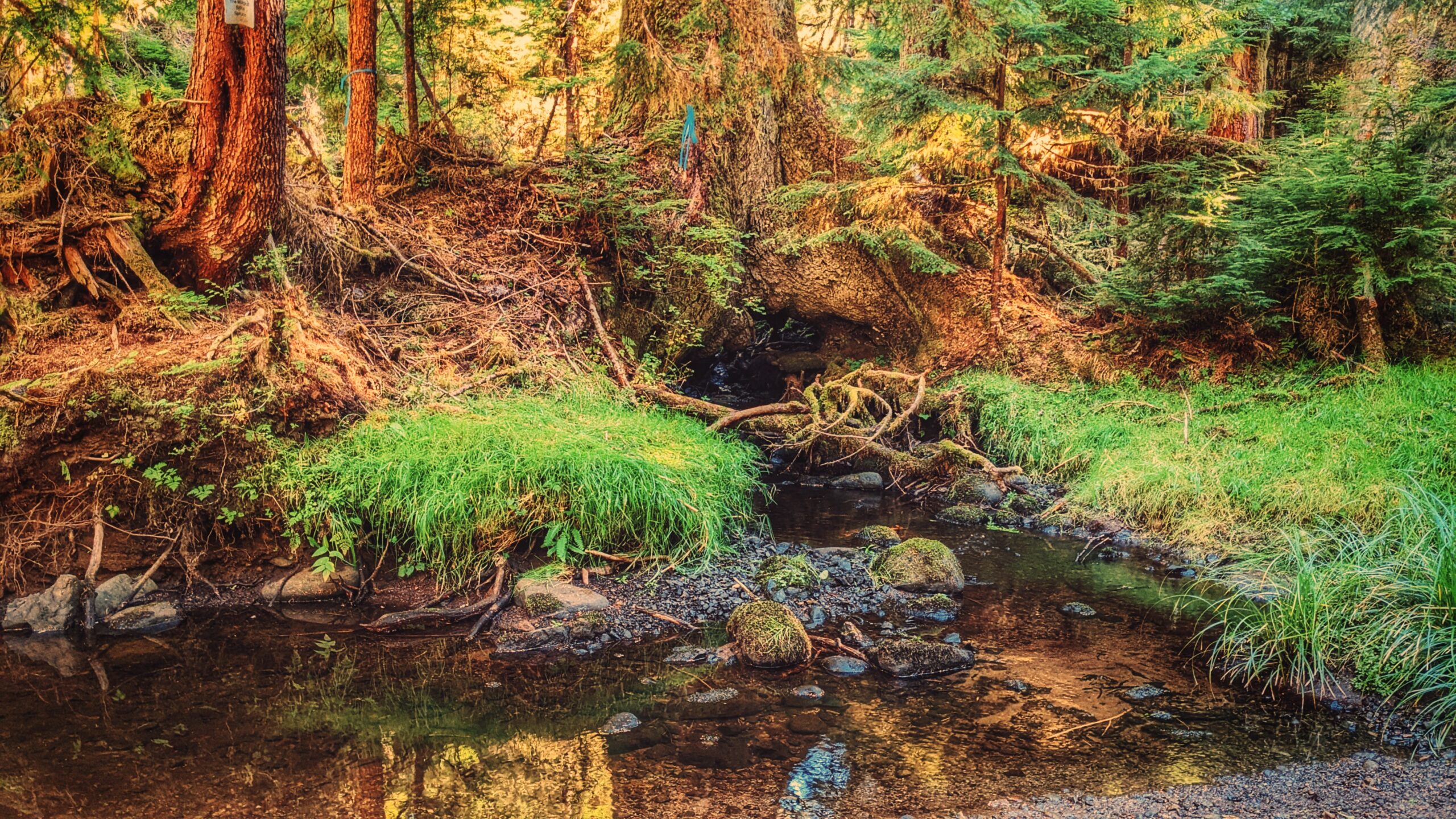
The Monique Creek Trail, like the Three Mile Creek Trail, is found deep within the Tlall Conservancy.
Accessing it in the current day requires a bit of effort because the original point of entry – Survey Forest
Service Road – was formally decommissioned in 2016 after years of disuse.

Now, if you wish to visit this trail, you’ll have to drive nearly 1.5 hours along the Daajing Giids backroads: First, drive approximately 20 minutes along the QC Mainline (passing the decommissioned Survey Forest Service Road) until you come upon the un-signed junction for Lakes Main Road, near the Mile 17 marker, to your RIGHT. Take this turn and follow Lakes Main for nearly an hour – you will eventually connect to what’s left of the Survey Forest Service Road. Once here, turn to your RIGHT and park your vehicle. You will see the decommissioned section of the Survey Forest Road. For all intents and purposes, this is where your hike begins.

You must hike along the Survey Forest Road for approximately 3.5 kilometers before hitting the “official”
Monique Creek Trailhead. This portion of the hike is relatively straightforward and easy; however, the
numerous trenches dug as part of the decommissioning process – there are more than 10 of them – can be a bit of a challenge. Long grass has grown over the rocks, making footing a little uncertain.

The official Monique Creek Trail begins at an overgrown spur road and will be to your LEFT. An orange
arrow – one of the few still left after 20+ years – and an extremely faded trailhead sign indicate the start
of the route. The official trail follows the spur road for a few hundred meters before turning off into
the dense bush. Because most of the trail markers have gone, it’s very easy to miss the turnoff point, which is exactly what we did. We continued hiking along the increasingly overgrown road for a good 5 minutes before realizing we were off the trail.

Because the turnoff point is extremely dense, how do you know where to depart the old road? The best answer we can give is, as you’re hiking the overgrown road, keep your eyes peeled for a lone orange trail marker pointing BACK towards the Monique Creek Trailhead. From the marker, turn LEFT into the dense bush. This is where the route gets fun because the trail is almost non-existent at this point. There is the odd marker, but they’re far and few between. We spent 30 minutes in here, trying to find our way.

Once you emerge from the dense bush, you’re rewarded with the lovely confluence of Survey and
Monique Creeks. You’ll spy a trail marker on the opposite side of Survey Creek. Cross here. There
apparently used to be a natural log bridge, but it’s not there anymore. Be prepared to get your feet wet
unless you’re wearing boots! After you cross, walk upstream along Monique Creek.

The Monique Creek is a nice example of a coho spawning stream flowing through old-growth forests.
Unaffected by development, it’s an ideal place to study the unique habitat features for spawning coho.
As we hiked along the creek, we found many frogs, some elk tracks, and salmon Fry in the creek!

By the route’s end – just minutes after a log jam – you’ll come upon the trail’s star attraction: A large Sitka Spruce that has a creek running through its roots! The tree is a special sight and well worth the hike.

Unfortunately, trails like Monique Creek have fallen into severe disuse due largely to the difficulty
associated with getting to them. Once upon a time, you could probably do this hike in a couple of hours; however, because you now have to drive nearly 1.5hrs + hike 3.5km before getting to the trailhead, it is
best to give yourself a full day to enjoy the serenity of nature.

DIFFICULTY: Moderate
TOTAL DISTANCE: 3km (return, official trail); 10km (return, from Survey Forest Rd)
TIME: 6 hours
TYPE: Out-and-Back
ELEVATION GAIN: 40 meters

THREE MILE CREEK TRAIL FEATURES:
·       Salmon spawning creek
·       Cascade
·       Tlall Conservancy

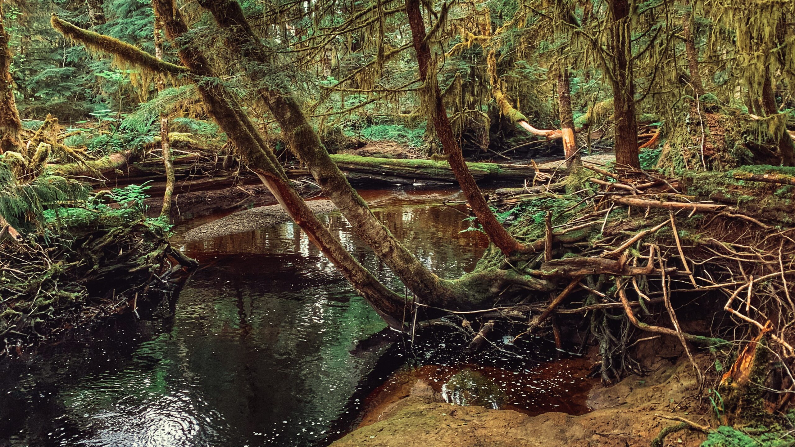
The Three Mile Creek Trail is found deep within the Tlall Conservancy. Accessing it in the current day
requires a bit of effort because the original point of entry – Survey Forest Service Road – was formally
decommissioned in 2016 after years of disuse.

Now, if you wish to visit this trail, you’ll have to drive nearly 1.5 hours along the Daajing Giids backroads: First, drive approximately 20 minutes along the QC Mainline (passing the decommissioned Survey Forest Service Road) until you come upon the un-signed junction for Lakes Main Road to your RIGHT.

Take this turn and follow Lakes Main for nearly an hour – you will eventually connect to what’s left of the Survey Forest Service Road. Once here, you’ll spy a bridge that crosses Three Mile Creek.

If you’ve come all this way to hike the trail, do NOT cross the bridge because the unsigned trailhead for Three Mile Creek Trail is just before the bridge on your RIGHT.

Lack of maintenance for nearly two decades has made the route difficult to see but the faint outline of a
trail is there. Descend the minor slope and begin your trek!

In the late 1990s and early 2000s, Three Mile Creek Trail – along with the nearby Monique Creek Trail
was promoted in an interpretive booklet by the Tlell Watershed Society. Evidence of their “wilderness
interpretive route” narrative can still be found near the start of the trail. Look up at an alder tree near
the Three Mile Creek bridge – you’ll spy signage explaining the creek’s role as an important area for
spawning coho and steelhead salmon. I suspect there were more signs like this along the trail, but we
didn’t see any on our hike. Time and the elements have likely eliminated them.

While the trail is only 1 kilometre in length, expect to take at least an hour to complete the full route.
Three Mile Creek hasn’t seen any maintenance for nearly 2 decades – well before the decommissioning of Survey Forest Road – and it shows. Almost right out of the gate, the trail is difficult to find and follow.

The path is mostly overgrown and significant deadfall litters the trail. The odd trail marker can still be
found, and they help somewhat, but we still lost the trail for brief moments. I guess the best thing to
keep in mind is that the route basically follows Three Mile Creek for its duration.

As we hiked along the creek, we admired the old-growth Sitka Spruce and Red Cedar. We did not encounter any wildlife; however, we did spy on elk tracks and bear dung along the way.

Why might someone wish to come into the backcountry and hike this trail? I can posit a couple of
reasons: 1) To explore an important tributary to the Tlell River Watershed; and, 2) To probe deeper into
the Tlall Conservancy beyond what’s available near the community of Tlell. Either way, getting here and
hiking the trail are certainly adventures in their own right!

DIFFICULTY: Moderate
TOTAL DISTANCE: 2km (return)
TIME: Approximately 2 hours, depending on skill level
TYPE: Out-and-Back
ELEVATION GAIN: None