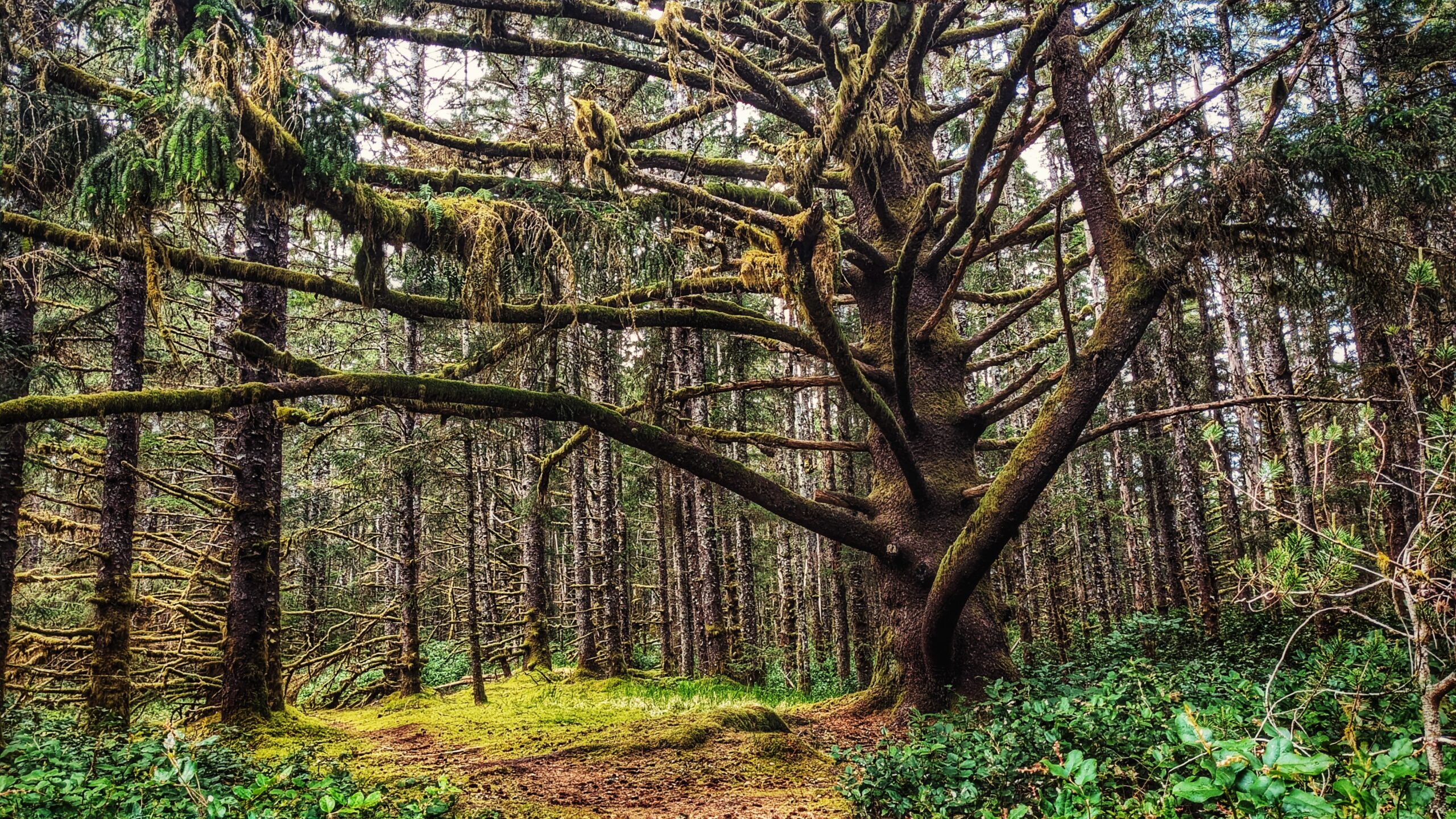
Susan’s Trail Features:
A big wolf tree
Mossy forest walk
A route leading to Tlell River
ABOUT
We discovered Susan’s Trail quite by chance earlier this year while browsing the Hospital Day-sponsored “Trail Bingo.” The “bingo card” features a number of well-known short trails, including the aforementioned “Susan’s Trail” – the only one on the list we were unfamiliar with. After a bit of detective work, we discovered the trail, in the current day, is recorded on most maps as part of the larger Misty Meadows Beach Loop Trail. Where, then, is Susan’s Trail and why is it important?
Susan’s Trail is unmarked, but its location is familiar: As you drive in towards the Misty Meadows campsite you will inevitably spy “the big tree” to your left. This marks the start, or trailhead, of Susan’s Trail. You can park your car on the side of the road or drive a couple of hundred meters forward to the campsite and park there before beginning your hike.
Susan’s Trail was developed by the late Susan Wright and her husband. It is single-track and runs for approximately 720 meters one-way through fairly dense salal early on before transitioning into mossy carpeted forest of a young hemlock. Within the final 70 meters, the trail runs close to Highway 16 and skirts the Tlell Cemetery, so if you’re afraid of ghosts or ghouls you might wish to skip this one 😉 At the trail’s terminus point, you will emerge onto the dirt road that leads to the cemetery.
From here, you have two options: Turn back and return the way you came OR walk out onto Beitush Road and stroll north along the Tlell River to experience and/or complete the larger Misty Meadows Loop Trail (described at length in another entry).
The trail, while brief, represents a good bit of local contemporary history. In that respect, it’s a shame the route is now just considered part of the larger Misty Meadows Beach Loop Trail.
DIFFICULTY: Easy
TOTAL DISTANCE: 1.44km (return)
TIME: 20 minutes
TYPE: Out-and-Back
ELEVATION GAIN: None


