


Evans Homestead Trail Features
Settler history and structures
100+-year-old Rhododendrons
Access to Kamdis Conservancy
ABOUT
Located within the 2,722-hectare Kamdis Heritage Site/Conservancy, the “Evans Homestead” Trail was first brought to our attention via a series of old photos taken in 1957 by Terry Annis, and posted by Go Haida Gwaii.
The ruins of the homestead, and the promise of massive rhododendrons, were most enticing. Unfortunately, directions towards this unmarked and unmaintained route are sparse.
Nevertheless, while the trail lacks formal upkeep and trail markers, it is still easy to locate and follow with a bit of effort. How do I get to the trailhead? You will find the Evans Homestead trailhead approximately 19 kilometres north of Port Clements, at the end of Nadu Road. Once you arrive at the terminus of Nadu Road, park your vehicle.
You will see two roads side-by-side. The one on the right, which looks to be built on large segments of clay, is used by the Mennonites and is private. You want the overgrown road beside it. This old skid road, once used for logging, represents the official start and trailhead of the “Evans Homestead” hike.
Follow the old skid road for approximately 1 kilometre. After hiking for about 15 minutes, you’ll have to use a natural log bridge to cross the Nadu River on your LEFT. It is important to keep a watchful eye for the crossing because the trail actually continues on past it to the mouth of Nadu River and Masset Inlet. On the plus side, if you do miss the turn-off and hike to the river’s mouth (as we did), you’ll be treated to a unique-looking old-growth cedar tree!
After crossing the log bridge, follow the trail out towards Masset Inlet. It’s clear someone uses this area as an access point because, when we hiked the route, a small table was set up near a skiff. Perhaps the boat is used to access nearby Kumdis Island?
Anyway, it’s at this point you’ll observe the first major piece of colonial history: An old rotting dock which, because of the moss and small trees growing on it, has become quite photogenic. At one point, from this dock, you could walk approximately 1.6 kilometres up an old road towards the remains of a peat moss plant (opened in 1967, after Bering Industries spent $1 million building it, it closed barely a year later).
Unfortunately, when we visited in June 2021, this part of the trail was marked as “closed” – probably due to the extreme overgrowth and lack of upkeep.
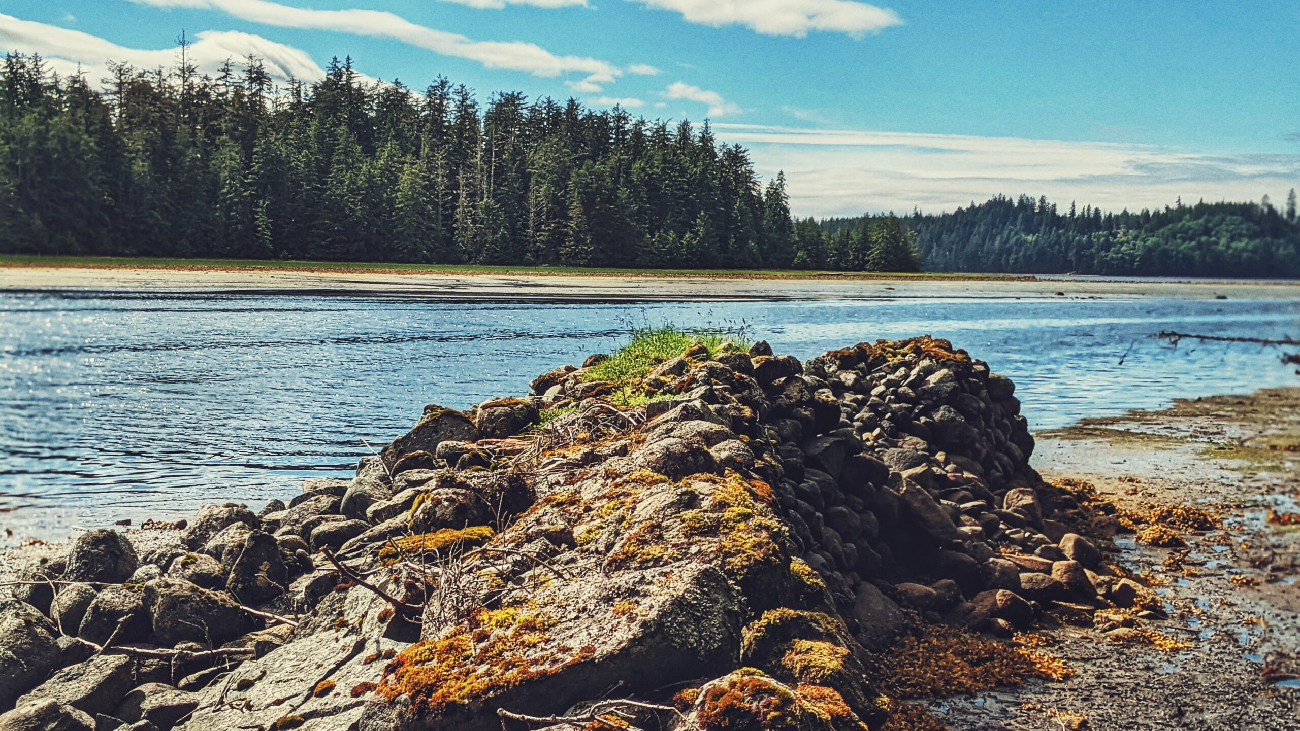
From the old dock, walk south along the beach and shoreline for 20 minutes and you’ll eventually come upon the ancient stone breakwater. After 110+ years, only a tiny portion has collapsed, speaking volumes as to the skill, care and craftsmanship that went into building structures at this site.
Finding the actual homestead site proved to be a little tricky, though. We knew the short trail up to the Evans Homestead was near the breakwater, but couldn’t pinpoint where exactly. We ambled around the breakwater for a good hour and a half pondering our next steps.
One of our team members eventually decided to explore the hillside behind the breakwater. He returned after 15 minutes and reported that it was “nice and flat” up there but “just turned into a big swamp.”
His wife made her way up the steep and muddy embankment and discovered: The “big swamp” was what we were looking for! Thus, we scrambled up the muddy embankment!
As it turns out, the flat, slightly swampy area is the Evans Homestead: Here you will observe 100+-year-old rhododendron trees and remnants of the homestead originally built in 1911 by Edward Evans. From a historical perspective, the site is a real treat to visit and gives you a small taste of what early pioneering life must’ve been like.
While not many remain, the effort left behind impressive stonemasonry and beautiful rhododendrons. If you’d like to see the rhododendron trees in bloom, we’d recommend visiting this area in June or July.
Note: The beach section of this hike MUST be completed on a low or receding tide, so be sure to check the tide tables if you wish to reach the homestead.
DIFFICULTY: Easy
TOTAL DISTANCE: 4 kilometers (return)
TIME: 2 hours
TYPE: Out-and-Back
ELEVATION GAIN: Minimal