


Riley Creek Trail Features:
Old Growth Trees
Multiple access to Riley Creek
Pristine beaches
NOTE: Rennell Sound is subject to variable weather conditions, heavy rainfall, and landslide risk, particularly from September thru May. Be prepared for emergencies and road closures during weather events.
ABOUT
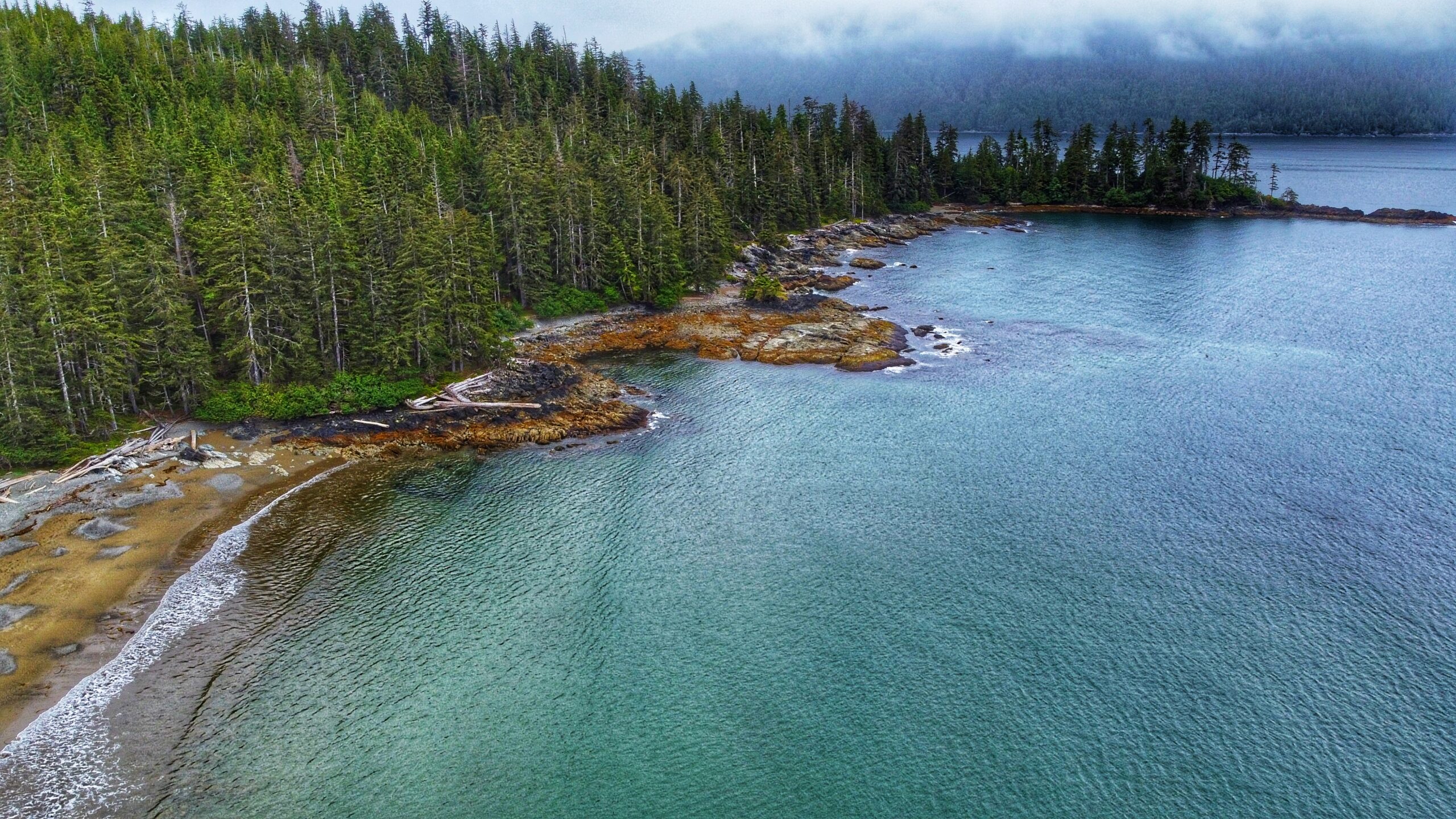
Located within Rennell Sound and the Duu Guusd Conservancy, the Riley Creek Trail offers hikers a substantive walk through riparian old growth forest, which terminates at a secluded sand and pebble beach. According to Dalzell, Riley Creek was named after the engineer who “surveyed the proposed railway route to the west coast of Graham Island.” The trail is not formally maintained, so be prepared for potentially challenging conditions as a result of blowdown.
To reach the Riley Creek Trail, and other trails in the area, one requires a good deal of patience and a high clearance vehicle because the old logging road out to Rennell is in poor shape and rife with large potholes. Once you make it, however, you will be rewarded with some of the most beautiful beaches anywhere in the world.
If traveling from Daajing Giids, drive approximately 22 kilometers along the QC Mainline (use appropriate caution as these are active logging roads). You will come upon a blue sign with white text pointing you WEST towards the Duu Guusd Conservancy and Rennell Sound. You are now on the Rennell Sound Forest Service Road. From here, it is a 15 kilometer drive towards the Sound. Along the way, you will drive through Rennell Pass, including Rennell Hill with its steep 25% grade. While there is no longer active logging in this area, it is strongly recommended that you still drive with caution because the Rennell FSR is narrow and filled with significant potholes. For this reason, a high clearance vehicle is suggested.
LOCATING THE TRAILHEAD
Once at the bottom of Rennell Hill, you will come upon the Rennell Sound Recreation Site. From here, drive north for approximately 12 kilometers along the Rennell FSR. You will pass the trailhead sign for Five Mile Beach before coming upon the Riley Creek trailhead marker. There is a small pullout with enough room for two or three vehicles to park. Welcome to the Riley Creek Trail!
As you get ready for the hike, you will undoubtedly read the information contained on the trailhead sign. Please note that key information on this board is incorrect. First, while the trail is marked throughout, the Ben Davidson trail marker is not used; rather, it is a mix of flagging tape ad orange squares. Second, the stated length of the trail – 2.3km one way – is off by a significant margin. Other sources indicate the route to be 2 kilometers, 5 kilometers and 10 kilometers one-way; however, none of these are correct. The actual length of the trail, one way, is 3.44 kilometers. As such, one should ensure they’ve brought sufficient water and snacks for this trek through the forest.
HIKING THE TRAIL
The Riley Creek Trail is the only substantive hiking trail within Rennell Sound where the trail itself functions as the attraction (with the other three, the trails are secondary to the beaches). While not formally maintained, the path is obvious and generally well-marked. When we hiked the route, there were only a couple of spots – just past the mid-way point – where we had to take a moment to locate the trail thanks to blowdown.
As you hike the riparian wilderness, take time to appreciate the lush flora that surrounds you. Much of the Riley Creek route is covered in thick green moss, which gives the environment a fairy-like atmosphere. Combine this with the gentle lull of the creek and you have all the ingredients necessary for a relaxing stroll through Haida Gwaii’s rainforest.
We should note that, even during dry conditions, parts of the trail can be quite miry. There are boardwalks and stepping blocks to assist with this, but even these should be used with caution. The boardwalks are old and some have been compromised; the stepping blocks, while solid, are extremely slippery and pose their own hazard. In addition, there are numerous sections of blowdown along the way. Most of it is minor and easy to navigate, but there are at least two areas with fairly significant deadfall on the trail: About 45 minutes in, while walking along a ridge, you’ll notice a large spruce has toppled over and ripped out a large section of the trail. We briefly thought about turning around at this point, but carefully navigated around the fallen tree and returned to the trail. Then, about 40 minutes later, you’ll come upon this area with a clutter of fallen alder and spruce. It’s easy enough to duck around these, but it does make the trail a little difficult to follow – at least momentarily.
About 500 meters out from Riley Beach, the trail splits. At this point, you have the option of crossing Riley Creek and continuing along the southern side of the creek towards the beach OR staying on the north side of Riley Creek and continuing to the beach via this route. One should only cross Riley Creek when water levels are low. If you choose not to cross the creek, you will still get to the beach. After such a lengthy and somewhat challenging trek through the woods, Riley Beach provides the perfect spot for a bite to eat and re-charge before hiking back to your vehicle.
DIFFICULTY: Moderate
TOTAL DISTANCE: 3.44km (one-way)
TIME: 5 hours (return)
TYPE: Out-and-Back
ELEVATION GAIN: 25 meters