


SCOUT LAKE TRAIL FEATURES
Sloped trails
Lake on top
Boggy environment
Note that in some literature Scout Lake is also referred to as “Charlie Hardie South Lake Trail.”
ABOUT
Locating the Scout Lake Trailhead marker is an adventure in itself. To find this trail, you first have to hike the full Charlie Hartie Trail, which clocks in at approximately 800 meters one way and has an elevation gain of 160 meters. After about an hour of hiking, you’ll come upon the official terminus point of the Charlie Hartie Trail, as indicated by a fork and some signage. One arrow points left towards “Charlie Hardie,” but blowdown and lack of maintenance have made this route towards the creek virtually unnavigable. The right-pointing arrow, on the other hand, indicates the route to Scout Lake and, in effect, represents the trailhead. From this point onwards, it’s an uphill climb – of just over 1 kilometer in the distance – towards the small lake. Blue tape indicates your path.
The Scout Lake Trail, much like the Charlie Hartie that precedes it, is rough, narrow, miry, and quite steep in some places. For much of the climb, you’ll be making your way through dense forest, but there are a few monumental cedars along the way. Seeing these giants up close really helps to put things into perspective and highlights, only too clearly, why protecting our forests is important.
Just before reaching the zenith of your climb, you will have to descend into a small ravine and cross Templeton Creek before climbing again and finally reaching the flat bog lands. This part of the trek is fairly straightforward in summer, but if you hike the route during winter be prepared to deal with plenty of packed snow and ice.
Once you reach the bog, the ground is mostly flat and it’s an easy hike to Scout Lake from here. Just make sure you’re wearing good waterproof gear and be cautious of the numerous small pools dotting
the landscape. DO NOT step in these. They may look shallow but they’re deceptively deep!
As you close in on Scout Lake, you’ll come across one of this hike’s more interesting features – a sign that looks like it came right out of a Dr. Seuss book! It points every which way and nowhere in particular. The wooden sign gives general distances to Scout Lake, Regier Lake, Chinukundl Creek, and Queen Charlotte. We’ve wondered if it’s possible to hike towards Regier Lake from here.
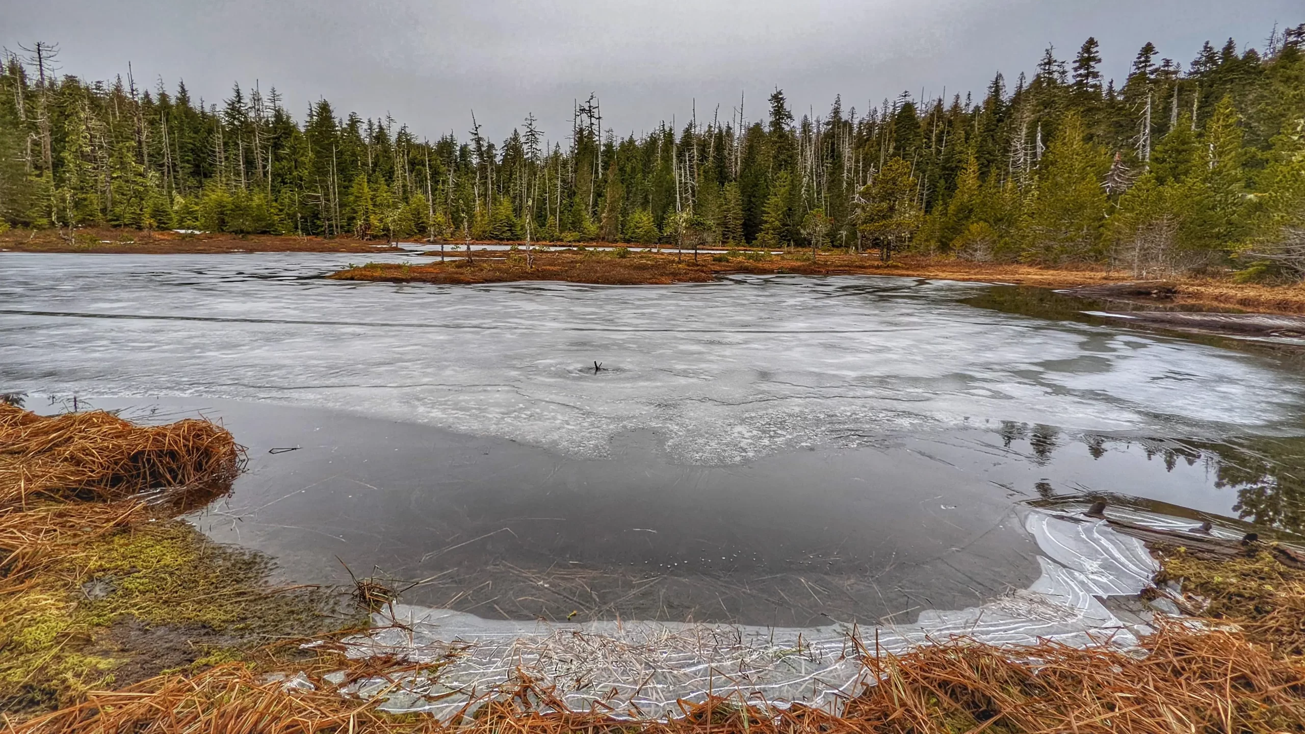
Once you reach the Dr. Seuss sign, Scout Lake will be to your left (or west) – a little over 5 minutes away. Just follow the pink tape on what looks like a deer trail and you’ll eventually reach your destination. When we saw Scout Lake, it was still partially frozen, which added to its charm.
All in all, Scout Lake is a good, albeit challenging, hike. It is more scenic than the Charlie Hartie, though we say that only because Scout Lake actually leads somewhere rather than ending at a random point (as
the existing “Charlie” does). Hiking to Scout Lake, you encounter beautiful green mosses; monumental cedars; and a unique bog environment, featuring salal, Labrador Tea, and a host of other flora. In brief, it’s a challenging but rewarding hiking adventure!
DIFFICULTY: Hard
TOTAL DISTANCE: 3.5 kilometers return (including Charlie Hartie Trail)
TIME: 2 hours one-way
TYPE: Out-and-Back
ELEVATION GAIN: 395 meters